http://twitter.com/AndyHazelton/status/1415095622781259777
2021 Global Model Runs Discussion (Out thru day 16)
Moderator: S2k Moderators
Forum rules

The posts in this forum are NOT official forecasts and should not be used as such. They are just the opinion of the poster and may or may not be backed by sound meteorological data. They are NOT endorsed by any professional institution or STORM2K. For official information, please refer to products from the National Hurricane Center and National Weather Service.
-
toad strangler

- S2K Supporter

- Posts: 4546
- Joined: Sun Jul 28, 2013 3:09 pm
- Location: Earth
- Contact:
-
AlphaToOmega
- Category 5

- Posts: 1448
- Joined: Sat Jun 26, 2021 10:51 am
- Location: Somewhere in Massachusetts
Re: 2021 Global Model Runs Discussion (Out thru day 16)
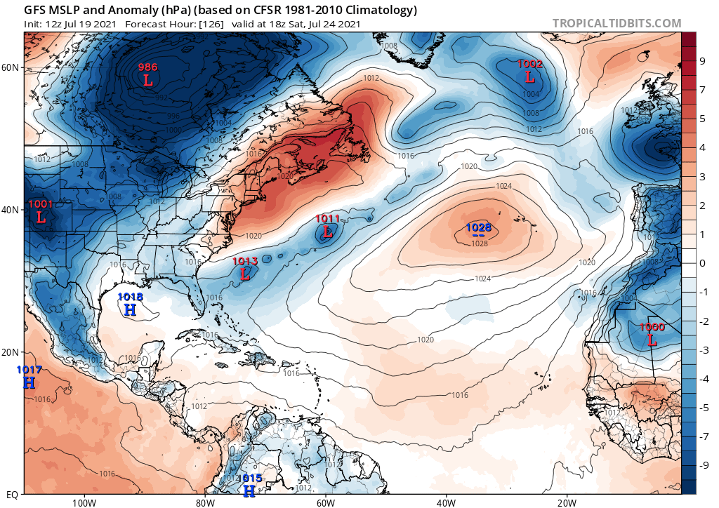
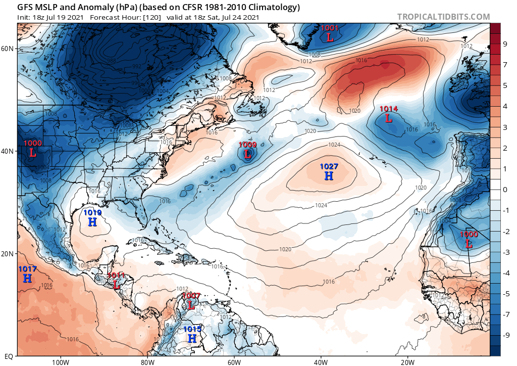
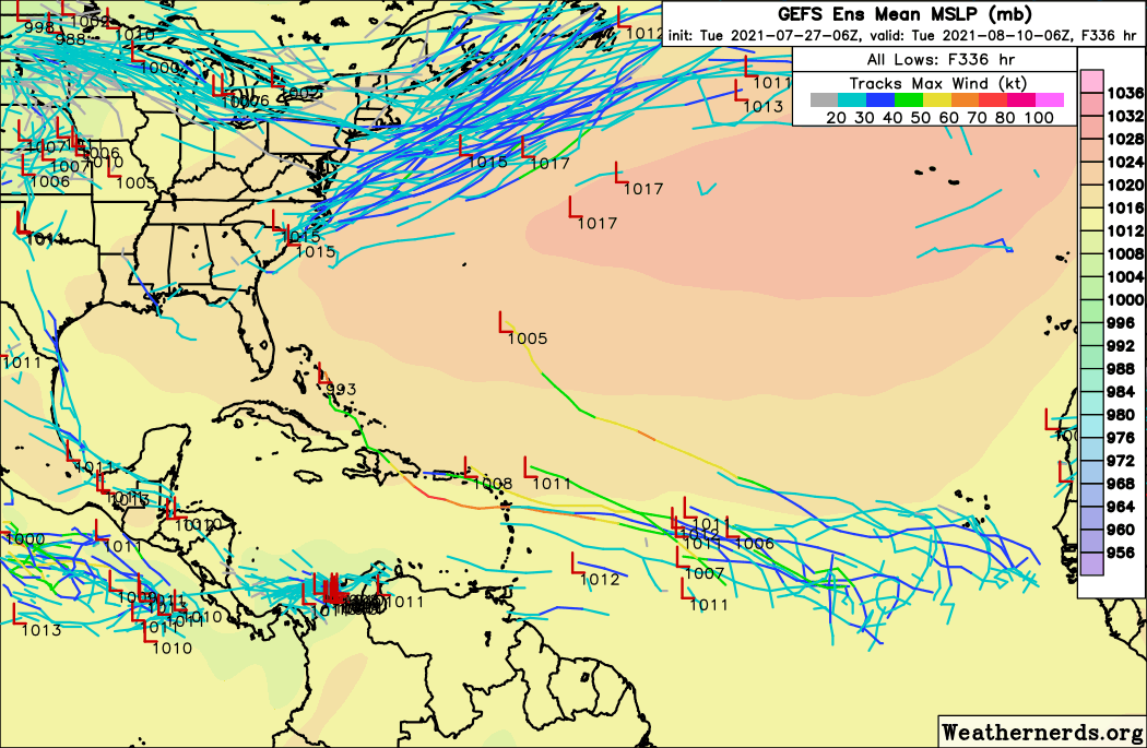
For whatever reason, the GFS have a problem with phantom storms in the Southwest Caribbean. What is it about that area that makes the GFS go crazy?
https://www.weathernerds.org/models/gefs.html?&inittype=zoom&initfield=MSLP_Surface&initcycle=12&initfhour=006&initimdimx=1050&initimdimy=685&initrange=50.000000000000:258.000000000000:0:350.000000000000&initcx1=0&initcy1=0&initcx2=0&initcy2=0&initcross=False&initsound=False&initsoundx=1&initsoundy=1&initloop=True&initoverlay=False&initlstart=000&initlend=336&initlint=6&initol1=MSLP_Surface&initol2=null&initol3=null&initol4=null&initol5=null&initcities=Off&inithgwys=Off&inittracks=On&initlows=On&initlatlon=Off
https://www.weathernerds.org/models/gefs.html?&inittype=zoom&initfield=MSLP_Surface&initcycle=12&initfhour=006&initimdimx=1050&initimdimy=685&initrange=50.000000000000:258.000000000000:0:350.000000000000&initcx1=0&initcy1=0&initcx2=0&initcy2=0&initcross=False&initsound=False&initsoundx=1&initsoundy=1&initloop=True&initoverlay=False&initlstart=000&initlend=336&initlint=6&initol1=MSLP_Surface&initol2=null&initol3=null&initol4=null&initol5=null&initcities=Off&inithgwys=Off&inittracks=On&initlows=On&initlatlon=Off
0 likes
-
beoumont

- Category 1

- Posts: 473
- Joined: Sun Jul 10, 2011 4:13 pm
- Location: East Central Florida
- Contact:
Re: 2021 Global Model Runs Discussion (Out thru day 16)
SEASON_CANCELED wrote:AxaltaRacing24 wrote:AlphaToOmega wrote:
Literally impossible for a tropical system to form over land
toss it
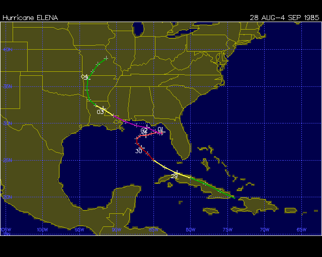
Tropical Storm Elena, 1985, formed over the mainland of Cuber; later Hurricane Elena, cat 3. Entered eastern Cuber as a depression, moving WNW. The center traversed most of the length of the island, always over land; and the pressure fell 8 mb. Become a named tropical storm while still over NW Cuber when recon. measured 50 mph winds off the n. coast of the island.
1 likes
List of 79 tropical cyclones intercepted by Richard Horodner:
http://www.canebeard.com/page/page/572246.htm
http://www.canebeard.com/page/page/572246.htm
-
Category5Kaiju

- Category 5
- Posts: 4334
- Joined: Thu Dec 24, 2020 12:45 pm
- Location: Seattle and Phoenix
Re: 2021 Global Model Runs Discussion (Out thru day 16)
By the very extreme end of July into the first three days of August at least, the GFS is showing an extremely convectively active ITCZ but nothing develop yet. That should be around the same time the MJO's favorable phase begins to set in, so perhaps that could be the next best time we could theoretically see something in the deep tropics develop?
5 likes
Unless explicitly stated, all info in my posts is based on my own opinions and observations. Tropical storms and hurricanes can be extremely dangerous. Refer to an accredited weather research agency or meteorologist if you need to make serious decisions regarding an approaching storm.
-
cycloneye

- Admin

- Posts: 149505
- Age: 69
- Joined: Thu Oct 10, 2002 10:54 am
- Location: San Juan, Puerto Rico
Re: 2021 Global Model Runs Discussion (Out thru day 16)
0 likes
Visit the Caribbean-Central America Weather Thread where you can find at first post web cams,radars
and observations from Caribbean basin members Click Here
and observations from Caribbean basin members Click Here
-
captainbarbossa19

- Professional-Met

- Posts: 1094
- Age: 27
- Joined: Wed Aug 21, 2019 11:09 pm
- Location: Beaumont, TX
Re: 2021 Global Model Runs Discussion (Out thru day 16)
cycloneye wrote:https://twitter.com/RyanMaue/status/1417173844918480904
This would not be the first time models have shown nothing in the Atlantic into late July/early August. I suspect they may show nothing until conditions at initialization are favorable for development. We might get away with no more storms in July, but somehow I think August is going to be quite ugly, especially towards the middle and end of the month.
5 likes
-
Category5Kaiju
- Category 5
- Posts: 4334
- Joined: Thu Dec 24, 2020 12:45 pm
- Location: Seattle and Phoenix
Re: 2021 Global Model Runs Discussion (Out thru day 16)
Yeah, so about that without another July NS...at least according to this, there's a slim chance we may need to watch the subtropics near the very end of this month....
https://weather.us/cyclone-tracks/euro/grid-americas/2021071912-240.html
https://weather.us/cyclone-tracks/euro/grid-americas/2021071912-240.html
0 likes
Unless explicitly stated, all info in my posts is based on my own opinions and observations. Tropical storms and hurricanes can be extremely dangerous. Refer to an accredited weather research agency or meteorologist if you need to make serious decisions regarding an approaching storm.
-
AlphaToOmega
- Category 5
- Posts: 1448
- Joined: Sat Jun 26, 2021 10:51 am
- Location: Somewhere in Massachusetts
Re: 2021 Global Model Runs Discussion (Out thru day 16)
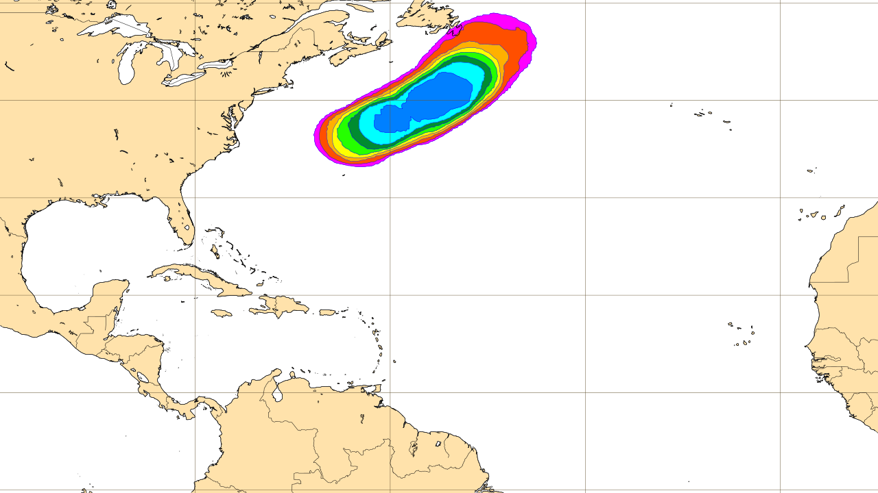
A weak tropical storm in the subtropics similar to Tropical Storms Bill (2021) and Claudette (2015) is shown by the operational GFS.
0 likes
-
Category5Kaiju
- Category 5
- Posts: 4334
- Joined: Thu Dec 24, 2020 12:45 pm
- Location: Seattle and Phoenix
Re: 2021 Global Model Runs Discussion (Out thru day 16)
AlphaToOmega wrote:https://i.postimg.cc/h42dM6d6/gfs-mslpa-atl-22.png
https://i.postimg.cc/X7xQfsjY/gfs-mslpa-atl-21.png
A weak tropical storm in the subtropics similar to Tropical Storms Bill (2021) and Claudette (2015) is shown by the operational GFS.
Now the key question is is it going to be just a front, or will it be possible for a part of it to break free and develop into a subtropical or tropical entity independently. I would not be surprised if nothing happens, but I also wouldn't be surprised if by next week there's a very weak but legitimate TC there. These kinds of tropical storms are very hard to predict.
0 likes
Unless explicitly stated, all info in my posts is based on my own opinions and observations. Tropical storms and hurricanes can be extremely dangerous. Refer to an accredited weather research agency or meteorologist if you need to make serious decisions regarding an approaching storm.

Re: 2021 Global Model Runs Discussion (Out thru day 16)
captainbarbossa19 wrote:cycloneye wrote:https://twitter.com/RyanMaue/status/1417173844918480904
This would not be the first time models have shown nothing in the Atlantic into late July/early August. I suspect they may show nothing until conditions at initialization are favorable for development. We might get away with no more storms in July, but somehow I think August is going to be quite ugly, especially towards the middle and end of the month.
Correct. Models will continue to show little.... "until they do" LOL. That seems common in most years where suddenly one or more global models will wake up suggesting potential development 3-5 days out, in spite of those same models seeing nothing the day before while looking out for the next 10 days. Just how it goes.
10 likes
Andy D
(For official information, please refer to the NHC and NWS products.)
(For official information, please refer to the NHC and NWS products.)

Re: 2021 Global Model Runs Discussion (Out thru day 16)
AlphaToOmega wrote:For whatever reason, the GFS have a problem with phantom storms in the Southwest Caribbean. What is it about that area that makes the GFS go crazy?
https://www.weathernerds.org/models/gefs.html?&inittype=zoom&initfield=MSLP_Surface&initcycle=12&initfhour=006&initimdimx=1050&initimdimy=685&initrange=50.000000000000:258.000000000000:0:350.000000000000&initcx1=0&initcy1=0&initcx2=0&initcy2=0&initcross=False&initsound=False&initsoundx=1&initsoundy=1&initloop=True&initoverlay=False&initlstart=000&initlend=336&initlint=6&initol1=MSLP_Surface&initol2=null&initol3=null&initol4=null&initol5=null&initcities=Off&inithgwys=Off&inittracks=On&initlows=On&initlatlon=Off
Its where the trade winds lighten up.
Tropical waves often slow down and sometimes develop convection and spin up south of Cuba.
0 likes
-
toad strangler
- S2K Supporter
- Posts: 4546
- Joined: Sun Jul 28, 2013 3:09 pm
- Location: Earth
- Contact:
Re: 2021 Global Model Runs Discussion (Out thru day 16)
AlphaToOmega wrote:For whatever reason, the GFS have a problem with phantom storms in the Southwest Caribbean. What is it about that area that makes the GFS go crazy?
https://www.weathernerds.org/models/gefs.html?&inittype=zoom&initfield=MSLP_Surface&initcycle=12&initfhour=006&initimdimx=1050&initimdimy=685&initrange=50.000000000000:258.000000000000:0:350.000000000000&initcx1=0&initcy1=0&initcx2=0&initcy2=0&initcross=False&initsound=False&initsoundx=1&initsoundy=1&initloop=True&initoverlay=False&initlstart=000&initlend=336&initlint=6&initol1=MSLP_Surface&initol2=null&initol3=null&initol4=null&initol5=null&initcities=Off&inithgwys=Off&inittracks=On&initlows=On&initlatlon=Off
The GFS is notorious for spinning up phantoms derived from modeling spurious vorticity off of the mountains of Columbia and Venezuela
0 likes
My Weather Station
https://www.wunderground.com/dashboard/pws/KFLPORTS603
https://www.wunderground.com/dashboard/pws/KFLPORTS603

Re: 2021 Global Model Runs Discussion (Out thru day 16)
We might want to keep an eye on a piece of vorticity at 850 mb dropping southward off a trough into north Florida and then rotating west into the eastern GOM. None of the models develop it but all (Euro, GFS, ICON, and CMC) show the broad low retrograding into the GOM. These systems can sometimes develop in these near shore environments.
5 likes
-
Category5Kaiju
- Category 5
- Posts: 4334
- Joined: Thu Dec 24, 2020 12:45 pm
- Location: Seattle and Phoenix
Re: 2021 Global Model Runs Discussion (Out thru day 16)
ronjon wrote:We might want to keep an eye on a piece of vorticity at 850 mb dropping southward off a trough into north Florida and then rotating west into the eastern GOM. None of the models develop it but all (Euro, GFS, ICON, and CMC) show the broad low retrograding into the GOM. These systems can sometimes develop in these near shore environments.
There's also a front in the subtropics roughly 5-6 days from now that *could* spawn something if conditions and timing are ok in the subtropics; even during a suppressed phase this shows how you should always be alert on possible "popup" systems.
0 likes
Unless explicitly stated, all info in my posts is based on my own opinions and observations. Tropical storms and hurricanes can be extremely dangerous. Refer to an accredited weather research agency or meteorologist if you need to make serious decisions regarding an approaching storm.
-
AlphaToOmega
- Category 5
- Posts: 1448
- Joined: Sat Jun 26, 2021 10:51 am
- Location: Somewhere in Massachusetts
Re: 2021 Global Model Runs Discussion (Out thru day 16)
70-80% chance of seeing a tropical storm form in the Gulf Stream
1 likes
-
SFLcane

- S2K Supporter
- Posts: 10281
- Age: 48
- Joined: Sat Jun 05, 2010 1:44 pm
- Location: Lake Worth Florida
Re: 2021 Global Model Runs Discussion (Out thru day 16)
Let’s start up those engines just a bit.
8 likes
-
Category5Kaiju
- Category 5
- Posts: 4334
- Joined: Thu Dec 24, 2020 12:45 pm
- Location: Seattle and Phoenix
Re: 2021 Global Model Runs Discussion (Out thru day 16)
SFLcane wrote:Let’s start up those engines just a bit.
https://i.postimg.cc/wMkhsMzH/B5-EF7-DA3-D525-4864-BBD6-9-B8-C9155-C4-D8.png
August 10? Signs of waves actually beginning to do something in the deep tropics and when the MJO should begin to exert influence in the basin? Seems somewhat plausible imho
0 likes
Unless explicitly stated, all info in my posts is based on my own opinions and observations. Tropical storms and hurricanes can be extremely dangerous. Refer to an accredited weather research agency or meteorologist if you need to make serious decisions regarding an approaching storm.
-
cycloneye
- Admin
- Posts: 149505
- Age: 69
- Joined: Thu Oct 10, 2002 10:54 am
- Location: San Juan, Puerto Rico
Re: 2021 Global Model Runs Discussion (Out thru day 16)
12z GFS on long range for August 8. After this frame it does not do anything more.

2 likes
Visit the Caribbean-Central America Weather Thread where you can find at first post web cams,radars
and observations from Caribbean basin members Click Here
and observations from Caribbean basin members Click Here
-
SFLcane
- S2K Supporter
- Posts: 10281
- Age: 48
- Joined: Sat Jun 05, 2010 1:44 pm
- Location: Lake Worth Florida
Re: 2021 Global Model Runs Discussion (Out thru day 16)
cycloneye wrote:12z GFS on long range for August 8. After this frame it does not do anything more.
https://i.imgur.com/obq0Q5l.png
Yeah there's quite a monsoon trough out there on the GFS. Meets a dusty/sheared graveyard quickly
3 likes
-
cycloneye
- Admin
- Posts: 149505
- Age: 69
- Joined: Thu Oct 10, 2002 10:54 am
- Location: San Juan, Puerto Rico
Re: 2021 Global Model Runs Discussion (Out thru day 16)
GFS repeats on same date the 8th.

2 likes
Visit the Caribbean-Central America Weather Thread where you can find at first post web cams,radars
and observations from Caribbean basin members Click Here
and observations from Caribbean basin members Click Here
Who is online
Users browsing this forum: Ulf and 293 guests