

Shell Mound wrote:AxaltaRacing24 wrote:
Freezing out there isn't it?
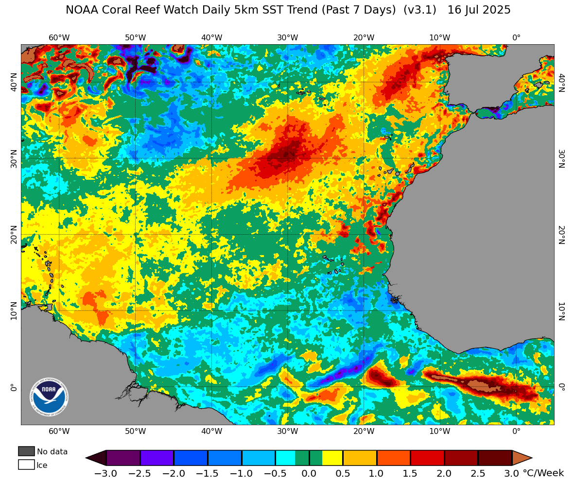
Personally I think the warming over the past four to five days is temporary. The long-term trend on the charts is negligible. One must look at the moving average for the entire period in question rather than short-term trends. Wait another week and a half and the warming will reverse, that is, revert to the long-term moving average. So far every short-term warming trend has reversed itself after a while. I doubt that this latest trend will be different from the rest, but we shall see. The Canary Current remains cool and all the TC activity in the CPAC is atypical of a -PMM/-ENSO combination.
Can you clarify TC activity in the CPAC?


