2021 Indicators: SST's / SAL / MSLP / Shear / Steering / Instability / Sat Images

This is the general tropical discussion area. Anyone can take their shot at predicting a storms path.

Moderator: S2k Moderators

Forum rules

The posts in this forum are NOT official forecasts and should not be used as such. They are just the opinion of the poster and may or may not be backed by sound meteorological data. They are NOT endorsed by any professional institution or STORM2K. For official information, please refer to products from the National Hurricane Center and National Weather Service.

Help Support Storm2K
Message
Author
User avatar
SFLcane
S2K Supporter
S2K Supporter
Posts: 10163
Age: 47
Joined: Sat Jun 05, 2010 1:44 pm
Location: Lake Worth Florida

Re: 2021 Indicators: SST's / SAL / MSLP / Shear / Steering / Instability / Sat Images

#2081 Postby SFLcane » Mon Aug 02, 2021 8:49 am

aspen wrote:
SFLcane wrote:
aspen wrote:If the EPac was capable of producing actually decent TCs then this phase with the -VP cell and MJO forcing would be interesting…but it’s not, so now we’re all just stuck nitpicking over shear forecasts and MJO propagation and the most minute VP anomalies while the EPac tosses out slop storm after slop storm that aren’t worth giving much attention.


Well, the thing is it's the convection that matters. As long as the EPAC is convectively active (even if they are slop TCs) it's gonna hinder the Atlantic.

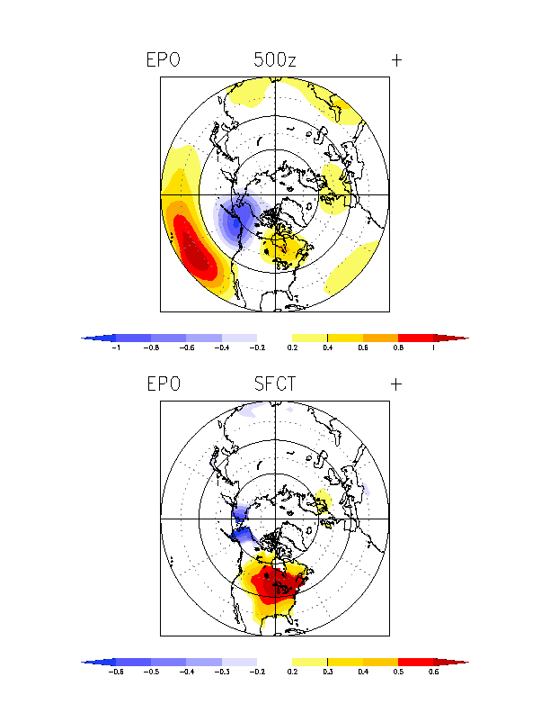
If late week’s wave develops and sticks to a low latitude early on but then gets north of the Caribbean, would it survive? I don’t think the EPac-induced TUTT gets that far east, so maybe it could be something interesting before running into a wall of shear.

The WPac is also out of commission for doing anything worthwhile because the current setup out there is garbage. Only weak, strung-out TCs for the time being it seems.


Yeah although again I wonder if the convection (monsoon trough) is causing some downstream enhancement of the TUTT.
0 likes   

User avatar
Category5Kaiju
Category 5
Category 5
Posts: 4097
Joined: Thu Dec 24, 2020 12:45 pm
Location: Seattle

Re: 2021 Indicators: SST's / SAL / MSLP / Shear / Steering / Instability / Sat Images

#2082 Postby Category5Kaiju » Mon Aug 02, 2021 8:54 am

AlphaToOmega wrote:EPac storms are often underperforming their expectations by the NHC at least this year. TD 9E was expected to become a tropical storm, yet it never happened. There have been disturbances in the EPac that were given high chances of development (at or above 70%) this year, yet they did not form. This is evidence that the EPac is hostile for tropical cyclogenesis. The only thing that is making the EPac convectively active is a favorable MJO phase.


This is why for what I am seeing for the foreseeable and logical future, I simply do not think a rapid fire succession of major EPAC hurricanes as the GFS has been showing again and again will really come to fruition (sure, maybe one or two more storms, but definitely not expecting a 1980s/1990s like paintball gun of powerful hurricanes). I also think that while it will be eventual, the models will start realizing that the EPAC may not be as favorable as they have been showing and begin to favor showing activity occur in the Atlantic instead (which, mind you, looks to be barren on many of these models, even until mid-month which I find very weird).
2 likes   
Unless explicitly stated, all info in my posts is based on my own opinions and observations. Tropical storms and hurricanes can be extremely dangerous. Do not think you can beat Mother Nature. Refer to an accredited weather research agency or meteorologist if you need to make serious decisions regarding an approaching storm.

User avatar
Blown Away
S2K Supporter
S2K Supporter
Posts: 10146
Joined: Wed May 26, 2004 6:17 am

Re: 2021 Indicators: SST's / SAL / MSLP / Shear / Steering / Instability / Sat Images

#2083 Postby Blown Away » Mon Aug 02, 2021 9:10 am

During above average seasons having a mid August hurricane or major is not that uncommon, many examples. The TW's moving off Africa now will be in the NE Caribbean in the 8+ day window and any CONUS threat is @12+ days out, so the timing is about right and seeing some hints in the long range modeling now is expected IMO. It's nearing go time if this is truly going to be an "Above Average" season as predicted.
5 likes   
Hurricane Eye Experience: David 79, Irene 99, Frances 04, Jeanne 04, Wilma 05... EYE COMING MY WAY IN 2024…
Hurricane Brush Experience: Andrew 92, Erin 95, Floyd 99, Matthew 16, Irma 17, Ian 22, Nicole 22…

User avatar
Stormybajan
Category 1
Category 1
Posts: 448
Joined: Thu May 20, 2021 3:21 pm
Location: Windward Islands

Re: 2021 Indicators: SST's / SAL / MSLP / Shear / Steering / Instability / Sat Images

#2084 Postby Stormybajan » Mon Aug 02, 2021 9:20 am

 https://twitter.com/webberweather/status/1422196254872805394


Great tweet from Eric Webb on the MJO!
10 likes   
Sad West Indies and Manchester United fan ⚽️

User avatar
Teban54
Category 5
Category 5
Posts: 3206
Joined: Sat May 19, 2018 1:19 pm

Re: 2021 Indicators: SST's / SAL / MSLP / Shear / Steering / Instability / Sat Images

#2085 Postby Teban54 » Mon Aug 02, 2021 9:30 am

I see we're approaching the peak of the season cancel season. :lol:
7 likes   

User avatar
toad strangler
S2K Supporter
S2K Supporter
Posts: 4543
Joined: Sun Jul 28, 2013 3:09 pm
Location: Earth
Contact:

Re: 2021 Indicators: SST's / SAL / MSLP / Shear / Steering / Instability / Sat Images

#2086 Postby toad strangler » Mon Aug 02, 2021 9:32 am

Teban54 wrote:I see we're approaching the peak of the season cancel season. :lol:


:?:
1 likes   

User avatar
AnnularCane
S2K Supporter
S2K Supporter
Posts: 2862
Joined: Thu Jun 08, 2006 9:18 am
Location: Wytheville, VA

Re: 2021 Indicators: SST's / SAL / MSLP / Shear / Steering / Instability / Sat Images

#2087 Postby AnnularCane » Mon Aug 02, 2021 9:41 am

toad strangler wrote:
Teban54 wrote:I see we're approaching the peak of the season cancel season. :lol:


:?:


Usually July into the first half of August when a general lack of activity and/or not much on the models prompts season cancelling.
0 likes   
"But it never rained rain. It never snowed snow. And it never blew just wind. It rained things like soup and juice. It snowed mashed potatoes and green peas. And sometimes the wind blew in storms of hamburgers." -- Judi Barrett, Cloudy with a Chance of Meatballs

User avatar
cycloneye
Admin
Admin
Posts: 145328
Age: 68
Joined: Thu Oct 10, 2002 10:54 am
Location: San Juan, Puerto Rico

Re: 2021 Indicators: SST's / SAL / MSLP / Shear / Steering / Instability / Sat Images

#2088 Postby cycloneye » Mon Aug 02, 2021 11:30 am

2 likes   
Visit the Caribbean-Central America Weather Thread where you can find at first post web cams,radars
and observations from Caribbean basin members Click Here

User avatar
Category5Kaiju
Category 5
Category 5
Posts: 4097
Joined: Thu Dec 24, 2020 12:45 pm
Location: Seattle

Re: 2021 Indicators: SST's / SAL / MSLP / Shear / Steering / Instability / Sat Images

#2089 Postby Category5Kaiju » Mon Aug 02, 2021 11:39 am

You know that Avicii top hit song "Wake Me Up?" For some reason I always think of that song everytime we're in late July/early August and I see wx enthusiasts on social media comment about them wanting to like go back to sleep and get up when the real Atlantic action begins or making those sleeping emojis after seeing the Atlantic dry and sheared with the MJO-boosted action in the EPAC and with no model support for any major Atlantic storms anytime soon :ggreen:
3 likes   
Unless explicitly stated, all info in my posts is based on my own opinions and observations. Tropical storms and hurricanes can be extremely dangerous. Do not think you can beat Mother Nature. Refer to an accredited weather research agency or meteorologist if you need to make serious decisions regarding an approaching storm.

Shell Mound
Category 5
Category 5
Posts: 2434
Age: 32
Joined: Thu Sep 07, 2017 3:39 pm
Location: St. Petersburg, FL → Scandinavia

Re: 2021 Indicators: SST's / SAL / MSLP / Shear / Steering / Instability / Sat Images

#2090 Postby Shell Mound » Mon Aug 02, 2021 12:29 pm

NotSparta wrote:
Shell Mound wrote:
jconsor wrote:I am skeptical of the EPS for the wave just off the African coast currently. Next wave likely has a better chance to develop.

https://twitter.com/AndyHazelton/status/1422155493372481536

https://twitter.com/AndyHazelton/status/1422156861734785028
https://twitter.com/AndyHazelton/status/1422160640752431109
https://twitter.com/dmorris9661/status/1422162833295527941
The tone of the discussion in the thread sounds very bearish in regard to the Atlantic through the last week of August. In particular some contributors mention cooler SST along 15°N that would hinder any system that manages to extricate itself from the ITCZ. Others also note that the EPS has apparently trended slightly toward the GEFS’s slower eastward progression of the -VP over the EPAC. They only intimate that due to climatology (!) the Atlantic “might” become a little more conducive for TCG beyond August 20, particularly during September, and that the -VP over the EPAC needs to be centred east of 60°W for the Atlantic to enter its most favourable state. To me all this sounds extremely bearish.

Sounds like confirmation bias to me. Have only really seen people bearish on the first couple of weeks, then it's really all systems go as MJO and climo align for a peak season burst it looks like

Image

The CFSv2 shows an East-Coast trough, however subtle, developing beneath northward-displaced ridging during the last week of August and first week of September, replacing the landfall-friendly pattern that is forecast for the first two-thirds of August. Mid-level flow is northwesterly over most of the Northern Tier during the peak of the Atlantic season, which would normally favour OTS and/or low-latitude tracks. If the latter were to occur, they might stay well to the south of the CONUS and affect Central America instead. So it appears to be good news for the CONUS that the expected increase in activity during late August and early September is likely to coincide with a pattern-shift that discourages landfalls. Note the textbook-style +EPO/west-based -NAO in place, which would tend to suppress the Bermuda High.
0 likes   
CVW / MiamiensisWx / Shell Mound
The posts in this forum are NOT official forecasts and should not be used as such. They are just the opinion of the poster and may or may not be backed by sound meteorological data. They are NOT endorsed by any professional institution or STORM2K. For official information, please refer to products from the NHC and NWS.

User avatar
Category5Kaiju
Category 5
Category 5
Posts: 4097
Joined: Thu Dec 24, 2020 12:45 pm
Location: Seattle

Re: 2021 Indicators: SST's / SAL / MSLP / Shear / Steering / Instability / Sat Images

#2091 Postby Category5Kaiju » Mon Aug 02, 2021 12:45 pm

And....the NHC has a lemon for the possible quick spinup near the Cabo Verde Islands recently hinted by the GFS and Euro
4 likes   
Unless explicitly stated, all info in my posts is based on my own opinions and observations. Tropical storms and hurricanes can be extremely dangerous. Do not think you can beat Mother Nature. Refer to an accredited weather research agency or meteorologist if you need to make serious decisions regarding an approaching storm.

User avatar
captainbarbossa19
Professional-Met
Professional-Met
Posts: 1092
Age: 27
Joined: Wed Aug 21, 2019 11:09 pm
Location: Beaumont, TX

Re: 2021 Indicators: SST's / SAL / MSLP / Shear / Steering / Instability / Sat Images

#2092 Postby captainbarbossa19 » Mon Aug 02, 2021 12:59 pm

Shell Mound wrote:
NotSparta wrote:
Shell Mound wrote:https://twitter.com/AndyHazelton/status/1422156861734785028
https://twitter.com/AndyHazelton/status/1422160640752431109
https://twitter.com/dmorris9661/status/1422162833295527941
The tone of the discussion in the thread sounds very bearish in regard to the Atlantic through the last week of August. In particular some contributors mention cooler SST along 15°N that would hinder any system that manages to extricate itself from the ITCZ. Others also note that the EPS has apparently trended slightly toward the GEFS’s slower eastward progression of the -VP over the EPAC. They only intimate that due to climatology (!) the Atlantic “might” become a little more conducive for TCG beyond August 20, particularly during September, and that the -VP over the EPAC needs to be centred east of 60°W for the Atlantic to enter its most favourable state. To me all this sounds extremely bearish.

Sounds like confirmation bias to me. Have only really seen people bearish on the first couple of weeks, then it's really all systems go as MJO and climo align for a peak season burst it looks like

https://i.ibb.co/K0Rx6XD/Trough-1.png

The CFSv2 shows an East-Coast trough, however subtle, developing beneath northward-displaced ridging during the last week of August and first week of September, replacing the landfall-friendly pattern that is forecast for the first two-thirds of August. Mid-level flow is northwesterly over most of the Northern Tier during the peak of the Atlantic season, which would normally favour OTS and/or low-latitude tracks. If the latter were to occur, they might stay well to the south of the CONUS and affect Central America instead. So it appears to be good news for the CONUS that the expected increase in activity during late August and early September is likely to coincide with a pattern-shift that discourages landfalls. Note the textbook-style +EPO/west-based -NAO in place, which would tend to suppress the Bermuda High.


All it takes it for one storm to fall under a different setup and it can be a completely different story. The general pattern might be this for September, but that does not mean that all the storms are going to stay south of the CONUS.
1 likes   

User avatar
captainbarbossa19
Professional-Met
Professional-Met
Posts: 1092
Age: 27
Joined: Wed Aug 21, 2019 11:09 pm
Location: Beaumont, TX

Re: 2021 Indicators: SST's / SAL / MSLP / Shear / Steering / Instability / Sat Images

#2093 Postby captainbarbossa19 » Mon Aug 02, 2021 1:03 pm

AnnularCane wrote:
toad strangler wrote:
Teban54 wrote:I see we're approaching the peak of the season cancel season. :lol:


:?:


Usually July into the first half of August when a general lack of activity and/or not much on the models prompts season cancelling.


The best part comes when the experts start to doubt that the season as a whole is going to be active.

One week later: Storms form

Experts: :crazyeyes:

After this many experts say, "I always knew this was going to happen. Forecast verified!"
7 likes   

Shell Mound
Category 5
Category 5
Posts: 2434
Age: 32
Joined: Thu Sep 07, 2017 3:39 pm
Location: St. Petersburg, FL → Scandinavia

Re: 2021 Indicators: SST's / SAL / MSLP / Shear / Steering / Instability / Sat Images

#2094 Postby Shell Mound » Mon Aug 02, 2021 1:07 pm

captainbarbossa19 wrote:
Shell Mound wrote:
NotSparta wrote:Sounds like confirmation bias to me. Have only really seen people bearish on the first couple of weeks, then it's really all systems go as MJO and climo align for a peak season burst it looks like

https://i.ibb.co/K0Rx6XD/Trough-1.png

The CFSv2 shows an East-Coast trough, however subtle, developing beneath northward-displaced ridging during the last week of August and first week of September, replacing the landfall-friendly pattern that is forecast for the first two-thirds of August. Mid-level flow is northwesterly over most of the Northern Tier during the peak of the Atlantic season, which would normally favour OTS and/or low-latitude tracks. If the latter were to occur, they might stay well to the south of the CONUS and affect Central America instead. So it appears to be good news for the CONUS that the expected increase in activity during late August and early September is likely to coincide with a pattern-shift that discourages landfalls. Note the textbook-style +EPO/west-based -NAO in place, which would tend to suppress the Bermuda High.

All it takes it for one storm to fall under a different setup and it can be a completely different story. The general pattern might be this for September, but that does not mean that all the storms are going to stay south of the CONUS.

Yet this general pattern would make a (significant) hurricane impact on the CONUS far less likely than a different pattern would. That is still salient.
0 likes   
CVW / MiamiensisWx / Shell Mound
The posts in this forum are NOT official forecasts and should not be used as such. They are just the opinion of the poster and may or may not be backed by sound meteorological data. They are NOT endorsed by any professional institution or STORM2K. For official information, please refer to products from the NHC and NWS.

AutoPenalti
Category 5
Category 5
Posts: 4030
Age: 29
Joined: Mon Aug 17, 2015 4:16 pm
Location: Ft. Lauderdale, Florida

Re: 2021 Indicators: SST's / SAL / MSLP / Shear / Steering / Instability / Sat Images

#2095 Postby AutoPenalti » Mon Aug 02, 2021 1:08 pm

4 likes   
The posts in this forum are NOT official forecasts and should not be used as such. They are just the opinion of the poster and may or may not be backed by sound meteorological data. They are NOT endorsed by any professional institution or STORM2K. For official information, please refer to products from the NHC and NWS.


Model Runs Cheat Sheet:
GFS (5:30 AM/PM, 11:30 AM/PM)
HWRF, GFDL, UKMET, NAVGEM (6:30-8:00 AM/PM, 12:30-2:00 AM/PM)
ECMWF (1:45 AM/PM)

TCVN
is a weighted averaged

User avatar
AnnularCane
S2K Supporter
S2K Supporter
Posts: 2862
Joined: Thu Jun 08, 2006 9:18 am
Location: Wytheville, VA

Re: 2021 Indicators: SST's / SAL / MSLP / Shear / Steering / Instability / Sat Images

#2096 Postby AnnularCane » Mon Aug 02, 2021 1:09 pm

captainbarbossa19 wrote:
AnnularCane wrote:
toad strangler wrote:
:?:


Usually July into the first half of August when a general lack of activity and/or not much on the models prompts season cancelling.


The best part comes when the experts start to doubt that the season as a whole is going to be active.

One week later: Storms form

Experts: :crazyeyes:

After this many experts say, "I always knew this was going to happen. Forecast verified!"


Almost like a cue for the Atlantic. :lol:

"Okay, the experts are showing doubt. Time to start spinning!"
4 likes   
"But it never rained rain. It never snowed snow. And it never blew just wind. It rained things like soup and juice. It snowed mashed potatoes and green peas. And sometimes the wind blew in storms of hamburgers." -- Judi Barrett, Cloudy with a Chance of Meatballs

tolakram
Admin
Admin
Posts: 20009
Age: 62
Joined: Sun Aug 27, 2006 8:23 pm
Location: Florence, KY (name is Mark)

Re: 2021 Indicators: SST's / SAL / MSLP / Shear / Steering / Instability / Sat Images

#2097 Postby tolakram » Mon Aug 02, 2021 1:11 pm

Shell Mound wrote:The CFSv2 shows an East-Coast trough, however subtle, developing beneath northward-displaced ridging during the last week of August and first week of September, replacing the landfall-friendly pattern that is forecast for the first two-thirds of August. Mid-level flow is northwesterly over most of the Northern Tier during the peak of the Atlantic season, which would normally favour OTS and/or low-latitude tracks. If the latter were to occur, they might stay well to the south of the CONUS and affect Central America instead. So it appears to be good news for the CONUS that the expected increase in activity during late August and early September is likely to coincide with a pattern-shift that discourages landfalls. Note the textbook-style +EPO/west-based -NAO in place, which would tend to suppress the Bermuda High.


Since the weather is never static, like a single plot shows, how do we determine what the change in risk % is based on a model that tried to predict long term patterns? It that a 10% greater chance of a trough? Is it a 5% greater change of a stronger ridge? The plots are both useful and potentially confusing if one looks at them as static. There will rarely be a constant ridge like what shows on that diagram, but ridging might be more common.
3 likes   
M a r k
- - - - -
Join us in chat: Storm2K Chatroom Invite. Android and IOS apps also available.

The posts in this forum are NOT official forecasts and should not be used as such. Posts are NOT endorsed by any professional institution or STORM2K.org. For official information and forecasts, please refer to NHC and NWS products.

User avatar
cycloneye
Admin
Admin
Posts: 145328
Age: 68
Joined: Thu Oct 10, 2002 10:54 am
Location: San Juan, Puerto Rico

Re: 2021 Indicators: SST's / SAL / MSLP / Shear / Steering / Instability / Sat Images

#2098 Postby cycloneye » Mon Aug 02, 2021 3:03 pm

0 likes   
Visit the Caribbean-Central America Weather Thread where you can find at first post web cams,radars
and observations from Caribbean basin members Click Here

AlphaToOmega
Category 5
Category 5
Posts: 1448
Joined: Sat Jun 26, 2021 10:51 am
Location: Somewhere in Massachusetts

Re: 2021 Indicators: SST's / SAL / MSLP / Shear / Steering / Instability / Sat Images

#2099 Postby AlphaToOmega » Mon Aug 02, 2021 3:35 pm

The current ECMWF MJO forecast suggests Phase I by August 7, Phase II by August 12, and Phase III by August 22. Phase IV of the MJO should be present by late August and early September. I would ring the bell on August 6, not August 20.
0 likes   

User avatar
Blown Away
S2K Supporter
S2K Supporter
Posts: 10146
Joined: Wed May 26, 2004 6:17 am

Re: 2021 Indicators: SST's / SAL / MSLP / Shear / Steering / Instability / Sat Images

#2100 Postby Blown Away » Mon Aug 02, 2021 3:42 pm

Image
JB getting fired up for August.
0 likes   
Hurricane Eye Experience: David 79, Irene 99, Frances 04, Jeanne 04, Wilma 05... EYE COMING MY WAY IN 2024…
Hurricane Brush Experience: Andrew 92, Erin 95, Floyd 99, Matthew 16, Irma 17, Ian 22, Nicole 22…


Return to “Talkin' Tropics”

Who is online

Users browsing this forum: No registered users and 33 guests