Shell Mound wrote:Category5Kaiju wrote:aspen wrote:...we really need to watch out for anything that makes it into the Gulf. The entire region is at least... It’s a powder keg waiting to be lit.
For real, let's hope we don't get any storm that is able to
take full advantage of those conditions and blow up into a monster
Regarding the Gulf: we say the same thing every year.

It’s a broken record. The Gulf is
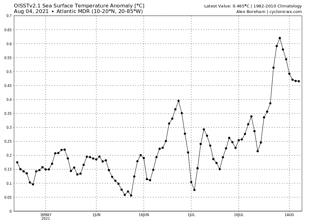
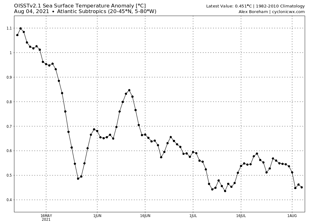
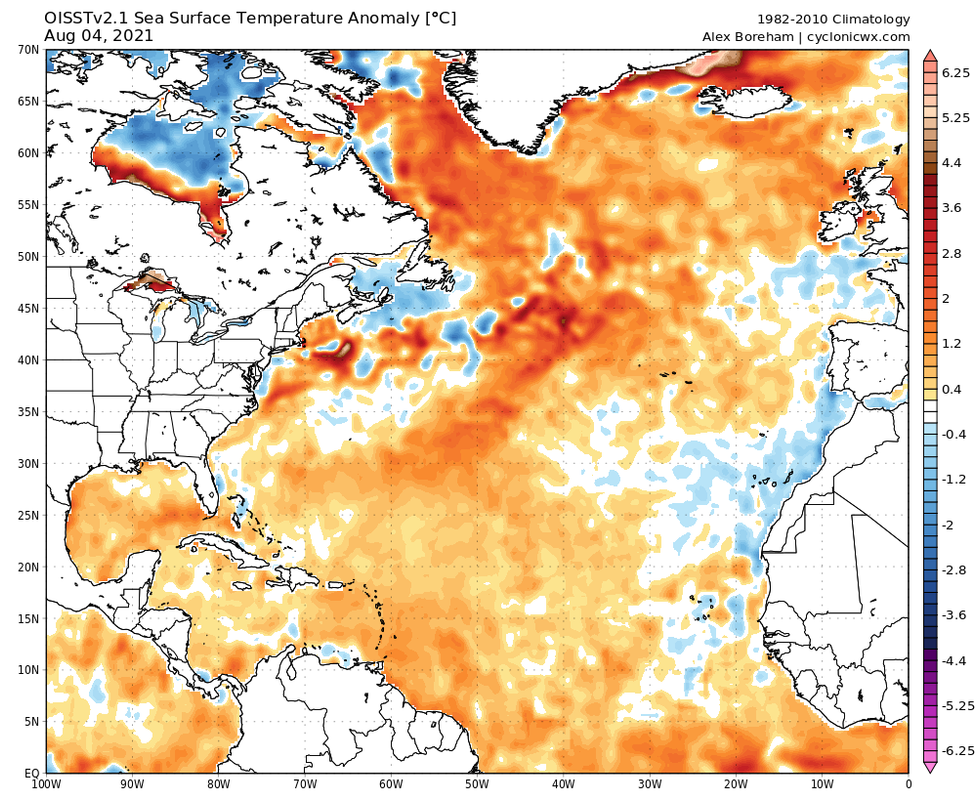
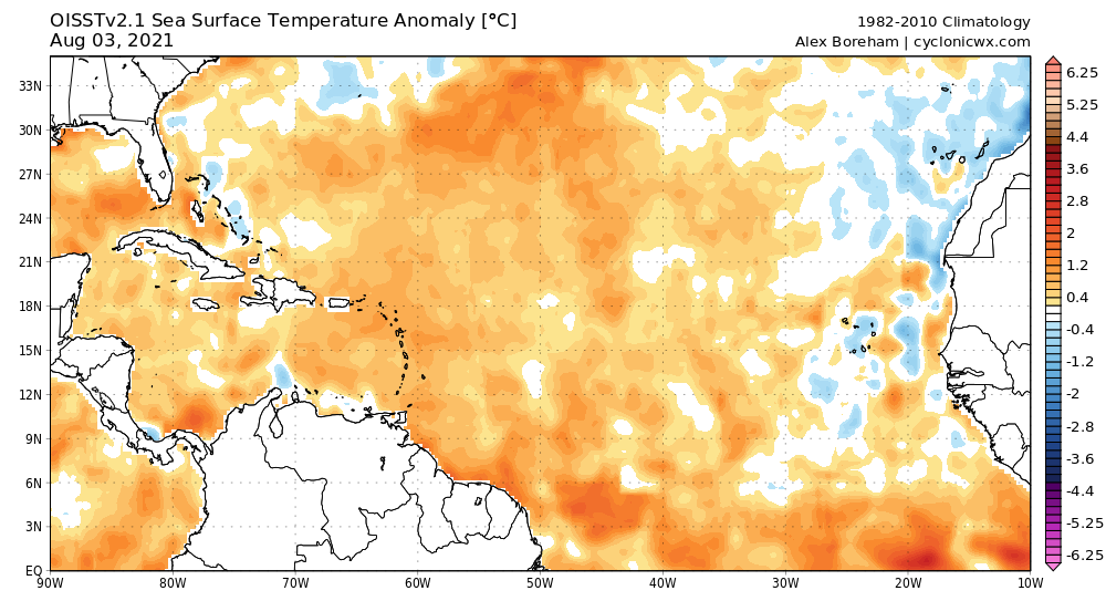
always sufficiently warm to support Category-5 cyclones, even during -AMO cycles. “Record-high” SST and/or THC in the Gulf are irrelevant, whereas shear and dry air
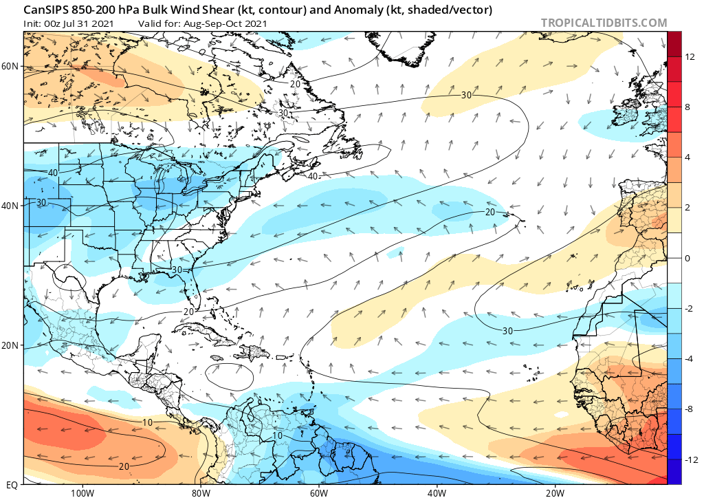
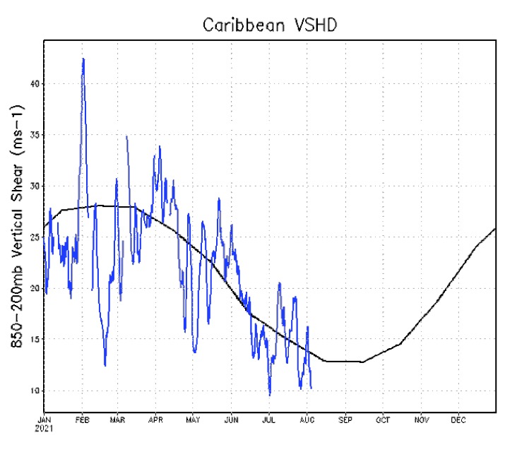
are relevant. Anyway, vertical wind shear was above average in the Caribbean during July 2021, which would actually correlate with lower seasonal ACE. Combined with the -VP over the EPAC, this could indicate more hostile conditions over the Gulf, Caribbean, and western MDR during the peak period of ASO.
Shell Mound, hopefully you don't mind if I ask, but where exactly are you getting this sense that there will be a -VP cell that would make conditions very unfavorable in the Atlantic, let alone persist in a strong manner throughout the season? From my understanding (and this is something NotSparta mentioned in a post a while ago), but 2010 and 2020 were the only two seasons since 1995 to not feature a EPAC rising cell at one point, and given that to be the case, we still managed to get storms like Opal (1995), Bret (1999), Ivan (2004), Katrina/Rita/Wilma (2005), Harvey (2017), and Michael (2018) that were powerful storms in the Gulf and made landfall as major hurricanes. Not to mention a -VP cell in the EPAC making the West Atlantic very unfavorable for storms and killing a season is something I personally have not really heard of before as being possible until you brought it up, so unless another poster here has any insight on this, I just find it somewhat hard to believe that that single parameter alone would be capable of exerting such a dominating influence of the Atlantic and ultimately ruin a season that is otherwise expected to occur during a La Nina. We'll see though, but that's just my take at least.
Also if you don't mind, but could you show where exactly you are getting the idea that more shear in the Caribbean in July correlates with lower seasonal ACE? I'm curious to see the data if you don't mind me asking.
Unless explicitly stated, all info in my posts is based on my own opinions and observations. Tropical storms and hurricanes can be extremely dangerous. Refer to an accredited weather research agency or meteorologist if you need to make serious decisions regarding an approaching storm.


