
2021 Global Model Runs Discussion (Out thru day 16)
Moderator: S2k Moderators
Forum rules

The posts in this forum are NOT official forecasts and should not be used as such. They are just the opinion of the poster and may or may not be backed by sound meteorological data. They are NOT endorsed by any professional institution or STORM2K. For official information, please refer to products from the National Hurricane Center and National Weather Service.
-
Spacecoast

- Category 2

- Posts: 773
- Joined: Thu Aug 31, 2017 2:03 pm
Re: 2021 Global Model Runs Discussion (Out thru day 16)
ECMF ensembles show three systems...
4 likes
-
SFLcane

- S2K Supporter

- Posts: 10281
- Age: 48
- Joined: Sat Jun 05, 2010 1:44 pm
- Location: Lake Worth Florida
Re: 2021 Global Model Runs Discussion (Out thru day 16)
One thing we know based on the lastest models is we should see a ramp in long range guidance soon the Atlantic looks very favorable from about Aug 20th through peak season sept 15th.
2 likes
-
gatorcane

- S2K Supporter
- Posts: 23708
- Age: 48
- Joined: Sun Mar 13, 2005 3:54 pm
- Location: Boca Raton, FL
Re: 2021 Global Model Runs Discussion (Out thru day 16)
The EPAC is going to need to slow down for things to really ramp up in the Atlantic. The GFS continues to favor the EPAC going out to Nora.
0 likes
-
toad strangler

- S2K Supporter
- Posts: 4546
- Joined: Sun Jul 28, 2013 3:09 pm
- Location: Earth
- Contact:
Re: 2021 Global Model Runs Discussion (Out thru day 16)
18z GFS still an E PAC TC pezz dispenser. meh, we’ll see about all that
0 likes
My Weather Station
https://www.wunderground.com/dashboard/pws/KFLPORTS603
https://www.wunderground.com/dashboard/pws/KFLPORTS603

Re: 2021 Global Model Runs Discussion (Out thru day 16)
Hey, GFS, this isn’t an El Niño year or a season starting from +ENSO. Stop trying to pump out storms at a rate that rivals or exceeds 2016/18.
9 likes
Irene '11 Sandy '12 Hermine '16 5/15/2018 Derecho Fay '20 Isaias '20 Elsa '21 Henri '21 Ida '21
I am only a meteorology enthusiast who knows a decent amount about tropical cyclones. Look to the professional mets, the NHC, or your local weather office for the best information.
I am only a meteorology enthusiast who knows a decent amount about tropical cyclones. Look to the professional mets, the NHC, or your local weather office for the best information.
-
Category5Kaiju

- Category 5

- Posts: 4334
- Joined: Thu Dec 24, 2020 12:45 pm
- Location: Seattle and Phoenix
Re: 2021 Global Model Runs Discussion (Out thru day 16)
Yeah idk, this GFS model continously blowing up literally every single cloud into a TC in the EPAC seems a bit fishy, but we'll see. I do have a hunch that there's some model bias here though and that it is slowly (but I guess it will be eventual) realizing the transition from EPAC to Atlantic in terms of favorability.
1 likes
Unless explicitly stated, all info in my posts is based on my own opinions and observations. Tropical storms and hurricanes can be extremely dangerous. Refer to an accredited weather research agency or meteorologist if you need to make serious decisions regarding an approaching storm.
-
crownweather

- S2K Supporter
- Posts: 602
- Age: 51
- Joined: Sat Aug 12, 2006 9:21 am
- Location: Sturbridge, Massachusetts
- Contact:
Re: 2021 Global Model Runs Discussion (Out thru day 16)
00Z GFS model starting to trend towards showing more areas to watch in the next couple of weeks or so, including:
Invest 92-L that ends up heading westward quite a ways, but curves towards Bermuda in the longer range. Still think it's turning it too quickly.
Central Atlantic tropical wave that tries to make a go at it in the Bahamas later next week.
Also, development of a Gulf of Mexico tropical system near the end of the GFS model run.
2 likes
Rob Lightbown
Crown Weather Services
https://crownweather.com
Crown Weather Services
https://crownweather.com
-
AtlanticWind

- S2K Supporter
- Posts: 1898
- Age: 67
- Joined: Sun Aug 08, 2004 9:57 pm
- Location: Plantation,Fla
Re: 2021 Global Model Runs Discussion (Out thru day 16)
crownweather wrote:00Z GFS model starting to trend towards showing more areas to watch in the next couple of weeks or so, including:
Invest 92-L that ends up heading westward quite a ways, but curves towards Bermuda in the longer range. Still think it's turning it too quickly.
Central Atlantic tropical wave that tries to make a go at it in the Bahamas later next week.
Also, development of a Gulf of Mexico tropical system near the end of the GFS model run.
Things are starting to come alive on GFS , expect it will start showing stronger systems soon.
2 likes
-
crownweather
- S2K Supporter
- Posts: 602
- Age: 51
- Joined: Sat Aug 12, 2006 9:21 am
- Location: Sturbridge, Massachusetts
- Contact:
Re: 2021 Global Model Runs Discussion (Out thru day 16)
AtlanticWind wrote:crownweather wrote:00Z GFS model starting to trend towards showing more areas to watch in the next couple of weeks or so, including:
Invest 92-L that ends up heading westward quite a ways, but curves towards Bermuda in the longer range. Still think it's turning it too quickly.
Central Atlantic tropical wave that tries to make a go at it in the Bahamas later next week.
Also, development of a Gulf of Mexico tropical system near the end of the GFS model run.
Things are starting to come alive on GFS , expect it will start showing stronger systems soon.
Yep, agreed. Wasn't buying the quick NW motion GFS was showing for 92-L. Definitely think that we'll see that tropical switch get turned on within the next 10 days or so & we should be rocking and rolling during the 2nd half of this month. BTW, Euro now slowly coming on board too with showing a little more development in the MDR in the next week or so.
5 likes
Rob Lightbown
Crown Weather Services
https://crownweather.com
Crown Weather Services
https://crownweather.com
Re: 2021 Global Model Runs Discussion (Out thru day 16)
crownweather wrote:00Z GFS model starting to trend towards showing more areas to watch in the next couple of weeks or so, including:
Invest 92-L that ends up heading westward quite a ways, but curves towards Bermuda in the longer range. Still think it's turning it too quickly.
Central Atlantic tropical wave that tries to make a go at it in the Bahamas later next week.
Also, development of a Gulf of Mexico tropical system near the end of the GFS model run.
There’s also a low pressure system that emerges from the Mid-Atlantic on Monday that might bear watching for a quick spin up like Bill or Kyle.
1 likes
Irene '11 Sandy '12 Hermine '16 5/15/2018 Derecho Fay '20 Isaias '20 Elsa '21 Henri '21 Ida '21
I am only a meteorology enthusiast who knows a decent amount about tropical cyclones. Look to the professional mets, the NHC, or your local weather office for the best information.
I am only a meteorology enthusiast who knows a decent amount about tropical cyclones. Look to the professional mets, the NHC, or your local weather office for the best information.
-
AlphaToOmega
- Category 5
- Posts: 1448
- Joined: Sat Jun 26, 2021 10:51 am
- Location: Somewhere in Massachusetts
Re: 2021 Global Model Runs Discussion (Out thru day 16)
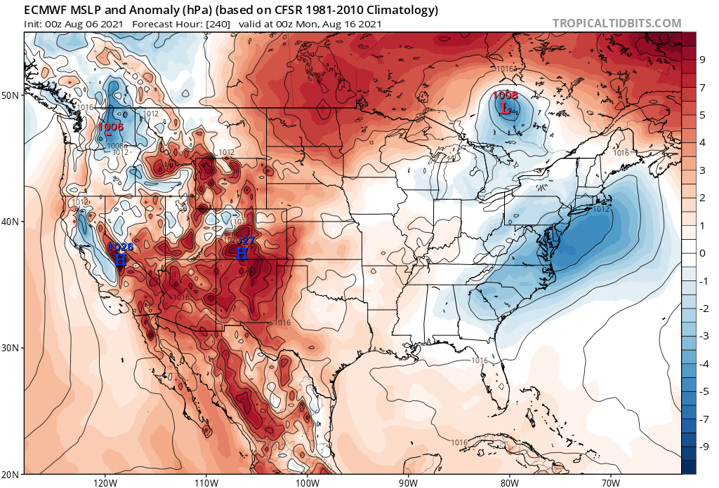
I love it when my tropical storms develop inside Ontario
1 likes
Re: 2021 Global Model Runs Discussion (Out thru day 16)
That long-range Caribbean/Gulf system appears on the 06z GFS too. Looks like the precursor wave emerges off of Africa on August 10th. If these currently marked waves fail to develop but help prep the environment ahead of this modeled wave, it’s possible we might need to watch it for MDR development.
1 likes
Irene '11 Sandy '12 Hermine '16 5/15/2018 Derecho Fay '20 Isaias '20 Elsa '21 Henri '21 Ida '21
I am only a meteorology enthusiast who knows a decent amount about tropical cyclones. Look to the professional mets, the NHC, or your local weather office for the best information.
I am only a meteorology enthusiast who knows a decent amount about tropical cyclones. Look to the professional mets, the NHC, or your local weather office for the best information.
-
SFLcane
- S2K Supporter
- Posts: 10281
- Age: 48
- Joined: Sat Jun 05, 2010 1:44 pm
- Location: Lake Worth Florida
Re: 2021 Global Model Runs Discussion (Out thru day 16)
Overnight long range guidance is still meh… interesting the ECMWF seasonal backed off to average. Just to dry and stable right now. It's competing factors Right now La Niña and WAM vs stability plus cooler MDR (relative to the rest).
We will see when it flips.
We will see when it flips.
0 likes
-
Category5Kaiju
- Category 5
- Posts: 4334
- Joined: Thu Dec 24, 2020 12:45 pm
- Location: Seattle and Phoenix
Re: 2021 Global Model Runs Discussion (Out thru day 16)
GFS wants a pretty robust Caribbean rider by the end of its run
0 likes
Unless explicitly stated, all info in my posts is based on my own opinions and observations. Tropical storms and hurricanes can be extremely dangerous. Refer to an accredited weather research agency or meteorologist if you need to make serious decisions regarding an approaching storm.
-
Dean4Storms
- S2K Supporter
- Posts: 6358
- Age: 63
- Joined: Sun Aug 31, 2003 1:01 pm
- Location: Miramar Bch. FL
Re: 2021 Global Model Runs Discussion (Out thru day 16)
Of course out in long range none of these solutions are to be trusted but the overall pattern is toward an active next 4 weeks. East Coast and Gulf could come under the gun before the end of August arrives.
3 likes
-
doomhaMwx

- Category 5
- Posts: 2487
- Age: 27
- Joined: Tue Apr 18, 2017 4:01 am
- Location: Baguio/Benguet, Philippines
- Contact:
Re: 2021 Global Model Runs Discussion (Out thru day 16)
How about a bonafide hurricane in the Black Sea by GFS?! 
https://twitter.com/WxNB_/status/1423591639050825739
https://twitter.com/WxNB_/status/1423591658696945674
https://twitter.com/WxNB_/status/1423591639050825739
https://twitter.com/WxNB_/status/1423591658696945674
6 likes
-
AlphaToOmega
- Category 5
- Posts: 1448
- Joined: Sat Jun 26, 2021 10:51 am
- Location: Somewhere in Massachusetts
Re: 2021 Global Model Runs Discussion (Out thru day 16)
Models show tropical development inside Canada, and now they show development in the Black Sea? What is next? Are models going to start showing a 150-knot hurricane forming inside Kansas?
0 likes
-
Category5Kaiju
- Category 5
- Posts: 4334
- Joined: Thu Dec 24, 2020 12:45 pm
- Location: Seattle and Phoenix
Re: 2021 Global Model Runs Discussion (Out thru day 16)
Imran_doomhaMwx wrote:How about a bonafide hurricane in the Black Sea by GFS?!
https://twitter.com/WxNB_/status/1423591639050825739?s=19
https://twitter.com/WxNB_/status/1423591658696945674?s=19
Ok, Medicanes hitting Italy or Greece are believable, but a hurricane hitting Ukraine is simply not.
1 likes
Unless explicitly stated, all info in my posts is based on my own opinions and observations. Tropical storms and hurricanes can be extremely dangerous. Refer to an accredited weather research agency or meteorologist if you need to make serious decisions regarding an approaching storm.
-
hurricane2025
- Category 1

- Posts: 254
- Joined: Thu Apr 08, 2021 10:36 am
Who is online
Users browsing this forum: Category5Kaiju and 195 guests