
12z EURO 120 Hours... Vorticity much better (Still TD/TS at best) than previous runs as it skims N of Hispaniola...
Moderator: S2k Moderators


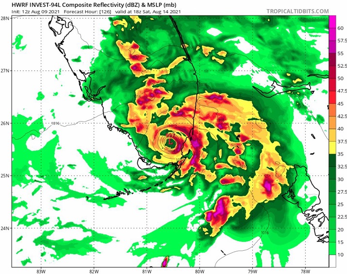
Hypercane_Kyle wrote:12z HWRF keeps the system a tropical cyclone, but very weak. Getting absolutely slammed with shear in the Bahamas.


BobHarlem wrote:Hypercane_Kyle wrote:12z HWRF keeps the system a tropical cyclone, but very weak. Getting absolutely slammed with shear in the Bahamas.
End of the run it seems to make a fairly quick ramp up as the shear abates just on the western side of the Bahamas approaching S. Fl. This one is going to drive people crazy if it does that.
Blown Away wrote:
Models sniffing better conditions near SFL...


AtlanticWind wrote:Just dont completely trust the models on intensity 5 days out.
Hwrf shows this starting to intensify right before coming ashore in S Fla
Euro shows the same thing.
If the shear forecasts are a little off , Future (possible) Fred will have very warm waters
to fuel it.
Still somewhat concerned if this avoids much land interaction and stays over water North
of the Greater Antilles.
AtlanticWind wrote:
Drops 13 MB in a very short time .That must mean much better conditions right before landfall in S Fla.


Users browsing this forum: No registered users and 20 guests

