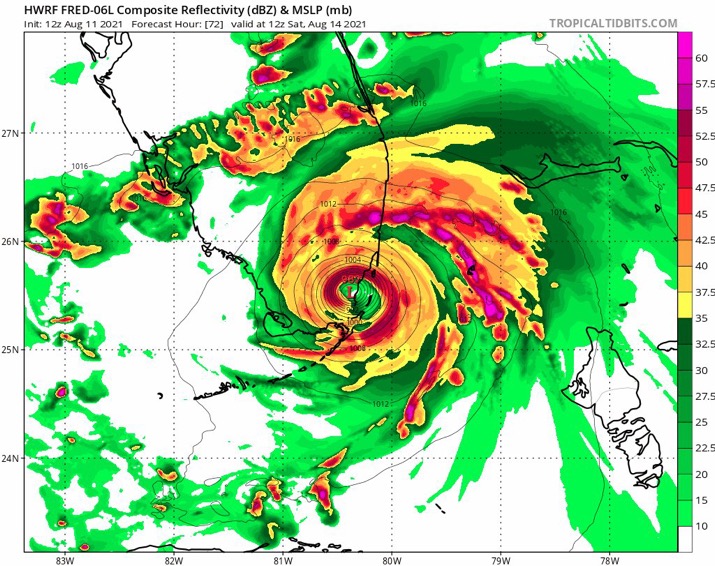
Jr0d wrote:The HWRF is back to being the HWRF on this run. After having the center 'jump' north over Hispaniola it shows Fred pulling itself together on late Friday, also a bit slower than most of the models.
https://ibb.co/WHLLGWd
Levi said in his video the llc may very well jump north