Moderator: S2k Moderators


tolakram wrote:It's interesting how everything is pointing positive, but the MJO appears to be stuck, or just slow to move into phase II. My guess is even though the conditions look bad what we're actually seeing is storms than in most years would not develop. We shall see in a couple of weeks. If Fred ends up doing anything, and right now it's a depression just north of Cuba, it may be our first sign.
tolakram wrote:It's interesting how everything is pointing positive, but the MJO appears to be stuck, or just slow to move into phase II. My guess is even though the conditions look bad what we're actually seeing is storms than in most years would not develop. We shall see in a couple of weeks. If Fred ends up doing anything, and right now it's a depression just north of Cuba, it may be our first sign.
Teban54 wrote:IIRC every season around August 15, some people and even experts are saying "there are no signs of [insert unfavorable conditions here] changing anytime soon", only for them to actually change a few weeks later.


Shell Mound wrote:Teban54 wrote:IIRC every season around August 15, some people and even experts are saying "there are no signs of [insert unfavorable conditions here] changing anytime soon", only for them to actually change a few weeks later.
Do you see any factor that could finally allow the African monsoon to weaken and thereby reduce easterly shear over the MDR?
Kingarabian wrote:Shell Mound wrote:Teban54 wrote:IIRC every season around August 15, some people and even experts are saying "there are no signs of [insert unfavorable conditions here] changing anytime soon", only for them to actually change a few weeks later.
Do you see any factor that could finally allow the African monsoon to weaken and thereby reduce easterly shear over the MDR?
It's nagging mid shear for the most part in the eastern Atlantic that will eventually let up, or, systems will find a sweet spot to develop. Stuff like this happens during exceptional events. I recall the 2015 Super El Nino there was spotty nagging mid shear across the CPAC and EPAC. I really doubt the WAM can get too strong that it inhibits development.
Kingarabian wrote:Shell Mound wrote:Teban54 wrote:IIRC every season around August 15, some people and even experts are saying "there are no signs of [insert unfavorable conditions here] changing anytime soon", only for them to actually change a few weeks later.
Do you see any factor that could finally allow the African monsoon to weaken and thereby reduce easterly shear over the MDR?
It's nagging mid shear for the most part in the eastern Atlantic that will eventually let up, or, systems will find a sweet spot to develop. Stuff like this happens during exceptional events.
Shell Mound wrote:Teban54 wrote:IIRC every season around August 15, some people and even experts are saying "there are no signs of [insert unfavorable conditions here] changing anytime soon", only for them to actually change a few weeks later.
Do you see any factor that could finally allow the African monsoon to weaken and thereby reduce easterly shear over the MDR?

AlphaToOmega wrote:Shell Mound wrote:Teban54 wrote:IIRC every season around August 15, some people and even experts are saying "there are no signs of [insert unfavorable conditions here] changing anytime soon", only for them to actually change a few weeks later.
Do you see any factor that could finally allow the African monsoon to weaken and thereby reduce easterly shear over the MDR?
2020 had a strong West African Monsoon and the Godzilla Dust Storm, yet the season was hyperactive. The models show a VP anomaly pattern very similar to the one in 2020.
Shell Mound wrote:AlphaToOmega wrote:Shell Mound wrote:Do you see any factor that could finally allow the African monsoon to weaken and thereby reduce easterly shear over the MDR?
2020 had a strong West African Monsoon and the Godzilla Dust Storm, yet the season was hyperactive. The models show a VP anomaly pattern very similar to the one in 2020.
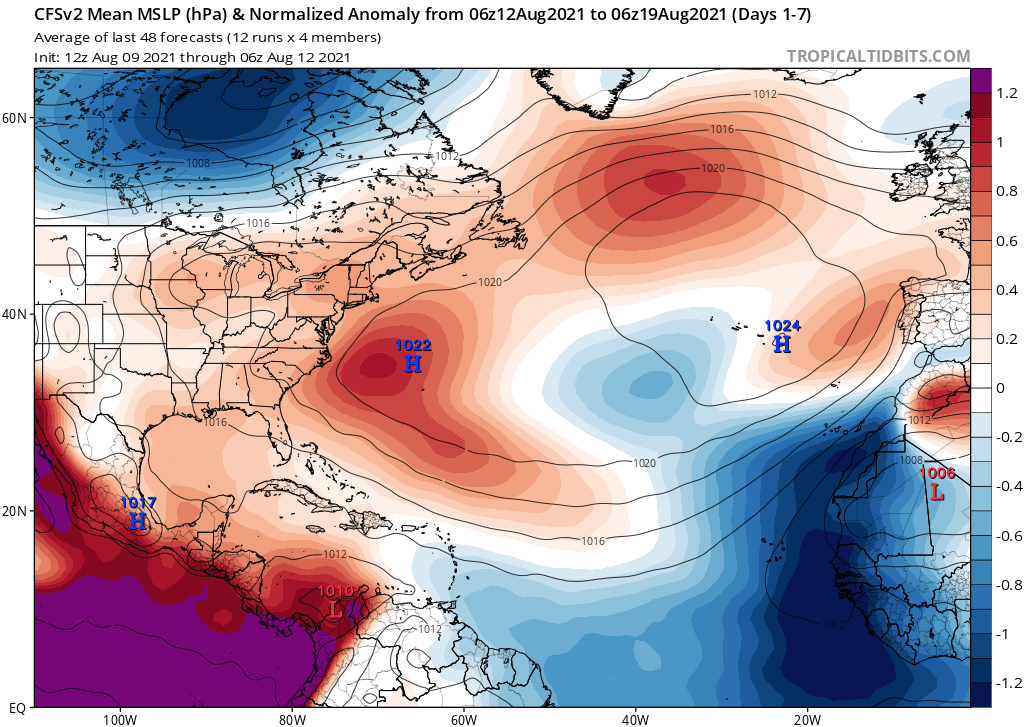
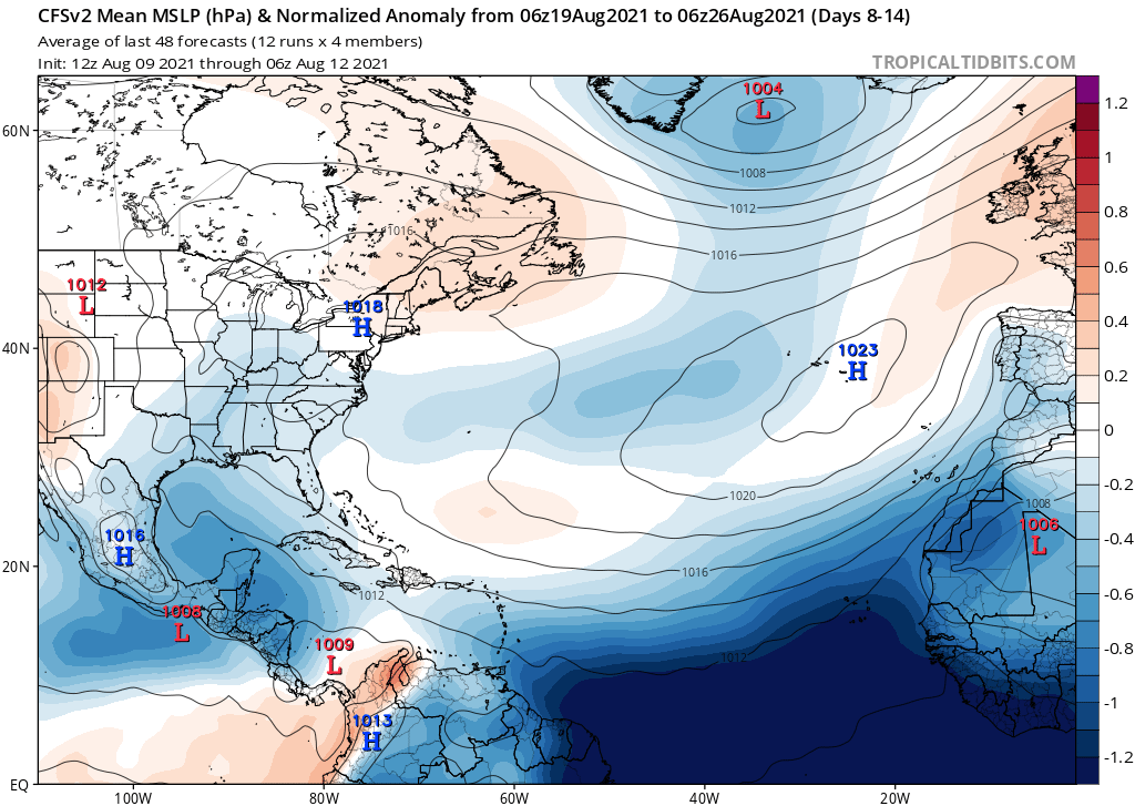
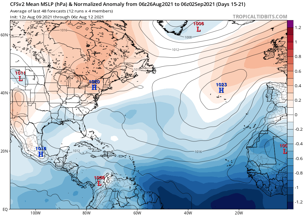
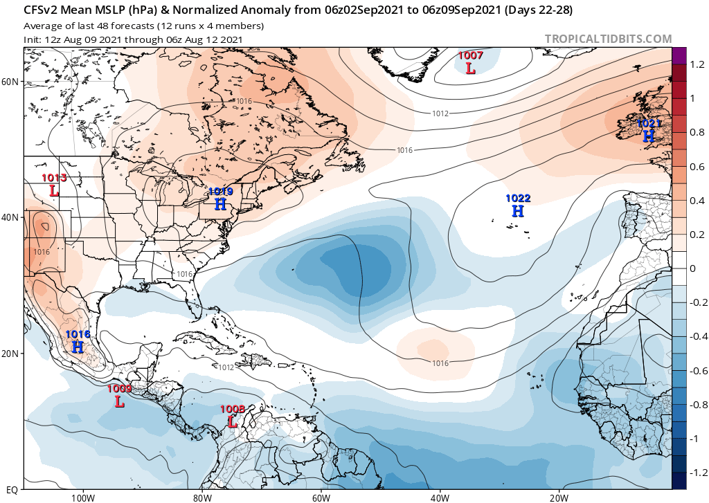
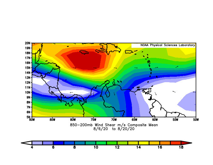
2020 only managed to be hyperactive because VWS in the Caribbean was very low, especially in October and November. Otherwise the MDR was unfavourable due to dry air, a sprawling African monsoon (and thus a strong AEJ imparting easterly shear), and typhoon-aided TUTT activity. Thus far 2021 has been featuring the same issues that plagued 2020 in the MDR, but in addition has also seen numerous PV streamers impinging on the Caribbean, preventing African easterly waves from finding more conducive conditions there, unlike in 2020. So 2021 is like 2020, but without the favourable Caribbean to compensate...
Shell Mound wrote:AlphaToOmega wrote:Shell Mound wrote:Do you see any factor that could finally allow the African monsoon to weaken and thereby reduce easterly shear over the MDR?
2020 had a strong West African Monsoon and the Godzilla Dust Storm, yet the season was hyperactive. The models show a VP anomaly pattern very similar to the one in 2020.
2020 only managed to be hyperactive because VWS in the Caribbean was very low, especially in October and November. Otherwise the MDR was unfavourable due to dry air, a sprawling African monsoon (and thus a strong AEJ imparting easterly shear), and typhoon-aided TUTT activity. Thus far 2021 has been featuring the same issues that plagued 2020 in the MDR, but in addition has also seen numerous PV streamers impinging on the Caribbean, preventing African easterly waves from finding more conducive conditions there, unlike in 2020. So 2021 is like 2020, but without the favourable Caribbean to compensate...


Users browsing this forum: Ulf and 144 guests


