Looks like it’s 2 waves potentially first one recurves but the second one could be on a more westerly course.
Moderator: S2k Moderators


SFLcane wrote:EPS beginning to perk up…
Looks like it’s 2 waves potentially first one recurves but the second one could be on a more westerly course.
https://i.postimg.cc/5Nxf4gbK/A6-A8082-F-3-DF4-422-C-94-D8-4-E90-DD9-E04-A6.gif


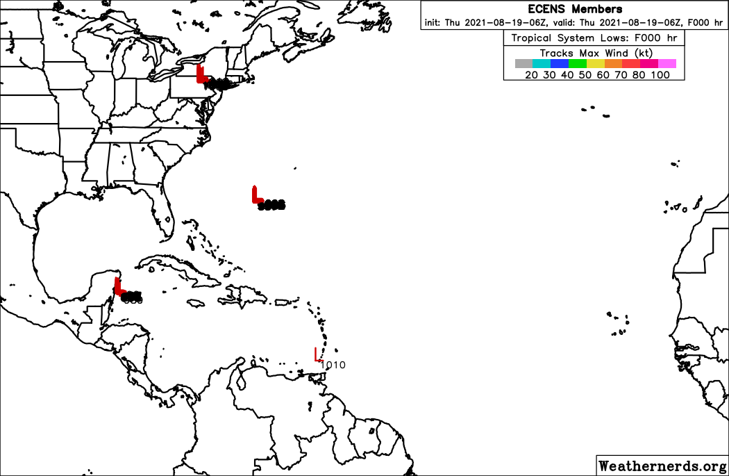
Jr0d wrote:Let's hope the GFS is in fantasy land at the end of the latest run showing a major storm in the Caribbean moving north towards Western Cuba.
Given it originates in the CAG, I do not think it is a likely solution, however the indications that the Northwest Caribbean or Gulf of Mexico will have something around Labor Day weekend is strong.
https://i.ibb.co/XLkGQmq/Screenshot-20210819-111429.png

toad strangler wrote:12z GFS fantasy range again shows a strong cyclone coming up out of the S Caribbean but I strongly caution the validity of this as initial vorticity comes off the mountainous coasts of Columbia & Venezuela. A legendary spot that spits out spurious GFS storms.
AutoPenalti wrote:toad strangler wrote:12z GFS fantasy range again shows a strong cyclone coming up out of the S Caribbean but I strongly caution the validity of this as initial vorticity comes off the mountainous coasts of Columbia & Venezuela. A legendary spot that spits out spurious GFS storms.
Well, at least we know it's pumping out SOMETHING.
SFLcane wrote:AutoPenalti wrote:toad strangler wrote:12z GFS fantasy range again shows a strong cyclone coming up out of the S Caribbean but I strongly caution the validity of this as initial vorticity comes off the mountainous coasts of Columbia & Venezuela. A legendary spot that spits out spurious GFS storms.
Well, at least we know it's pumping out SOMETHING.
That’s if you call something 300+hrs out something.
toad strangler wrote:12z GFS fantasy range again shows a strong cyclone coming up out of the S Caribbean but I strongly caution the validity of this as initial vorticity comes off the mountainous coasts of Columbia & Venezuela. A legendary spot that spits out spurious GFS storms.


lsuhurricane wrote:12z EPS goes berserk with development after 196hrs in many areas. We've been warned......
https://i.ibb.co/j8DpbJY/14-km-EPS-Global-Cyclones-Tropical-Atlantic-Ens-MSLP-Spaghettios.gif
SoupBone wrote:lsuhurricane wrote:12z EPS goes berserk with development after 196hrs in many areas. We've been warned......
https://i.ibb.co/j8DpbJY/14-km-EPS-Global-Cyclones-Tropical-Atlantic-Ens-MSLP-Spaghettios.gif
I can't see your image. I wonder if it's being blocked by work.

Users browsing this forum: StPeteMike and 245 guests


