cycloneye wrote:https://i.imgur.com/VMtZ2wR.gif
Wow..
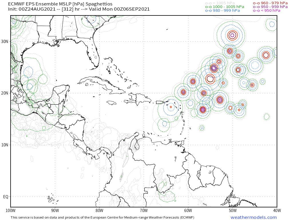
A bit of a SW trend on this 00z EPS run.
Moderator: S2k Moderators


cycloneye wrote:https://i.imgur.com/VMtZ2wR.gif

SFLcane wrote:cycloneye wrote:https://i.imgur.com/VMtZ2wR.gif
Wow..
A bit of a SW trend on this 00z EPS run.
https://i.postimg.cc/g2wFMbb5/0-A3-AADEF-3-A14-4712-842-B-6-E397-C1007-ED.png


Blown Away wrote:https://i.imgur.com/BGfBPZe.gif
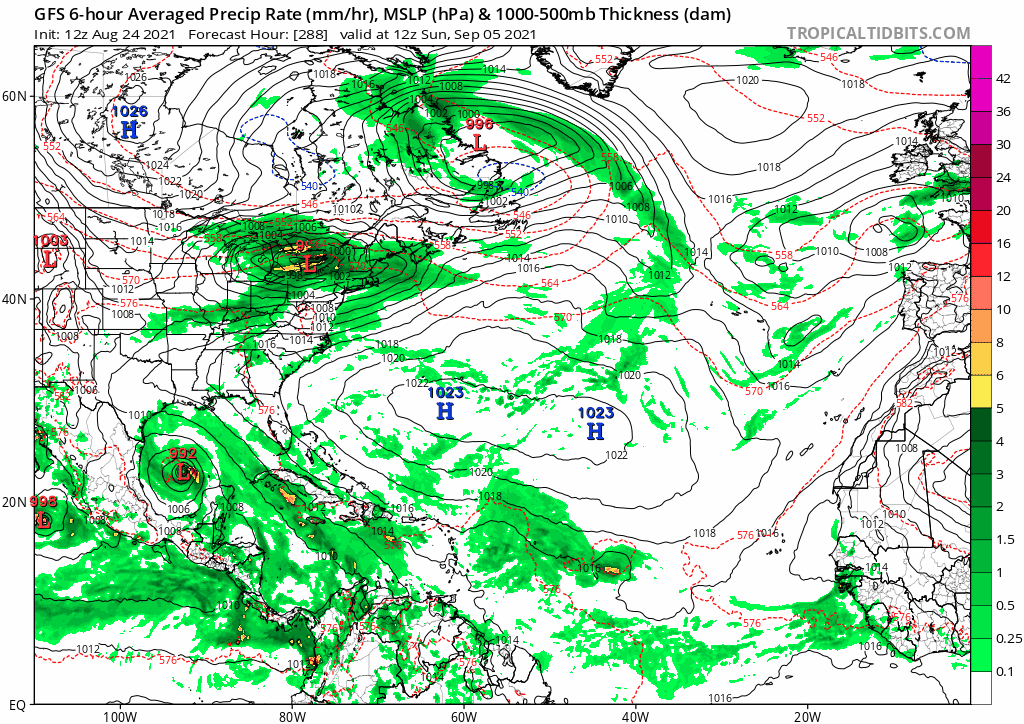
06z GFS... Wow lots going on!!! Take away is there will likely be a lot of activity for these models to resolve, so I wouldn't focus on a track idea beyond 5 days...

Blown Away wrote:https://i.imgur.com/BGfBPZe.gif
06z GFS... Wow lots going on!!! Take away is there will likely be a lot of activity for these models to resolve, so I wouldn't focus on a track idea beyond 5 days...
Also, how many weeks in a row when you run the GFS is there a system developing in the EPAC... Nearly every run!!!
AutoPenalti wrote:
According to that, anything that even gets going even past the MDR is most likely to be pulled out.
Shell Mound wrote:AutoPenalti wrote:
According to that, anything that even gets going even past the MDR is most likely to be pulled out.
The absence of ridging during peak season could allow the CONUS to escape high-end hurricane impacts, given that most of its Category-4+ landfalls were associated with storms that formed in the MDR during August/September.
Shell Mound wrote:AutoPenalti wrote:
According to that, anything that even gets going even past the MDR is most likely to be pulled out.
The absence of ridging during peak season could allow the CONUS to escape high-end hurricane impacts, given that most of its Category-4+ landfalls were associated with storms that formed in the MDR during August/September. Of the thirty Category-4+ hurricanes to strike the CONUS since 1851, fully twenty (two-thirds or 67%) became depressions or stronger in the MDR. So if the upcoming pattern favours OTS, the the U.S. is almost certain to escape Category-4+ impacts for the remainder of the season. We shall see. Both the EPS and GEFS agree on significant TUTT activity and/or weaknesses over the open Atlantic during the climatological peak of the season.

Users browsing this forum: Ulf and 204 guests


