Models were
highlighting this possibility as
early as mid July. So this is not unforeseen and could be great news for the mainland U.S. (see below).
chaser1 wrote:Category5Kaiju wrote:It's also interesting to note that of the 4 recorded Cat 5 CONUS landfalls, Andrew was the only one that formed and originated in the MDR. 1935, Camille, and Michael were homegrown; while n=4 is a very small sample size to look at, perhaps there's something about starting near land and blowing up that proves more durable and advantageous for a storm to make landfall at such strength in the CONUS as opposed to being a long tracker?
This is correct. I have said for years here on this forum, it's not about the eye-candy way off to the east.... it's not about "how many" either. In terms of potential for landfall and destruction, what's most relevant for any given geographic point are those conditions and the steering which are most apt to lead to potential impact for "that given region". That naturally means different things to those in the Islands verses Bermuda. and especially to the many different points along the U.S. coastline. For every Hurricane Allen that might threaten the Texas coastline, how many other storms have struck Texas that actually developed much further west. The same applies for those in Florida. The majority if significant storms impacting Florida have ultimately developed in the Western Atlantic basin. Meanwhile, those CV origin tropical cyclones that don't veer out to sea have posed the greatest threat to the Caribbean and perhaps the mid-Atlantic Seaboard.

Of the thirty hurricanes to strike the CONUS as Category-4+ cyclones since 1851, twenty (two-thirds or 67%) originated as depressions or stronger in the MDR.
So if the upcoming pattern during peak season favours OTS, it means that the seasonal risk of a Category-4+ LF on the CONUS could be greatly diminished.
Of course, our potential system in the W Caribbean could always prove to be one of the exceptions, similar to 1961’s Carla...

 Credit: Wikipedia
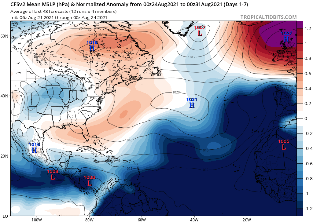
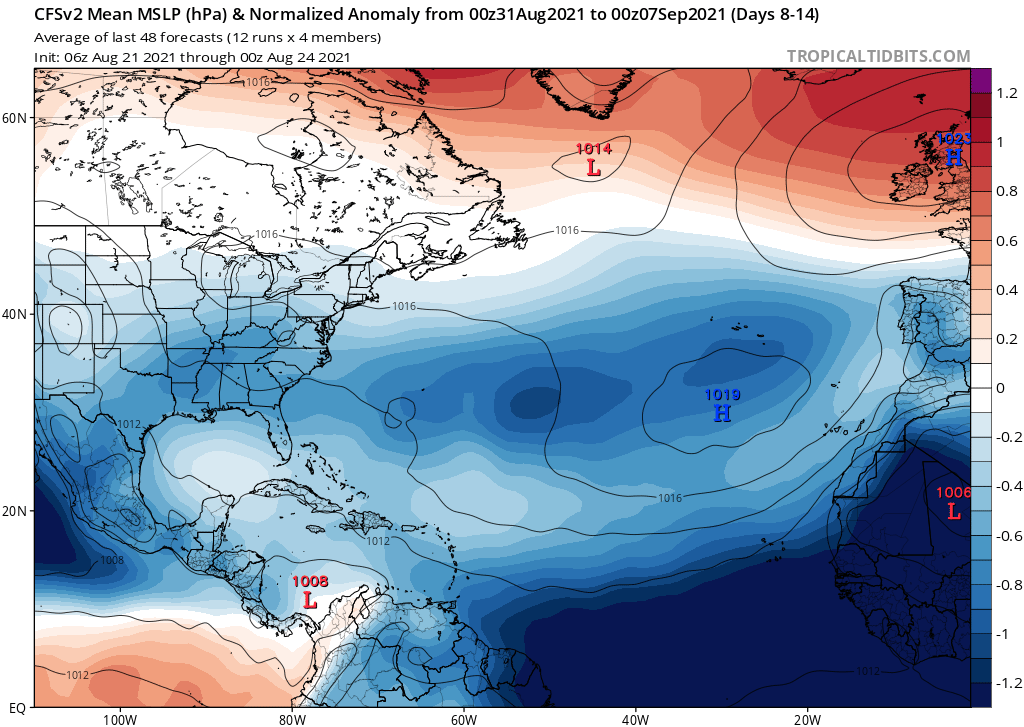
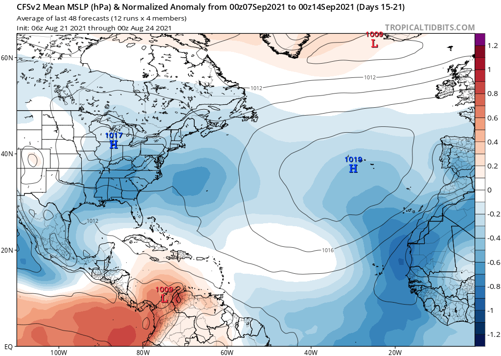
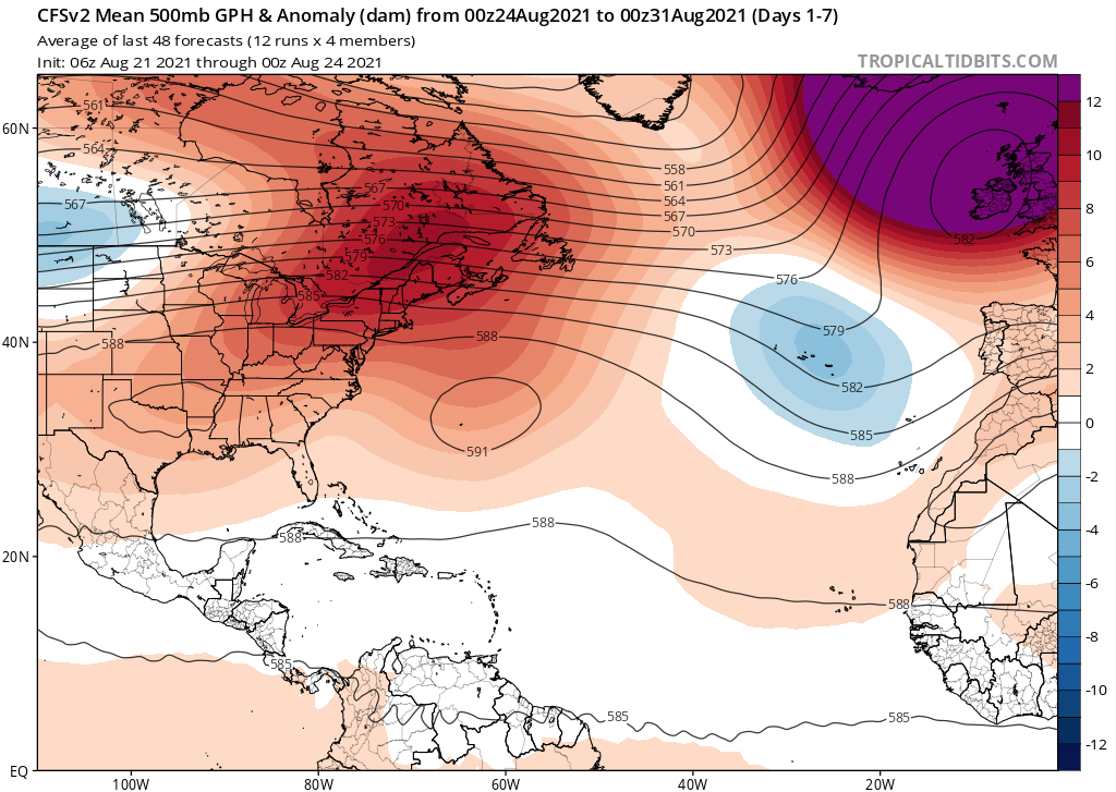
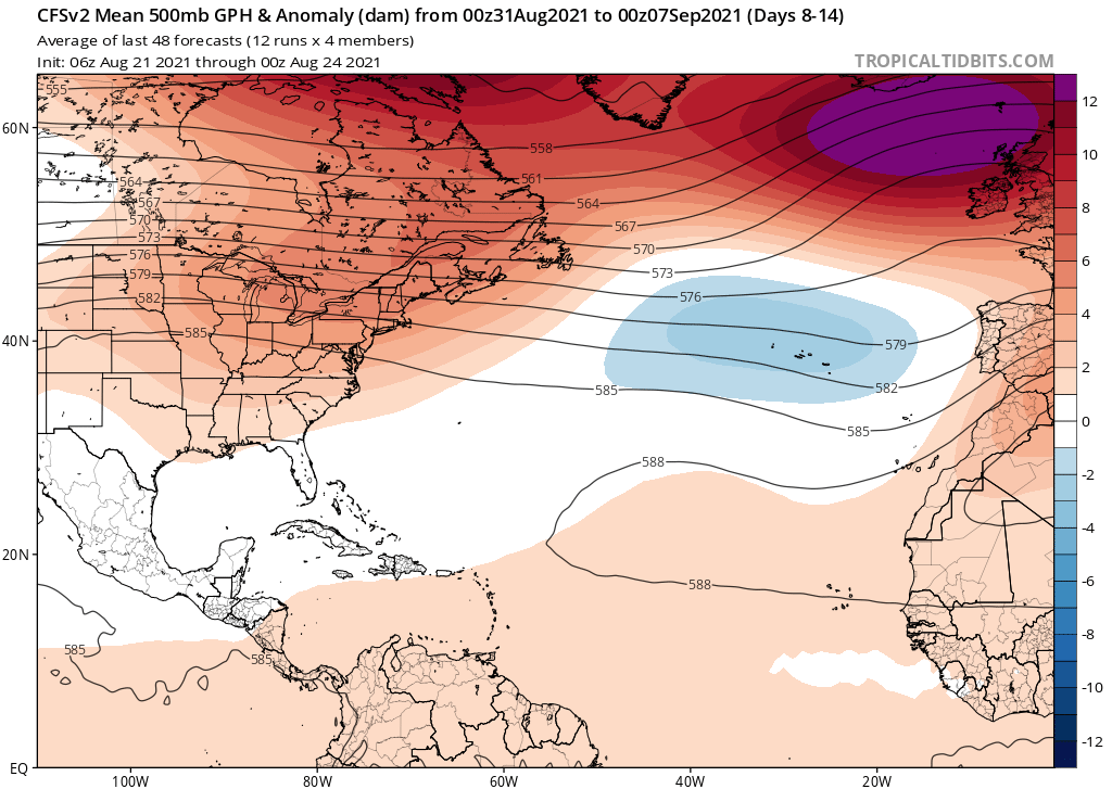
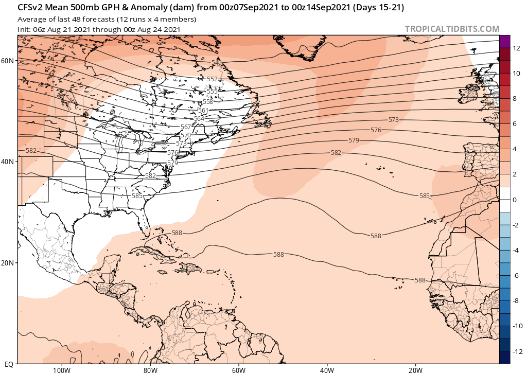
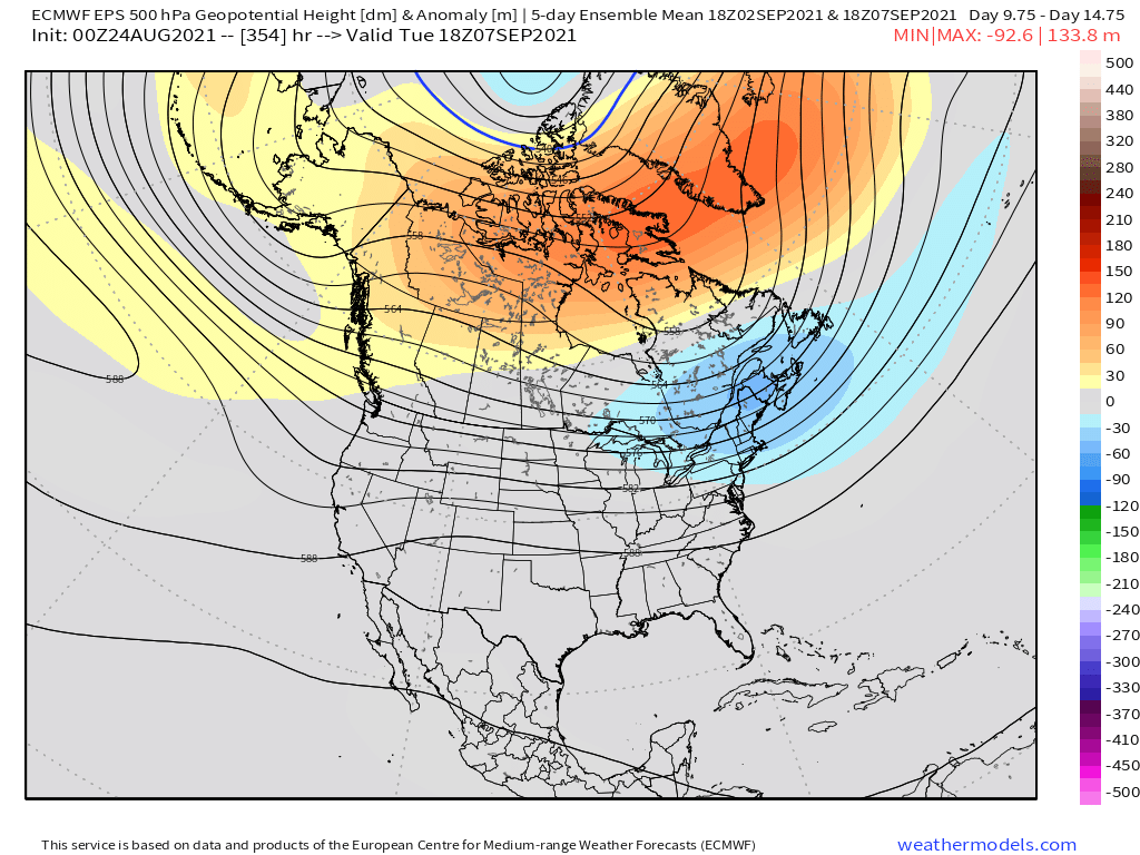
Compared to 2010, 2021 thus far seems to have featured stronger and more zonal ridging. The 500-mb composites confirm this general pattern:


So maybe those model runs for the peak of the 2021 season will end up being incorrect, at least to some degree. 2021 is certainly not 2010.


