ATL: KATE - Remnants - Discussion
Moderator: S2k Moderators

Re: ATL: INVEST 98L - Discussion - WSW of Cabo Verde Islands
Models like this a bit more. Maybe it can be a surprise development and snag the name Julian or Kate. Probably won’t be anything more than a mid-grade TS though.
0 likes
Irene '11 Sandy '12 Hermine '16 5/15/2018 Derecho Fay '20 Isaias '20 Elsa '21 Henri '21 Ida '21
I am only a meteorology enthusiast who knows a decent amount about tropical cyclones. Look to the professional mets, the NHC, or your local weather office for the best information.
I am only a meteorology enthusiast who knows a decent amount about tropical cyclones. Look to the professional mets, the NHC, or your local weather office for the best information.
Re: ATL: INVEST 98L - Discussion - WSW of Cabo Verde Islands
aspen wrote:Models like this a bit more. Maybe it can be a surprise development and snag the name Julian or Kate. Probably won’t be anything more than a mid-grade TS though.
Is this system likely to remain at sea?...
0 likes
-
Sciencerocks
- Category 5

- Posts: 10186
- Age: 40
- Joined: Thu Jul 06, 2017 1:51 am
-
cycloneye

- Admin

- Posts: 149550
- Age: 69
- Joined: Thu Oct 10, 2002 10:54 am
- Location: San Juan, Puerto Rico
Re: ATL: INVEST 98L - Discussion - SW of Cabo Verde Islands
A tropical wave over the far eastern tropical Atlantic located
several hundred miles west-southwest of the Cabo Verde Islands is
producing disorganized showers and thunderstorms. Some development
of this system is possible over the next several days while it moves
west-northwestward at 10 to 15 mph over the eastern tropical
Atlantic. Upper-level winds are forecast to become less conducive
for development by early next week.
* Formation chance through 48 hours...low...20 percent.
* Formation chance through 5 days...low...30 percent.
0 likes
Visit the Caribbean-Central America Weather Thread where you can find at first post web cams,radars
and observations from Caribbean basin members Click Here
and observations from Caribbean basin members Click Here
-
Sciencerocks
- Category 5
- Posts: 10186
- Age: 40
- Joined: Thu Jul 06, 2017 1:51 am

Re: ATL: INVEST 98L - Discussion - SW of Cabo Verde Islands
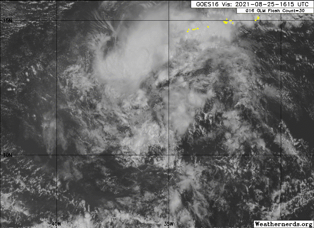
Deep convection popping again. Looks better than you might expect from a 20/30 wave.
0 likes
TC naming lists: retirements and intensity
Most aggressive Advisory #1's in North Atlantic (cr. kevin for starting the list)
Most aggressive Advisory #1's in North Atlantic (cr. kevin for starting the list)


Re: ATL: INVEST 98L - Discussion - SW of Cabo Verde Islands
Teban54 wrote:Deep convection popping again. Looks better than you might expect from a 20/30 wave.
just took a look that is a decent blow-up, have not looked at it in about 24 hours, seems to have moved NW a bit but not by a whole lot.
0 likes
Once I see the REDS and GREENS Converge on a Base Velocity. ... I'm There!!
This is NOT an Official Forecast....Just my Opinion. For official information, please refer to the NHC and NWS products.
HIGHLIGHTS : '13 El Reno Tornado : 2013 Storm Chaser Tour, Joaquin; SC flood event, Matthew '16, Lowcountry Snow storm Jan '18
This is NOT an Official Forecast....Just my Opinion. For official information, please refer to the NHC and NWS products.
HIGHLIGHTS : '13 El Reno Tornado : 2013 Storm Chaser Tour, Joaquin; SC flood event, Matthew '16, Lowcountry Snow storm Jan '18
-
cycloneye
- Admin
- Posts: 149550
- Age: 69
- Joined: Thu Oct 10, 2002 10:54 am
- Location: San Juan, Puerto Rico
Re: ATL: INVEST 98L - Discussion - SW of Cabo Verde Islands
A tropical wave located over the central tropical Atlantic about
1000 miles west-southwest of the Cabo Verde Islands is producing
disorganized showers and thunderstorms. Environmental conditions
appear a little more conducive for development during the next few
days, and a tropical depression could form by the weekend while the
system moves toward the west-northwest or northwest at 10 to 15
mph. Upper-level winds could become less conducive for development
by early next week.
* Formation chance through 48 hours...medium...40 percent.
* Formation chance through 5 days...medium...50 percent.
0 likes
Visit the Caribbean-Central America Weather Thread where you can find at first post web cams,radars
and observations from Caribbean basin members Click Here
and observations from Caribbean basin members Click Here
Re: ATL: INVEST 98L - Discussion - SW of Cabo Verde Islands
The HWRF has shown this becoming a weak Cat 1 in 5 days when it reaches some 27-28C SSTs around 30N/40W. Models overall have lost interest in 97L but have shown more development for 98L, and it looks the best of the two; 97L still appears to be strung out. It’s also quite possible neither of these develop, or it only peaks as a weak to moderate TS.
2 likes
Irene '11 Sandy '12 Hermine '16 5/15/2018 Derecho Fay '20 Isaias '20 Elsa '21 Henri '21 Ida '21
I am only a meteorology enthusiast who knows a decent amount about tropical cyclones. Look to the professional mets, the NHC, or your local weather office for the best information.
I am only a meteorology enthusiast who knows a decent amount about tropical cyclones. Look to the professional mets, the NHC, or your local weather office for the best information.
Re: ATL: INVEST 98L - Discussion - WSW of Cabo Verde Islands
This looks great on Vis for an Invest seen TS look worse 
0 likes
Once I see the REDS and GREENS Converge on a Base Velocity. ... I'm There!!
This is NOT an Official Forecast....Just my Opinion. For official information, please refer to the NHC and NWS products.
HIGHLIGHTS : '13 El Reno Tornado : 2013 Storm Chaser Tour, Joaquin; SC flood event, Matthew '16, Lowcountry Snow storm Jan '18
This is NOT an Official Forecast....Just my Opinion. For official information, please refer to the NHC and NWS products.
HIGHLIGHTS : '13 El Reno Tornado : 2013 Storm Chaser Tour, Joaquin; SC flood event, Matthew '16, Lowcountry Snow storm Jan '18
-
Sciencerocks
- Category 5
- Posts: 10186
- Age: 40
- Joined: Thu Jul 06, 2017 1:51 am
-
Stormybajan

- Category 1

- Posts: 453
- Joined: Thu May 20, 2021 3:21 pm
- Location: Windward Islands
Re: ATL: INVEST 98L - Discussion - WSW of Cabo Verde Islands
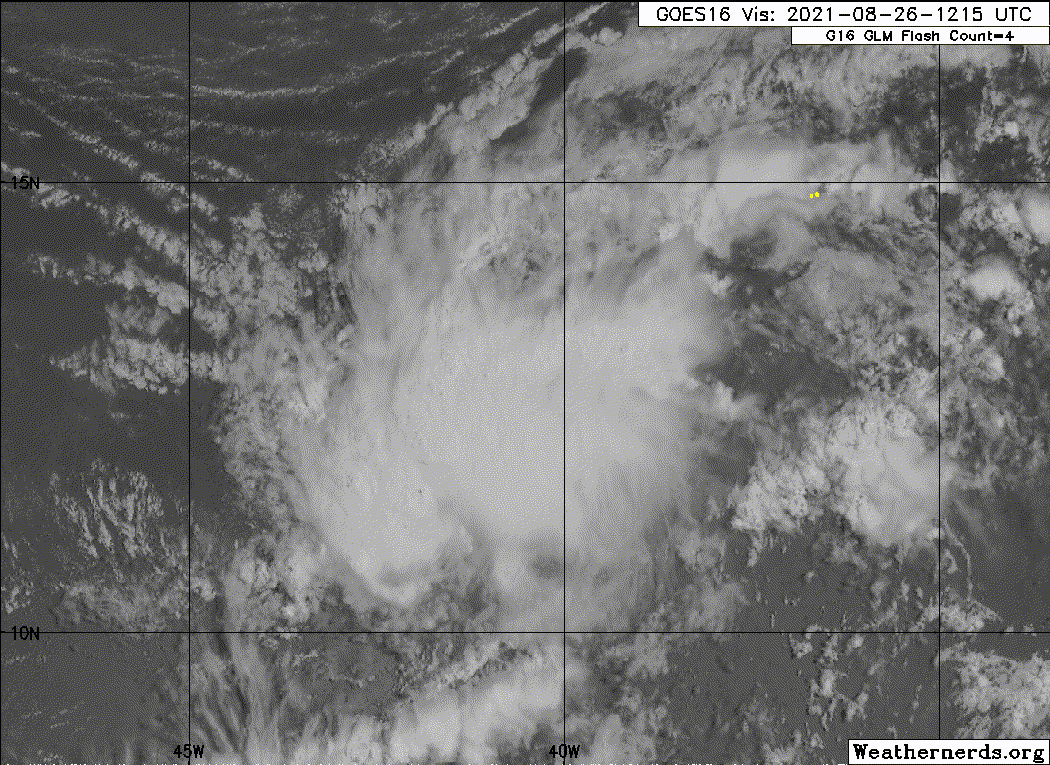
98L looks way better than I expected at this point. Lets see if it can pull a fast one and become Julian
0 likes
Sad West Indies and Manchester United fan ⚽️
-
cycloneye
- Admin
- Posts: 149550
- Age: 69
- Joined: Thu Oct 10, 2002 10:54 am
- Location: San Juan, Puerto Rico
Re: ATL: INVEST 98L - Discussion - WSW of Cabo Verde Islands
A tropical wave located over the tropical Atlantic about midway
between the Cabo Verde Islands and the Lesser Antilles continues
to produce a large area of disorganized showers and thunderstorms.
Environmental conditions are expected to be conducive for
development during the next few days, and a tropical depression is
likely to form over the weekend while the system moves toward the
west-northwest or northwest at 10 to 15 mph. The disturbance is
forecast to turn northward early next week.
* Formation chance through 48 hours...medium...60 percent.
* Formation chance through 5 days...high...70 percent.
0 likes
Visit the Caribbean-Central America Weather Thread where you can find at first post web cams,radars
and observations from Caribbean basin members Click Here
and observations from Caribbean basin members Click Here
-
Sciencerocks
- Category 5
- Posts: 10186
- Age: 40
- Joined: Thu Jul 06, 2017 1:51 am
-
ScottNAtlanta

- Category 5
- Posts: 2535
- Joined: Sat May 25, 2013 3:11 pm
- Location: Atlanta, GA
Re: ATL: INVEST 98L - Discussion
I don't see anything in the immediate future that is going to make this gain latitude.
0 likes
The posts in this forum are NOT official forecast and should not be used as such. They are just the opinion of the poster and may or may not be backed by sound meteorological data. They are NOT endorsed by any professional institution or storm2k.org. For official information, please refer to the NHC and NWS products.
Re: ATL: INVEST 98L - Discussion
ScottNAtlanta wrote:I don't see anything in the immediate future that is going to make this gain latitude.
Yeah I was thinking the same, looks impressive, they have had this area highlighted with a NW ever since it was a lemon, and it's only gained 2/3 degrees of latitude in about 48 hours
3 likes
Once I see the REDS and GREENS Converge on a Base Velocity. ... I'm There!!
This is NOT an Official Forecast....Just my Opinion. For official information, please refer to the NHC and NWS products.
HIGHLIGHTS : '13 El Reno Tornado : 2013 Storm Chaser Tour, Joaquin; SC flood event, Matthew '16, Lowcountry Snow storm Jan '18
This is NOT an Official Forecast....Just my Opinion. For official information, please refer to the NHC and NWS products.
HIGHLIGHTS : '13 El Reno Tornado : 2013 Storm Chaser Tour, Joaquin; SC flood event, Matthew '16, Lowcountry Snow storm Jan '18
-
cheezyWXguy

- Category 5
- Posts: 6282
- Joined: Mon Feb 13, 2006 12:29 am
- Location: Dallas, TX
Re: ATL: INVEST 98L - Discussion
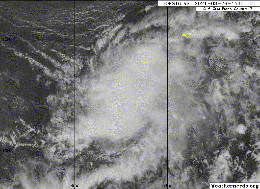
Looks very good, but it is very likely not closed at the surface yet. Everything to the south is moving directly north, no west winds yet. Shouldn’t take long if it keeps this up though
0 likes


Re: ATL: INVEST 98L - Discussion
Mid level center around 12N & 42 looks to be really starting to crank and work toward the surface. It's now over 28C SST's too. It wouldn't shock me if this earned a name by Sat morning.
0 likes
Andy D
(For official information, please refer to the NHC and NWS products.)
(For official information, please refer to the NHC and NWS products.)
-
cycloneye
- Admin
- Posts: 149550
- Age: 69
- Joined: Thu Oct 10, 2002 10:54 am
- Location: San Juan, Puerto Rico
Re: ATL: INVEST 98L - Discussion
A tropical wave located about midway between the Cabo Verde Islands
and the Lesser Antilles continues to produce a large area of
disorganized showers and thunderstorms. Gradual development of this
system is expected, and a tropical depression is likely to form
during the next couple of days before it moves into an environment
of stronger upper-level winds and slightly cooler waters. The
disturbance is forecast to move west-northwestward for another day
or so and then turn northward over the weekend.
* Formation chance through 48 hours...medium...60 percent.
* Formation chance through 5 days...high...70 percent.
0 likes
Visit the Caribbean-Central America Weather Thread where you can find at first post web cams,radars
and observations from Caribbean basin members Click Here
and observations from Caribbean basin members Click Here
-
ScottNAtlanta
- Category 5
- Posts: 2535
- Joined: Sat May 25, 2013 3:11 pm
- Location: Atlanta, GA
Re: ATL: INVEST 98L - Discussion
Ok...this was 20/40, then 20/30, and now it's 60/70. 
Looking at the WV loop if anything it looks like it is being pushed just south of west. According to most of the models this needs to take a pretty drastic turn north in the next 24hrs and I just don't see it. I think the models were taking a 97L into account being much stronger than it got.
Looking at the WV loop if anything it looks like it is being pushed just south of west. According to most of the models this needs to take a pretty drastic turn north in the next 24hrs and I just don't see it. I think the models were taking a 97L into account being much stronger than it got.
0 likes
The posts in this forum are NOT official forecast and should not be used as such. They are just the opinion of the poster and may or may not be backed by sound meteorological data. They are NOT endorsed by any professional institution or storm2k.org. For official information, please refer to the NHC and NWS products.
Who is online
Users browsing this forum: No registered users and 22 guests