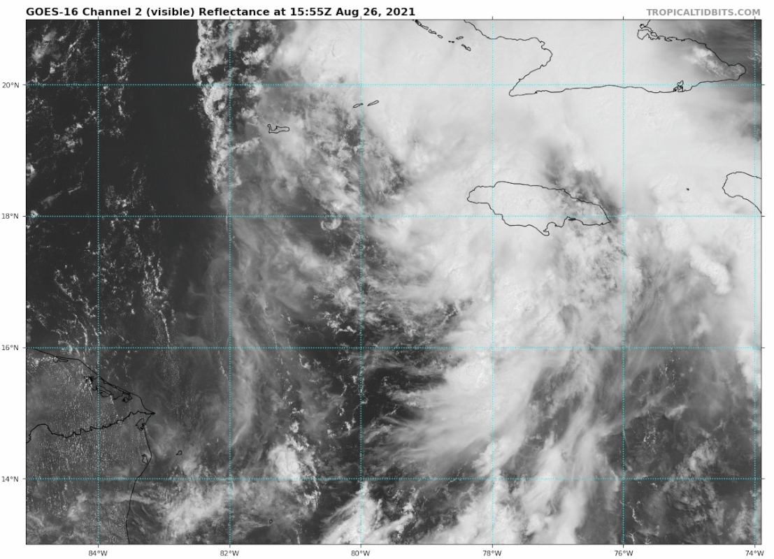
ATL: IDA - Remnants - Discussion

Moderator: S2k Moderators

Message
Author
underthwx
Category 5
Category 5
Posts: 2360
Joined: Sat Jul 30, 2011 2:14 pm
Location: Brazoria County Texas

Re: ATL: NINE - Tropical Depression - Discussion Update= 18z Best Track up to TS IDA

#601 Postby underthwx » Thu Aug 26, 2021 2:40 pm

Hypercane_Kyle wrote:
underthwx wrote:
Hypercane_Kyle wrote:Tropical Storm Ida

9-3-1

I suspect Ida won't be known as a "Tropical Storm" for very long though.

Historical note: Ida was the replacement name for 2003's Isabel. 2009's Ida also approached the Gulf Coast as a hurricane.

https://i.imgur.com/igSJ6HU.jpg


Are you thinking it's a Hurricane prior to entering the Gulf?....


Very real possibility. GFS & HWRF get it close. My guess is 60 knots before Cuba.


Thankyou for your reply...
0 likes   

User avatar
aspen
Category 5
Category 5
Posts: 8818
Joined: Sat Oct 12, 2019 7:10 pm
Location: Connecticut, USA

Re: ATL: NINE - Tropical Depression - Discussion Update= 18z Best Track up to TS IDA

#602 Postby aspen » Thu Aug 26, 2021 2:41 pm

Hypercane_Kyle wrote:
aspen wrote:This is a six hour old TC. Of course it’s gonna look rather rough. It’ll be slow to improve for the next day or so, but should be a better TS by late tonight into early tomorrow.


Honestly does not look that rough. A little sheared but a solid and organizing 35 knot TS.

https://i.imgur.com/7feAzu0.jpg

Its banding and outflow pattern look good for a newly formed TC. It just needs to produce some deep convection over the core.
1 likes   
Irene '11 Sandy '12 Hermine '16 5/15/2018 Derecho Fay '20 Isaias '20 Elsa '21 Henri '21 Ida '21

I am only a meteorology enthusiast who knows a decent amount about tropical cyclones. Look to the professional mets, the NHC, or your local weather office for the best information.

User avatar
InfernoFlameCat
Category 5
Category 5
Posts: 2102
Age: 22
Joined: Mon Dec 14, 2020 10:52 am
Location: Buford, GA

Re: ATL: NINE - Tropical Depression - Discussion

#603 Postby InfernoFlameCat » Thu Aug 26, 2021 2:44 pm

Stormgodess wrote:
Weather Dude wrote:
Stormgodess wrote:

You might as well be speaking madarin :( Im so sorry, What does that mean?

It means it's going to be TS Ida at the next advisory


So with the coords being 17.7N 79.4w That is where I question if an eye was forming earlier? Is it that its just too early in the life of this system for that?

And please dont take that as me questioning anyones judgement, Im sincerely trying to understand and learn

https://i.postimg.cc/QMNLtWXh/goes16-vis-09-L-202108261555.gif

No eye. You need an eyewall for that and on radar there is no eyewall as of now. What you saw was a dry slot in the convection. Typically an eye will be surrounded by deep convection that is rapidly rotating around the eye feature. Also a system will need to develop a Central Dense Overcast/ CDO beforehand. high latitude systems can in fact exhibit an eye at low strength (Ex Pablo before it became a hurricane it had an eye at 50 mph that it maintained through hurricane strength) but farther south generally a clear eye is only found in mature hurricanes.
Last edited by InfernoFlameCat on Thu Aug 26, 2021 2:46 pm, edited 1 time in total.
8 likes   
I am by no means a professional. DO NOT look at my forecasts for official information or make decisions based on what I post.

Goal: to become a registered expert over tropical and subtropical cyclones.

TallahasseeMan
Tropical Storm
Tropical Storm
Posts: 120
Joined: Sat Aug 01, 2020 1:49 pm

Re: ATL: NINE - Tropical Depression - Discussion Update= 18z Best Track up to TS IDA

#604 Postby TallahasseeMan » Thu Aug 26, 2021 2:45 pm

Looks like Recon is getting on the scene at a good time.
0 likes   
Direct hit: Francis '04, Jeanne '04, Wilma '05 Hermine '16 Michael '18

Outer bands: Katrina '05 Irma '17

User avatar
Stormgodess
Category 1
Category 1
Posts: 301
Joined: Mon Sep 14, 2020 1:31 am

Re: ATL: NINE - Tropical Depression - Discussion

#605 Postby Stormgodess » Thu Aug 26, 2021 2:48 pm

InfernoFlameCat wrote:
Stormgodess wrote:
Weather Dude wrote:It means it's going to be TS Ida at the next advisory


So with the coords being 17.7N 79.4w That is where I question if an eye was forming earlier? Is it that its just too early in the life of this system for that?

And please dont take that as me questioning anyones judgement, Im sincerely trying to understand and learn

https://i.postimg.cc/QMNLtWXh/goes16-vis-09-L-202108261555.gif

No eye. You need an eyewall for that and on radar there is no eyewall as of now. What you saw was a dry slot in the convection. Typically an eye will be surrounded by deep convection that is rapidly rotating around the eye feature. Also a system will need to develop a Central Dense Overcast/ CDO beforehand. high latitude systems can in fact exhibit an eye at low strength (Ex Pablo before it became a hurricane it had an eye at 50 mph that it maintained through hurricane strength) but farther south generally a clear eye is only found in mature hurricanes.


Thank you so much... That is exactly the sort of info I was looking for and I understood it too! :woo:
7 likes   

User avatar
skyline385
Category 5
Category 5
Posts: 2728
Age: 35
Joined: Wed Aug 26, 2020 11:15 pm
Location: Houston TX

Re: ATL: NINE - Tropical Depression - Discussion

#606 Postby skyline385 » Thu Aug 26, 2021 2:53 pm

Recon seems to be finding weak flight level winds but there is an unflagged 40 kts SFMR
0 likes   

User avatar
Ubuntwo
Category 5
Category 5
Posts: 1406
Age: 31
Joined: Thu Oct 05, 2017 10:41 pm

Re: ATL: NINE - Tropical Depression - Discussion

#607 Postby Ubuntwo » Thu Aug 26, 2021 2:54 pm

skyline385 wrote:Recon seems to be finding weak flight level winds but there is an unflagged 40 kts SFMR

Discard, that was while they were descending. Next dataset should be entirely at operational altitude.
0 likes   
Kendall -> SLO -> PBC

Memorable Storms: Katrina (for its Florida landfall...) Wilma Matthew Irma

User avatar
ColdMiser123
Professional-Met
Professional-Met
Posts: 904
Age: 29
Joined: Mon Sep 26, 2016 3:26 pm
Location: Northeast US

Re: ATL: NINE - Tropical Depression - Discussion

#608 Postby ColdMiser123 » Thu Aug 26, 2021 2:55 pm

skyline385 wrote:Recon seems to be finding weak flight level winds but there is an unflagged 40 kts SFMR


Still about 2 degrees longitude to go before they reach the 18z BT center.
0 likes   
B.S., M.S., Meteorology & Atmospheric Science

grapealcoholic
Category 2
Category 2
Posts: 684
Joined: Tue Aug 10, 2021 3:26 pm

Re: ATL: NINE - Tropical Depression - Discussion

#609 Postby grapealcoholic » Thu Aug 26, 2021 2:55 pm

I'd guess they find 50kt FL in that convection near the core
0 likes   

User avatar
ScottNAtlanta
Category 5
Category 5
Posts: 2367
Joined: Sat May 25, 2013 3:11 pm
Location: Atlanta, GA

Re: ATL: NINE - Tropical Depression - Discussion

#610 Postby ScottNAtlanta » Thu Aug 26, 2021 2:56 pm

skyline385 wrote:Recon seems to be finding weak flight level winds but there is an unflagged 40 kts SFMR


They have just started to descend from 24,000 ft. They are not quite there yet
0 likes   
The posts in this forum are NOT official forecast and should not be used as such. They are just the opinion of the poster and may or may not be backed by sound meteorological data. They are NOT endorsed by any professional institution or storm2k.org. For official information, please refer to the NHC and NWS products.

Sciencerocks
Category 5
Category 5
Posts: 9155
Age: 39
Joined: Thu Jul 06, 2017 1:51 am

Re: ATL: NINE - Tropical Depression - Discussion Update= Plane at operational altitude

#611 Postby Sciencerocks » Thu Aug 26, 2021 2:58 pm

Image
1 likes   

User avatar
Jr0d
S2K Supporter
S2K Supporter
Posts: 1409
Joined: Tue Aug 27, 2019 10:52 am
Location: Cayo Hueso

Re: ATL: NINE - Tropical Depression - Discussion

#612 Postby Jr0d » Thu Aug 26, 2021 2:59 pm

MississippiWx wrote:
wx98 wrote:
MississippiWx wrote:
So from the previous NHC advisory, the center has moved north-northEAST. Lol. I think we all know what's happening here-they are slowly correcting their initial position to the mid-level center that has taken over. It's still slightly further north than this best track update.


Just as I said a few posts ago, this shift to the right may affect model guidance at 18z and 0z.


At this rate, South FL could receive some impacts.


I was thinking last night that the lower Florida Keys would need to be under watches and warnings when this got classified just based on what I saw and what the models were doing.

Now with the center forming further north and east than originally expected I would give Key West over a 50% probability of seeing storm conditions.
0 likes   

User avatar
skyline385
Category 5
Category 5
Posts: 2728
Age: 35
Joined: Wed Aug 26, 2020 11:15 pm
Location: Houston TX

Re: ATL: NINE - Tropical Depression - Discussion Update= Plane at operational altitude

#613 Postby skyline385 » Thu Aug 26, 2021 3:01 pm

ColdMiser123 wrote:
skyline385 wrote:Recon seems to be finding weak flight level winds but there is an unflagged 40 kts SFMR


Still about 2 degrees longitude to go before they reach the 18z BT center.

Ahh that explains it, readings seemed a bit off to me as well. Wondering why they didn't just flag it...
0 likes   

User avatar
Jr0d
S2K Supporter
S2K Supporter
Posts: 1409
Joined: Tue Aug 27, 2019 10:52 am
Location: Cayo Hueso

Re: ATL: NINE - Tropical Depression - Discussion

#614 Postby Jr0d » Thu Aug 26, 2021 3:02 pm

grapealcoholic wrote:I'd guess they find 50kt FL in that convection near the core


I expect them to find a fairly strong tropical storm too. So much for systems struggling to consolidate like they did earlier this year.
1 likes   

LSUfisherman2001
Tropical Wave
Tropical Wave
Posts: 1
Joined: Thu Aug 26, 2021 9:31 am

Re: ATL: NINE - Tropical Depression - Discussion Update= Plane at operational altitude

#615 Postby LSUfisherman2001 » Thu Aug 26, 2021 3:04 pm

Thank you so much... That is exactly the sort of info I was looking for and I understood it too! :woo:


Stormgodess, I have been around this forum since 2004 despite my post count. This is not my normal account because I am having some login issues. Anyway, I just wanted to tell you to never be afraid of asking questions on this board. There are some really talented Pro Mets and some gifted amateurs on here as well. They have always been very quick to answer questions that are asked for informational purposes not just to be snarky. I find this to be the best board for information on the web, and I find it to be the most carefully moderated. This has kept this board on top of the online tropical weather sites.
Thanks,
Tim
20 likes   

User avatar
cycloneye
Admin
Admin
Posts: 145308
Age: 68
Joined: Thu Oct 10, 2002 10:54 am
Location: San Juan, Puerto Rico

Re: ATL: NINE - Tropical Depression - Discussion Update= Plane at operational altitude

#616 Postby cycloneye » Thu Aug 26, 2021 3:05 pm

Image
2 likes   
Visit the Caribbean-Central America Weather Thread where you can find at first post web cams,radars
and observations from Caribbean basin members Click Here

ThetaE
Tropical Storm
Tropical Storm
Posts: 244
Joined: Sat Sep 24, 2016 4:50 pm
Location: Boston

Re: ATL: NINE - Tropical Depression - Discussion

#617 Postby ThetaE » Thu Aug 26, 2021 3:10 pm

GCANE wrote:This thing hasn't done anything all day.
Seeing small outflow boundaries from dry-air intrusion.

[url]https://i.postimg.cc/mDv3t4Kw/99L1.png [/url]


Those outflow boundaries look to be coming from convection pretty removed from the center of circulation. It's definitely a sign that air in that location is dry in the mid-levels, but the fact that we can see any outflow boundaries means that convection is attempting to mix that dry air out ahead of TD 9/Ida.

That doesn't mean said convection removed from the center will be 100% effective at sheltering the core of TD 9/Ida, but I feel like I've seen outflow boundaries west of the trough axis/center of circulation since yesterday, and those outflow boundaries have made a lot of progress putting distance between TD 9/Ida and the dry air to the west.
3 likes   
I'm a busy grad student, not a professional forecaster. Please refer to the NHC and NWS for official forecasts.

catskillfire51
S2K Supporter
S2K Supporter
Posts: 480
Age: 38
Joined: Sun Aug 26, 2012 5:40 pm
Location: Lake Jackson, TX

Re: ATL: NINE - Tropical Depression - Discussion

#618 Postby catskillfire51 » Thu Aug 26, 2021 3:19 pm

Image
3 likes   

User avatar
SoupBone
Category 5
Category 5
Posts: 3111
Joined: Tue Sep 20, 2005 5:24 pm

Re: ATL: NINE - Tropical Depression - Discussion Update= Plane at operational altitude

#619 Postby SoupBone » Thu Aug 26, 2021 3:19 pm


Why are they way up there? That's east of Cayo Ciprey (I had to look that up :lol: )
0 likes   
Personal Forecast Disclaimer:
The posts in this forum are NOT official forecast and should not be used as such. They are just the opinion of the poster and may or may not be backed by sound meteorological data. They are NOT endorsed by any professional institution or storm2k.org. For official information, please refer to the NHC and NWS products.

User avatar
cycloneye
Admin
Admin
Posts: 145308
Age: 68
Joined: Thu Oct 10, 2002 10:54 am
Location: San Juan, Puerto Rico

Re: ATL: NINE - Tropical Depression - Discussion Update= Plane at operational altitude

#620 Postby cycloneye » Thu Aug 26, 2021 3:25 pm

SoupBone wrote:


Why are they way up there? That's east of Cayo Ciprey (I had to look that up :lol: )


Look now.

Image
1 likes   
Visit the Caribbean-Central America Weather Thread where you can find at first post web cams,radars
and observations from Caribbean basin members Click Here


Return to “2021”

Who is online

Users browsing this forum: No registered users and 2 guests