
55-60 kt for 5pm?
https://rammb-data.cira.colostate.edu/t ... 2108291800
ATL: JULIAN - Post-Tropical
Moderator: S2k Moderators
Re: ATL: JULIAN - Tropical Storm - Discussion
0 likes
Irene '11 Sandy '12 Hermine '16 5/15/2018 Derecho Fay '20 Isaias '20 Elsa '21 Henri '21 Ida '21
I am only a meteorology enthusiast who knows a decent amount about tropical cyclones. Look to the professional mets, the NHC, or your local weather office for the best information.
I am only a meteorology enthusiast who knows a decent amount about tropical cyclones. Look to the professional mets, the NHC, or your local weather office for the best information.
-
Sciencerocks
- Category 5

- Posts: 10186
- Age: 40
- Joined: Thu Jul 06, 2017 1:51 am
-
cycloneye

- Admin

- Posts: 149550
- Age: 69
- Joined: Thu Oct 10, 2002 10:54 am
- Location: San Juan, Puerto Rico
Re: ATL: JULIAN - Tropical Storm - Discussion
Tropical Storm Julian Discussion Number 4
NWS National Hurricane Center Miami FL AL112021
900 PM GMT Sun Aug 29 2021
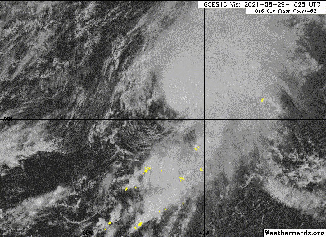
The convective pattern and structure of Julian has remained
consistent throughout today, with the low-level center remaining
tucked under the southwestern edge of a deep convective mass and
good outflow in the northeastern semicircle. A late morning ASCAT-C
overpass sampled peak winds of 45 to 47 kt, and since the cyclone
has likely intensified slightly since that time, the initial
intensity has been increased to 50 kt.
Julian is now moving quickly to the northeast, or 050/21 kt in
southwesterly flow to the south of a deep-layer area of low pressure
located just east of Newfoundland. The storm is forecast to continue
to move northeastward at a similar forward speed through Monday, and
then begin to turn northward then northwestward Monday night through
Tuesday as the cyclone moves around the periphery of the larger low.
The model track guidance continues to be in excellent agreement on
this scenario, and the latest NHC track forecast is little changed
from the previous one.
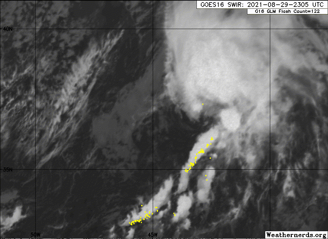
A cold front associated with the low east of Newfoundland has
already begun to interact with the circulation of Julian, as noted
by dry air being pulled into the southern portion of the
circulation, and linear banding developing to the south of the
cyclone. Baroclinic forcing could allow for some slight additional
strengthening through tonight. However, Julian should cross the 26 C
isotherm this evening, and reach waters of 22 C by 24 h while
interacting with the cold front and associated mid- to upper level
trough to its north. These factors should cause the cyclone to go
through extratropical transition tonight through tomorrow morning,
with the transition complete by late tomorrow. The latest SHIPS
guidance as well as the FSU phase-space diagrams depict this
transition scenario. Once extratropical, the system should dissipate
within a couple of days over the north Atlantic. The latest NHC
intensity forecast was essentially an update of the previous one,
and is close to the HCCA and IVCN solutions.
FORECAST POSITIONS AND MAX WINDS
INIT 29/2100Z 36.7N 44.6W 50 KT 60 MPH
12H 30/0600Z 38.8N 41.4W 55 KT 65 MPH
24H 30/1800Z 42.2N 38.1W 55 KT 65 MPH...POST-TROP/EXTRATROP
36H 31/0600Z 46.3N 36.8W 50 KT 60 MPH...POST-TROP/EXTRATROP
48H 31/1800Z 51.0N 37.7W 45 KT 50 MPH...POST-TROP/EXTRATROP
60H 01/0600Z 55.0N 39.6W 40 KT 45 MPH...POST-TROP/EXTRATROP
72H 01/1800Z...DISSIPATED
$$
Forecaster Latto
NWS National Hurricane Center Miami FL AL112021
900 PM GMT Sun Aug 29 2021
The convective pattern and structure of Julian has remained
consistent throughout today, with the low-level center remaining
tucked under the southwestern edge of a deep convective mass and
good outflow in the northeastern semicircle. A late morning ASCAT-C
overpass sampled peak winds of 45 to 47 kt, and since the cyclone
has likely intensified slightly since that time, the initial
intensity has been increased to 50 kt.
Julian is now moving quickly to the northeast, or 050/21 kt in
southwesterly flow to the south of a deep-layer area of low pressure
located just east of Newfoundland. The storm is forecast to continue
to move northeastward at a similar forward speed through Monday, and
then begin to turn northward then northwestward Monday night through
Tuesday as the cyclone moves around the periphery of the larger low.
The model track guidance continues to be in excellent agreement on
this scenario, and the latest NHC track forecast is little changed
from the previous one.
A cold front associated with the low east of Newfoundland has
already begun to interact with the circulation of Julian, as noted
by dry air being pulled into the southern portion of the
circulation, and linear banding developing to the south of the
cyclone. Baroclinic forcing could allow for some slight additional
strengthening through tonight. However, Julian should cross the 26 C
isotherm this evening, and reach waters of 22 C by 24 h while
interacting with the cold front and associated mid- to upper level
trough to its north. These factors should cause the cyclone to go
through extratropical transition tonight through tomorrow morning,
with the transition complete by late tomorrow. The latest SHIPS
guidance as well as the FSU phase-space diagrams depict this
transition scenario. Once extratropical, the system should dissipate
within a couple of days over the north Atlantic. The latest NHC
intensity forecast was essentially an update of the previous one,
and is close to the HCCA and IVCN solutions.
FORECAST POSITIONS AND MAX WINDS
INIT 29/2100Z 36.7N 44.6W 50 KT 60 MPH
12H 30/0600Z 38.8N 41.4W 55 KT 65 MPH
24H 30/1800Z 42.2N 38.1W 55 KT 65 MPH...POST-TROP/EXTRATROP
36H 31/0600Z 46.3N 36.8W 50 KT 60 MPH...POST-TROP/EXTRATROP
48H 31/1800Z 51.0N 37.7W 45 KT 50 MPH...POST-TROP/EXTRATROP
60H 01/0600Z 55.0N 39.6W 40 KT 45 MPH...POST-TROP/EXTRATROP
72H 01/1800Z...DISSIPATED
$$
Forecaster Latto
0 likes
Visit the Caribbean-Central America Weather Thread where you can find at first post web cams,radars
and observations from Caribbean basin members Click Here
and observations from Caribbean basin members Click Here
-
Sciencerocks
- Category 5
- Posts: 10186
- Age: 40
- Joined: Thu Jul 06, 2017 1:51 am
-
cycloneye
- Admin
- Posts: 149550
- Age: 69
- Joined: Thu Oct 10, 2002 10:54 am
- Location: San Juan, Puerto Rico
Re: ATL: JULIAN - Post Tropical
BULLETIN
Post-Tropical Cyclone Julian Advisory Number 5
NWS National Hurricane Center Miami FL AL112021
300 AM GMT Mon Aug 30 2021
...JULIAN BECOMES AN EXTRATROPICAL CYCLONE...
...THIS IS THE LAST ADVISORY...
SUMMARY OF 300 AM GMT...0300 UTC...INFORMATION
----------------------------------------------
LOCATION...38.1N 41.9W
ABOUT 820 MI...1325 KM SE OF CAPE RACE NEWFOUNDLAND
ABOUT 810 MI...1300 KM W OF THE AZORES
MAXIMUM SUSTAINED WINDS...60 MPH...95 KM/H
PRESENT MOVEMENT...NE OR 40 DEGREES AT 26 MPH...43 KM/H
MINIMUM CENTRAL PRESSURE...995 MB...29.39 INCHES
WATCHES AND WARNINGS
--------------------
There are no coastal watches or warnings in effect.
DISCUSSION AND OUTLOOK
----------------------
At 300 AM GMT (0300 UTC), the center of Post-Tropical Cyclone Julian
was located near latitude 38.1 North, longitude 41.9 West. The
post-tropical cyclone is moving toward the northeast near 26 mph (43
km/h). This general motion is expected to continue through Monday,
followed by a turn to the north, then northeast Monday night into
Tuesday.
Maximum sustained winds are near 60 mph (95 km/h) with higher gusts.
Little change in strength is expected through tonight.
Tropical-storm-force winds extend outward up to 105 miles (165 km)
from the center.
The estimated minimum central pressure is 995 mb (29.39 inches).
HAZARDS AFFECTING LAND
----------------------
None.
NEXT ADVISORY
-------------
This is the last public advisory issued by the National Hurricane
Center on this system. Additional information on this system can be
found in High Seas Forecasts issued by the National Weather Service,
under AWIPS header NFDHSFAT1, WMO header FZNT01 KWBC, and online at
ocean.weather.gov/shtml/NFDHSFAT1.php
$$
Forecaster Latto
0 likes
Visit the Caribbean-Central America Weather Thread where you can find at first post web cams,radars
and observations from Caribbean basin members Click Here
and observations from Caribbean basin members Click Here
-
ElectricStorm

- Category 5
- Posts: 5148
- Age: 25
- Joined: Tue Aug 13, 2019 11:23 pm
- Location: Norman, OK
Re: ATL: JULIAN - Post Tropical
Weather Dude wrote:I'm thinking this one could make a run for Cat 1 status. It may not get there, but it could get close.
Looks like it's already ET now so this didn't happen although 50kts is respectable for a system that was only named for a day.
1 likes
B.S Meteorology, University of Oklahoma '25
Please refer to the NHC, NWS, or SPC for official information.
Please refer to the NHC, NWS, or SPC for official information.
-
IsabelaWeather
- Category 1

- Posts: 316
- Age: 36
- Joined: Tue Jul 07, 2020 7:29 am
- Location: Isabela, Puerto Rico
Re: ATL: JULIAN - Post Tropical
Weather Dude wrote:Weather Dude wrote:I'm thinking this one could make a run for Cat 1 status. It may not get there, but it could get close.
Looks like it's already ET now so this didn't happen although 50kts is respectable for a system that was only named for a day.
Whats the record for shortest TC lifespan?
0 likes

Re: ATL: JULIAN - Post Tropical
IsabelaWeather wrote:Weather Dude wrote:Weather Dude wrote:I'm thinking this one could make a run for Cat 1 status. It may not get there, but it could get close.
Looks like it's already ET now so this didn't happen although 50kts is respectable for a system that was only named for a day.
Whats the record for shortest TC lifespan?
Not sure if that's the record, but Tropical Storm Olga in 2019 was also only classified as a TS for 12 hours and became extratropical thereafter. Nestor in the same year was a TS for 18 hours.
0 likes
TC naming lists: retirements and intensity
Most aggressive Advisory #1's in North Atlantic (cr. kevin for starting the list)
Most aggressive Advisory #1's in North Atlantic (cr. kevin for starting the list)
-
Extratropical94

- Professional-Met

- Posts: 3545
- Age: 31
- Joined: Wed Oct 20, 2010 6:36 am
- Location: Hamburg, Germany
- Contact:
Re: ATL: JULIAN - Post Tropical
IsabelaWeather wrote:Weather Dude wrote:Weather Dude wrote:I'm thinking this one could make a run for Cat 1 status. It may not get there, but it could get close.
Looks like it's already ET now so this didn't happen although 50kts is respectable for a system that was only named for a day.
Whats the record for shortest TC lifespan?
These are all the systems in the hurricane database with a TC livespan of 24 hours or less during the satellite era.
So it's a three-way tie between 2019's Olga, 2010's TD5, and TD10 in 1988 (which for some reason is listed as unnamed TD17 in HURDAT). Of those three, Olga was the only system to reach TS status.
ID STORM YEAR HRS
AL171988 UNNAMED 1988 12
AL052010 FIVE 2010 12
AL172019 OLGA 2019 12
AL021999 UNNAMED 1999 18
AL092001 UNNAMED 2001 18
AL102007 TEN 2007 18
AL082013 EIGHT 2013 18
AL022017 BRET 2017 18
AL182017 PHILIPPE 2017 18
AL012019 ANDREA 2019 18
AL162019 NESTOR 2019 18
AL042021 DANNY 2021 18
AL012000 UNNAMED 2000 24
AL092000 UNNAMED 2000 24
AL022003 UNNAMED 2003 24
AL092003 UNNAMED 2003 24
AL212005 UNNAMED 2005 24
AL062011 FRANKLIN 2011 24
AL022020 BERTHA 2020 24
AL112021 JULIAN 2021 24
2 likes
54° 11' 59'' N, 9° 9' 20'' E
Boomer Sooner!
Go Broncos! Go Cards!
Clinching counties, one at a time: https://mob-rule.com/user-gifs/USA/xtrp94.gif
- Daniel
Boomer Sooner!
Go Broncos! Go Cards!
Clinching counties, one at a time: https://mob-rule.com/user-gifs/USA/xtrp94.gif
- Daniel
Who is online
Users browsing this forum: No registered users and 18 guests