
EPAC: OLAF - Post-Tropical
Moderator: S2k Moderators
-
Yellow Evan

- Professional-Met

- Posts: 16242
- Age: 27
- Joined: Fri Jul 15, 2011 12:48 pm
- Location: Henderson, Nevada/Honolulu, HI
- Contact:

Re: EPAC: OLAF - Hurricane
The best looking cat 2.
2 likes
Personal Forecast Disclaimer:
The posts in this forum are NOT official forecast and should not be used as such. They are just the opinion of the poster and may or may not be backed by sound meteorological data. For official information, please refer to the NHC and NWS products.
The posts in this forum are NOT official forecast and should not be used as such. They are just the opinion of the poster and may or may not be backed by sound meteorological data. For official information, please refer to the NHC and NWS products.
-
Yellow Evan
- Professional-Met
- Posts: 16242
- Age: 27
- Joined: Fri Jul 15, 2011 12:48 pm
- Location: Henderson, Nevada/Honolulu, HI
- Contact:
-
galaxy401

- Category 5

- Posts: 2446
- Age: 30
- Joined: Sat Aug 25, 2012 9:04 pm
- Location: Casa Grande, Arizona
Re: EPAC: OLAF - Hurricane
Pressure very close to the NHC advisory. Cat 2 is probably the right call.
0 likes
Got my eyes on moving right into Hurricane Alley: Florida.
-
Sciencerocks
- Category 5
- Posts: 10186
- Age: 40
- Joined: Thu Jul 06, 2017 1:51 am
Re: EPAC: OLAF - Hurricane
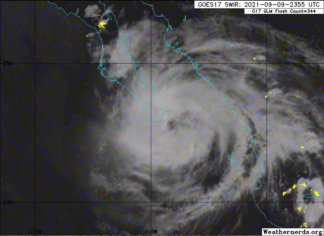
Hurricane Olaf Tropical Cyclone Update
NWS National Hurricane Center Miami FL EP152021
920 PM MDT Thu Sep 09 2021
...OLAF MAKES LANDFALL VERY NEAR SAN JOSE DEL CABO MEXICO...
Radar data from the Mexican Meteorological Service site at Los
Cabos and surface pressure data from the region indicate that Olaf
made landfall very near San Jose del Cabo, Baja California Sur, at
around 900 PM MDT (0300 UTC). Maximum sustained winds were
estimated to be near 100 mph (155 km/h).
SUMMARY OF 920 PM MDT...0320 UTC...INFORMATION
---------------------------------------------------
LOCATION...23.1N 109.6W
ABOUT 25 MI...40 KM ENE OF CABO SAN LUCAS MEXICO
ABOUT 85 MI...135 KM SE OF LA PAZ MEXICO
MAXIMUM SUSTAINED WINDS...100 MPH...155 KM/H
PRESENT MOVEMENT...NW OR 325 DEGREES AT 12 MPH...19 KM/H
MINIMUM CENTRAL PRESSURE...976 MB...28.82 INCHES
$$
Forecaster Berg
0 likes
Personal Forecast Disclaimer:
The posts in this forum are NOT official forecast and should not be used as such. They are just the opinion of the poster and may or may not be backed by sound meteorological data. For official information, please refer to the NHC and NWS products.
The posts in this forum are NOT official forecast and should not be used as such. They are just the opinion of the poster and may or may not be backed by sound meteorological data. For official information, please refer to the NHC and NWS products.
-
Astromanía
- Category 2

- Posts: 796
- Age: 27
- Joined: Sat Aug 25, 2018 10:34 pm
- Location: Monterrey, N.L, México
Re: EPAC: OLAF - Hurricane
Ugh direct landfall in San Jose del Cabo, at least it's not a major but yeah its the worst hurricane in Baja California Sur since Odile 2014, I think this was a really surprise for everyone especially for this kind of year
0 likes
-
Astromanía
- Category 2
- Posts: 796
- Age: 27
- Joined: Sat Aug 25, 2018 10:34 pm
- Location: Monterrey, N.L, México
Re: EPAC: OLAF - Hurricane
To think this could have been a major easily if only it had like 6 more hours before landfall, it could have been a worse disaster, still I'm suprise the landfall intensity is not at least 90 kts, but according to the pressure Josh measured there I think it's ok 85 kts, the pressure and wind didn't had time to catch up
0 likes
-
Yellow Evan
- Professional-Met
- Posts: 16242
- Age: 27
- Joined: Fri Jul 15, 2011 12:48 pm
- Location: Henderson, Nevada/Honolulu, HI
- Contact:
Re: EPAC: OLAF - Hurricane
A few eastward wobbles and this may emerge into the bay of La Paz as a minimal hurricane, which is the most populated part of the state.
0 likes
-
Yellow Evan
- Professional-Met
- Posts: 16242
- Age: 27
- Joined: Fri Jul 15, 2011 12:48 pm
- Location: Henderson, Nevada/Honolulu, HI
- Contact:
Re: EPAC: OLAF - Tropical Storm
Yellow Evan wrote:0z ECMWF almost joins GFS in showing landfall, passing the center of Olaf about 15 miles offshore. The storm itself has been moving right of its 6z forecast point and latest motion has been distinctly NNW. This reminds me of Odile if I’m being honest in that respect and if this current motion where to continue, we’d be dealing with a hurricane into San Jose del Cabo in 24 hours. Looking at the 700-600 mbar steering on the GFS, I don’t think that’s unreasonable.
Intensity wise, this has a legit CDO now and there are even signs of bursting vertical hot towers so I’m inclined to think this is vertically stacked now unlike earlier. Rapid intensification is possible given the low wind shear and close proximity to an ULAC but model support for such is lacking so with relatively limited time until land interaction, I wouldn’t count on it. A standard climatological rate of T1.0/day would bring this to minimal hurricane strength, which is a reasonable if slightly conservative projection.
This aged well.
6 likes
-
Yellow Evan
- Professional-Met
- Posts: 16242
- Age: 27
- Joined: Fri Jul 15, 2011 12:48 pm
- Location: Henderson, Nevada/Honolulu, HI
- Contact:
Re: EPAC: OLAF - Hurricane
619
WTPZ45 KNHC 100843
TCDEP5
Hurricane Olaf Discussion Number 11
NWS National Hurricane Center Miami FL EP152021
300 AM MDT Fri Sep 10 2021
Olaf made landfall very near San Jose del Cabo, Baja California
Sur, around 0300 UTC based on radar images from Los Cabos and
surface pressure reports from the region. Since then, the radar
data showed that the center crossed the peninsula and re-emerged
just off the southwestern coast a few hours ago with heavy
rainbands continuing to stream northward across the area between
Cabo San Lucas and La Paz. Assuming some weakening over land, the
initial intensity is set at 75 kt, which matches the latest Dvorak
Current Intensity estimates from TAFB and SAB.
The hurricane continues to move toward the northwest but has turned
more to the left, or 315/11 kt. A strong mid-level high centered
over the southern Rockies is forecast to build westward over the
Pacific during the next few days, which should cause Olaf to turn
westward by 36 hours and then southwestward by 60 hours until the
end of the forecast period. On this track, Olaf will move along
the southwestern coast of Baja California Sur for the next 12-18
hours but then turn westward away from land by tonight. This part
of the forecast is unchanged from the previous advisory. There is
some disagreement among the models on how far south Olaf will move
on days 3 through 5 (as a remnant low), and the new NHC forecast
has been nudged southward at those times toward the GFS, ECMWF, and
HCCA model solutions.
Olaf's proximity to the mountainous terrain of the Baja California
peninsula during the next 12 to 18 hours will likely cause
additional steady weakening, and the winds are forecast to fall
below hurricane force by this evening. The storm will then move
over waters colder than 26 degrees Celsius when it turns west of
Cabo San Lazaro tonight, which should spur additional weakening.
The SHIPS and LGEM models appear to be keeping Olaf's winds too
high for the next day or so, and as a result the NHC intensity
forecast is set below the HCCA consensus aid, closer to the GFS
and ECMWF intensity trends. In fact, model-simulated satellite
imagery suggests that the cold water could cause all of Olaf's deep
convection to dissipate in 36-48 hours, and the cyclone is therefore
forecast to degenerate to a post-tropical cyclone by Saturday night.
Key Messages:
1. Olaf is forecast to move along the southwestern coast of the
Baja California peninsula today, with hurricane and tropical storm
conditions continuing over southern portions of Baja California Sur
through this evening. These winds should diminish tonight once
Olaf weakens and turns westward away from land.
2. Heavy rains associated with Olaf are expected across portions of
southern Baja California Sur today. This will pose a threat of
significant and life-threatening flash flooding and mudslides.
FORECAST POSITIONS AND MAX WINDS
INIT 10/0900Z 23.7N 110.7W 75 KT 85 MPH...NEAR THE COAST
12H 10/1800Z 24.4N 111.9W 65 KT 75 MPH...NEAR THE COAST
24H 11/0600Z 24.7N 113.3W 55 KT 65 MPH
36H 11/1800Z 24.5N 114.5W 45 KT 50 MPH
48H 12/0600Z 23.9N 115.6W 35 KT 40 MPH...POST-TROPICAL
60H 12/1800Z 23.0N 116.9W 30 KT 35 MPH...POST-TROP/REMNT LOW
72H 13/0600Z 22.1N 118.2W 25 KT 30 MPH...POST-TROP/REMNT LOW
96H 14/0600Z 21.0N 120.9W 20 KT 25 MPH...POST-TROP/REMNT LOW
120H 15/0600Z 20.5N 122.7W 20 KT 25 MPH...POST-TROP/REMNT LOW
$$
Forecaster Berg
0 likes
-
Hurricane Mike
- Category 2
- Posts: 675
- Joined: Tue Apr 10, 2018 7:44 am
Re: EPAC: OLAF - Tropical Storm
Hurricane Mike wrote:Skeptical this becomes a hurricane.
Welp, I blew that forecast

0 likes
-
cycloneye

- Admin

- Posts: 149550
- Age: 69
- Joined: Thu Oct 10, 2002 10:54 am
- Location: San Juan, Puerto Rico
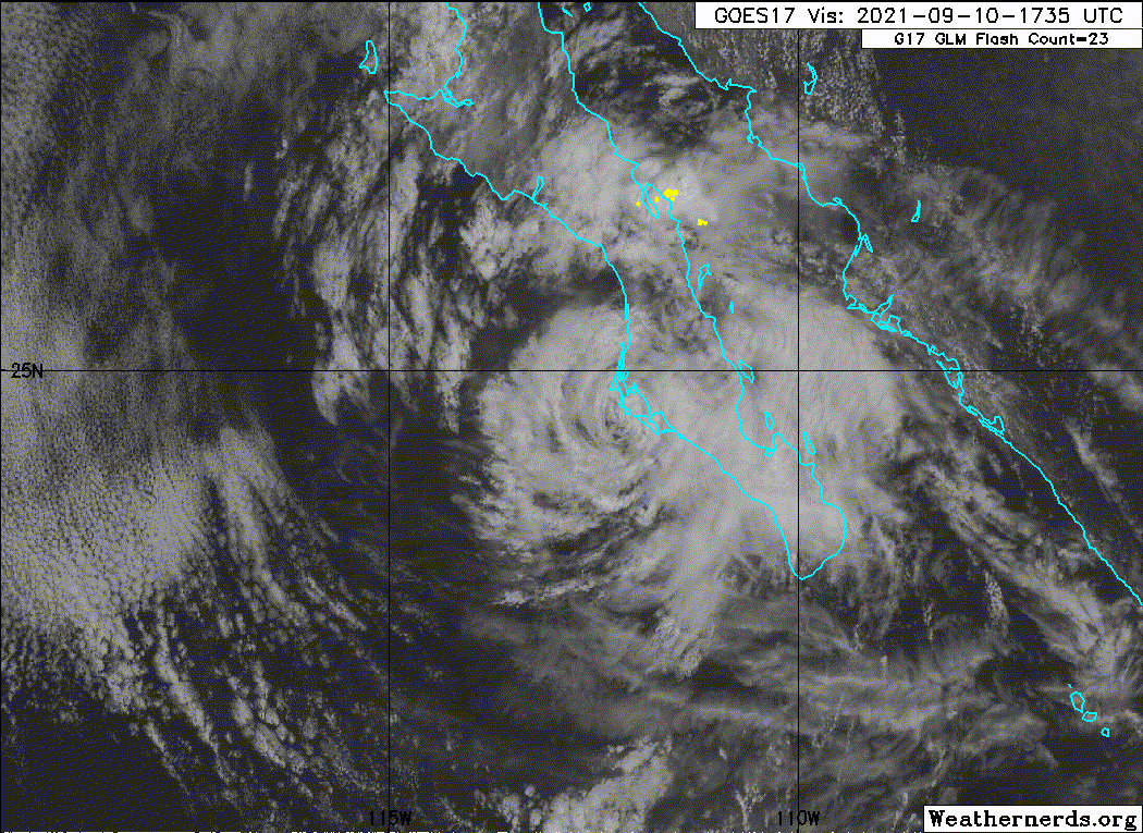
Re: EPAC: OLAF - Tropical Storm
TCDEP5
Tropical Storm Olaf Discussion Number 12
NWS National Hurricane Center Miami FL EP152021
900 AM MDT Fri Sep 10 2021
The satellite presentation of Olaf has significantly degraded over
the past several hours after the center moved across the southern
portion of Baja California Sur overnight. The system's organized
convection has collapsed, and infrared satellite imagery indicates
cloud top temperatures are rapidly warming near the estimated center
position. The initial intensity is lowered to 60 kt for this
advisory, which now makes Olaf a tropical storm. This estimate may
still be generous, but limited surface observations and radar data
make it difficult to confidently assess the intensity. Hopefully,
scatterometer data this afternoon will provide more insight into
changes in Olaf's surface wind field.
The tropical storm has slowed down a bit since last night, and its
estimated motion is northwest (310 degrees) at 9 kt. Recent
microwave imagery suggests the center of Olaf is just offshore the
southwestern coast of Baja California Sur, and the cyclone is likely
to move roughly parallel to the coast today. Then, a strong
mid-level high pressure ridge centered over the southern Rockies is
expected to build westward to the north of Olaf. This ridge should
turn Olaf toward the west by tonight, and then toward the southwest
through early next week. The official NHC track forecast has been
adjusted to the south of the previous forecast once again, in
agreement with the latest multi-model consensus aids.
Olaf is likely to continue rapidly weakening during the next couple
of days. In the short-term, its proximity to the mountainous terrain
of the Baja California peninsula will disrupt its ability to sustain
organized convection. As Olaf moves away from land, the cyclone will
encounter decreasing sea-surface temperatures and very dry mid-level
air, which should expedite its transition into a post-tropical
cyclone. In fact, the latest GFS and ECMWF model simulated satellite
imagery show Olaf becoming completely devoid of convection within
the next 24-36 h. The latest NHC intensity forecast shows more rapid
weakening than the previous one, primarily based on recent satellite
trends and the lower initial intensity. The official forecast
remains below the HCCA and IVCN consensus aids, which are inflated
by the SHIPS and LGEM models that fail to weaken Olaf during the
next 24 h.
Key Messages:
1. Olaf is forecast to move along the southwestern coast of the
Baja California peninsula today, with tropical storm conditions
continuing over southern portions of Baja California Sur through
this evening. These winds should diminish tonight as Olaf continues
weakening and turns westward away from land.
2. Heavy rains associated with Olaf are expected across portions of
southern Baja California Sur through today. This will pose a threat
of significant and life-threatening flash flooding and mudslides.
FORECAST POSITIONS AND MAX WINDS
INIT 10/1500Z 24.1N 111.3W 60 KT 70 MPH
12H 11/0000Z 24.5N 112.4W 50 KT 60 MPH
24H 11/1200Z 24.6N 113.6W 40 KT 45 MPH
36H 12/0000Z 24.3N 114.7W 35 KT 40 MPH...POST-TROPICAL
48H 12/1200Z 23.4N 115.9W 30 KT 35 MPH...POST-TROP/REMNT LOW
60H 13/0000Z 22.4N 117.3W 25 KT 30 MPH...POST-TROP/REMNT LOW
72H 13/1200Z 21.6N 118.6W 25 KT 30 MPH...POST-TROP/REMNT LOW
96H 14/1200Z 20.7N 121.0W 20 KT 25 MPH...POST-TROP/REMNT LOW
120H 15/1200Z 20.0N 123.0W 20 KT 25 MPH...POST-TROP/REMNT LOW
$$
Forecaster Reinhart
0 likes
Visit the Caribbean-Central America Weather Thread where you can find at first post web cams,radars
and observations from Caribbean basin members Click Here
and observations from Caribbean basin members Click Here
-
Yellow Evan
- Professional-Met
- Posts: 16242
- Age: 27
- Joined: Fri Jul 15, 2011 12:48 pm
- Location: Henderson, Nevada/Honolulu, HI
- Contact:
-
Sciencerocks
- Category 5
- Posts: 10186
- Age: 40
- Joined: Thu Jul 06, 2017 1:51 am
-
hurricaneCW
- Category 5
- Posts: 1799
- Joined: Wed Mar 03, 2010 6:20 am
- Location: Toms River, NJ
-
Sciencerocks
- Category 5
- Posts: 10186
- Age: 40
- Joined: Thu Jul 06, 2017 1:51 am
-
Sciencerocks
- Category 5
- Posts: 10186
- Age: 40
- Joined: Thu Jul 06, 2017 1:51 am
-
SconnieCane
- Category 5
- Posts: 1013
- Joined: Thu Aug 02, 2018 5:29 pm
- Location: Madison, WI
-
cycloneye
- Admin
- Posts: 149550
- Age: 69
- Joined: Thu Oct 10, 2002 10:54 am
- Location: San Juan, Puerto Rico
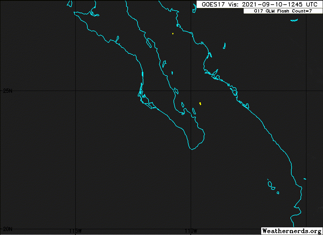
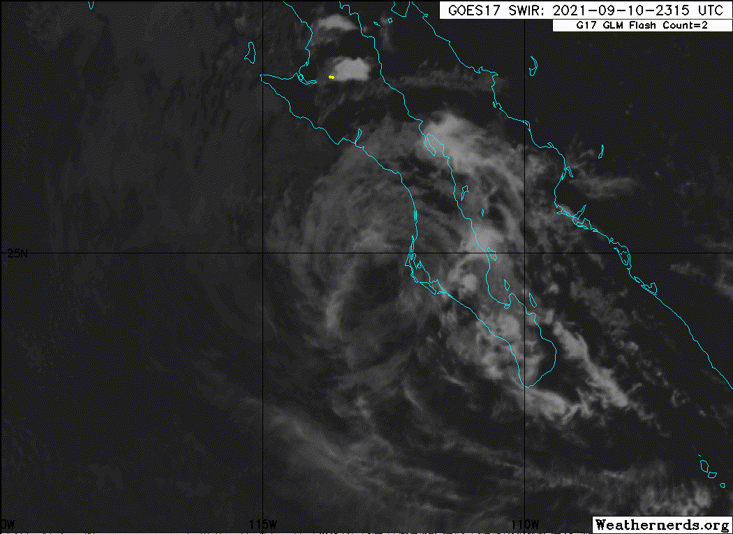
Re: EPAC: OLAF - Tropical Depression
BULLETIN
Tropical Depression Olaf Advisory Number 14
NWS National Hurricane Center Miami FL EP152021
900 PM MDT Fri Sep 10 2021
...OLAF WEAKENS TO A TROPICAL DEPRESSION...
...ALL TROPICAL STORM WARNINGS HAVE BEEN DISCONTINUED...
SUMMARY OF 900 PM MDT...0300 UTC...INFORMATION
----------------------------------------------
LOCATION...24.7N 113.3W
ABOUT 65 MI...100 KM W OF CABO SAN LAZARO MEXICO
MAXIMUM SUSTAINED WINDS...35 MPH...55 KM/H
PRESENT MOVEMENT...W OR 270 DEGREES AT 6 MPH...9 KM/H
MINIMUM CENTRAL PRESSURE...1003 MB...29.62 INCHES
WATCHES AND WARNINGS
--------------------
CHANGES WITH THIS ADVISORY:
The Government of Mexico has discontinued all Tropical Storm
Warnings for Baja California Sur Mexico.
SUMMARY OF WATCHES AND WARNINGS IN EFFECT:
There are no coastal watches or warnings in effect.
DISCUSSION AND OUTLOOK
----------------------
At 900 PM MDT (0300 UTC), the center of Tropical Depression Olaf was
located near latitude 24.7 North, longitude 113.3 West. The
depression is now moving toward the west near 8 mph (13 km/h). A
turn toward the southwest is expected by Saturday night, with this
motion continuing into early next week.
Maximum sustained winds have decreased to near 35 mph (55 km/h) with
higher gusts. Additional weakening is expected during the next
couple of days, and Olaf is forecast to degenerate to a
post-tropical remnant low tomorrow morning.
The estimated minimum central pressure is 1003 mb (29.62 inches).
HAZARDS AFFECTING LAND
----------------------
SURF: Swells generated by Olaf will affect portions of the coasts
of Nayarit and Sinaloa through this evening, and portions of the
west coast of Baja California Sur through tomorrow. These swells
are likely to cause life-threatening surf and rip current
conditions. Please consult products from your local weather office.
NEXT ADVISORY
-------------
Next complete advisory at 300 AM MDT.
$$
Forecaster Papin
0 likes
Visit the Caribbean-Central America Weather Thread where you can find at first post web cams,radars
and observations from Caribbean basin members Click Here
and observations from Caribbean basin members Click Here
Who is online
Users browsing this forum: No registered users and 23 guests