tolakram wrote:AlphaToOmega wrote:tolakram wrote:I'm expecting another big burst in activity, but I think at this point hyperactive is off the table, as it should be. One would hope hyperactive seasons are quite rare. This talk of hyperactivity has also diminished, in my opinion, how destructive non hyperactive seasons can be.
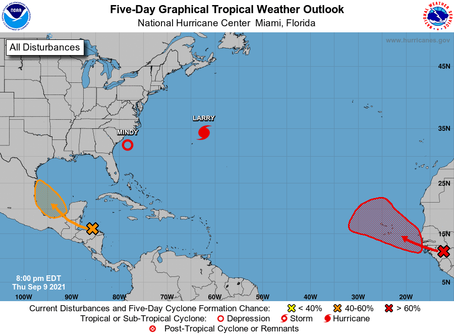
I am not so convinced hyperactivity is off the table. A La Nina is likely going to make October and November very active. If you are using the definition of >210 ACE, I could see the argument; but hyperactivity is currently defined as >159 ACE. The season so far has produced 66.8 ACE.
EDIT: Your definition of "off the table" is probable, not possible. Could you elaborate as to why hyperactivity is not probable?
Why is it probable? To me it's insane to ever think an extreme season is probable. Statistically it's never probably, otherwise it wouldn't be an outlier. Most probably is a solidly above average season, IMO anyway. Why is it so important that this season reach a certain metric?
I wholeheartedly agree. I've always found it hilarious how some pro's & weather geeks obsess over how "this or that year was hyper" or how this year's ACE may be titillatingly high, or similar to ____ . To me having a conversation or debate regarding a season's ACE, is about the same as having a debate or conversation about flatulence

I mean seriously, if I were fortunate enough to be on the opposite side of the house where some rancid foul odor existed.... then - I'm good. No harm - no foul; No impact to me! On the other hand if I'm sitting in some small office waiting room and the three others in the room pass gas, well THAT has affected "me"