WPAC: CHANTHU - Post-Tropical
Moderator: S2k Moderators


Re: WPAC: CHANTHU - Typhoon
Awful job by the JTWC today constantly lagging many hours behind
0 likes
-
mrbagyo

- Category 5

- Posts: 3963
- Age: 33
- Joined: Thu Apr 12, 2012 9:18 am
- Location: 14.13N 120.98E
- Contact:
Re: WPAC: CHANTHU - Typhoon
934.9 mb at Ivana, Batan island

3 likes
The posts in this forum are NOT official forecast and should not be used as such. They are just the opinion of the poster and may or may not be backed by sound meteorological data. They are NOT endorsed by any professional institution or storm2k.org. For official information, please refer to RSMC, NHC and NWS products.

Re: WPAC: CHANTHU - Typhoon
mrbagyo wrote:934.9 mb at Ivana, Batan island
https://s9.gifyu.com/images/Screenshot_2021-09-11-10-01-58-922_com.android.chrome.png
Impressive given how it relatively weakened, makes you think it peaked at or just below 900mb.
0 likes
Personal Forecast Disclaimer:
The posts in this forum are NOT official forecast and should not be used as such. They are just the opinion of the poster and may or may not be backed by sound meteorological data. For official information, please refer to the NHC and NWS products.
The posts in this forum are NOT official forecast and should not be used as such. They are just the opinion of the poster and may or may not be backed by sound meteorological data. For official information, please refer to the NHC and NWS products.
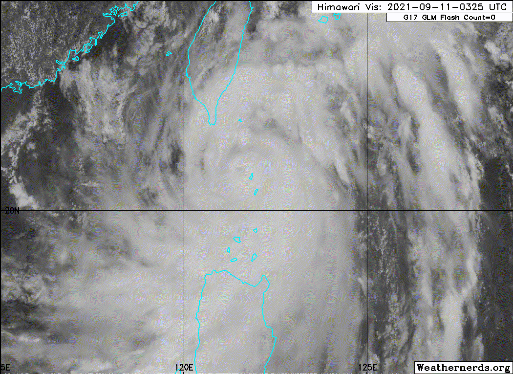
Re: WPAC: CHANTHU - Typhoon
That eastern eyewall brutalizing Itbayat, will probably destroy what Meranti didn't few years ago..
0 likes
Personal Forecast Disclaimer:
The posts in this forum are NOT official forecast and should not be used as such. They are just the opinion of the poster and may or may not be backed by sound meteorological data. For official information, please refer to the NHC and NWS products.
The posts in this forum are NOT official forecast and should not be used as such. They are just the opinion of the poster and may or may not be backed by sound meteorological data. For official information, please refer to the NHC and NWS products.
-
Iceresistance

- Category 5
- Posts: 9598
- Age: 22
- Joined: Sat Oct 10, 2020 9:45 am
- Location: Tecumseh, OK/Norman, OK
Re: WPAC: CHANTHU - Typhoon
I don't know what is going on with Chanthu (Kiko), but the typhoon is RAPIDLY weakening right now . . .
Northerly Wind Shear combined with Dry Air?

Northerly Wind Shear combined with Dry Air?
1 likes
Bill 2015 & Beta 2020
Winter 2020-2021
All observations are in Tecumseh, OK unless otherwise noted.
Winter posts are focused mainly for Oklahoma & Texas.
Take any of my forecasts with a grain of salt, refer to the NWS, SPC, and NHC for official information
Never say Never with weather! Because ANYTHING is possible!
Winter 2020-2021
All observations are in Tecumseh, OK unless otherwise noted.
Winter posts are focused mainly for Oklahoma & Texas.
Take any of my forecasts with a grain of salt, refer to the NWS, SPC, and NHC for official information
Never say Never with weather! Because ANYTHING is possible!
Re: WPAC: CHANTHU - Typhoon
1 likes
Personal Forecast Disclaimer:
The posts in this forum are NOT official forecast and should not be used as such. They are just the opinion of the poster and may or may not be backed by sound meteorological data. They are NOT endorsed by any professional institution or storm2k.org. For official information, please refer to RSMC and NWS products.
The posts in this forum are NOT official forecast and should not be used as such. They are just the opinion of the poster and may or may not be backed by sound meteorological data. They are NOT endorsed by any professional institution or storm2k.org. For official information, please refer to RSMC and NWS products.
-
Yellow Evan

- Professional-Met

- Posts: 16242
- Age: 27
- Joined: Fri Jul 15, 2011 12:48 pm
- Location: Henderson, Nevada/Honolulu, HI
- Contact:
Re: WPAC: CHANTHU - Typhoon
935 lines up with CKZ if you assume an intensity of around 125 knots.
1 likes
Re: WPAC: CHANTHU - Typhoon
Can we use radar velocities from Taiwan radar to estimate winds in Itbayat? The dBZ is off the charts.

0 likes
Personal Forecast Disclaimer:
The posts in this forum are NOT official forecast and should not be used as such. They are just the opinion of the poster and may or may not be backed by sound meteorological data. For official information, please refer to the NHC and NWS products.
The posts in this forum are NOT official forecast and should not be used as such. They are just the opinion of the poster and may or may not be backed by sound meteorological data. For official information, please refer to the NHC and NWS products.

Re: WPAC: CHANTHU - Typhoon
Appears to be ramping up again and starting to lift north.
0 likes
Personal Forecast Disclaimer:
The posts in this forum are NOT official forecast and should not be used as such. They are just the opinion of the poster and may or may not be backed by sound meteorological data. For official information, please refer to the NHC and NWS products.
The posts in this forum are NOT official forecast and should not be used as such. They are just the opinion of the poster and may or may not be backed by sound meteorological data. For official information, please refer to the NHC and NWS products.
-
Sciencerocks
- Category 5
- Posts: 10186
- Age: 40
- Joined: Thu Jul 06, 2017 1:51 am

Re: WPAC: CHANTHU - Typhoon
Iceresistance wrote:I don't know what is going on with Chanthu (Kiko), but the typhoon is RAPIDLY weakening right now . . .
Northerly Wind Shear combined with Dry Air?
https://s9.gifyu.com/images/83391493.gif
It's always kind of sad to see a STY go. :\
0 likes
-
mrbagyo
- Category 5
- Posts: 3963
- Age: 33
- Joined: Thu Apr 12, 2012 9:18 am
- Location: 14.13N 120.98E
- Contact:
Re: WPAC: CHANTHU - Typhoon
Are Taiwan's NTU buoys near Orchid island still working?
0 likes
The posts in this forum are NOT official forecast and should not be used as such. They are just the opinion of the poster and may or may not be backed by sound meteorological data. They are NOT endorsed by any professional institution or storm2k.org. For official information, please refer to RSMC, NHC and NWS products.

Re: WPAC: CHANTHU - Typhoon
0 likes
-
dexterlabio
- Category 5
- Posts: 3511
- Joined: Sat Oct 24, 2009 11:50 pm
Re: WPAC: CHANTHU - Typhoon
CryHavoc wrote:Iceresistance wrote:I don't know what is going on with Chanthu (Kiko), but the typhoon is RAPIDLY weakening right now . . .
Northerly Wind Shear combined with Dry Air?
https://s9.gifyu.com/images/83391493.gif
It's always kind of sad to see a STY go. :\
But it needs to go or else East Asia will be in bigger trouble
If I may guess, the reason for Chanthu's degredation is the steep drop in SSTs
0 likes
Personal Forecast Disclaimer:
The posts in this forum are NOT official forecast and should not be used as such. They are just the opinion of the poster and may or may not be backed by sound meteorological data. They are NOT endorsed by any professional institution or storm2k.org. For official information, please refer to the NHC and NWS products.
The posts in this forum are NOT official forecast and should not be used as such. They are just the opinion of the poster and may or may not be backed by sound meteorological data. They are NOT endorsed by any professional institution or storm2k.org. For official information, please refer to the NHC and NWS products.

Re: WPAC: CHANTHU - Typhoon
So the JTWC drops it down 5 kt when it’s clearly strengthening, but then keeps it as a Cat 5 when it’s clearly weakening?! What is up with them?
5 likes
Irene '11 Sandy '12 Hermine '16 5/15/2018 Derecho Fay '20 Isaias '20 Elsa '21 Henri '21 Ida '21
I am only a meteorology enthusiast who knows a decent amount about tropical cyclones. Look to the professional mets, the NHC, or your local weather office for the best information.
I am only a meteorology enthusiast who knows a decent amount about tropical cyclones. Look to the professional mets, the NHC, or your local weather office for the best information.
-
mrbagyo
- Category 5
- Posts: 3963
- Age: 33
- Joined: Thu Apr 12, 2012 9:18 am
- Location: 14.13N 120.98E
- Contact:
Re: WPAC: CHANTHU - Typhoon
Probably the best footage I've seen so far for this typhoon
6:30 am (Philippine Standard Time), September 11, 2021
Super typhoon Chanthu (Kiko) started to ravage Sabtang Island of Batanes
Video © Dennis Ballesteros Valdez

6:30 am (Philippine Standard Time), September 11, 2021
Super typhoon Chanthu (Kiko) started to ravage Sabtang Island of Batanes
Video © Dennis Ballesteros Valdez
4 likes
The posts in this forum are NOT official forecast and should not be used as such. They are just the opinion of the poster and may or may not be backed by sound meteorological data. They are NOT endorsed by any professional institution or storm2k.org. For official information, please refer to RSMC, NHC and NWS products.
-
StormTracker89
- Tropical Depression

- Posts: 57
- Joined: Sat May 16, 2020 3:47 pm
- Location: Somewhere in the Pacific
Re: WPAC: CHANTHU - Typhoon
aspen wrote:So the JTWC drops it down 5 kt when it’s clearly strengthening, but then keeps it as a Cat 5 when it’s clearly weakening?! What is up with them?
Did you read the discussion? At the time of the analysis, it was actually looking better, as noted by others on this site who noted the eye was clearing out again. But it didn't last long. Also it takes time for a system to spin down, just because the satellite presentation degrades does not equal an instantaneous reduction in the wind speed.
3 likes
-
mrbagyo
- Category 5
- Posts: 3963
- Age: 33
- Joined: Thu Apr 12, 2012 9:18 am
- Location: 14.13N 120.98E
- Contact:
Re: WPAC: CHANTHU - Typhoon

0 likes
The posts in this forum are NOT official forecast and should not be used as such. They are just the opinion of the poster and may or may not be backed by sound meteorological data. They are NOT endorsed by any professional institution or storm2k.org. For official information, please refer to RSMC, NHC and NWS products.
Who is online
Users browsing this forum: No registered users and 11 guests