ATL: PETER - Remnants - Discussion
Moderator: S2k Moderators
-
Category5Kaiju

- Category 5

- Posts: 4336
- Joined: Thu Dec 24, 2020 12:45 pm
- Location: Seattle during the summer, Phoenix during the winter
Re: ATL: INVEST 95L - Discussion
I have been quite curious about this, but does anybody have an idea on why we're seeing such a strong TUTT in a year that is supposed to trend toward possible moderate La Nina later? Is this strong of a TUTT in late September possible in La Nina years? I thought the point of La Ninas was that they reduced shear in the Atlantic, especially late season.
1 likes
Unless explicitly stated, all information in my posts is based on my own opinions and observations. Tropical storms and hurricanes can be extremely dangerous. Refer to an accredited weather research agency or meteorologist if you need to make serious decisions regarding an approaching storm.
-
ElectricStorm

- Category 5
- Posts: 5148
- Age: 25
- Joined: Tue Aug 13, 2019 11:23 pm
- Location: Norman, OK
Re: ATL: INVEST 95L - Discussion
Category5Kaiju wrote:I have been quite curious about this, but does anybody have an idea on why we're seeing such a strong TUTT in a year that is supposed to trend toward possible moderate La Nina later? Is this strong of a TUTT in late September possible in La Nina years? I thought the point of La Ninas was that they reduced shear in the Atlantic, especially late season.
Last September had a TUTT problem as well so I don't think it's an ENSO issue but idk
0 likes
B.S Meteorology, University of Oklahoma '25
Please refer to the NHC, NWS, or SPC for official information.
Please refer to the NHC, NWS, or SPC for official information.
-
InfernoFlameCat

- Category 5
- Posts: 2127
- Age: 22
- Joined: Mon Dec 14, 2020 10:52 am
- Location: Buford, GA
Re: ATL: INVEST 95L - Discussion
Category5Kaiju wrote:I have been quite curious about this, but does anybody have an idea on why we're seeing such a strong TUTT in a year that is supposed to trend toward possible moderate La Nina later? Is this strong of a TUTT in late September possible in La Nina years? I thought the point of La Ninas was that they reduced shear in the Atlantic, especially late season.
I think the TUTT will be enhanced by 96L and that might be why it could be so strong. Like the outflow from 96L if it is stronger would benefit the ULL because that would feed it. I am not very knowledgeable on how exactly TUTTs strengthen and what environment is favorable though so this is just an educated guess I am giving here.
0 likes
I am by no means a professional. DO NOT look at my forecasts for official information or make decisions based on what I post.
Goal: to become a registered expert over tropical and subtropical cyclones.
Goal: to become a registered expert over tropical and subtropical cyclones.

Re: ATL: INVEST 95L - Discussion
Weather Dude wrote:Category5Kaiju wrote:I have been quite curious about this, but does anybody have an idea on why we're seeing such a strong TUTT in a year that is supposed to trend toward possible moderate La Nina later? Is this strong of a TUTT in late September possible in La Nina years? I thought the point of La Ninas was that they reduced shear in the Atlantic, especially late season.
Last September had a TUTT problem as well so I don't think it's an ENSO issue but idk
2020’s early September TUTT was due to recurving typhoons enhancing it. Maybe Chanthu has gone from a ridge enhancer to a TUTT enhancer?
0 likes
Irene '11 Sandy '12 Hermine '16 5/15/2018 Derecho Fay '20 Isaias '20 Elsa '21 Henri '21 Ida '21
I am only a meteorology enthusiast who knows a decent amount about tropical cyclones. Look to the professional mets, the NHC, or your local weather office for the best information.
I am only a meteorology enthusiast who knows a decent amount about tropical cyclones. Look to the professional mets, the NHC, or your local weather office for the best information.
-
cycloneye

- Admin

- Posts: 149524
- Age: 69
- Joined: Thu Oct 10, 2002 10:54 am
- Location: San Juan, Puerto Rico
Re: ATL: INVEST 95L - Discussion
aspen wrote:Weather Dude wrote:Category5Kaiju wrote:I have been quite curious about this, but does anybody have an idea on why we're seeing such a strong TUTT in a year that is supposed to trend toward possible moderate La Nina later? Is this strong of a TUTT in late September possible in La Nina years? I thought the point of La Ninas was that they reduced shear in the Atlantic, especially late season.
Last September had a TUTT problem as well so I don't think it's an ENSO issue but idk
2020’s early September TUTT was due to recurving typhoons enhancing it. Maybe Chanthu has gone from a ridge enhancer to a TUTT enhancer?
Wasn't there were discussions about the typhoon pumping the ridge?
1 likes
Visit the Caribbean-Central America Weather Thread where you can find at first post web cams,radars
and observations from Caribbean basin members Click Here
and observations from Caribbean basin members Click Here
-
toad strangler

- S2K Supporter

- Posts: 4546
- Joined: Sun Jul 28, 2013 3:09 pm
- Location: Earth
- Contact:
Re: ATL: INVEST 95L - Discussion
cycloneye wrote:aspen wrote:Weather Dude wrote:Last September had a TUTT problem as well so I don't think it's an ENSO issue but idk
2020’s early September TUTT was due to recurving typhoons enhancing it. Maybe Chanthu has gone from a ridge enhancer to a TUTT enhancer?
Wasn't there were discussions about the typhoon pumping the ridge?
There WAS. 48 plus hours ago. Crickets since.
6 likes
My Weather Station
https://www.wunderground.com/dashboard/pws/KFLPORTS603
https://www.wunderground.com/dashboard/pws/KFLPORTS603
-
AlphaToOmega
- Category 5
- Posts: 1448
- Joined: Sat Jun 26, 2021 10:51 am
- Location: Somewhere in Massachusetts
Re: ATL: INVEST 95L - Discussion
Showers and thunderstorms associated with a low pressure area
located a few hundred miles south of the Cabo Verde Islands are
becoming better organized. Environmental conditions are expected
to remain conducive for development, and a tropical depression is
likely to form during the next couple of days while system moves
generally westward at about 15 mph across the eastern tropical
Atlantic Ocean.
* Formation chance through 48 hours...high...80 percent.
* Formation chance through 5 days...high...90 percent.
1 likes
-
gatorcane

- S2K Supporter
- Posts: 23708
- Age: 48
- Joined: Sun Mar 13, 2005 3:54 pm
- Location: Boca Raton, FL
Re: ATL: INVEST 95L - Discussion
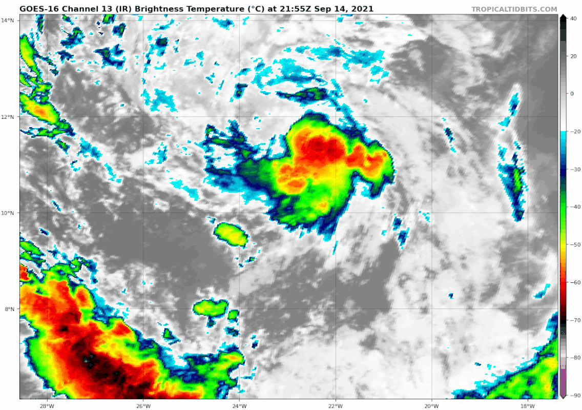
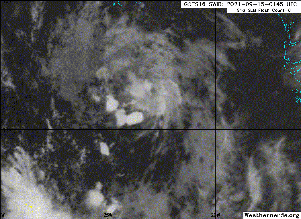
Looks small and weak. Maybe the less bullish 12Z Euro and its ensembles are on to something:
0 likes

Re: ATL: INVEST 95L - Discussion
Not surprised by the seemingly "slower than expected" organization. It seems to me that even in the most active MDR years (2017 included), we rarely see more than one storms develop immediately off the African coast and quickly intensity to a hurricane. The SST and OHC in the eastern Atlantic are just not high enough to support that.
If anything, the Euro probably spoiled us with its bias of intensifying waves too early and sending them too far north.
If anything, the Euro probably spoiled us with its bias of intensifying waves too early and sending them too far north.
1 likes
TC naming lists: retirements and intensity
Most aggressive Advisory #1's in North Atlantic (cr. kevin for starting the list)
Most aggressive Advisory #1's in North Atlantic (cr. kevin for starting the list)
-
GeneratorPower

- S2K Supporter
- Posts: 1648
- Age: 46
- Joined: Sun Dec 18, 2005 11:48 pm
- Location: Huntsville, AL
Re: ATL: INVEST 95L - Discussion
Teban54 wrote:Not surprised by the seemingly "slower than expected" organization. It seems to me that even in the most active MDR years (2017 included), we rarely see more than one storms develop immediately off the African coast and quickly intensity to a hurricane. The SST and OHC in the eastern Atlantic are just not high enough to support that.
If anything, the Euro probably spoiled us with its bias of intensifying waves too early and sending them too far north.
Exactly right
0 likes
-
Hypercane_Kyle

- Category 5
- Posts: 3465
- Joined: Sat Mar 07, 2015 7:58 pm
- Location: Cape Canaveral, FL
Re: ATL: INVEST 95L - Discussion
toad strangler wrote:cycloneye wrote:aspen wrote:2020’s early September TUTT was due to recurving typhoons enhancing it. Maybe Chanthu has gone from a ridge enhancer to a TUTT enhancer?
Wasn't there were discussions about the typhoon pumping the ridge?
There WAS. 48 plus hours ago. Crickets since.
Yeah, the Bahamas system threw a wrench in things IMHO. That'll likely develop into a TC in its on right and help steer 95L away from land regardless of the intensity. Lesser Antilles threat at most.
0 likes
My posts are my own personal opinion, defer to the National Hurricane Center (NHC) and other NOAA products for decision making during hurricane season.
-
Hurricaneman

- Category 5
- Posts: 7404
- Age: 45
- Joined: Tue Aug 31, 2004 3:24 pm
- Location: central florida
-
Sciencerocks
- Category 5
- Posts: 10186
- Age: 40
- Joined: Thu Jul 06, 2017 1:51 am
-
grapealcoholic
- Category 2

- Posts: 703
- Joined: Tue Aug 10, 2021 3:26 pm
Re: ATL: INVEST 95L - Discussion
Odette is actually over fairly warm water, with an even warmer stretch just ahead of it.

2 likes

Re: ATL: INVEST 95L - Discussion
Category5Kaiju wrote:I have been quite curious about this, but does anybody have an idea on why we're seeing such a strong TUTT in a year that is supposed to trend toward possible moderate La Nina later? Is this strong of a TUTT in late September possible in La Nina years? I thought the point of La Ninas was that they reduced shear in the Atlantic, especially late season.
The gulf storms probably increased the ridging centering that further west, take a look at the current sharp trough digging south off Florida in the WV imagery. 96L might be forming too early to leave a weakness its a pretty random prediction this far out.
0 likes

Re: ATL: INVEST 95L - Discussion
grapealcoholic wrote:Odette is actually over fairly warm water, with an even warmer stretch just ahead of it.
https://www.tropicaltidbits.com/analysis/models/hwrf-p/2021091500/hwrf-p_sst_noice_95L_3.png
You mean what we presume will become Odette.
6 likes
-
Category5Kaiju
- Category 5
- Posts: 4336
- Joined: Thu Dec 24, 2020 12:45 pm
- Location: Seattle during the summer, Phoenix during the winter
Re: ATL: INVEST 95L - Discussion
abajan wrote:grapealcoholic wrote:Odette is actually over fairly warm water, with an even warmer stretch just ahead of it.
https://www.tropicaltidbits.com/analysis/models/hwrf-p/2021091500/hwrf-p_sst_noice_95L_3.png
You mean what we presume will become Odette.
Just for funsies, if 96L steals the name Odette and 95L instead becomes Peter, I would love to see what the pre-namers would say then; while not a huge deal at the moment, pre-naming is generally not the best idea, especially when you have competitive AOIs like this. Anyways, I wonder what 95L’s long term prospects look like with it taking longer to develop.
4 likes
Unless explicitly stated, all information in my posts is based on my own opinions and observations. Tropical storms and hurricanes can be extremely dangerous. Refer to an accredited weather research agency or meteorologist if you need to make serious decisions regarding an approaching storm.

Re: ATL: INVEST 95L - Discussion
I am very suspect about the current forecasted track.
The African Easterly Jet has dramatically dissipated, so steering is pretty much dictated by how long this can remain a wave.
Nothing at 500mb to push this one way or another.
When it gets to about 55W it'll start to encounter a strong TUTT at the Virgin Islands.
Any move of 95L into the TUTT would shred it to pieces.
I can see this more staying weak and LL vort being further south than what GFS is currently depicting.
Maybe 50/50 this runs the Carib.
3 likes
-
Category5Kaiju
- Category 5
- Posts: 4336
- Joined: Thu Dec 24, 2020 12:45 pm
- Location: Seattle during the summer, Phoenix during the winter
Re: ATL: INVEST 95L - Discussion
GCANE wrote:I am very suspect about the current forecasted track.
The African Easterly Jet has dramatically dissipated, so steering is pretty much dictated by how long this can remain a wave.
Nothing at 500mb to push this one way or another.
When it gets to about 55W it'll start to encounter a strong TUTT at the Virgin Islands.
Any move of 95L into the TUTT would shred it to pieces.
I can see this more staying weak and LL vort being further south than what GFS is currently depicting.
Maybe 50/50 this runs the Carib.
You make an interesting point. If 95L takes longer to develop, then I would have to imagine that it would simply move more westward; in fact, if it were to get stronger quicker, it would likely turn north more readily, and if the TUTT is positioned morth of the islands, then a stronger storm in the short run would mean it would smash into the TUTT and weaken considerably. However, if it stays weak but survives, it'll likely move into a position where a storm positioned somewhere in the Caribbean Sea cannot be ruled out.
2 likes
Unless explicitly stated, all information in my posts is based on my own opinions and observations. Tropical storms and hurricanes can be extremely dangerous. Refer to an accredited weather research agency or meteorologist if you need to make serious decisions regarding an approaching storm.
-
cycloneye
- Admin
- Posts: 149524
- Age: 69
- Joined: Thu Oct 10, 2002 10:54 am
- Location: San Juan, Puerto Rico
Re: ATL: INVEST 95L - Discussion
AL, 95, 2021091512, , BEST, 0, 102N, 261W, 30, 1009, DB
1 likes
Visit the Caribbean-Central America Weather Thread where you can find at first post web cams,radars
and observations from Caribbean basin members Click Here
and observations from Caribbean basin members Click Here
Who is online
Users browsing this forum: No registered users and 33 guests