ATL: SAM - Remnants - Discussion
Moderator: S2k Moderators
-
SconnieCane
- Category 5

- Posts: 1013
- Joined: Thu Aug 02, 2018 5:29 pm
- Location: Madison, WI
Re: ATL: INVEST 98L - Discussion
Looks like this will be the "fun times ahead" invest/cyclone it once appeared that 95L/Peter would be. Lots of moving parts with as has been mentioned the other weak TCs/ex-TCs possibly drifting around the Atlantic several days down the line and throwing wrenches into the usual ridge/trough pattern. Very complex setup that probably won't be resolved well by any model in the long or even medium range.
1 likes
-
cycloneye

- Admin

- Posts: 149508
- Age: 69
- Joined: Thu Oct 10, 2002 10:54 am
- Location: San Juan, Puerto Rico
Re: ATL: INVEST 98L - Discussion
A. TROPICAL DISTURBANCE (98L)
B. 20/1730Z
C. 9.6N
D. 23.3W
E. FIVE/MET-11
F. T1.5/1.5
G. IR/EIR/VIS
H. REMARKS...SYSTEM HAS 3/10 BANDING RESULTING IN A DT OF 1.5. THE 24
HR TREND IS DEVELOPING. MET IS 1.0 AND PT IS 1.5. FT IS BASED ON PT DUE
TO PARTS OF BANDING BEING BROKEN ON VISIBLE SATELLITE IMAGERY MAKING IT
NOT CLEAR CUT.
I. ADDL POSITIONS
NIL
...PATEL
0 likes
Visit the Caribbean-Central America Weather Thread where you can find at first post web cams,radars
and observations from Caribbean basin members Click Here
and observations from Caribbean basin members Click Here
-
Sciencerocks
- Category 5
- Posts: 10186
- Age: 40
- Joined: Thu Jul 06, 2017 1:51 am
-
tolakram
- Admin
- Posts: 20186
- Age: 62
- Joined: Sun Aug 27, 2006 8:23 pm
- Location: Florence, KY (name is Mark)
Re: ATL: INVEST 98L - Discussion
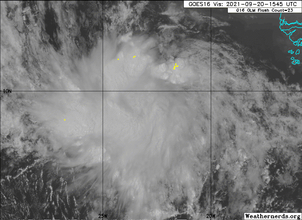
Eye like feature so soon!
1 likes
M a r k
- - - - -
Join us in chat: Storm2K Chatroom Invite. Android and IOS apps also available.
The posts in this forum are NOT official forecasts and should not be used as such. Posts are NOT endorsed by any professional institution or STORM2K.org. For official information and forecasts, please refer to NHC and NWS products.
-
cycloneye
- Admin
- Posts: 149508
- Age: 69
- Joined: Thu Oct 10, 2002 10:54 am
- Location: San Juan, Puerto Rico
Re: ATL: INVEST 98L - Discussion
AL, 98, 2021092018, , BEST, 0, 92N, 228W, 25, 1009, DB
0 likes
Visit the Caribbean-Central America Weather Thread where you can find at first post web cams,radars
and observations from Caribbean basin members Click Here
and observations from Caribbean basin members Click Here

Re: ATL: INVEST 98L - Discussion
Quite a potent MLC already. Perhaps the HMON is right about rapid genesis over the next two days.
0 likes
Irene '11 Sandy '12 Hermine '16 5/15/2018 Derecho Fay '20 Isaias '20 Elsa '21 Henri '21 Ida '21
I am only a meteorology enthusiast who knows a decent amount about tropical cyclones. Look to the professional mets, the NHC, or your local weather office for the best information.
I am only a meteorology enthusiast who knows a decent amount about tropical cyclones. Look to the professional mets, the NHC, or your local weather office for the best information.
-
Iceresistance

- Category 5
- Posts: 9592
- Age: 22
- Joined: Sat Oct 10, 2020 9:45 am
- Location: Tecumseh, OK/Norman, OK
Re: ATL: INVEST 98L - Discussion
aspen wrote:Quite a potent MLC already. Perhaps the HMON is right about rapid genesis over the next two days.
Quite similar to how Larry started just 2 weeks before . . .
5 likes
Bill 2015 & Beta 2020
Winter 2020-2021
All observations are in Tecumseh, OK unless otherwise noted.
Winter posts are focused mainly for Oklahoma & Texas.
Take any of my forecasts with a grain of salt, refer to the NWS, SPC, and NHC for official information
Never say Never with weather! Because ANYTHING is possible!
Winter 2020-2021
All observations are in Tecumseh, OK unless otherwise noted.
Winter posts are focused mainly for Oklahoma & Texas.
Take any of my forecasts with a grain of salt, refer to the NWS, SPC, and NHC for official information
Never say Never with weather! Because ANYTHING is possible!
-
SconnieCane
- Category 5
- Posts: 1013
- Joined: Thu Aug 02, 2018 5:29 pm
- Location: Madison, WI
Re: ATL: INVEST 98L - Discussion
Can't be an eye yet, but already looks more TC-like than Odette ever did, and better than Peter has ever since it was named.
1 likes
-
InfernoFlameCat

- Category 5
- Posts: 2127
- Age: 22
- Joined: Mon Dec 14, 2020 10:52 am
- Location: Buford, GA
Re: ATL: INVEST 98L - Discussion
Clearly the system continues to organize. Also some convergence does appear to be occurring which will help the system maintain convection unlike Peter in its early stages.
1 likes
I am by no means a professional. DO NOT look at my forecasts for official information or make decisions based on what I post.
Goal: to become a registered expert over tropical and subtropical cyclones.
Goal: to become a registered expert over tropical and subtropical cyclones.
-
grapealcoholic
- Category 2

- Posts: 703
- Joined: Tue Aug 10, 2021 3:26 pm
-
ScottNAtlanta

- Category 5
- Posts: 2535
- Joined: Sat May 25, 2013 3:11 pm
- Location: Atlanta, GA
Re: ATL: INVEST 98L - Discussion
SconnieCane wrote:
Can't be an eye yet, but already looks more TC-like than Odette ever did, and better than Peter has ever since it was named.
I believe he was joking about the eye like feature
0 likes
The posts in this forum are NOT official forecast and should not be used as such. They are just the opinion of the poster and may or may not be backed by sound meteorological data. They are NOT endorsed by any professional institution or storm2k.org. For official information, please refer to the NHC and NWS products.
-
ScottNAtlanta
- Category 5
- Posts: 2535
- Joined: Sat May 25, 2013 3:11 pm
- Location: Atlanta, GA
Re: ATL: INVEST 98L - Discussion
tolakram wrote:Eye like feature so soon!
Am I like the only one that got that this was supposed to be funny (which I thought it was)
2 likes
The posts in this forum are NOT official forecast and should not be used as such. They are just the opinion of the poster and may or may not be backed by sound meteorological data. They are NOT endorsed by any professional institution or storm2k.org. For official information, please refer to the NHC and NWS products.
-
Hurrilurker

- Category 2
- Posts: 738
- Joined: Mon Jun 09, 2003 3:32 pm
- Location: San Francisco, CA
Re: ATL: INVEST 98L - Discussion
The rotation is fully there now, clearly, it just needs to get stacked. But it's coming together quickly.
0 likes
-
tolakram
- Admin
- Posts: 20186
- Age: 62
- Joined: Sun Aug 27, 2006 8:23 pm
- Location: Florence, KY (name is Mark)
Re: ATL: INVEST 98L - Discussion
ScottNAtlanta wrote:tolakram wrote:Eye like feature so soon!
Am I like the only one that got that this was supposed to be funny (which I thought it was)
Ha, anything that looks like a hole in the middle gets labeled eye like feature. I guess I should have added a
4 likes
M a r k
- - - - -
Join us in chat: Storm2K Chatroom Invite. Android and IOS apps also available.
The posts in this forum are NOT official forecasts and should not be used as such. Posts are NOT endorsed by any professional institution or STORM2K.org. For official information and forecasts, please refer to NHC and NWS products.
- - - - -
Join us in chat: Storm2K Chatroom Invite. Android and IOS apps also available.
The posts in this forum are NOT official forecasts and should not be used as such. Posts are NOT endorsed by any professional institution or STORM2K.org. For official information and forecasts, please refer to NHC and NWS products.


-
grapealcoholic
- Category 2
- Posts: 703
- Joined: Tue Aug 10, 2021 3:26 pm
Re: ATL: INVEST 98L - Discussion
This is behaving just like the precursor waves to Grace, Kate, and Larry: they had excellent spiral structures early on with strong MLCs, then that original convection waned but was replaced with new convection that, over the following days, translated the circulation down to the surface.
4 likes
Irene '11 Sandy '12 Hermine '16 5/15/2018 Derecho Fay '20 Isaias '20 Elsa '21 Henri '21 Ida '21
I am only a meteorology enthusiast who knows a decent amount about tropical cyclones. Look to the professional mets, the NHC, or your local weather office for the best information.
I am only a meteorology enthusiast who knows a decent amount about tropical cyclones. Look to the professional mets, the NHC, or your local weather office for the best information.
-
AlphaToOmega
- Category 5
- Posts: 1448
- Joined: Sat Jun 26, 2021 10:51 am
- Location: Somewhere in Massachusetts
Re: ATL: INVEST 98L - Discussion
Showers and thunderstorms associated with a tropical wave located
several hundred miles south of the Cabo Verde Islands continue to
show some signs of organization, although recent satellite wind data
indicate that the system lacks a surface circulation. Upper-level
winds, however, are expected to become conducive for further
development during the next day or two, and a tropical depression is
likely to form by Thursday or Friday while the system moves westward
at 10 to 15 mph across the eastern and central tropical Atlantic
Ocean.
* Formation chance through 48 hours...medium...40 percent.
* Formation chance through 5 days...high...80 percent.
0 likes


Who is online
Users browsing this forum: No registered users and 45 guests