
PR

Yikes!
Moderator: S2k Moderators


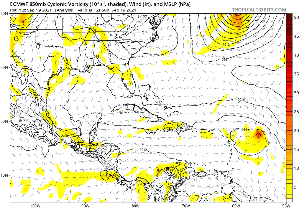
aspen wrote:SFLcane wrote:Could easily wnw into the Florida pen.
https://i.postimg.cc/9XG9gP1J/B9-E0-E98-F-28-B6-4682-B6-E1-1966-A82-FEDF2.png
https://i.postimg.cc/9QNwwLFF/D9300931-D1-F8-4-D03-8-D4-D-627-DD9-C67-E4-D.png
Yikes that would possibly end up as an Irma 2.0. Ridiculous for this time of year. This is a 2021 Euro run, though, so this track could (read: hopefully) bust.


sma10 wrote:aspen wrote:SFLcane wrote:Could easily wnw into the Florida pen.
https://i.postimg.cc/9XG9gP1J/B9-E0-E98-F-28-B6-4682-B6-E1-1966-A82-FEDF2.png
https://i.postimg.cc/9QNwwLFF/D9300931-D1-F8-4-D03-8-D4-D-627-DD9-C67-E4-D.png
Yikes that would possibly end up as an Irma 2.0. Ridiculous for this time of year. This is a 2021 Euro run, though, so this track could (read: hopefully) bust.
Irma? The only thing this has in common with Irma is that it's in the Atlantic Ocean, and has a general western motion


aspen wrote:sma10 wrote:aspen wrote:Yikes that would possibly end up as an Irma 2.0. Ridiculous for this time of year. This is a 2021 Euro run, though, so this track could (read: hopefully) bust.
Irma? The only thing this has in common with Irma is that it's in the Atlantic Ocean, and has a general western motion
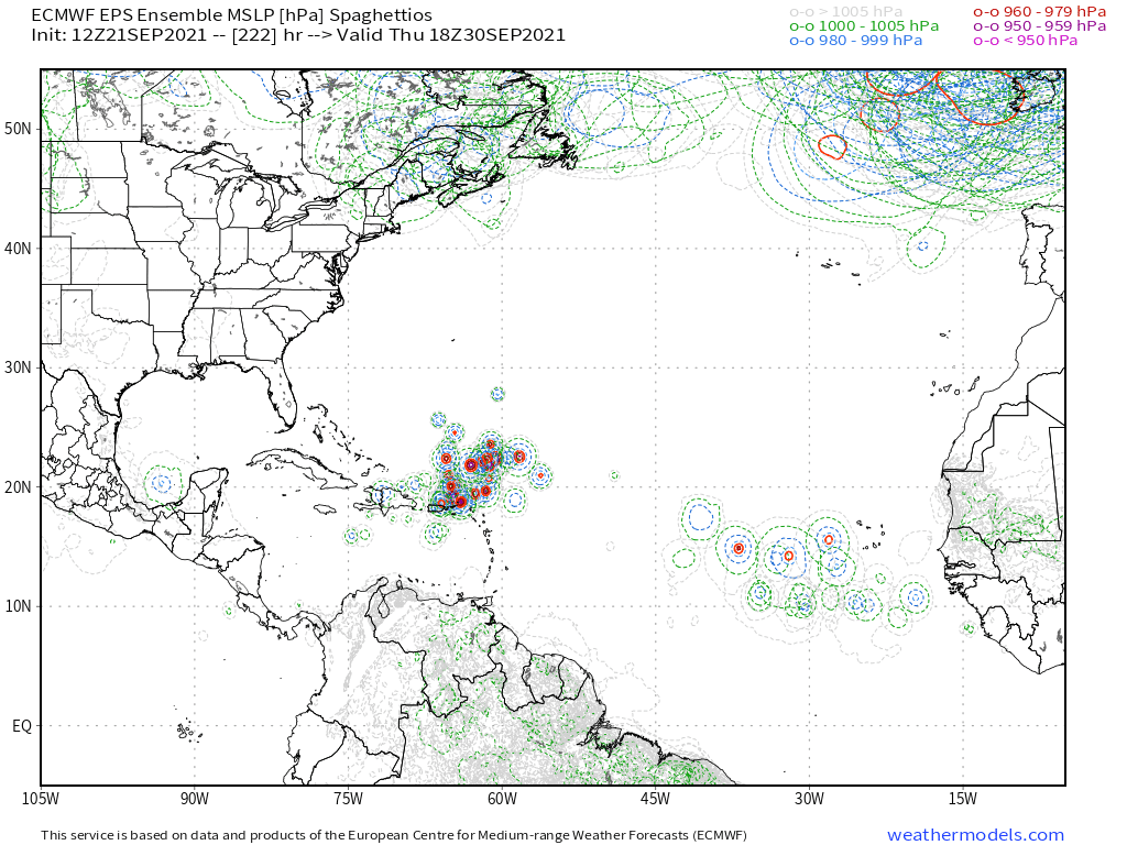
It’s starting from a much lower latitude, but if it follows this run, 98L could have an Irma-like track into the NW Lesser Antilles and passing just a hair north of the Greater Antilles, and it could be a major the entire time. A trough could save the day for Florida, unlike Irma.


skyline385 wrote:sma10 wrote:aspen wrote:Yikes that would possibly end up as an Irma 2.0. Ridiculous for this time of year. This is a 2021 Euro run, though, so this track could (read: hopefully) bust.
Irma? The only thing this has in common with Irma is that it's in the Atlantic Ocean, and has a general western motion
Think this EURO run has more in common with Maria than Irma...
aspen wrote:sma10 wrote:aspen wrote:Yikes that would possibly end up as an Irma 2.0. Ridiculous for this time of year. This is a 2021 Euro run, though, so this track could (read: hopefully) bust.
Irma? The only thing this has in common with Irma is that it's in the Atlantic Ocean, and has a general western motion
It’s starting from a much lower latitude, but if it follows this run, 98L could have an Irma-like track into the NW Lesser Antilles and passing just a hair north of the Greater Antilles, and it could be a major the entire time. A trough could save the day for Florida, unlike Irma.
toad strangler wrote:aspen wrote:sma10 wrote:
Irma? The only thing this has in common with Irma is that it's in the Atlantic Ocean, and has a general western motion
It’s starting from a much lower latitude, but if it follows this run, 98L could have an Irma-like track into the NW Lesser Antilles and passing just a hair north of the Greater Antilles, and it could be a major the entire time. A trough could save the day for Florida, unlike Irma.
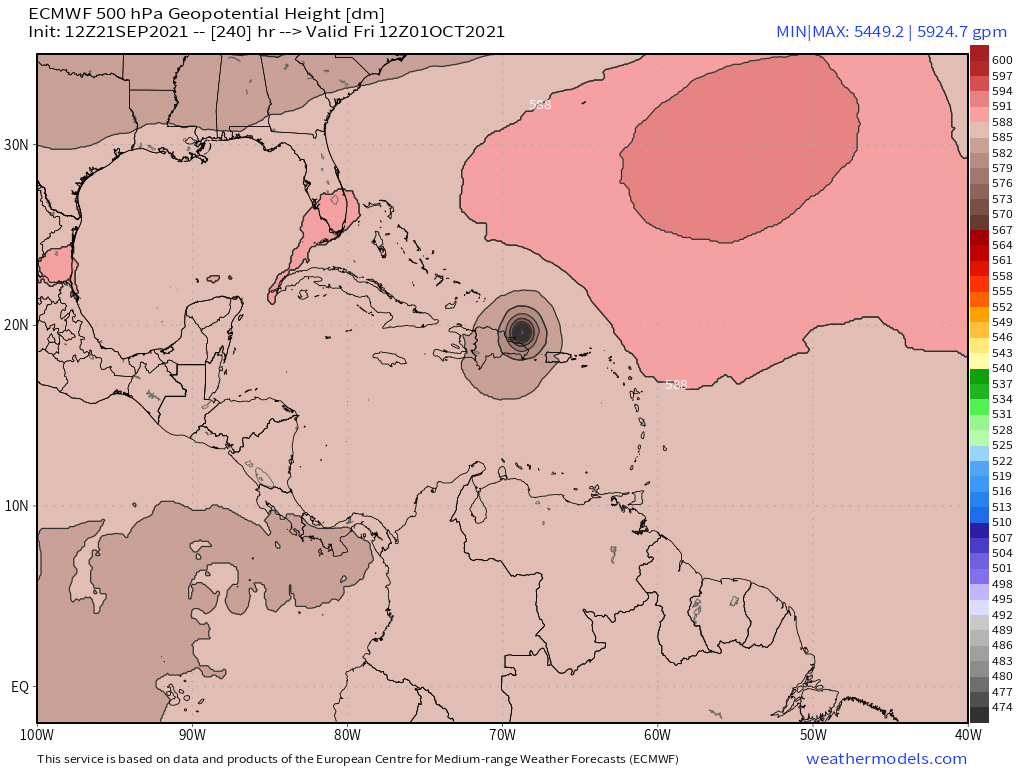
At this juncture you'd have to assume that a trough would dig and scoop this out but records are made to be broken. Wildly fluctuating model runs here combined with a 10 plus day time frame. Just mildly interestin at this point.

LarryWx wrote:12Z EPS: I count (at least) 4 hits on S or C FL (10/4-5) with also several different ones hitting further up in the SE US 10/5-6 meaning about 15% or so of the members hitting the SE US:
https://i.imgur.com/RMBv0Xo.png

LarryWx wrote:12Z EPS: I count (at least) 4 hits on S or C FL (10/4-5) with also several different ones hitting further up in the SE US 10/5-6 meaning about 15% or so of the members hitting the SE US:
https://i.imgur.com/RMBv0Xo.png
Users browsing this forum: No registered users and 21 guests


