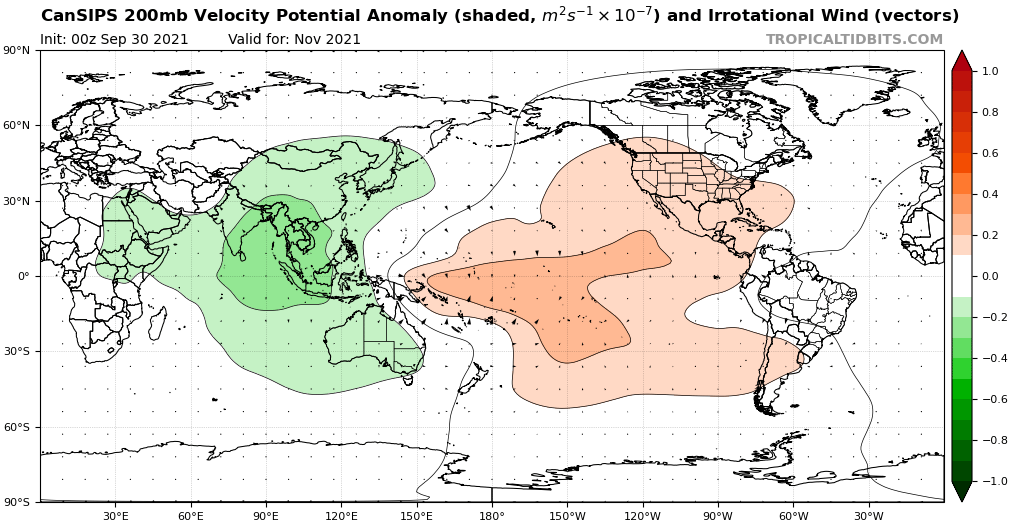
aspen wrote:If Pamela does become a strong major (Cat 4 or higher) and the Atlantic fails to produce anything in the next 3-4 weeks — despite the VP setup and ENSO setup favoring activity in the Caribbean over the EPac — then clearly something anomalous is going on. Could it just be the atmosphere taking a long time to adjust to the La Niña, or something else at play?
This year worldwide has been very strange in terms of TC activity, with many droughts and peaks across all three big NHem basins. The Atlantic has had plenty of peaks (late June, Aug20th-Sep5th, late September) and droughts (July10th-Aug10th, mid September), but so have both Pacific basins. The EPac was pumping out storms at a surprisingly good rate before shutting down after Olaf, and the WPac went without a single major for over 4 months before producing back-to-back Cat 5s (Chanthu and Mindulle).
There is this property of the MJO called amplitude. For 2021, it has been very high, which has caused huge bursts of activity this year. No need to overthink it