https://ftp.nhc.noaa.gov/atcf/btk
ATL: INVEST 93L - Discussion
Moderator: S2k Moderators
ATL: INVEST 93L - Discussion
AL, 93, 2021101012, , BEST, 0, 106N, 500W, 30, 1010, DB, 34, NEQ, 0, 0, 0, 0, 1013, 120, 40, 0, 0, L, 0, , 0, 0, INVEST, M, 0, , 0, 0, 0, 0, genesis-num, 046, SPAWNINVEST, al712021 to al932021,
https://ftp.nhc.noaa.gov/atcf/btk
0 likes
- Iceresistance
- Category 5
- Posts: 9278
- Age: 21
- Joined: Sat Oct 10, 2020 9:45 am
- Location: Tecumseh, OK/Norman, OK
Re: ATL: INVEST 93L - Discussion
That was unexpected
3 likes
Bill 2015 & Beta 2020
Winter 2020-2021
All observations are in Tecumseh, OK unless otherwise noted.
Winter posts are focused mainly for Oklahoma & Texas.
Take any of my forecasts with a grain of salt, refer to the NWS, SPC, and NHC for official information
Never say Never with weather! Because ANYTHING is possible!
Winter 2020-2021

All observations are in Tecumseh, OK unless otherwise noted.
Winter posts are focused mainly for Oklahoma & Texas.
Take any of my forecasts with a grain of salt, refer to the NWS, SPC, and NHC for official information
Never say Never with weather! Because ANYTHING is possible!
- InfernoFlameCat
- Category 5
- Posts: 2102
- Age: 22
- Joined: Mon Dec 14, 2020 10:52 am
- Location: Buford, GA
Re: ATL: INVEST 93L - Discussion
Wut. It doesnt have an area of formation. If I had to guess though it is probably that blob in the middle of the tropic Atlantic.
0 likes
I am by no means a professional. DO NOT look at my forecasts for official information or make decisions based on what I post.
Goal: to become a registered expert over tropical and subtropical cyclones.
- Stormybajan
- Category 1
- Posts: 447
- Joined: Thu May 20, 2021 3:21 pm
- Location: Windward Islands
Re: ATL: INVEST 93L - Discussion
This wave is looking good on visible currently. However windshear seems to be screaming ahead of it so it shouldnt become much, atleast east of us in the islands. However I am hoping for 93L to give us a bit more rain than we've had over the weekend 

4 likes
Sad West Indies and Manchester United fan ⚽️
- InfernoFlameCat
- Category 5
- Posts: 2102
- Age: 22
- Joined: Mon Dec 14, 2020 10:52 am
- Location: Buford, GA
Re: ATL: INVEST 93L - Discussion
It looks amazing. Death by 50knots though is pretty painful.
1 likes
I am by no means a professional. DO NOT look at my forecasts for official information or make decisions based on what I post.
Goal: to become a registered expert over tropical and subtropical cyclones.
-
- Category 4
- Posts: 932
- Age: 23
- Joined: Sun Sep 29, 2019 7:33 pm
- Location: New Jersey
Re: ATL: INVEST 93L - Discussion
SHIPS only has shear at 10-15 kt before peaking at 25 kt then dropping to ~15 kt later in the period. RH is fairly good so the only problem will be shear. Hopefully it can fight the shear off and maybe become a brief hurricane even.
0 likes
- InfernoFlameCat
- Category 5
- Posts: 2102
- Age: 22
- Joined: Mon Dec 14, 2020 10:52 am
- Location: Buford, GA
Re: ATL: INVEST 93L - Discussion
MarioProtVI wrote:SHIPS only has shear at 10-15 kt before peaking at 25 kt then dropping to ~15 kt later in the period. RH is fairly good so the only problem will be shear. Hopefully it can fight the shear off and maybe become a brief hurricane even.
If it does that would not be good. Because it would become dominant over its environment and then be in a bathtub of 31C temps and some of the highest OHC in the world.
1 likes
I am by no means a professional. DO NOT look at my forecasts for official information or make decisions based on what I post.
Goal: to become a registered expert over tropical and subtropical cyclones.
-
- Category 5
- Posts: 4029
- Age: 28
- Joined: Mon Aug 17, 2015 4:16 pm
- Location: Ft. Lauderdale, Florida
Re: ATL: INVEST 93L - Discussion
lol that was quick.
1 likes
The posts in this forum are NOT official forecasts and should not be used as such. They are just the opinion of the poster and may or may not be backed by sound meteorological data. They are NOT endorsed by any professional institution or STORM2K. For official information, please refer to products from the NHC and NWS.
Model Runs Cheat Sheet:
GFS (5:30 AM/PM, 11:30 AM/PM)
HWRF, GFDL, UKMET, NAVGEM (6:30-8:00 AM/PM, 12:30-2:00 AM/PM)
ECMWF (1:45 AM/PM)
TCVN is a weighted averaged
Re: ATL: INVEST 93L - Discussion
This looks to be the precursor to the “Omar-like” (although not Omar-like but I kept calling it that) storm the GFS had for a few days then dropped.
0 likes
Irene '11 Sandy '12 Hermine '16 5/15/2018 Derecho Fay '20 Isaias '20 Elsa '21 Henri '21 Ida '21
I am only a meteorology enthusiast who knows a decent amount about tropical cyclones. Look to the professional mets, the NHC, or your local weather office for the best information.
- Stormybajan
- Category 1
- Posts: 447
- Joined: Thu May 20, 2021 3:21 pm
- Location: Windward Islands
Re: ATL: INVEST 93L - Discussion
20-30%
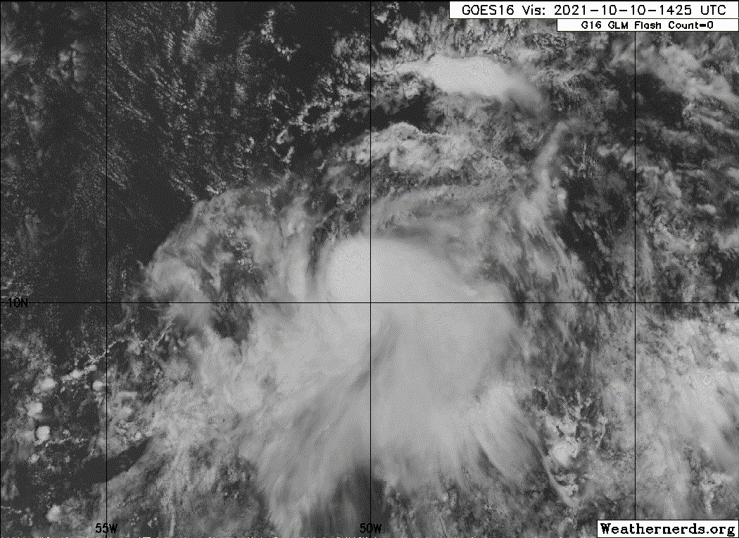
Can 93L surprise us?

1 likes
Sad West Indies and Manchester United fan ⚽️
-
- Category 5
- Posts: 8903
- Age: 39
- Joined: Thu Jul 06, 2017 1:51 am
Re: ATL: INVEST 93L - Discussion
Recent satellite-derived surface wind data indicate that a vigorous
tropical wave located about 500 miles east-southeast of the Windward
Islands is producing a concentrated area of cloudiness and
thunderstorms near the wave axis. Environmental conditions are
forecast to be marginally conducive for some additional development
of this system while it moves west-northwestward at about 15 mph
over the next few days. The disturbance is expected to approach the
central and northern Lesser Antilles by late Monday and early
Tuesday, and interests in these areas should monitor the progress of
this system. Regardless of development, the system will produce
locally heavy rainfall and gusty winds across portions of the
central and northern Lesser Antilles on Tuesday, and across the
Virgin Islands and northern Lesser Antilles on Wednesday.
* Formation chance through 48 hours...low...20 percent.
* Formation chance through 5 days...low...30 percent.
1 likes
Re: ATL: INVEST 93L - Discussion
4 likes
Re: ATL: INVEST 93L - Discussion
Holy crap...
The system ultimately strengthened and expanded as it tracked slowly westward; affecting Barbados late on October 9. Late on October 10, the worst of the hurricane passed over the island, with at least one estimate of winds as high as 200 mph (320 km/h) during landfall, which is higher than any other 1-minute sustained wind speed in recorded Atlantic basin history.
5 likes
- ouragans
- Category 1
- Posts: 481
- Age: 53
- Joined: Sun Jun 12, 2011 12:09 pm
- Location: Abymes, Guadeloupe F.W.I
- Contact:
Re: ATL: INVEST 93L - Discussion
Invest 93L
As of 18:00 UTC Oct 10, 2021:
Location: 10.7°N 50.9°W
Maximum Winds: 30 kt Gusts: N/A
Minimum Central Pressure: 1009 mb
Environmental Pressure: N/A
Radius of Circulation: N/A
Radius of Maximum wind: 40 nm
As of 18:00 UTC Oct 10, 2021:
Location: 10.7°N 50.9°W
Maximum Winds: 30 kt Gusts: N/A
Minimum Central Pressure: 1009 mb
Environmental Pressure: N/A
Radius of Circulation: N/A
Radius of Maximum wind: 40 nm
1 likes
Personal forecast disclaimer
This post is a personal point of view, not an information. Please refer to official statements for life-threatening decisions.
David '79, Frederic '79, Hugo '89, Iris, Luis & Marilyn '95, Georges '98, Lenny '99, Dean '07, Irma '17, Maria '17, Fiona '22, Philippe '23, Tammy '23
16°13'33.3,"6N -61°36'39.5"W
Re: ATL: INVEST 93L - Discussion
This vigorous disturbance is clearly spinning at some level. Development odds look a tad closer to 60-70% to me. "Shocker", and not a model saw this little flower bloom lol. Whether this will or will not fend off the shear remains to be seen but what is evident to me, is that the season is NOT over or likely to remain quiet for that much longer. More party favors coming. 

4 likes
Andy D
(For official information, please refer to the NHC and NWS products.)
- wxman57
- Moderator-Pro Met
- Posts: 22950
- Age: 67
- Joined: Sat Jun 21, 2003 8:06 pm
- Location: Houston, TX (southwest)
Re: ATL: INVEST 93L - Discussion
Every single scatterometer has missed it today. The circulation is probably in the mid-levels. Heading for increasing shear if it tracks any farther to the north.
2 likes
Re: ATL: INVEST 93L - Discussion
wxman57 wrote:Every single scatterometer has missed it today. The circulation is probably in the mid-levels. Heading for increasing shear if it tracks any farther to the north.
Mid-level only? I can't refute that possibility or that it clearly appears to be approaching shear. It's small size and apparant vigorous vorticity suggests to me that may well be near the surface. I agree that it's small size would generally leave it to be that much more defenseless against increasing shear though. Question is, would such a vigorous mid level low necessarily unwind within 2-4 days given unfavorable upper level conditions? I would think "inhibit" might well apply to further near-term development - but for how long?
0 likes
Andy D
(For official information, please refer to the NHC and NWS products.)
-
- Tropical Depression
- Posts: 80
- Joined: Wed Sep 26, 2018 4:30 pm
Re: ATL: INVEST 93L - Discussion
Two big fat hot towers recently popped up, but they're way north of the MLC. Looks like the MLC is already being pulled north though, let's see if it manages to consolidate north and form an LLC there.


2 likes
Who is online
Users browsing this forum: No registered users and 9 guests