https://twitter.com/tylerjstanfield/status/1454228062887944193
ATL: WANDA - Post-Tropical - Discussion
Moderator: S2k Moderators
-
Yellow Evan

- Professional-Met

- Posts: 16240
- Age: 27
- Joined: Fri Jul 15, 2011 12:48 pm
- Location: Henderson, Nevada/Honolulu, HI
- Contact:
-
TheDreamTraveler

- Category 2

- Posts: 645
- Joined: Sun Aug 22, 2010 3:10 am
- Location: PA

Re: ATL: INVEST 94L - Discussion
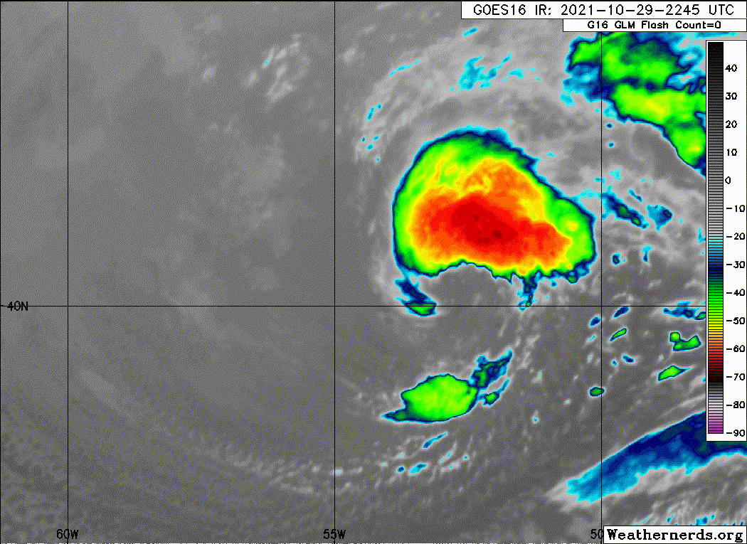
Improving with the strongest winds just west of center. Still embedded in a broader circulation but not far off.

Models have convection waning before ramping up again late Saturday into Sunday morning. That should be 94's best shot at getting a name.
Models have convection waning before ramping up again late Saturday into Sunday morning. That should be 94's best shot at getting a name.
0 likes
Kendall -> SLO -> PBC
Memorable Storms: Katrina (for its Florida landfall...) Wilma Matthew Irma
Memorable Storms: Katrina (for its Florida landfall...) Wilma Matthew Irma
-
Sciencerocks
- Category 5

- Posts: 10186
- Age: 40
- Joined: Thu Jul 06, 2017 1:51 am
Re: ATL: INVEST 94L - Discussion

0 likes
Kendall -> SLO -> PBC
Memorable Storms: Katrina (for its Florida landfall...) Wilma Matthew Irma
Memorable Storms: Katrina (for its Florida landfall...) Wilma Matthew Irma
-
MHC Tracking
- Tropical Storm

- Posts: 203
- Joined: Mon Mar 15, 2021 10:05 am
Re: ATL: INVEST 94L - Discussion
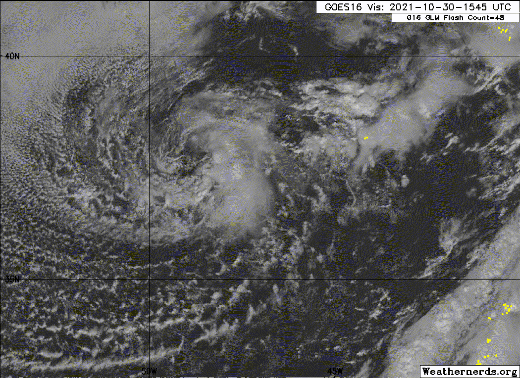
Personally, I've had it as an STC since around 18z yesterday. I expect the TCR will extend the duration rather significantly, provided it ever gets designated. It likely will though, as it is fully sparated from its fronts. The next TWO will likely raise the chances further, and we might have an SS at 10am, or 4pm.

0 likes

Re: ATL: INVEST 94L - Discussion
Ubuntwo wrote:Improving with the strongest winds just west of center. Still embedded in a broader circulation but not far off.
https://media.discordapp.net/attachments/686965241266962434/903808362624483348/20211029.png?width=676&height=676
Models have convection waning before ramping up again late Saturday into Sunday morning. That should be 94's best shot at getting a name.
So far 94L has followed those model solutions. Convection has waned overnight. We’ll see later today if convection deepens again.
0 likes
Irene '11 Sandy '12 Hermine '16 5/15/2018 Derecho Fay '20 Isaias '20 Elsa '21 Henri '21 Ida '21
I am only a meteorology enthusiast who knows a decent amount about tropical cyclones. Look to the professional mets, the NHC, or your local weather office for the best information.
I am only a meteorology enthusiast who knows a decent amount about tropical cyclones. Look to the professional mets, the NHC, or your local weather office for the best information.
-
cycloneye

- Admin

- Posts: 149505
- Age: 69
- Joined: Thu Oct 10, 2002 10:54 am
- Location: San Juan, Puerto Rico
Re: ATL: INVEST 94L - Discussion
Showers continue to show some signs of organization near a strong,
frontal low pressure system located several hundred miles
south-southeast of Cape Race, Newfoundland. The nontropical low is
likely to lose its associated fronts this weekend while it moves
southeastward toward slightly warmer waters, and thereafter it could
transition to a subtropical storm later this weekend or early next
week over the central Atlantic. The system is expected to turn
northward and move toward colder waters by the middle of next week.
For more information on this system, including gale warnings, see
High Seas Forecasts issued by the National Weather Service.
* Formation chance through 48 hours...medium...50 percent.
* Formation chance through 5 days...medium...60 percent.
0 likes
Visit the Caribbean-Central America Weather Thread where you can find at first post web cams,radars
and observations from Caribbean basin members Click Here
and observations from Caribbean basin members Click Here
-
AlphaToOmega
- Category 5
- Posts: 1448
- Joined: Sat Jun 26, 2021 10:51 am
- Location: Somewhere in Massachusetts
-
tolakram
- Admin
- Posts: 20186
- Age: 62
- Joined: Sun Aug 27, 2006 8:23 pm
- Location: Florence, KY (name is Mark)
Re: ATL: INVEST 94L - Discussion
I see the experts have come out to tell the NHC they are wrong. 
1 likes
M a r k
- - - - -
Join us in chat: Storm2K Chatroom Invite. Android and IOS apps also available.
The posts in this forum are NOT official forecasts and should not be used as such. Posts are NOT endorsed by any professional institution or STORM2K.org. For official information and forecasts, please refer to NHC and NWS products.


Re: ATL: INVEST 94L - Discussion
tolakram wrote:I see the experts have come out to tell the NHC they are wrong.
You act like they can't be wrong. They change things post analysis all the time.
6 likes
Alicia, Allison, Ike, Harvey, Nicholas, Beryl
Re: ATL: INVEST 94L - Discussion
A strong low pressure system located several hundred miles
south-southeast of Cape Race, Newfoundland, continues to produce
some shower activity near and to the east of its center while moving
southeastward at around 15 mph. The low appears to be gradually
losing its frontal structure, and the system is likely to transition
to a subtropical storm by early next week while it meanders over the
central subtropical Atlantic. By the middle of next week, the
system is expected to turn northward and move toward colder waters.
For more information on this system, including gale warnings, see
High Seas Forecasts issued by the National Weather Service.
* Formation chance through 48 hours...medium...60 percent.
* Formation chance through 5 days...high...70 percent.
1 likes
Kendall -> SLO -> PBC
Memorable Storms: Katrina (for its Florida landfall...) Wilma Matthew Irma
Memorable Storms: Katrina (for its Florida landfall...) Wilma Matthew Irma
-
CrazyC83
- Professional-Met
- Posts: 34315
- Joined: Tue Mar 07, 2006 11:57 pm
- Location: Deep South, for the first time!
Re: ATL: INVEST 94L - Discussion
It's borderline but you could make an argument now that it is a TC or STC. However, since no land is in the way, there is no need to pull the trigger until it is obvious.
0 likes
-
Sciencerocks
- Category 5
- Posts: 10186
- Age: 40
- Joined: Thu Jul 06, 2017 1:51 am

Re: ATL: INVEST 94L - Discussion
CrazyC83 wrote:It's borderline but you could make an argument now that it is a TC or STC. However, since no land is in the way, there is no need to pull the trigger until it is obvious.
Thinking it'll be named in time to avoid a storm-free October?
0 likes
The above post is not official and should not be used as such. It is the opinion of the poster and may or may not be backed by sound meteorological data. It is not endorsed by any professional institution or storm2k.org. For official information, please refer to the NHC and NWS products.

Re: ATL: INVEST 94L - Discussion
CrazyC83 wrote:It's borderline but you could make an argument now that it is a TC or STC. However, since no land is in the way, there is no need to pull the trigger until it is obvious.
Even though there is no land, there are ships.
0 likes
Re: ATL: INVEST 94L - Discussion
Have there been any documented impacts of solar storms on weather? 94L is pretty close to the range of latitudes that will experience auroras from the Coronal Mass Ejection tonight.
0 likes
Irene '11 Sandy '12 Hermine '16 5/15/2018 Derecho Fay '20 Isaias '20 Elsa '21 Henri '21 Ida '21
I am only a meteorology enthusiast who knows a decent amount about tropical cyclones. Look to the professional mets, the NHC, or your local weather office for the best information.
I am only a meteorology enthusiast who knows a decent amount about tropical cyclones. Look to the professional mets, the NHC, or your local weather office for the best information.
Re: ATL: INVEST 94L - Discussion
tolakram wrote:I see the experts have come out to tell the NHC they are wrong.
Please tell us where the front is and how you find it.
0 likes
-
AnnularCane

- S2K Supporter

- Posts: 2962
- Joined: Thu Jun 08, 2006 9:18 am
- Location: Wytheville, VA
Re: ATL: INVEST 94L - Discussion
Up to 90/90 already. 
0 likes
"But it never rained rain. It never snowed snow. And it never blew just wind. It rained things like soup and juice. It snowed mashed potatoes and green peas. And sometimes the wind blew in storms of hamburgers." -- Judi Barrett, Cloudy with a Chance of Meatballs
-
cycloneye
- Admin
- Posts: 149505
- Age: 69
- Joined: Thu Oct 10, 2002 10:54 am
- Location: San Juan, Puerto Rico
Re: ATL: INVEST 94L - Discussion
Showers and thunderstorms have become more concentrated near the
center of a gale-force low pressure system located over the central
Atlantic several hundred miles southeast of Cape Race, Newfoundland.
The low continues to lose its frontal structure, and the system is
likely to transition to a subtropical storm later tonight or on
Sunday while it moves southeastward over the central subtropical
Atlantic. By the middle of next week, the system is expected to
turn northward and move toward colder waters. For more information
on this system, including gale warnings, see High Seas Forecasts
issued by the National Weather Service.
* Formation chance through 48 hours...high...90 percent.
* Formation chance through 5 days...high...90 percent.
0 likes
Visit the Caribbean-Central America Weather Thread where you can find at first post web cams,radars
and observations from Caribbean basin members Click Here
and observations from Caribbean basin members Click Here
Who is online
Users browsing this forum: No registered users and 56 guests