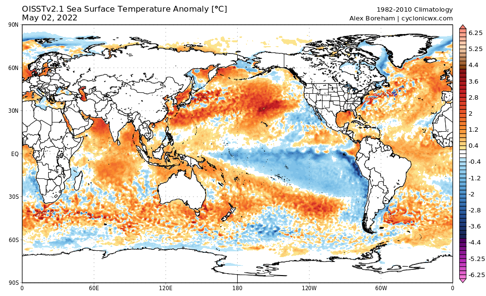
Category5Kaiju wrote:Imho, 2022 definitely has a high ceiling, and if its forecast conditions verify (especially with those weak trades in July), then we may be in for a hyperactive and (possibly) impactful season. Now I do not know how (assuming it is indeed hyperactive) 2022 would compare with 2017 or 2020, but it is something that we really need to watch going forward.
Based on ASO conditions, 2020 actually had a higher ceiling than 2017 because 2020 had a -PDO, but 2017 had a +PDO. However, 2017 ultimately had more ACE than 2020. As for 2022, it will likely have a bigger ceiling than 2017, but I am not so sure about 2020. However, "ceiling" does not equate to actual activity. 2010 actually had the highest ceiling of any recent season, but its ACE was only 6 above the hyperactive threshold; so one season can have a higher "ceiling" than another but be less active.

 This is what I dont want to see happening looking from Puerto Rico.