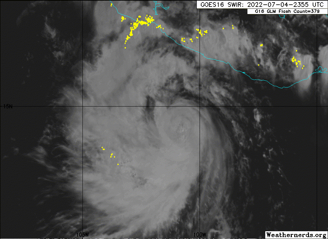
EPAC: BONNIE - Post-Tropical - Discussion
Moderator: S2k Moderators
- Yellow Evan
- Professional-Met
- Posts: 15959
- Age: 25
- Joined: Fri Jul 15, 2011 12:48 pm
- Location: Henderson, Nevada/Honolulu, HI
- Contact:
- Yellow Evan
- Professional-Met
- Posts: 15959
- Age: 25
- Joined: Fri Jul 15, 2011 12:48 pm
- Location: Henderson, Nevada/Honolulu, HI
- Contact:
Re: EPAC: BONNIE - Hurricane - Discussion
Appears to be undergoing an ERC again, which lines up with the eye contraction.
1 likes
- Yellow Evan
- Professional-Met
- Posts: 15959
- Age: 25
- Joined: Fri Jul 15, 2011 12:48 pm
- Location: Henderson, Nevada/Honolulu, HI
- Contact:
Re: EPAC: BONNIE - Hurricane - Discussion
TXPZ25 KNES 042351
TCSENP
A. 02L (BONNIE)
B. 04/2330Z
C. 14.3N
D. 100.8W
E. ONE/GOES-E
F. T4.5/4.5
G. IR/EIR/VIS
H. REMARKS...VIS IMAGERY SHOWS CLOUD FILLED EYE. IN EIR IMAGERY, LG EYE
SURROUNDED BY BLACK AND EMBEDDED IN LG YIELDS E-NO OF 5.0 WITH EYE-ADJ
OF -0.5, THUS A DT OF 4.5. MET AND PT ARE 5.0. FT IS BASED ON DT.
I. ADDL POSITIONS
NIL
...LEVINE
0 likes
- cycloneye
- Admin
- Posts: 139463
- Age: 67
- Joined: Thu Oct 10, 2002 10:54 am
- Location: San Juan, Puerto Rico
Re: EPAC: BONNIE - Hurricane - Discussion
Up to 90kt.
EP, 04, 2022070500, , BEST, 0, 143N, 1008W, 90, 974, HU
0 likes
Visit the Caribbean-Central America Weather Thread where you can find at first post web cams,radars
and observations from Caribbean basin members Click Here
- Yellow Evan
- Professional-Met
- Posts: 15959
- Age: 25
- Joined: Fri Jul 15, 2011 12:48 pm
- Location: Henderson, Nevada/Honolulu, HI
- Contact:
Re: EPAC: BONNIE - Hurricane - Discussion
Full outer eyewall still evident but seems to be contracting some.
0 likes
- cycloneye
- Admin
- Posts: 139463
- Age: 67
- Joined: Thu Oct 10, 2002 10:54 am
- Location: San Juan, Puerto Rico
Re: EPAC: BONNIE - Hurricane - Discussion
Is now forecast to reach cat 3 on Tuesday morning.
12H 05/1200Z 15.1N 103.5W 100 KT 115 MPH
0 likes
Visit the Caribbean-Central America Weather Thread where you can find at first post web cams,radars
and observations from Caribbean basin members Click Here
- cycloneye
- Admin
- Posts: 139463
- Age: 67
- Joined: Thu Oct 10, 2002 10:54 am
- Location: San Juan, Puerto Rico
Re: EPAC: BONNIE - Hurricane - Discussion
2 likes
Visit the Caribbean-Central America Weather Thread where you can find at first post web cams,radars
and observations from Caribbean basin members Click Here
-
- Category 5
- Posts: 7292
- Age: 38
- Joined: Thu Jul 06, 2017 1:51 am
- skyline385
- Category 5
- Posts: 2518
- Age: 33
- Joined: Wed Aug 26, 2020 11:15 pm
- Location: Houston TX
Re: EPAC: BONNIE - Hurricane - Discussion
cycloneye wrote:Is now forecast to reach cat 3 on Tuesday morning.12H 05/1200Z 15.1N 103.5W 100 KT 115 MPH
Looks like they forgot to update the cone with the Major forecast
0 likes
- ElectricStorm
- Category 5
- Posts: 4617
- Age: 23
- Joined: Tue Aug 13, 2019 11:23 pm
- Location: Skiatook, OK / Norman, OK
Re: EPAC: BONNIE - Hurricane - Discussion
skyline385 wrote:cycloneye wrote:Is now forecast to reach cat 3 on Tuesday morning.12H 05/1200Z 15.1N 103.5W 100 KT 115 MPH
Looks like they forgot to update the cone with the Major forecast
No the updated forecast no longer has it reaching Cat 3
0 likes
I am in no way a professional. Take what I say with a grain of salt as I could be totally wrong. Please refer to the NHC, NWS, or SPC for official information.
Boomer Sooner!
Boomer Sooner!
- skyline385
- Category 5
- Posts: 2518
- Age: 33
- Joined: Wed Aug 26, 2020 11:15 pm
- Location: Houston TX
Re: EPAC: BONNIE - Hurricane - Discussion
ElectricStorm wrote:skyline385 wrote:cycloneye wrote:Is now forecast to reach cat 3 on Tuesday morning.12H 05/1200Z 15.1N 103.5W 100 KT 115 MPH
Looks like they forgot to update the cone with the Major forecast
No the updated forecast no longer has it reaching Cat 3
Oh yea, i checked the forecast discussion before making that comment and somehow thought i saw a major in there. Guess that’s what i get for being here at 5.30 AM lol
0 likes
- Yellow Evan
- Professional-Met
- Posts: 15959
- Age: 25
- Joined: Fri Jul 15, 2011 12:48 pm
- Location: Henderson, Nevada/Honolulu, HI
- Contact:
- Yellow Evan
- Professional-Met
- Posts: 15959
- Age: 25
- Joined: Fri Jul 15, 2011 12:48 pm
- Location: Henderson, Nevada/Honolulu, HI
- Contact:
- InfernoFlameCat
- Category 5
- Posts: 1966
- Age: 21
- Joined: Mon Dec 14, 2020 10:52 am
- Location: Buford, GA
Re: EPAC: BONNIE - Hurricane - Discussion
Yellow Evan wrote:https://media.discordapp.net/attachments/733552978572869632/993842234258624512/IMG_0195.jpg
T6.0 instantaneous DT.
Instantaneous 6.0 one could argue major status. Sustained 6.0 cat 4.
0 likes
I am by no means a professional. DO NOT look at my forecasts for official information or make decisions based on what I post.
Goal: to become a registered expert over tropical and subtropical cyclones.
- Yellow Evan
- Professional-Met
- Posts: 15959
- Age: 25
- Joined: Fri Jul 15, 2011 12:48 pm
- Location: Henderson, Nevada/Honolulu, HI
- Contact:
Re: EPAC: BONNIE - Hurricane - Discussion
TXPZ25 KNES 051206
TCSENP
A. 02L (BONNIE)
B. 05/1130Z
C. 15.1N
D. 103.6W
E. ONE/GOES-E
F. T6.0/6.0
G. IR/EIR/SWIR
H. REMARKS...DG EYE SURROUNDED BY W AND EMB IN B RESULTS IN DT OF 6.0
AFTER EYE ADJ OF 0.5. MET IS 5.5 AND PT IS 6.0. FT IS BASED ON DT.
I. ADDL POSITIONS
NIL
...BROWN
TCSENP
A. 02L (BONNIE)
B. 05/1130Z
C. 15.1N
D. 103.6W
E. ONE/GOES-E
F. T6.0/6.0
G. IR/EIR/SWIR
H. REMARKS...DG EYE SURROUNDED BY W AND EMB IN B RESULTS IN DT OF 6.0
AFTER EYE ADJ OF 0.5. MET IS 5.5 AND PT IS 6.0. FT IS BASED ON DT.
I. ADDL POSITIONS
NIL
...BROWN
0 likes
- Yellow Evan
- Professional-Met
- Posts: 15959
- Age: 25
- Joined: Fri Jul 15, 2011 12:48 pm
- Location: Henderson, Nevada/Honolulu, HI
- Contact:
- cycloneye
- Admin
- Posts: 139463
- Age: 67
- Joined: Thu Oct 10, 2002 10:54 am
- Location: San Juan, Puerto Rico
Re: EPAC: BONNIE - Hurricane - Discussion
Cat 3.
EP, 04, 2022070512, , BEST, 0, 151N, 1037W, 100, 964, HU
1 likes
Visit the Caribbean-Central America Weather Thread where you can find at first post web cams,radars
and observations from Caribbean basin members Click Here
- InfernoFlameCat
- Category 5
- Posts: 1966
- Age: 21
- Joined: Mon Dec 14, 2020 10:52 am
- Location: Buford, GA
Re: EPAC: BONNIE - Hurricane - Discussion
Makes sense with the instantaneous 6.0 with a maintained 5.0+
0 likes
I am by no means a professional. DO NOT look at my forecasts for official information or make decisions based on what I post.
Goal: to become a registered expert over tropical and subtropical cyclones.
- cheezyWXguy
- Category 5
- Posts: 5565
- Joined: Mon Feb 13, 2006 12:29 am
- Location: Dallas, TX
Re: EPAC: BONNIE - Hurricane - Discussion
Given its progression through the ERC, I’m skeptical recon would actually find cat3 winds at this time, considering what double eye walls can do to flatten the pressure gradient. It’s understandable though since Dvorak is really all we have to go off of right now. Either way, if shear holds off long enough to let the new eye clear out there won’t be any more question that it’s a major
0 likes
Re: EPAC: BONNIE - Hurricane - Discussion
I noticed on the NHC forecast track, that Bonnie weakens to a TS in a few days, is this a result of cooler water?
0 likes
Who is online
Users browsing this forum: No registered users and 3 guests