2022 Indicators (SSTs/SAL/MSLP/Shear/Steering/Instability) and >Day 16 Models

This is the general tropical discussion area. Anyone can take their shot at predicting a storms path.

Moderator: S2k Moderators

Forum rules

The posts in this forum are NOT official forecasts and should not be used as such. They are just the opinion of the poster and may or may not be backed by sound meteorological data. They are NOT endorsed by any professional institution or STORM2K. For official information, please refer to products from the National Hurricane Center and National Weather Service.

Help Support Storm2K
Message
Author
User avatar
skyline385
Category 5
Category 5
Posts: 2728
Age: 35
Joined: Wed Aug 26, 2020 11:15 pm
Location: Houston TX

Re: 2022 Indicators (SSTs/SAL/MSLP/Shear/Steering/Instability) and >Day 16 Models

#1901 Postby skyline385 » Mon Jul 18, 2022 9:29 pm

Category5Kaiju wrote:
AtlanticWind wrote:I think also that while trying to read the tea leaves a month in advance can be fun , I have yet to
see any past seasons when it really gave us any foresight into what ending up happening.


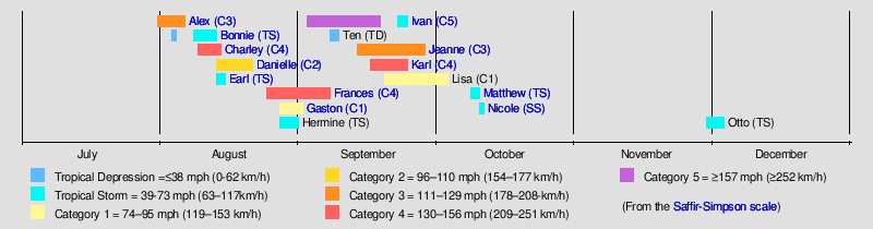
Yeah good point; I mean, even in 2005 there were season canceled comments after Emily, so yeah :D


Would love to meet the dude who called season cancelled after a Cat 5 in July and in a season which never had any break in activity.
2 likes   

User avatar
WiscoWx02
Category 1
Category 1
Posts: 391
Joined: Sat Jul 31, 2021 8:09 pm

Re: 2022 Indicators (SSTs/SAL/MSLP/Shear/Steering/Instability) and >Day 16 Models

#1902 Postby WiscoWx02 » Mon Jul 18, 2022 9:41 pm

Category5Kaiju wrote:
WiscoWx02 wrote:And just like that, with some posts of social media you would think we are watching an El Nino develop and a thermohaline collapse at the same time :lol:

Honestly though think about it like this…2018 had a insane eastern Pacific hurricane season due to an El Nino and the Atlantic was still somewhat active. Now we have a La Nina, a strong WAM. a cool subtropics, a warmer than normal MDR and westerly trades coming, and some are saying we might as well compare this season to other just average seasons. A “here we go again moment” to be sure. I seriously don’t buy the EPS forecast. I really think all the models have a temporary bias toward the east Pacific because it’s been so busy as of late. These models always do this time of year. Look at Estelle right now…the storm had the look to rapidly intensify and it didn’t. We’ve seen all of this before again and again and again in the last 6 years and all those hurricane seasons ended up being above average. I’m not buying the quieter hurricane season after all posts, think the opinions of the most extreme views in terms of expected inactivity are too static and don’t take into account some expected changes that will likely change model outputs in the coming weeks. The biggest of which to watch is how much the MDR warms due to weaker trades in the coming weeks. This will likely influence other things globally especially when things are already so quiet world wide. Still think the ball is in the Atlantic’s court more so than any other basin.

Add on: to be clear I am not expecting a hyperactive hurricane season at this point, but above average is likely IMO still and 1999, 2008, 2021 are some of the best analogue years in my opinion.


If anything, this likely could very well be a year with a not-so-crazy number of total NSs (especially given we're not seeing many shorties per se) but still a decent hurricane and major hurricane ratio. It's still mid-July, so of course dry air and shear are going to be a problem for anything that wants to develop. However, as USTropics said, there's hardly any red flag, concrete evidence that this season is going to massively bust, aside from the occasional zilch runs by very long range models (which, of course, did not definitively predict Irma, or Dorian, or Laura in July) and incessantly fluctuating MJO/CCKW propagation maps. I still am expecting a pretty active season once everything is all done. Hyperactivity-wise, I genuinely believe that it's going to be a bit tricky to tell in advance, since all it can take is one or maybe two long-lived storms to get us over that 160 ACE mark. But who knows, maybe September will tell us a different story.

Additionally, I remember you a while back saying that we may not get a NS until August, and I'm starting to actually think that you may be onto something here. Seems like shorties are not to be taken for granted this year, unlike 2020 and 2021. I suppose that's a bit of a good thing considering there are a select few who complain that shorties should not be classified and that they're just clouds, so perhaps we won't have to worry about arguments regarding that :D


I certainly goofed a little though…we had Bonnie and Colin but I think once we hit August 20th, as with almost every year, things get going. I agree with your view on fewer named storms but that doesn’t mean weaker…think a quality over quantity season is coming, and if anything that makes me a little more uneasy if I’m being honest but of course, we could just see a bunch of Larry’s and Sam’s, which would be pretty cool.
0 likes   

User avatar
skyline385
Category 5
Category 5
Posts: 2728
Age: 35
Joined: Wed Aug 26, 2020 11:15 pm
Location: Houston TX

Re: 2022 Indicators (SSTs/SAL/MSLP/Shear/Steering/Instability) and >Day 16 Models

#1903 Postby skyline385 » Mon Jul 18, 2022 9:59 pm

skyline385 wrote:Hmm missed this one because was focusing on long-range, this is probably also what the GFS has been hinting at. Maybe could see something weak spin up?

https://i.imgur.com/pSItMwX.png


Slightly more GEFS support for end of July coinciding with the rising cell over NATL, there is a small chance here

Image
0 likes   

User avatar
skyline385
Category 5
Category 5
Posts: 2728
Age: 35
Joined: Wed Aug 26, 2020 11:15 pm
Location: Houston TX

Re: 2022 Indicators (SSTs/SAL/MSLP/Shear/Steering/Instability) and >Day 16 Models

#1904 Postby skyline385 » Mon Jul 18, 2022 10:05 pm

LOL after all the gloom in this thread with today's weeklies, this is what the weekly cyclones just popped out :lol:
Hope everyone is prepared

Image
1 likes   

User avatar
Category5Kaiju
Category 5
Category 5
Posts: 4097
Joined: Thu Dec 24, 2020 12:45 pm
Location: Seattle

Re: 2022 Indicators (SSTs/SAL/MSLP/Shear/Steering/Instability) and >Day 16 Models

#1905 Postby Category5Kaiju » Mon Jul 18, 2022 10:13 pm

Here's a quick visual rundown and a reminder on why a season should never be doubted before August 20 prematurely and why that date is truly the key start date:

1998:
Image

1999:
Image

2003:
Image

2004:
Image

2010:
Image

2011:
Image

2013 :D (will put this here as the one, very rare example of when season canceling actually worked; also, you can see how truly, ridiculously extreme it was for it to happen):
Image

2016:
Image

2017:
Image

2018:
Image

2019:
Image

2020:
Image

2021:
Image
1 likes   
Unless explicitly stated, all info in my posts is based on my own opinions and observations. Tropical storms and hurricanes can be extremely dangerous. Do not think you can beat Mother Nature. Refer to an accredited weather research agency or meteorologist if you need to make serious decisions regarding an approaching storm.

User avatar
weeniepatrol
Category 5
Category 5
Posts: 1276
Joined: Sat Aug 22, 2020 5:30 pm
Location: WA State

Re: 2022 Indicators (SSTs/SAL/MSLP/Shear/Steering/Instability) and >Day 16 Models

#1906 Postby weeniepatrol » Mon Jul 18, 2022 11:23 pm

zzh wrote:https://i.imgur.com/8bixHO5.png
A big TUTT out there, pretty much shuts down the entire Atlantic.


Looks identical to climo to me

Image

Image
Last edited by weeniepatrol on Mon Jul 18, 2022 11:43 pm, edited 1 time in total.
1 likes   

User avatar
weeniepatrol
Category 5
Category 5
Posts: 1276
Joined: Sat Aug 22, 2020 5:30 pm
Location: WA State

Re: 2022 Indicators (SSTs/SAL/MSLP/Shear/Steering/Instability) and >Day 16 Models

#1907 Postby weeniepatrol » Mon Jul 18, 2022 11:37 pm

Glad that we have wisened up to the typical handwringing, gang. Warms my cold heart a little. As for the Eric Webb tweet regarding the hyperactive -vp200a composite:

 https://twitter.com/webberweather/status/1292126380319289346


Aug to Oct -VP200a composite for ATL hyperactive seasons in NCEP data (1948 to present)

Image

Western Atlantic subsidence does not bother the systems that are already well-established. We observed this most notably in 2017 with strong hurricanes plowing into subsidence.
4 likes   

User avatar
toad strangler
S2K Supporter
S2K Supporter
Posts: 4543
Joined: Sun Jul 28, 2013 3:09 pm
Location: Earth
Contact:

Re: 2022 Indicators (SSTs/SAL/MSLP/Shear/Steering/Instability) and >Day 16 Models

#1908 Postby toad strangler » Tue Jul 19, 2022 6:12 am

AtlanticWind wrote:We have seen the Euro miss development outside of 3 or 4 days, I cant put much stock on these
long lead time forecasts. It is still very likely we see a burst of activity starting mid August.

Overall conditions still appear favorable and though we could have something unforeseen disrupt
peak season , I would still put my money on a very active season.


ya, and ACE is the very last item on my bucket list that I care about during a tropical season. I'm wary about TC's that might threaten land. Those are the systems that I look out for. ACE eating mid ocean titans put me to sleep. And that's the way I like it during peak season. Asleep near my pool. 8-) :sun:

So, some of the bearish discussion comes with mainly ACE in mind. Hyperactivity and the like. An ACE season of 60 could be devastating. So, I caution against any "bust" forecasting with strictly ACE in mind.
1 likes   

tolakram
Admin
Admin
Posts: 20009
Age: 62
Joined: Sun Aug 27, 2006 8:23 pm
Location: Florence, KY (name is Mark)

Re: 2022 Indicators (SSTs/SAL/MSLP/Shear/Steering/Instability) and >Day 16 Models

#1909 Postby tolakram » Tue Jul 19, 2022 6:35 am

Did something change since yesterday that is of any significance? I believe the skill of any model over 20 days is near 0. Does anyone have some past skill analysis available? I see this from July but it's Europe, not the Atlantic.

https://journals.ametsoc.org/view/journ ... 0207.1.xml
4 likes   
M a r k
- - - - -
Join us in chat: Storm2K Chatroom Invite. Android and IOS apps also available.

The posts in this forum are NOT official forecasts and should not be used as such. Posts are NOT endorsed by any professional institution or STORM2K.org. For official information and forecasts, please refer to NHC and NWS products.

User avatar
InfernoFlameCat
Category 5
Category 5
Posts: 2102
Age: 22
Joined: Mon Dec 14, 2020 10:52 am
Location: Buford, GA

Re: 2022 Indicators (SSTs/SAL/MSLP/Shear/Steering/Instability) and >Day 16 Models

#1910 Postby InfernoFlameCat » Tue Jul 19, 2022 7:22 am

tolakram wrote:Did something change since yesterday that is of any significance? I believe the skill of any model over 20 days is near 0. Does anyone have some past skill analysis available? I see this from July but it's Europe, not the Atlantic.

https://journals.ametsoc.org/view/journ ... 0207.1.xml

I think people put too much thought about models. Models are only somewhat accurate 5 days out. 16 days out and only patterns are what should be taken away from models. Past that, and nothing is reliable on those models. There are too many small scale features that go undetected, like a little cloud that changes the atmosphere ever so slightly for models to be remotely close to what pans out. After 20 days out, models are only good for extremely large climatology favored events, like the July TUTT. Us young in’s don’t remember when models couldn’t predict things accurately 3 days out :lol: . And remember, with all their power, supercomputer models still fall short when compared to humans when predicting storms. Very talented humans perhaps, but still humans. The takeaway is don’t read into models too much past 120 hours and especially past 400 hours.
0 likes   
I am by no means a professional. DO NOT look at my forecasts for official information or make decisions based on what I post.

Goal: to become a registered expert over tropical and subtropical cyclones.

User avatar
skyline385
Category 5
Category 5
Posts: 2728
Age: 35
Joined: Wed Aug 26, 2020 11:15 pm
Location: Houston TX

Re: 2022 Indicators (SSTs/SAL/MSLP/Shear/Steering/Instability) and >Day 16 Models

#1911 Postby skyline385 » Tue Jul 19, 2022 7:36 am

InfernoFlameCat wrote:
tolakram wrote:Did something change since yesterday that is of any significance? I believe the skill of any model over 20 days is near 0. Does anyone have some past skill analysis available? I see this from July but it's Europe, not the Atlantic.

https://journals.ametsoc.org/view/journ ... 0207.1.xml

I think people put too much thought about models. Models are only somewhat accurate 5 days out. 16 days out and only patterns are what should be taken away from models. Past that, and nothing is reliable on those models. There are too many small scale features that go undetected, like a little cloud that changes the atmosphere ever so slightly for models to be remotely close to what pans out. After 20 days out, models are only good for extremely large climatology favored events, like the July TUTT. Us young in’s don’t remember when models couldn’t predict things accurately 3 days out :lol: . And remember, with all their power, supercomputer models still fall short when compared to humans when predicting storms. Very talented humans perhaps, but still humans. The takeaway is don’t read into models too much past 120 hours and especially past 400 hours.


Always been the case yea, models should only be looked for trends (and even those fail at times). And funny you mention the TUTT, cause Papin talked in a tweet few days ago about how long range models dont even accurately depict the TUTT. Its also the reason why looking for systems on low-res climate models like the CFS is just a toin coss basically.
3 likes   

User avatar
Category5Kaiju
Category 5
Category 5
Posts: 4097
Joined: Thu Dec 24, 2020 12:45 pm
Location: Seattle

Re: 2022 Indicators (SSTs/SAL/MSLP/Shear/Steering/Instability) and >Day 16 Models

#1912 Postby Category5Kaiju » Tue Jul 19, 2022 8:14 am

 https://twitter.com/AndyHazelton/status/1549374181455802368


Looks like we're starting to see signs that the EPAC is not going to be as conducive as it has been for a rapid burst in activity, thus implicitly but slowly paving the way for the Atlantic...
4 likes   
Unless explicitly stated, all info in my posts is based on my own opinions and observations. Tropical storms and hurricanes can be extremely dangerous. Do not think you can beat Mother Nature. Refer to an accredited weather research agency or meteorologist if you need to make serious decisions regarding an approaching storm.

User avatar
WiscoWx02
Category 1
Category 1
Posts: 391
Joined: Sat Jul 31, 2021 8:09 pm

Re: 2022 Indicators (SSTs/SAL/MSLP/Shear/Steering/Instability) and >Day 16 Models

#1913 Postby WiscoWx02 » Tue Jul 19, 2022 9:31 am

Category5Kaiju wrote:https://twitter.com/AndyHazelton/status/1549374181455802368?cxt=HHwWgMCt3f3mvYArAAAA

Looks like we're starting to see signs that the EPAC is not going to be as conducive as it has been for a rapid burst in activity, thus implicitly but slowly paving the way for the Atlantic...


Estelle going down like a sinking ship agrees. Also some ensembles are starting to latch onto activity in the Atlantic…I think this time last year they showed zilch for activity and the eastern Pacific was going nuts with Felicia and models showed that they would just keep coming. I think the models showed this all the way until Fred formed almost if I recall correctly. Eastern Pacific storms started struggling and support for the Atlantic went up…think we are already seeing the same happen this year.
0 likes   

User avatar
skyline385
Category 5
Category 5
Posts: 2728
Age: 35
Joined: Wed Aug 26, 2020 11:15 pm
Location: Houston TX

2022 Indicators (SSTs/SAL/MSLP/Shear/Steering/Instability) and >Day 16 Models

#1914 Postby skyline385 » Tue Jul 19, 2022 9:35 am

WiscoWx02 wrote:
Category5Kaiju wrote:https://twitter.com/AndyHazelton/status/1549374181455802368?cxt=HHwWgMCt3f3mvYArAAAA

Looks like we're starting to see signs that the EPAC is not going to be as conducive as it has been for a rapid burst in activity, thus implicitly but slowly paving the way for the Atlantic...


Estelle going down like a sinking ship agrees. Also some ensembles are starting to latch onto activity in the Atlantic…I think this time last year they showed zilch for activity and the eastern Pacific was going nuts with Felicia and models showed that they would just keep coming. I think the models showed this all the way until Fred formed almost if I recall correctly. Eastern Pacific storms started struggling and support for the Atlantic went up…think we are already seeing the same happen this year.

This trend has been prevalent since the beginning of July and we just had Darby bomb out and make a trek all the way to Hawaii. Estelle going down isn’t related to this imo, it’s just insta-seasonal variation very likely. Now, the Nina is strengthening and it will affect the Atlantic but Estelle isn’t an example of it.
Last edited by skyline385 on Tue Jul 19, 2022 9:35 am, edited 1 time in total.
0 likes   

User avatar
cycloneye
Admin
Admin
Posts: 145347
Age: 68
Joined: Thu Oct 10, 2002 10:54 am
Location: San Juan, Puerto Rico

Re: 2022 Indicators (SSTs/SAL/MSLP/Shear/Steering/Instability) and >Day 16 Models

#1915 Postby cycloneye » Tue Jul 19, 2022 10:00 am

skyline385 wrote:
WiscoWx02 wrote:
Category5Kaiju wrote:https://twitter.com/AndyHazelton/status/1549374181455802368?cxt=HHwWgMCt3f3mvYArAAAA

Looks like we're starting to see signs that the EPAC is not going to be as conducive as it has been for a rapid burst in activity, thus implicitly but slowly paving the way for the Atlantic...


Estelle going down like a sinking ship agrees. Also some ensembles are starting to latch onto activity in the Atlantic…I think this time last year they showed zilch for activity and the eastern Pacific was going nuts with Felicia and models showed that they would just keep coming. I think the models showed this all the way until Fred formed almost if I recall correctly. Eastern Pacific storms started struggling and support for the Atlantic went up…think we are already seeing the same happen this year.

This trend has been prevalent since the beginning of July and we just had Darby bomb out and make a trek all the way to Hawaii. Estelle going down isn’t related to this imo, it’s just insta-seasonal variation very likely. Now, the Nino is strengthening and it will affect the Atlantic but Estelle isn’t an example of it.


You mean't La Niña right?
4 likes   
Visit the Caribbean-Central America Weather Thread where you can find at first post web cams,radars
and observations from Caribbean basin members Click Here

User avatar
SFLcane
S2K Supporter
S2K Supporter
Posts: 10163
Age: 47
Joined: Sat Jun 05, 2010 1:44 pm
Location: Lake Worth Florida

Re: 2022 Indicators (SSTs/SAL/MSLP/Shear/Steering/Instability) and >Day 16 Models

#1916 Postby SFLcane » Tue Jul 19, 2022 10:06 am

1 likes   

User avatar
SFLcane
S2K Supporter
S2K Supporter
Posts: 10163
Age: 47
Joined: Sat Jun 05, 2010 1:44 pm
Location: Lake Worth Florida

Re: 2022 Indicators (SSTs/SAL/MSLP/Shear/Steering/Instability) and >Day 16 Models

#1917 Postby SFLcane » Tue Jul 19, 2022 10:08 am

0 likes   

User avatar
skyline385
Category 5
Category 5
Posts: 2728
Age: 35
Joined: Wed Aug 26, 2020 11:15 pm
Location: Houston TX

Re: 2022 Indicators (SSTs/SAL/MSLP/Shear/Steering/Instability) and >Day 16 Models

#1918 Postby skyline385 » Tue Jul 19, 2022 10:38 am

cycloneye wrote:
skyline385 wrote:
WiscoWx02 wrote:

Estelle going down like a sinking ship agrees. Also some ensembles are starting to latch onto activity in the Atlantic…I think this time last year they showed zilch for activity and the eastern Pacific was going nuts with Felicia and models showed that they would just keep coming. I think the models showed this all the way until Fred formed almost if I recall correctly. Eastern Pacific storms started struggling and support for the Atlantic went up…think we are already seeing the same happen this year.

This trend has been prevalent since the beginning of July and we just had Darby bomb out and make a trek all the way to Hawaii. Estelle going down isn’t related to this imo, it’s just insta-seasonal variation very likely. Now, the Nino is strengthening and it will affect the Atlantic but Estelle isn’t an example of it.


You mean't La Niña right?

Yea meant Nina, just noticed that i accidentally typed Nino
1 likes   

User avatar
captainbarbossa19
Professional-Met
Professional-Met
Posts: 1092
Age: 27
Joined: Wed Aug 21, 2019 11:09 pm
Location: Beaumont, TX

Re: 2022 Indicators (SSTs/SAL/MSLP/Shear/Steering/Instability) and >Day 16 Models

#1919 Postby captainbarbossa19 » Tue Jul 19, 2022 11:49 am

Category5Kaiju wrote:Here's a quick visual rundown and a reminder on why a season should never be doubted before August 20 prematurely and why that date is truly the key start date:

1998:
https://upload.wikimedia.org/wikipedia/en/timeline/1g4mzk2k9u8l75c6zdd8hkoptxrncgz.png

1999:
https://upload.wikimedia.org/wikipedia/en/timeline/t21ofl0iuzij4urqjb4nudu93ucgbdg.png

2003:
https://upload.wikimedia.org/wikipedia/en/timeline/bktfdqoi3tyujitg3q6gy6ey0jzxq21.png

2004:
https://upload.wikimedia.org/wikipedia/en/timeline/exdlilc7516zaw2d6396r51pnunze1h.png

2010:
https://upload.wikimedia.org/wikipedia/en/timeline/h3xbiot6woaayux0kszrq4g3hf6lh2k.png

2011:
https://upload.wikimedia.org/wikipedia/en/timeline/gntuh75194fircq3un152db2xju852s.png

2013 :D (will put this here as the one, very rare example of when season canceling actually worked; also, you can see how truly, ridiculously extreme it was for it to happen):
https://upload.wikimedia.org/wikipedia/en/timeline/4jenm2ixiyhtvpywkjg7ddrhtbe8574.png

2016:
https://upload.wikimedia.org/wikipedia/en/timeline/9ce2wz1txelbufmv75v50xc4fuh603n.png

2017:
https://upload.wikimedia.org/wikipedia/en/timeline/o9cpjsvq9qtlykd0fh2s6xeqjrx51kn.png

2018:
https://upload.wikimedia.org/wikipedia/en/timeline/pmvlwbtkjitdychomb2d6819564i8hw.png

2019:
https://upload.wikimedia.org/wikipedia/en/timeline/a6aenjn93nng6yiyiucz96ubnx964kj.png

2020:
https://upload.wikimedia.org/wikipedia/en/timeline/4r9ph20l0rqj1kqouyb5e1m0ry9ttox.png

2021:
https://upload.wikimedia.org/wikipedia/en/timeline/n8n8kscrprwzmfekmgyn8tylrs8whjn.png


Yep. The average first major date from these years (excluding 2013 because there were no majors) is August 19. This is why the bell is rung on the 20th by CSU.

Edit: I calculated this by taking the formation date of each major storm, but I did not use the date that each storm became a major. So technically, it is later than August 19th. However, the other information helps us see when to expect the storm that will eventually become the first major.
Last edited by captainbarbossa19 on Tue Jul 19, 2022 11:56 am, edited 1 time in total.
0 likes   

User avatar
SFLcane
S2K Supporter
S2K Supporter
Posts: 10163
Age: 47
Joined: Sat Jun 05, 2010 1:44 pm
Location: Lake Worth Florida

Re: 2022 Indicators (SSTs/SAL/MSLP/Shear/Steering/Instability) and >Day 16 Models

#1920 Postby SFLcane » Tue Jul 19, 2022 11:50 am

Image
5 likes   


Return to “Talkin' Tropics”

Who is online

Users browsing this forum: cheezyWXguy and 37 guests