
2022 Global Model Runs Discussion (Out thru day 16)
Moderator: S2k Moderators
Forum rules

The posts in this forum are NOT official forecasts and should not be used as such. They are just the opinion of the poster and may or may not be backed by sound meteorological data. They are NOT endorsed by any professional institution or STORM2K. For official information, please refer to products from the National Hurricane Center and National Weather Service.
-
Spacecoast

- Category 2

- Posts: 773
- Joined: Thu Aug 31, 2017 2:03 pm
Re: 2022 Global Model Runs Discussion (Out thru day 16)
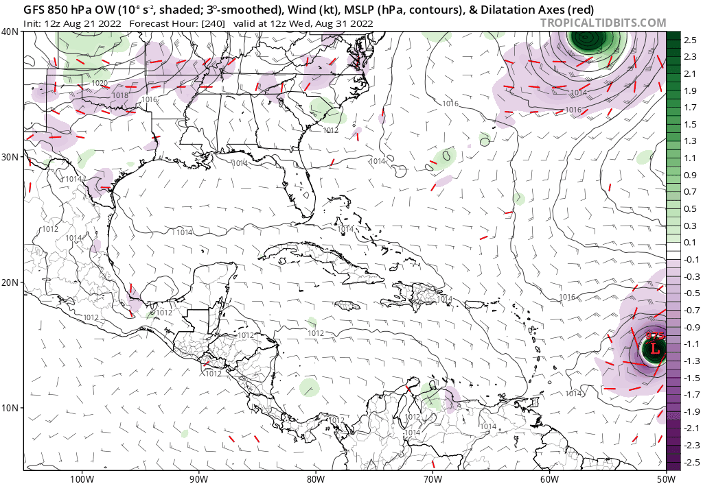
12z GFS
Last edited by Spacecoast on Sun Aug 21, 2022 12:47 pm, edited 1 time in total.
1 likes
-
lsuhurricane
- Category 1

- Posts: 270
- Joined: Tue Aug 15, 2017 2:53 pm
Re: 2022 Global Model Runs Discussion (Out thru day 16)

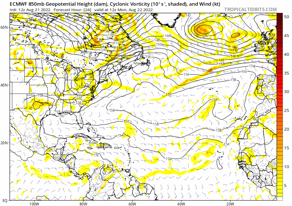
Very intense ensemble support on the 12z GEFS. Note the blue high pressure anomalies anchored around FL and to the east. Should keep these moving to the west in the short term.
0 likes
-
SconnieCane
- Category 5

- Posts: 1013
- Joined: Thu Aug 02, 2018 5:29 pm
- Location: Madison, WI
Re: 2022 Global Model Runs Discussion (Out thru day 16)
Spacecoast wrote:12z GFS
[url]https://i.ibb.co/bbyvpgh/ec5.gif [/url]
Ivan, is that you? (Tracks quite a bit further north as it enters the Caribbean, but still ends up splitting the goalposts between Cuba and the Yucatan). Ultimate weenie track and very dangerous.
1 likes
Re: 2022 Global Model Runs Discussion (Out thru day 16)
The 12z UKMET (out to 144) has no TC in the Atlantic basin.
0 likes
Personal Forecast Disclaimer:
The posts in this forum are NOT official forecasts and should not be used as such. They are just the opinion of the poster and may or may not be backed by sound meteorological data. They are NOT endorsed by any professional institution or storm2k.org. For official information, please refer to the NHC and NWS products.
The posts in this forum are NOT official forecasts and should not be used as such. They are just the opinion of the poster and may or may not be backed by sound meteorological data. They are NOT endorsed by any professional institution or storm2k.org. For official information, please refer to the NHC and NWS products.
-
Blown Away

- S2K Supporter

- Posts: 10253
- Joined: Wed May 26, 2004 6:17 am
Re: 2022 Global Model Runs Discussion (Out thru day 16)
lsuhurricane wrote:https://www.tropicaltidbits.com/analysis/models/gfs-ens/2022082112/gfs-ememb_lowlocs_atl_46.png
Very intense ensemble support on the 12z GEFS. Note the blue high pressure anomalies anchored around FL and to the east. Should keep these moving to the west in the short term.
The ensembles compared to the operational show big discrepancy in forward speed. The ensembles map is at 270 hrs and operational was a few hundred miles E of Caribbean at 270 hours. The takeaway is GFS continues showing very favorable conditions after @60W.
0 likes
Hurricane Eye Experience: David 79, Irene 99, Frances 04, Jeanne 04, Wilma 05… Hurricane Brush Experience: Andrew 92, Erin 95, Floyd 99, Matthew 16, Irma 17, Ian 22, Nicole 22…

Re: 2022 Global Model Runs Discussion (Out thru day 16)
Spacecoast wrote:12z GFS
[url]https://i.ibb.co/bbyvpgh/ec5.gif [/url]
That looks Mexico or South Texas bound.
0 likes
-
wxman57

- Moderator-Pro Met

- Posts: 23173
- Age: 68
- Joined: Sat Jun 21, 2003 8:06 pm
- Location: Houston, TX (southwest)
Re: 2022 Global Model Runs Discussion (Out thru day 16)
Major hurricane to strike Houston/Galveston Sept. 8th. No doubt about it, the 12Z GFS is always right at 384 hrs. Ridge to the north weakening a little. Yep, right to Houston. Going fill up my four 5-gal gas cans now and buy all the water in Kroger.
12 likes
-
Blown Away
- S2K Supporter
- Posts: 10253
- Joined: Wed May 26, 2004 6:17 am
Re: 2022 Global Model Runs Discussion (Out thru day 16)
wxman57 wrote:Major hurricane to strike Houston/Galveston Sept. 8th. No doubt about it, the 12Z GFS is always right at 384 hrs. Ridge to the north weakening a little. Yep, right to Houston. Going fill up my four 5-gal gas cans now and buy all the water in Kroger.
Here it comes. Strengthening as it passes through NE Caribbean and seems likely it would have continued getting stronger if it had passed N or S of GA on its way to 57’s house.
1 likes
Hurricane Eye Experience: David 79, Irene 99, Frances 04, Jeanne 04, Wilma 05… Hurricane Brush Experience: Andrew 92, Erin 95, Floyd 99, Matthew 16, Irma 17, Ian 22, Nicole 22…

Re: 2022 Global Model Runs Discussion (Out thru day 16)
wxman57 wrote:Major hurricane to strike Houston/Galveston Sept. 8th. No doubt about it, the 12Z GFS is always right at 384 hrs. Ridge to the north weakening a little. Yep, right to Houston. Going fill up my four 5-gal gas cans now and buy all the water in Kroger.
Is that spawning of the central American wave?
0 likes
Personal Forecast Disclaimer:
The posts in this forum are NOT official forecast and should not be used as such. They are just the opinion of the poster and may or may not be backed by sound meteorological data. They are NOT endorsed by any professional institution or storm2k.org. For official information, please refer to the NHC and NWS products.
The posts in this forum are NOT official forecast and should not be used as such. They are just the opinion of the poster and may or may not be backed by sound meteorological data. They are NOT endorsed by any professional institution or storm2k.org. For official information, please refer to the NHC and NWS products.
-
Spacecoast
- Category 2
- Posts: 773
- Joined: Thu Aug 31, 2017 2:03 pm
Re: 2022 Global Model Runs Discussion (Out thru day 16)
12z GEFS:

12z EC Genesis:

12z EC Genesis:
Last edited by Spacecoast on Sun Aug 21, 2022 3:18 pm, edited 2 times in total.
0 likes
Re: 2022 Global Model Runs Discussion (Out thru day 16)
Spacecoast wrote:12z GEFS:
[url]https://i.ibb.co/qkT4dWV/ec6.gif [/url]
I feel like it could come in even further sw and be a Caribbean cruiser.
1 likes
Re: 2022 Global Model Runs Discussion (Out thru day 16)
Cpv17 wrote:Spacecoast wrote:12z GEFS:
[url]https://i.ibb.co/qkT4dWV/ec6.gif [/url]
I feel like it could come in even further sw and be a Caribbean cruiser.
Or adjust north since that is 3 southern adjustments in a row…
0 likes
Re: 2022 Global Model Runs Discussion (Out thru day 16)
Cat5James wrote:Cpv17 wrote:Spacecoast wrote:12z GEFS:
[url]https://i.ibb.co/qkT4dWV/ec6.gif [/url]
I feel like it could come in even further sw and be a Caribbean cruiser.
Or adjust north since that is 3 southern adjustments in a row…
Yeah, I mean it’s possible for sure but I just feel like climo favors the southern and western tracks for late August.
0 likes
Re: 2022 Global Model Runs Discussion (Out thru day 16)
Cpv17 wrote:Cat5James wrote:Cpv17 wrote:
I feel like it could come in even further sw and be a Caribbean cruiser.
Or adjust north since that is 3 southern adjustments in a row…
Yeah, I mean it’s possible for sure but I just feel like climo favors the southern and western tracks for late August.
Agreed. I’m just expecting to see a bit of the “windshield wiper” effect.
0 likes
-
Blown Away
- S2K Supporter
- Posts: 10253
- Joined: Wed May 26, 2004 6:17 am
Re: 2022 Global Model Runs Discussion (Out thru day 16)
12z Euro
0 likes
Hurricane Eye Experience: David 79, Irene 99, Frances 04, Jeanne 04, Wilma 05… Hurricane Brush Experience: Andrew 92, Erin 95, Floyd 99, Matthew 16, Irma 17, Ian 22, Nicole 22…
-
skyline385

- Category 5
- Posts: 2728
- Age: 35
- Joined: Wed Aug 26, 2020 11:15 pm
- Location: Houston TX
2022 Global Model Runs Discussion (Out thru day 16)
12Z EPS very bullish, same for GEFS


Sent from my iPhone using Tapatalk
Sent from my iPhone using Tapatalk
0 likes

Re: 2022 Global Model Runs Discussion (Out thru day 16)
12z Euro suddenly has a third TC towards the end of this run, which gets too close to the second TC. Seems bogus, as the third wave already becomes a 1002mb TC before exiting Africa. I know the Euro ensembles have such a bias, but it's the first time the operational shows it this season.
0 likes
TC naming lists: retirements and intensity
Most aggressive Advisory #1's in North Atlantic (cr. kevin for starting the list)
Most aggressive Advisory #1's in North Atlantic (cr. kevin for starting the list)
-
Blown Away
- S2K Supporter
- Posts: 10253
- Joined: Wed May 26, 2004 6:17 am
Re: 2022 Global Model Runs Discussion (Out thru day 16)
Cpv17 wrote:Cat5James wrote:Cpv17 wrote:
I feel like it could come in even further sw and be a Caribbean cruiser.
Or adjust north since that is 3 southern adjustments in a row…
Yeah, I mean it’s possible for sure but I just feel like climo favors the southern and western tracks for late August.
That far out all options are on the table. For now most of the GFS/Euro ensembles actually go N of the islands and many recurve.
0 likes
Hurricane Eye Experience: David 79, Irene 99, Frances 04, Jeanne 04, Wilma 05… Hurricane Brush Experience: Andrew 92, Erin 95, Floyd 99, Matthew 16, Irma 17, Ian 22, Nicole 22…
-
cycloneye

- Admin

- Posts: 149399
- Age: 69
- Joined: Thu Oct 10, 2002 10:54 am
- Location: San Juan, Puerto Rico
Re: 2022 Global Model Runs Discussion (Out thru day 16)
0 likes
Visit the Caribbean-Central America Weather Thread where you can find at first post web cams,radars
and observations from Caribbean basin members Click Here
and observations from Caribbean basin members Click Here
Re: 2022 Global Model Runs Discussion (Out thru day 16)
I know it is from a wave west of the one now just west of the CVs and may be the one recently near 40W: ICON keeps developing a low just E of the L Antilles that I can't find on any of the other models. Anyone else notice this?
0 likes
Personal Forecast Disclaimer:
The posts in this forum are NOT official forecasts and should not be used as such. They are just the opinion of the poster and may or may not be backed by sound meteorological data. They are NOT endorsed by any professional institution or storm2k.org. For official information, please refer to the NHC and NWS products.
The posts in this forum are NOT official forecasts and should not be used as such. They are just the opinion of the poster and may or may not be backed by sound meteorological data. They are NOT endorsed by any professional institution or storm2k.org. For official information, please refer to the NHC and NWS products.
Who is online
Users browsing this forum: Hurricane2022 and 250 guests