
Low Pressure in the Central Atlantic (Is Invest 91L)
Moderator: S2k Moderators
Forum rules

The posts in this forum are NOT official forecasts and should not be used as such. They are just the opinion of the poster and may or may not be backed by sound meteorological data. They are NOT endorsed by any professional institution or STORM2K. For official information, please refer to products from the National Hurricane Center and National Weather Service.
-
cycloneye

- Admin

- Posts: 149579
- Age: 69
- Joined: Thu Oct 10, 2002 10:54 am
- Location: San Juan, Puerto Rico
Re: Tropical Wave emerging from West Africa
This wave is now at the surface analysis map as it has been introduced.
0 likes
Visit the Caribbean-Central America Weather Thread where you can find at first post web cams,radars
and observations from Caribbean basin members Click Here
and observations from Caribbean basin members Click Here
-
ElectricStorm

- Category 5

- Posts: 5148
- Age: 25
- Joined: Tue Aug 13, 2019 11:23 pm
- Location: Norman, OK
Re: Tropical Wave off the African Coast
0z GFS stronger with this wave. Down to 988mb at hour 252 east of the islands
0 likes
B.S Meteorology, University of Oklahoma '25
Please refer to the NHC, NWS, or SPC for official information.
Please refer to the NHC, NWS, or SPC for official information.

-
cycloneye
- Admin
- Posts: 149579
- Age: 69
- Joined: Thu Oct 10, 2002 10:54 am
- Location: San Juan, Puerto Rico
Re: Tropical Wave off the African Coast
ECMWF 00z run.

2 likes
Visit the Caribbean-Central America Weather Thread where you can find at first post web cams,radars
and observations from Caribbean basin members Click Here
and observations from Caribbean basin members Click Here
-
USTropics
- Professional-Met

- Posts: 2739
- Joined: Sun Aug 12, 2007 3:45 am
- Location: Florida State University
Re: Tropical Wave off the African Coast
Notable increase in support on the 00z ECMWF ensemble guidance (animation below):

The usually conservative GEFS members have some strong solutions as well:

The usually conservative GEFS members have some strong solutions as well:
3 likes
-
cycloneye
- Admin
- Posts: 149579
- Age: 69
- Joined: Thu Oct 10, 2002 10:54 am
- Location: San Juan, Puerto Rico
Re: Tropical Wave off the African Coast
8 AM TWO:
2. Eastern Tropical Atlantic:
A tropical wave has moved off the west coast of Africa and is
producing a large area of disorganized showers and thunderstorms.
Environmental conditions could support some slow development of
this system through early next week while it moves quickly westward
across the eastern and central tropical Atlantic at 15 to 20 mph.
* Formation chance through 48 hours...low...10 percent.
* Formation chance through 5 days...low...20 percent.
0 likes
Visit the Caribbean-Central America Weather Thread where you can find at first post web cams,radars
and observations from Caribbean basin members Click Here
and observations from Caribbean basin members Click Here
-
USTropics
- Professional-Met
- Posts: 2739
- Joined: Sun Aug 12, 2007 3:45 am
- Location: Florida State University
Re: Tropical Wave off the African Coast
BobHarlem wrote:6z GFS does nothing at all with this wave.
Main issue is how low the GFS initializes the vorticity in 4-5 days. 06z GFS has this all the way down at 9.5N. It essentially stalls out there on the run due to the lack of steering currents:

Meanwhile, the 00z ECMWF has this initializing up near 12N same time period:

the 06Z ensembles (which run on the more conservative v15 framework), have some very aggressive members that form more north (11.5-12.5N):

2 likes
-
Blown Away

- S2K Supporter

- Posts: 10253
- Joined: Wed May 26, 2004 6:17 am
Re: Tropical Wave off the African Coast

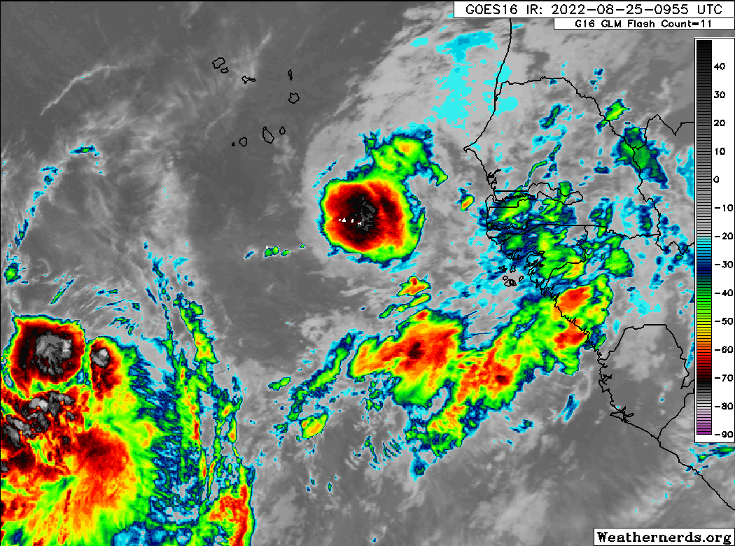
Latest. IMO, best looking TW so far.
8 likes
Hurricane Eye Experience: David 79, Irene 99, Frances 04, Jeanne 04, Wilma 05… Hurricane Brush Experience: Andrew 92, Erin 95, Floyd 99, Matthew 16, Irma 17, Ian 22, Nicole 22…

Re: Tropical Wave off the African Coast
Blown Away wrote:https://i.imgur.com/dIaATDi.gif
Latest. IMO, best looking TW so far.
Easily. It's huge too. I haven't been paying much attention to it, do the models give it a favorable environment to work with or will it be a sacrificial lamb to SAL?
0 likes
Personal Forecast Disclaimer:
The posts in this forum are NOT official forecast and should not be used as such. They are just the opinion of the poster and may or may not be backed by sound meteorological data. They are NOT endorsed by any professional institution or storm2k.org. For official information, please refer to the NHC and NWS products.
The posts in this forum are NOT official forecast and should not be used as such. They are just the opinion of the poster and may or may not be backed by sound meteorological data. They are NOT endorsed by any professional institution or storm2k.org. For official information, please refer to the NHC and NWS products.

-
Category5Kaiju

- Category 5
- Posts: 4340
- Joined: Thu Dec 24, 2020 12:45 pm
- Location: Seattle during the summer, Phoenix during the winter
Re: Tropical Wave off the African Coast
I wonder if it's a known phenomenon for waves to develop a protective "pocket" against mid-level dry air?
0 likes
Unless explicitly stated, all information in my posts is based on my own opinions and observations. Tropical storms and hurricanes can be extremely dangerous. Refer to an accredited weather research agency or meteorologist if you need to make serious decisions regarding an approaching storm.
-
Kingarabian

- S2K Supporter
- Posts: 16373
- Joined: Sat Aug 08, 2009 3:06 am
- Location: Honolulu, Hawaii
Re: Tropical Wave off the African Coast
Category5Kaiju wrote:I wonder if it's a known phenomenon for waves to develop a protective "pocket" against mid-level dry air?
All the time.
1 likes
RIP Kobe Bryant
-
USTropics
- Professional-Met
- Posts: 2739
- Joined: Sun Aug 12, 2007 3:45 am
- Location: Florida State University
Re: Tropical Wave off the African Coast
Kingarabian wrote:Category5Kaiju wrote:I wonder if it's a known phenomenon for waves to develop a protective "pocket" against mid-level dry air?
All the time.
Fun fact, back when NPS was tracking AEWs they referred to them as "pouches" because of the propensity for the waves to have a protective pouch similar to how kangaroos carry their young.
14 likes
-
Hurricaneman

- Category 5
- Posts: 7404
- Age: 45
- Joined: Tue Aug 31, 2004 3:24 pm
- Location: central florida
Re: Tropical Wave off the African Coast
BobHarlem wrote:6z GFS does nothing at all with this wave.
It was already wrong from initialization way farther south on the model with the model having it at 9n while it’s in real time 12.5n
0 likes
-
ScottNAtlanta

- Category 5
- Posts: 2535
- Joined: Sat May 25, 2013 3:11 pm
- Location: Atlanta, GA
Re: Tropical Wave off the African Coast
I'm fairly impressed by the wave in front. It hasn't dried up like many have before. The further west it gets things only get better.
2 likes
The posts in this forum are NOT official forecast and should not be used as such. They are just the opinion of the poster and may or may not be backed by sound meteorological data. They are NOT endorsed by any professional institution or storm2k.org. For official information, please refer to the NHC and NWS products.
-
InfernoFlameCat

- Category 5
- Posts: 2127
- Age: 22
- Joined: Mon Dec 14, 2020 10:52 am
- Location: Buford, GA
Re: Tropical Wave off the African Coast
This wave is trouble. The vorticity is quite good. The wave is also tightening. The switch has officially been flipped.
2 likes
I am by no means a professional. DO NOT look at my forecasts for official information or make decisions based on what I post.
Goal: to become a registered expert over tropical and subtropical cyclones.
Goal: to become a registered expert over tropical and subtropical cyclones.
-
ScottNAtlanta
- Category 5
- Posts: 2535
- Joined: Sat May 25, 2013 3:11 pm
- Location: Atlanta, GA
Re: Tropical Wave off the African Coast
There is some dry stable air over the Cabo Verde Islands very close to this wave. It could suffer some dry air as it moves forward.
0 likes
The posts in this forum are NOT official forecast and should not be used as such. They are just the opinion of the poster and may or may not be backed by sound meteorological data. They are NOT endorsed by any professional institution or storm2k.org. For official information, please refer to the NHC and NWS products.
-
cycloneye
- Admin
- Posts: 149579
- Age: 69
- Joined: Thu Oct 10, 2002 10:54 am
- Location: San Juan, Puerto Rico
Re: Tropical Wave off the African Coast
8 AM TWD:
A far eastern Atlantic tropical wave has its axis just offshore
Africa along 18W from 05N to 21N moving westward at 10 kt. The
surrounding environment of this wave has moistened up since 24
hours. Scattered moderate to isolated strong convection is noted
from 10N to 14N between 18W-22W. Scattered moderate convection
is from 08N to 11N between 14W-22W. Convective activity preceding
this wave consists of a large cluster numerous moderate to strong
convection from 06N to 13N between 26W-32W, and of scattered
moderate to isolated strong convection from 04N to 08N between
32W-38W. This activity has been rather persistent, and appears to
be a piece of energy that had detached from the wave when it was
inland Africa yesterday. Environmental conditions could support
some slow development of this system later this week, or during
the weekend as it continues on westward.
0 likes
Visit the Caribbean-Central America Weather Thread where you can find at first post web cams,radars
and observations from Caribbean basin members Click Here
and observations from Caribbean basin members Click Here
Who is online
Users browsing this forum: tolakram and 291 guests