

cycloneye wrote:https://i.imgur.com/OM1a4zt.gif
That’s a pretty sharp right hand turn
Moderator: S2k Moderators

cycloneye wrote:https://i.imgur.com/OM1a4zt.gif


cane5 wrote:This does not look good ..too close to South Florida.


SouthFLTropics wrote:AtlanticWind wrote:We have to remember this is modeling 9 to 10 days out, just not that reliable that far out.
This is a very valid point. Way too early in the game to know what may or may not happen in 10 days.


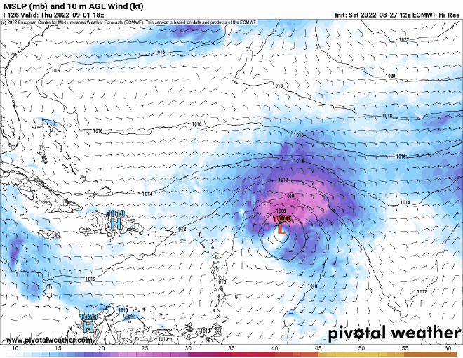
Blown Away wrote:[url]https://i.postimg.cc/FFdHckCk/floop-ecmwf-full-2022082712-sfcwind-mslp-watl.gif [/url]
No way abrupt stop and NE turn at that latitude.
Blown Away wrote:[url]https://i.postimg.cc/FFdHckCk/floop-ecmwf-full-2022082712-sfcwind-mslp-watl.gif [/url]
No way abrupt stop and NE turn at that latitude.

Category5Kaiju wrote:cycloneye wrote:https://i.imgur.com/OM1a4zt.gif
How common do storms actually do that, where they recurve at such an acute angle?

skyline385 wrote:Blown Away wrote:[url]https://i.postimg.cc/FFdHckCk/floop-ecmwf-full-2022082712-sfcwind-mslp-watl.gif [/url]
No way abrupt stop and NE turn at that latitude.
GFS has been showing this for several runs now and both the GEFS and EPS had several members doing a sharp turn around the Bahamas. It is still too early but is most definitely a possibility with a ridge budling up over Florida.
https://i.imgur.com/TShXVj3.png


Blown Away wrote:skyline385 wrote:Blown Away wrote:[url]https://i.postimg.cc/FFdHckCk/floop-ecmwf-full-2022082712-sfcwind-mslp-watl.gif [/url]
No way abrupt stop and NE turn at that latitude.
GFS has been showing this for several runs now and both the GEFS and EPS had several members doing a sharp turn around the Bahamas. It is still too early but is most definitely a possibility with a ridge budling up over Florida.
https://i.imgur.com/TShXVj3.png
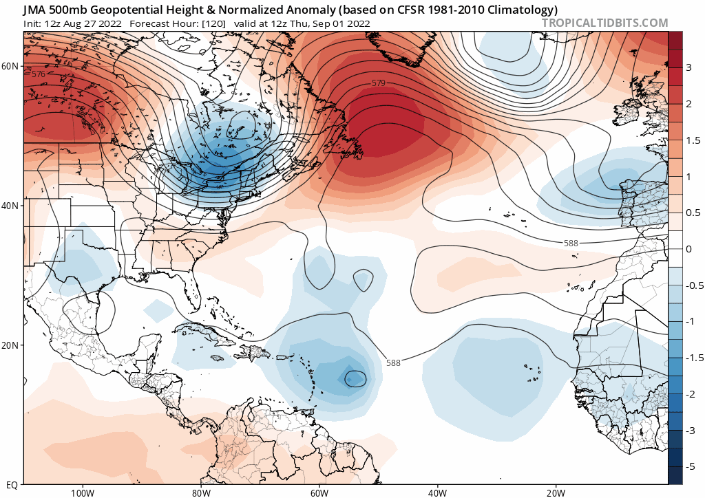
Weather patterns get very complex in the W Atl during Sept as we transition from summer to fall. Stalling, looping, and sharp NE turns not uncommon in long range modeling with W moving systems into the Bahamas area. As we move closer in time we will see stronger HP and W movement or a smoother recurve in the models, not stop then NE.

SFLcane wrote:Lol nearly impossible feat to keep a ridge holding for that long now a days. Shields up!
skyline385 wrote:Blown Away wrote:skyline385 wrote:
GFS has been showing this for several runs now and both the GEFS and EPS had several members doing a sharp turn around the Bahamas. It is still too early but is most definitely a possibility with a ridge budling up over Florida.
https://i.imgur.com/TShXVj3.png
Weather patterns get very complex in the W Atl during Sept as we transition from summer to fall. Stalling, looping, and sharp NE turns not uncommon in long range modeling with W moving systems into the Bahamas area. As we move closer in time we will see stronger HP and W movement or a smoother recurve in the models, not stop then NE.
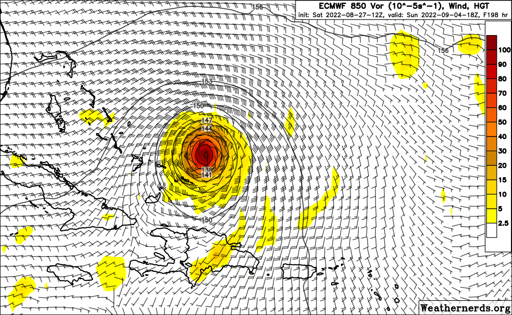
Gert 1981 - very similar path to what the Euro is predicting and around the same time frame
https://i.imgur.com/N9hCYc5.png
blp wrote:SFLcane wrote:Lol nearly impossible feat to keep a ridge holding for that long now a days. Shields up!
Of course a ridge can hold that long. Remember IKE in 08 that ridge drove IKE in same area west then SW through Cuba all the way to Texas. It's about the orientation and timing. If the ridge does not shift SW this thing would go through Florida and deep into the Gulf.
You know the drill this far out is it's a crap shoot. I will tell you one thing there ain't a strong trough anywhere on any of the models so the margins are small for this to easily flip next run.


Users browsing this forum: pepecool20 and 164 guests


