#70 Postby chaser1 » Sun Aug 28, 2022 12:16 pm
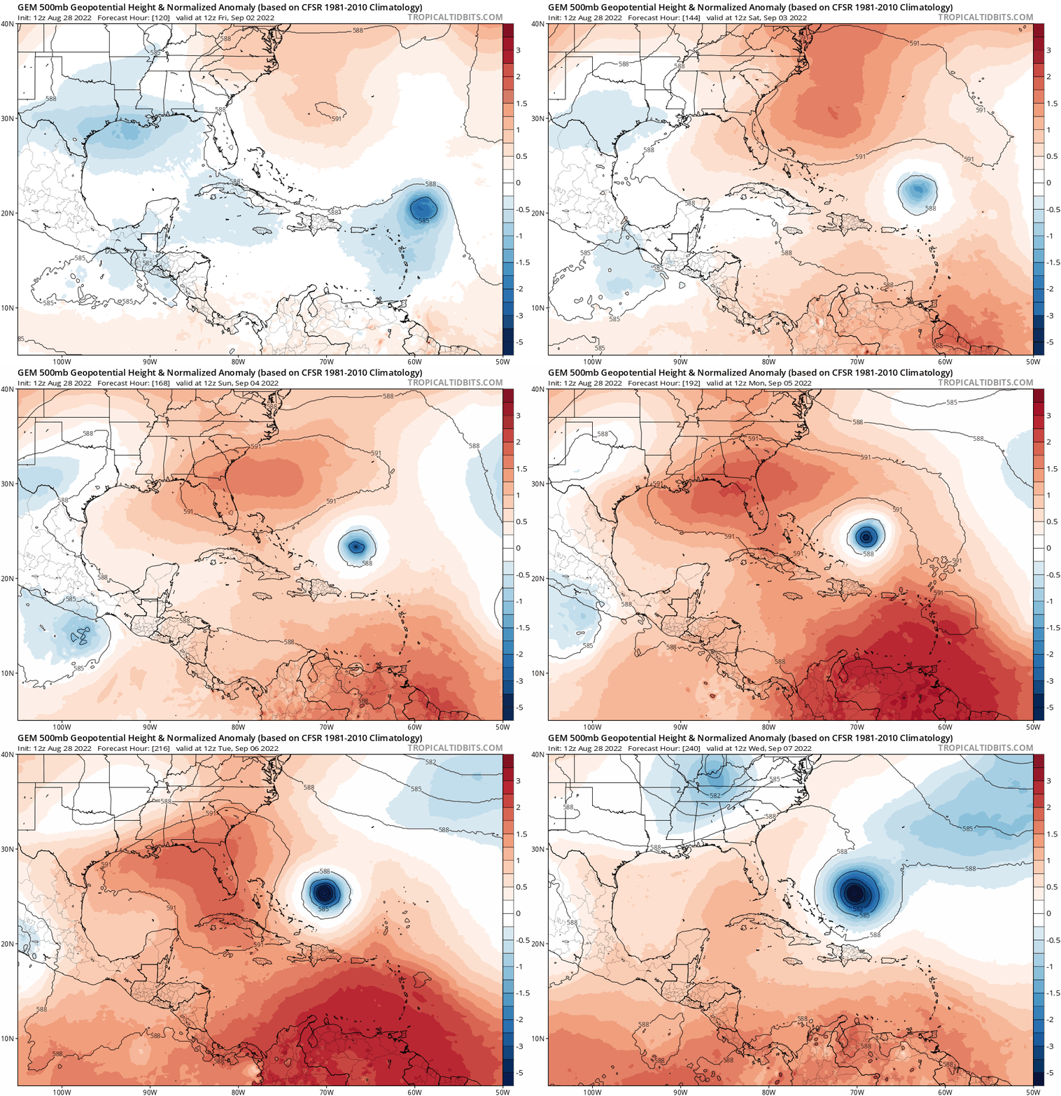
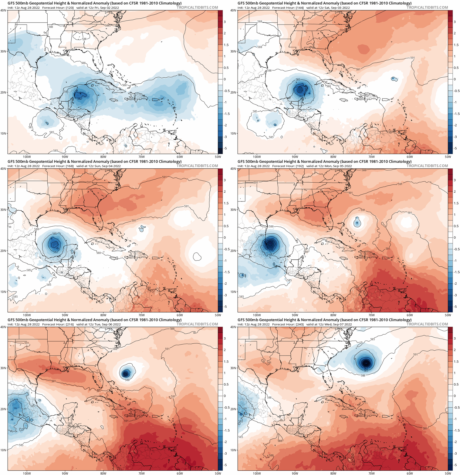
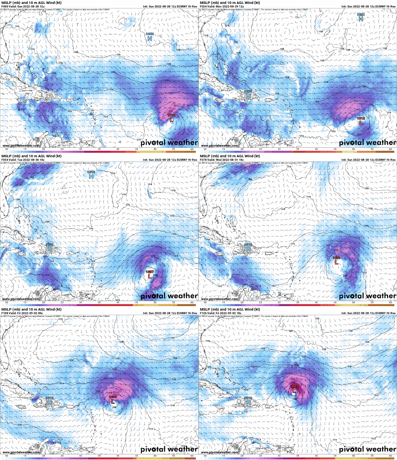
GFS seems to be the only player holding on to the SW GOM development. If a GOM tropical cyclone fails to materialize or is short lived, then I see no other influence that would suggest any southerly component of steering flow that would seem to alter a West to WNW motion in the longer term. No longer do any Global models show that odd West Atlantic "alien-grab" trough reaching southwestward and suddenly pulling 91L to the northeast. Seems like Globals (minus the GFS) are in better alignment suggesting fairly solid ridging north of the Bahamas easily up to 180 hr.'s. In fact, GFS, EURO, and CMC show no weakness showing up until at least 210 hr's where a shallow mid-level trough begins to develop in the Midwest and somehow slowly breaking down the SE CONUS ridge (in spite of progressive westerlies whipping deeper low's/troughs to the east). At least at the mid-levels, I'd say that the 500mb pattern is starting to look like....... well August LOL. I'm certainly not sold either way on any long-term intensity forecast but from a perspective of future motion and track, I am increasingly sensing that anything from a weak TD to a hurricane may be at play in "Hurricane Alley" west of 75W between 180-200 hr.s.
It will be very interesting to see during the next 2-3 days how the GFS and other models evolve (or drop) GOM development and that long range Midwest short-wave trough.
3 likes
Andy D
(For official information, please refer to the NHC and NWS products.)


