Tropical Storm Javier Discussion Number 8
NWS National Hurricane Center Miami FL EP112022
900 AM MDT Sat Sep 03 2022
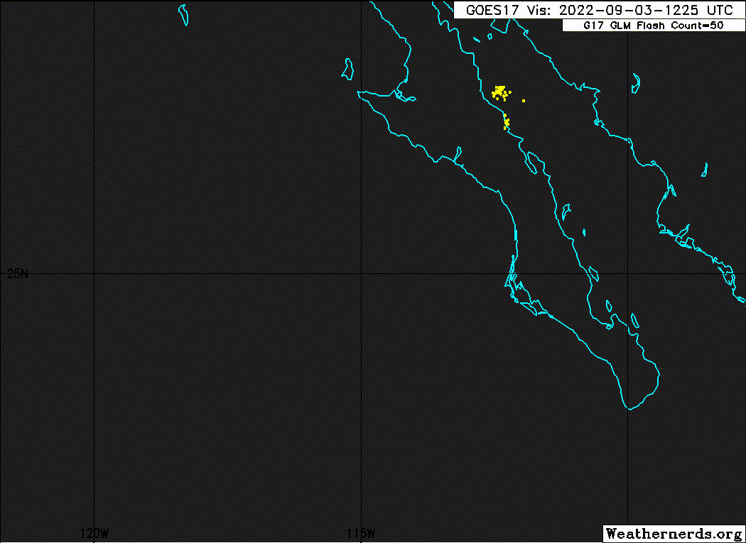
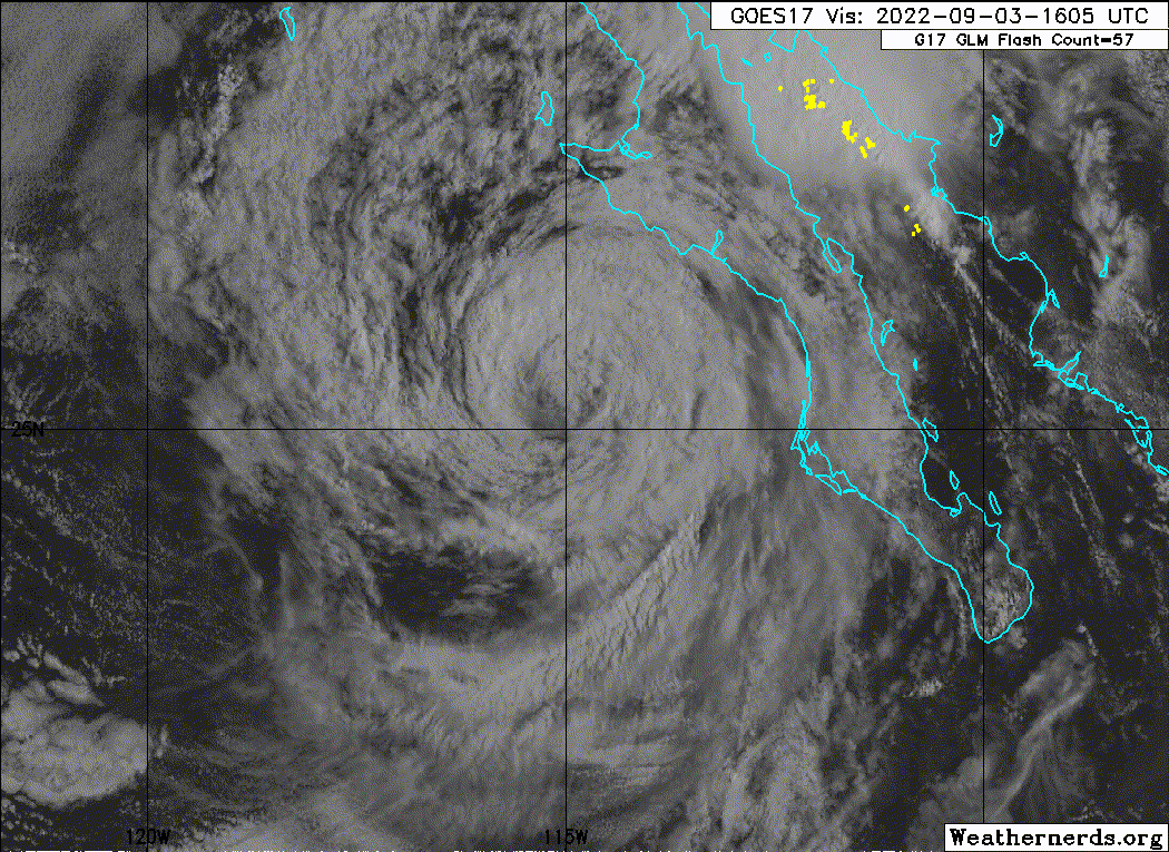
The satellite presentation of Javier has continued to deteriorate
over the past few hours. The deep convective burst noted in the
previous discussion has rotated to the southern portion of the
circulation and cloud top temperatures have warmed to above -70
degrees C. Microwave and infrared imagery show the northern half
of the semicircle to be devoid of any deep convection. A blend of
the objective and subjective satellite intensity estimates support
lowering the intensity to 40 kt for this advisory.
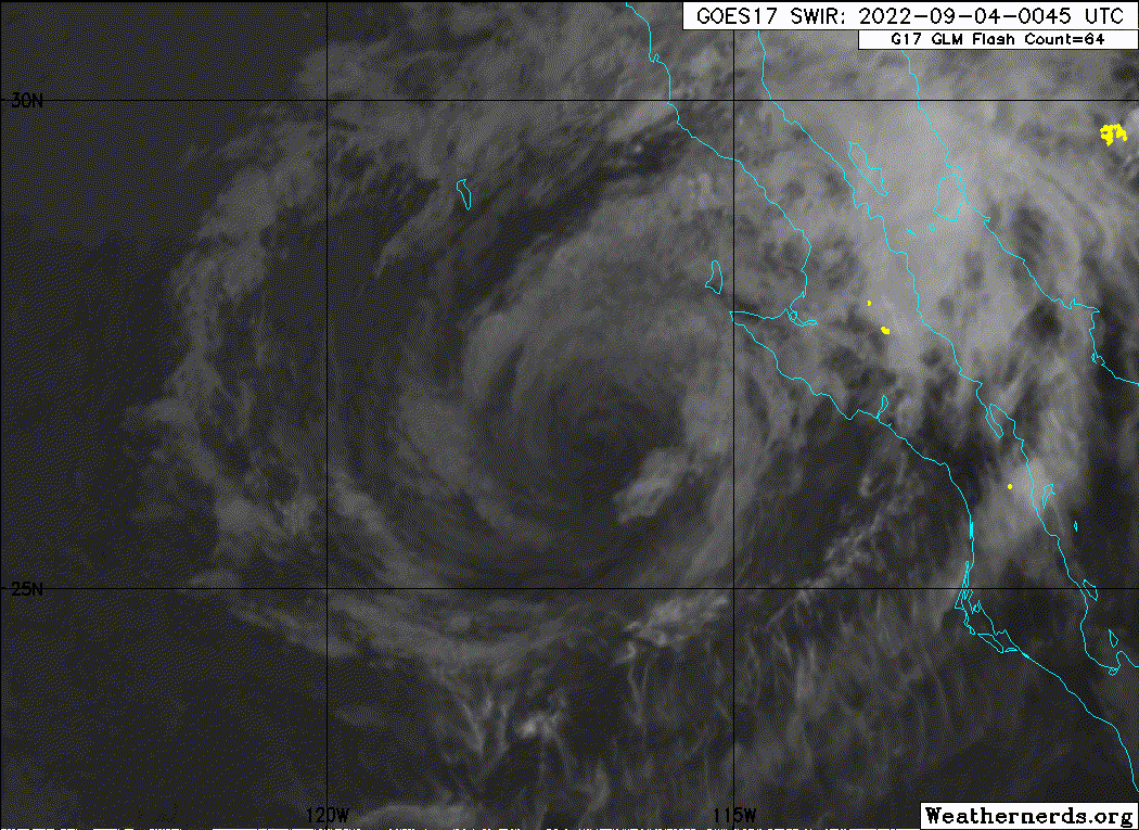
Javier appears to have begun its weakening trend. The system has
crossed over waters cooler than 26 degrees C and the sea surface
temperatures along the forecast track are expected to be
progressively colder. Atmospheric conditions are also predicted to
not be conducive for any additional strengthening. Global models
suggest that the vertical wind shear should increase and the
environmental moisture to decrease within a day. Based on this
information and guidance, the official forecast now shows Javier
becoming a post-tropical cyclone in 24 hours and weakening to a
remnant within two days.
The initial motion is estimated to be 325 degrees at 13 kt. Though
the center of Javier appears to have shifted slightly to the
north, the storm is expected to be steered northwestward by a
mid-level ridge to its northeast. Within a day or less, model
guidance agrees that the ridge should turn Javier to the
west-northwest. Low-level tradewinds are expected to turn a
weakening Javier to the west and west-southwest beyond 48 hours.
The NHC track forecast is shifted slightly northward from the
previous advisory prediction and is close the model consensus aids.
Although the NHC forecast wind radii do not explicitly reach the
coast of Mexico, any additional eastward or northward deviations
from the official track forecast could result in
tropical-storm-force winds reaching portions of Baja California
Sur, where a Tropical Storm Watch is in effect.
KEY MESSAGES:
1. Although the center is expected to stay offshore, heavy rainfall
from Tropical Storm Javier could lead to localized flash flooding in
Baja California Sur.
2. Tropical storm conditions are possible across portions of Baja
California Sur through today. A Tropical Storm Watch remains in
effect.
FORECAST POSITIONS AND MAX WINDS
INIT 03/1500Z 25.1N 114.8W 40 KT 45 MPH
12H 04/0000Z 26.4N 116.5W 40 KT 45 MPH
24H 04/1200Z 27.3N 119.2W 35 KT 40 MPH...POST-TROPICAL
36H 05/0000Z 27.7N 121.7W 35 KT 40 MPH...POST-TROPICAL
48H 05/1200Z 27.7N 124.3W 30 KT 35 MPH...POST-TROP/REMNT LOW
60H 06/0000Z 27.4N 126.8W 30 KT 35 MPH...POST-TROP/REMNT LOW
72H 06/1200Z 27.1N 129.1W 25 KT 30 MPH...POST-TROP/REMNT LOW
96H 07/1200Z 26.6N 132.4W 25 KT 30 MPH...POST-TROP/REMNT LOW
120H 08/1200Z 26.2N 134.6W 25 KT 30 MPH...POST-TROP/REMNT LOW
$$
Forecaster Bucci/Reinhart
NWS National Hurricane Center Miami FL EP112022
900 AM MDT Sat Sep 03 2022
The satellite presentation of Javier has continued to deteriorate
over the past few hours. The deep convective burst noted in the
previous discussion has rotated to the southern portion of the
circulation and cloud top temperatures have warmed to above -70
degrees C. Microwave and infrared imagery show the northern half
of the semicircle to be devoid of any deep convection. A blend of
the objective and subjective satellite intensity estimates support
lowering the intensity to 40 kt for this advisory.
Javier appears to have begun its weakening trend. The system has
crossed over waters cooler than 26 degrees C and the sea surface
temperatures along the forecast track are expected to be
progressively colder. Atmospheric conditions are also predicted to
not be conducive for any additional strengthening. Global models
suggest that the vertical wind shear should increase and the
environmental moisture to decrease within a day. Based on this
information and guidance, the official forecast now shows Javier
becoming a post-tropical cyclone in 24 hours and weakening to a
remnant within two days.
The initial motion is estimated to be 325 degrees at 13 kt. Though
the center of Javier appears to have shifted slightly to the
north, the storm is expected to be steered northwestward by a
mid-level ridge to its northeast. Within a day or less, model
guidance agrees that the ridge should turn Javier to the
west-northwest. Low-level tradewinds are expected to turn a
weakening Javier to the west and west-southwest beyond 48 hours.
The NHC track forecast is shifted slightly northward from the
previous advisory prediction and is close the model consensus aids.
Although the NHC forecast wind radii do not explicitly reach the
coast of Mexico, any additional eastward or northward deviations
from the official track forecast could result in
tropical-storm-force winds reaching portions of Baja California
Sur, where a Tropical Storm Watch is in effect.
KEY MESSAGES:
1. Although the center is expected to stay offshore, heavy rainfall
from Tropical Storm Javier could lead to localized flash flooding in
Baja California Sur.
2. Tropical storm conditions are possible across portions of Baja
California Sur through today. A Tropical Storm Watch remains in
effect.
FORECAST POSITIONS AND MAX WINDS
INIT 03/1500Z 25.1N 114.8W 40 KT 45 MPH
12H 04/0000Z 26.4N 116.5W 40 KT 45 MPH
24H 04/1200Z 27.3N 119.2W 35 KT 40 MPH...POST-TROPICAL
36H 05/0000Z 27.7N 121.7W 35 KT 40 MPH...POST-TROPICAL
48H 05/1200Z 27.7N 124.3W 30 KT 35 MPH...POST-TROP/REMNT LOW
60H 06/0000Z 27.4N 126.8W 30 KT 35 MPH...POST-TROP/REMNT LOW
72H 06/1200Z 27.1N 129.1W 25 KT 30 MPH...POST-TROP/REMNT LOW
96H 07/1200Z 26.6N 132.4W 25 KT 30 MPH...POST-TROP/REMNT LOW
120H 08/1200Z 26.2N 134.6W 25 KT 30 MPH...POST-TROP/REMNT LOW
$$
Forecaster Bucci/Reinhart