ATL: EARL - Models
Moderator: S2k Moderators

Re: ATL: EARL - Models
12z HWRF is the ideal outcome for Earl: moderate intensification into a high-end TS by the time it starts recurving, then intensifies into a major on its way into the subtropics due to passing over a pool of 29-30C SSTs east of Bermuda and getting favorable enhancement from a trough. That would yield several times more ACE than was Alex through Danielle have produced so far and leave all land areas unscathed.
3 likes
Irene '11 Sandy '12 Hermine '16 5/15/2018 Derecho Fay '20 Isaias '20 Elsa '21 Henri '21 Ida '21
I am only a meteorology enthusiast who knows a decent amount about tropical cyclones. Look to the professional mets, the NHC, or your local weather office for the best information.
I am only a meteorology enthusiast who knows a decent amount about tropical cyclones. Look to the professional mets, the NHC, or your local weather office for the best information.


Re: ATL: EARL - Models
aspen wrote:12z HWRF is the ideal outcome for Earl: moderate intensification into a high-end TS by the time it starts recurving, then intensifies into a major on its way into the subtropics due to passing over a pool of 29-30C SSTs east of Bermuda and getting favorable enhancement from a trough. That would yield several times more ACE than was Alex through Danielle have produced so far and leave all land areas unscathed.
This i can easily see this happening. Especially when that trough allows for favorable outflow channels as it turns north. I just hope it's current trends for organization continues so this can pass safely to the east of Bermuda.
2 likes
Tornado Intercept/Hurricane Intercept
Facebook: https://www.facebook.com/TornadoIntercept/
Twitter: @Tornado_Steejo
Instagram: Tornado_Steejo
A follower/member of Storm2k for 14 Years as Weatherfreak14
Facebook: https://www.facebook.com/TornadoIntercept/
Twitter: @Tornado_Steejo
Instagram: Tornado_Steejo
A follower/member of Storm2k for 14 Years as Weatherfreak14
-
floridasun
- Tropical Storm

- Posts: 245
- Joined: Tue Sep 14, 2021 3:59 pm

Re: ATL: EARL - Models
floridasun wrote:nhc map show turn by 2pm on sunday
So the models think the trough near Bermuda is going to dig far enough south that Earl feels a weakness?
Beginning to look like the weakness left behind by Danielle is too far northeast?
https://www.tropicaltidbits.com/sat/sat ... uct=wv_mid
2 likes
Re: ATL: EARL - Models
18z HWRF/HMON are initializing this as a weaker TC in the mid to upper 1000s mbar, when the latest recon found it in the upper 990s. The HMON doesn’t reach 999mb for another 60-66hrs.
EDIT: they’re stuck at 39 and 66hrs hours again, respectively. What’s been going on with the hurricane models on Tropical Tidbits?
EDIT: they’re stuck at 39 and 66hrs hours again, respectively. What’s been going on with the hurricane models on Tropical Tidbits?
Last edited by aspen on Sat Sep 03, 2022 6:35 pm, edited 1 time in total.
0 likes
Irene '11 Sandy '12 Hermine '16 5/15/2018 Derecho Fay '20 Isaias '20 Elsa '21 Henri '21 Ida '21
I am only a meteorology enthusiast who knows a decent amount about tropical cyclones. Look to the professional mets, the NHC, or your local weather office for the best information.
I am only a meteorology enthusiast who knows a decent amount about tropical cyclones. Look to the professional mets, the NHC, or your local weather office for the best information.

Re: ATL: EARL - Models
18z GFS turns this into a powerful extratropical storm for UK and France. Of course, unlikely, but interesting run.
0 likes
Re: ATL: EARL - Models
12z HAFS blew Earl into a high 3/low 4, FWIW.

3 likes
Irene '11 Sandy '12 Hermine '16 5/15/2018 Derecho Fay '20 Isaias '20 Elsa '21 Henri '21 Ida '21
I am only a meteorology enthusiast who knows a decent amount about tropical cyclones. Look to the professional mets, the NHC, or your local weather office for the best information.
I am only a meteorology enthusiast who knows a decent amount about tropical cyclones. Look to the professional mets, the NHC, or your local weather office for the best information.
-
TheDreamTraveler

- Category 2

- Posts: 645
- Joined: Sun Aug 22, 2010 3:10 am
- Location: PA
Re: ATL: EARL - Models
06z HWRF is interesting. It shows the LLC and MLC stacking sometime today due a massive blowup of convection (which seems to be happening now), and Earl becomes a Cat 1 hurricane before it gets disrupted by shear again on Monday night. It remains a ragged Cat 1 (maybe dropping below hurricane intensity for a bit) until it gets going again starting Wednesday night, as 29-30C SSTs and favorable trough interaction propel it to the 940s by the end of the run.
Edit: 06z HMON also shows a brief stacking and spike to Cat 1 intensity on Monday
Edit: 06z HMON also shows a brief stacking and spike to Cat 1 intensity on Monday
2 likes
Irene '11 Sandy '12 Hermine '16 5/15/2018 Derecho Fay '20 Isaias '20 Elsa '21 Henri '21 Ida '21
I am only a meteorology enthusiast who knows a decent amount about tropical cyclones. Look to the professional mets, the NHC, or your local weather office for the best information.
I am only a meteorology enthusiast who knows a decent amount about tropical cyclones. Look to the professional mets, the NHC, or your local weather office for the best information.
-
tolakram
- Admin

- Posts: 20186
- Age: 62
- Joined: Sun Aug 27, 2006 8:23 pm
- Location: Florence, KY (name is Mark)
Re: ATL: EARL - Models
6Z HWRF-P

0 likes
M a r k
- - - - -
Join us in chat: Storm2K Chatroom Invite. Android and IOS apps also available.
The posts in this forum are NOT official forecasts and should not be used as such. Posts are NOT endorsed by any professional institution or STORM2K.org. For official information and forecasts, please refer to NHC and NWS products.

Re: ATL: EARL - Models
BobHarlem wrote:12z icon and 12z CMC take Earl very near (or over) Bermuda
Interesting..slight left hook at the end of the run on ICON. Maybe ridge building back in?
0 likes
-
tolakram
- Admin
- Posts: 20186
- Age: 62
- Joined: Sun Aug 27, 2006 8:23 pm
- Location: Florence, KY (name is Mark)
Re: ATL: EARL - Models
12Z Euro

0 likes
M a r k
- - - - -
Join us in chat: Storm2K Chatroom Invite. Android and IOS apps also available.
The posts in this forum are NOT official forecasts and should not be used as such. Posts are NOT endorsed by any professional institution or STORM2K.org. For official information and forecasts, please refer to NHC and NWS products.
- - - - -
Join us in chat: Storm2K Chatroom Invite. Android and IOS apps also available.
The posts in this forum are NOT official forecasts and should not be used as such. Posts are NOT endorsed by any professional institution or STORM2K.org. For official information and forecasts, please refer to NHC and NWS products.

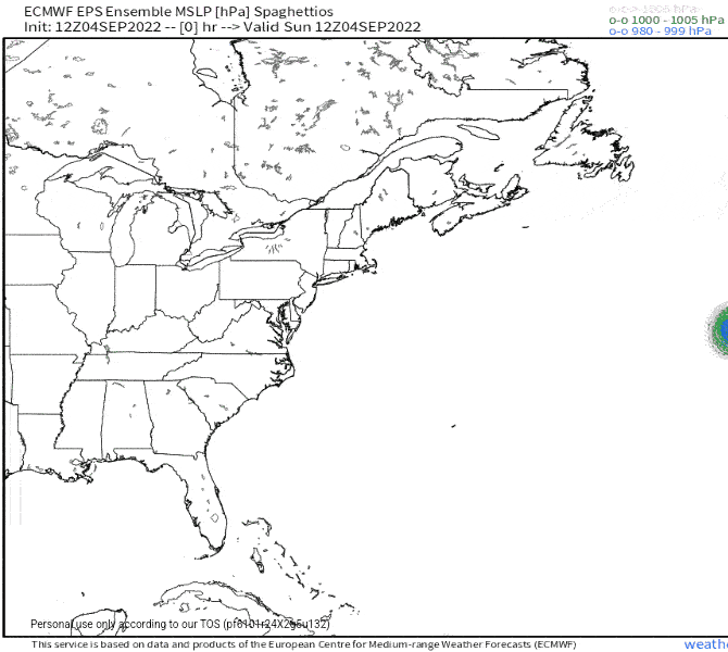
Re: ATL: EARL - Models
Euro Ensembles still trying to make this interesting..
9 likes
The following post is NOT an official forecast and should not be used as such. It is just the opinion of the poster and may or may not be backed by sound meteorological data. It is NOT endorsed by any professional institution including storm2k.org For Official Information please refer to the NHC and NWS products.
-
tolakram
- Admin
- Posts: 20186
- Age: 62
- Joined: Sun Aug 27, 2006 8:23 pm
- Location: Florence, KY (name is Mark)
Re: ATL: EARL - Models
https://twitter.com/JackSillin/status/1566575791969804288
Earl

source: http://arctic.som.ou.edu/tburg/products/realtime/tropical/
Earl
source: http://arctic.som.ou.edu/tburg/products/realtime/tropical/
0 likes
M a r k
- - - - -
Join us in chat: Storm2K Chatroom Invite. Android and IOS apps also available.
The posts in this forum are NOT official forecasts and should not be used as such. Posts are NOT endorsed by any professional institution or STORM2K.org. For official information and forecasts, please refer to NHC and NWS products.
- - - - -
Join us in chat: Storm2K Chatroom Invite. Android and IOS apps also available.
The posts in this forum are NOT official forecasts and should not be used as such. Posts are NOT endorsed by any professional institution or STORM2K.org. For official information and forecasts, please refer to NHC and NWS products.
-
tolakram
- Admin
- Posts: 20186
- Age: 62
- Joined: Sun Aug 27, 2006 8:23 pm
- Location: Florence, KY (name is Mark)
Re: ATL: EARL - Models
I made an animation of it. Very cool site!

2 likes
M a r k
- - - - -
Join us in chat: Storm2K Chatroom Invite. Android and IOS apps also available.
The posts in this forum are NOT official forecasts and should not be used as such. Posts are NOT endorsed by any professional institution or STORM2K.org. For official information and forecasts, please refer to NHC and NWS products.
- - - - -
Join us in chat: Storm2K Chatroom Invite. Android and IOS apps also available.
The posts in this forum are NOT official forecasts and should not be used as such. Posts are NOT endorsed by any professional institution or STORM2K.org. For official information and forecasts, please refer to NHC and NWS products.
-
AutoPenalti
- Category 5

- Posts: 4091
- Age: 29
- Joined: Mon Aug 17, 2015 4:16 pm
- Location: Ft. Lauderdale, Florida
Re: ATL: EARL - Models
blp wrote:Euro Ensembles still trying to make this interesting..
https://uploads.disquscdn.com/images/1063c243ea5ddb8d6c91de6b91e87ddba2b256844707972471223ce77b948436.gif
Huh??? What happened there??
0 likes
The posts in this forum are NOT official forecasts and should not be used as such. They are just the opinion of the poster and may or may not be backed by sound meteorological data. They are NOT endorsed by any professional institution or STORM2K. For official information, please refer to products from the NHC and NWS.
Model Runs Cheat Sheet:
GFS (5:30 AM/PM, 11:30 AM/PM)
HWRF, GFDL, UKMET, NAVGEM (6:30-8:00 AM/PM, 12:30-2:00 AM/PM)
ECMWF (1:45 AM/PM)
TCVN is a weighted averaged
-
CrazyC83
- Professional-Met

- Posts: 34316
- Joined: Tue Mar 07, 2006 11:57 pm
- Location: Deep South, for the first time!
Re: ATL: EARL - Models
AutoPenalti wrote:blp wrote:Euro Ensembles still trying to make this interesting..
https://uploads.disquscdn.com/images/1063c243ea5ddb8d6c91de6b91e87ddba2b256844707972471223ce77b948436.gif
Huh??? What happened there??
That wouldn't be an unprecedented track. Felix in 1995 did something similar.
0 likes
-
Jelmergraaff
- Tropical Storm
- Posts: 138
- Age: 23
- Joined: Fri Aug 27, 2021 1:00 pm
- Location: The Netherlands
Re: ATL: EARL - Models
HWRF (18z) had Earl as a rather intense MH at around +120h with a minimum pressure of 942 mb and max winds of 115kt/132mph. HMON less agressive, certainly regarding the wind speeds (pressure drops to 950 mb however).

1 likes
21-year old meteorologist and student MSc Climate Studies from The Netherlands. Interested in all fields of meteorology and climatology, including tropical systems like hurricanes.


Who is online
Users browsing this forum: No registered users and 30 guests