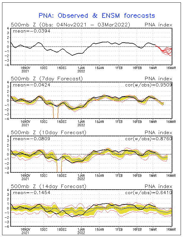
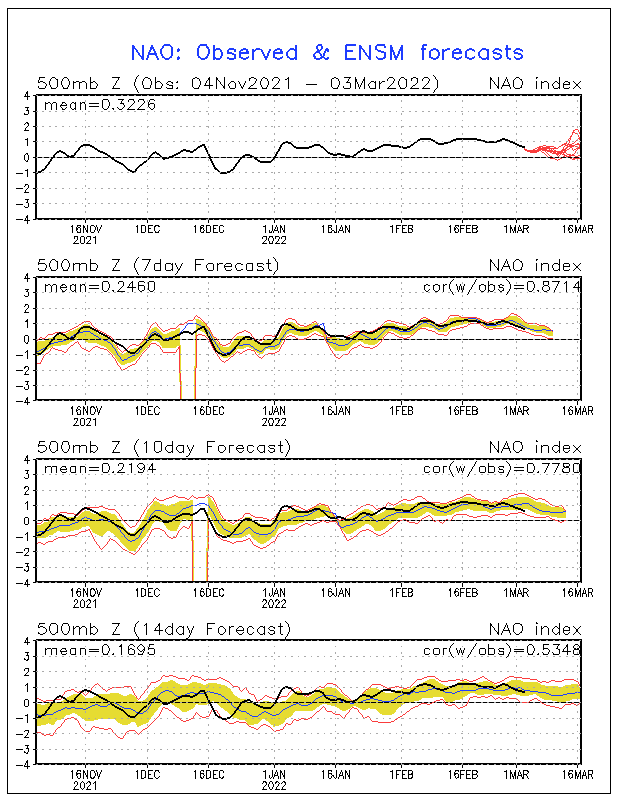
Simply put, that begins to big changes that translate in the pattern ...
PNA indicies and the forecasted ensemble mean ...

NAO indicies and the forecasted ensemble mean ...

The CMC ensembles are hinting at the change to more of a trough in the Great Plains instead of the Western States with that dreaded SE ridge (for winter weather lovers) ...
http://www.meteo.psu.edu/~gadomski/ENSC ... z/f240.gif
http://www.stormsfury1.com/Weather/Mode ... mbles.html
The GFS ensembles also are showing the change.
http://www.meteo.psu.edu/~gadomski/ENSHGT_12z/f240.gif
The 8-10 Day EURO average 3 day mean showing QUITE a Midwestern Trough ... which is pretty darn steep for the average of 3 days ...
Day 8-10 Average 3 day EURO/ECMWF mean
There's potential for quite a cool down in the MR/LR by the end of November ... after this latest quick hitting cold snap exits stage right and briefly warms back up (particularly in the Southeast) ...
SF
 The posts in this forum are NOT official forecast and should not be used as such. They are just the opinion of the poster and may or may not be backed by sound meteorological data. They are NOT endorsed by any professional institution or

