11:30pm Video Update on Tropical Storm Fiona for those interested
https://www.youtube.com/watch?v=W1ZWIPo2vOY
ATL: FIONA - Post-Tropical - Discussion
Moderator: S2k Moderators
-
Hurricane Mike
- Category 2

- Posts: 675
- Joined: Tue Apr 10, 2018 7:44 am
-
galaxy401

- Category 5

- Posts: 2446
- Age: 30
- Joined: Sat Aug 25, 2012 9:04 pm
- Location: Casa Grande, Arizona
Re: ATL: FIONA - Tropical Storm - Discussion
Pressure dropping with each Recon pass. Winds likely at 55 kts now. Fiona is gradually ramping up.
0 likes
Got my eyes on moving right into Hurricane Alley: Florida.
-
ElectricStorm

- Category 5
- Posts: 5147
- Age: 25
- Joined: Tue Aug 13, 2019 11:23 pm
- Location: Norman, OK
Re: ATL: FIONA - Tropical Storm - Discussion
Certainly looking better now. Hopefully the PR folks aren't too affected by this. Stay safe y'all
1 likes
B.S Meteorology, University of Oklahoma '25
Please refer to the NHC, NWS, or SPC for official information.
Please refer to the NHC, NWS, or SPC for official information.


Re: ATL: FIONA - Tropical Storm - Discussion
VDM just came in putting Fiona at 994mb. Last VDM 2 hours ago had it at 999.
0 likes
-
skyline385

- Category 5
- Posts: 2728
- Age: 35
- Joined: Wed Aug 26, 2020 11:15 pm
- Location: Houston TX
Re: ATL: FIONA - Tropical Storm - Discussion
Landy wrote:VDM just came in putting Fiona at 994mb. Last VDM 2 hours ago had it at 999.
Think its safe to ignore the previous drop, it had 999mb with 23 kts wind and also showed an anomalous increase in pressure from the drops before it.
Also, fwiw, the 994mb is higher than both the HWRF and HMON forecasts which had it at 989mb and 984mb at 0600 Zulu time respectively.

1 likes

Re: ATL: FIONA - Tropical Storm - Discussion
skyline385 wrote:Landy wrote:VDM just came in putting Fiona at 994mb. Last VDM 2 hours ago had it at 999.
Think its safe to ignore the previous drop, it had 999mb with 23 kts wind and also showed an anomalous increase in pressure from the drops before it.
Also, fwiw, the 994mb is higher than both the HWRF and HMON forecasts which had it at 989mb and 984mb at 0600 Zulu time respectively.
https://i.imgur.com/MrcsBnv.png
65/994 on the 2am advisory, almost 24 hours ahead of the latest Euro run
0 likes
The above post is not official and should not be used as such. It is the opinion of the poster and may or may not be backed by sound meteorological data. It is not endorsed by any professional institution or storm2k.org. For official information, please refer to the NHC and NWS products.
-
skyline385
- Category 5
- Posts: 2728
- Age: 35
- Joined: Wed Aug 26, 2020 11:15 pm
- Location: Houston TX
Re: ATL: FIONA - Tropical Storm - Discussion
Hammy wrote:skyline385 wrote:Landy wrote:VDM just came in putting Fiona at 994mb. Last VDM 2 hours ago had it at 999.
Think its safe to ignore the previous drop, it had 999mb with 23 kts wind and also showed an anomalous increase in pressure from the drops before it.
Also, fwiw, the 994mb is higher than both the HWRF and HMON forecasts which had it at 989mb and 984mb at 0600 Zulu time respectively.
https://i.imgur.com/MrcsBnv.png
65/994 on the 2am advisory, almost 24 hours ahead of the latest Euro run
Yep, but personally I wouldn't use the Euro for intensity estimates. Asides from being a global model, it was the worst performing model intensity wise in last year's (or 2020) post-season verification. I always prefer to use the global models for track and hurricane models for intensity estimates.
0 likes
-
skyline385
- Category 5
- Posts: 2728
- Age: 35
- Joined: Wed Aug 26, 2020 11:15 pm
- Location: Houston TX
ATL: FIONA - Tropical Storm - Discussion
Looking much better on radar now, even the centers seem to be aligned

Sent from my iPhone using Tapatalk
Sent from my iPhone using Tapatalk
Last edited by skyline385 on Sun Sep 18, 2022 1:58 am, edited 1 time in total.
3 likes
-
Hurricane Mike
- Category 2
- Posts: 675
- Joined: Tue Apr 10, 2018 7:44 am
Re: ATL: FIONA - Tropical Storm - Discussion
Fiona is looking on her way to becoming a hurricane.
2 likes
-
Chris_in_Tampa
- Category 5
- Posts: 5101
- Age: 42
- Joined: Thu Jun 21, 2007 11:06 pm
- Location: Tampa, Florida, USA
- Contact:
Re: ATL: FIONA - Tropical Storm - Discussion
Low-bandwidth imagery options that don't use as much data to load. (such as to use on a phone with little connectivity)
Short range Puerto Rico radar:
Single image, the latest image available (45kb - kilobytes):
https://radar.weather.gov/ridge/standard/TJUA_0.gif
Single animated GIF image of last 10 images, you can't pause it. (425kb)
https://radar.weather.gov/ridge/standard/TJUA_loop.gif
Puerto Rico satellite:
600 pixel wide single images:
IR - Color (80kb):
https://cdn.star.nesdis.noaa.gov/GOES16 ... 00x600.jpg
Geocolor (60kb):
https://cdn.star.nesdis.noaa.gov/GOES16 ... 00x600.jpg
Visible (During day; Size should be less than color):
https://cdn.star.nesdis.noaa.gov/GOES16 ... 00x600.jpg
1200 pixel wide single images:
IR - Color (230kb):
https://cdn.star.nesdis.noaa.gov/GOES16 ... 0x1200.jpg
Geocolor (160kb):
https://cdn.star.nesdis.noaa.gov/GOES16 ... 0x1200.jpg
Visible (During day; Size should be less than color):
https://cdn.star.nesdis.noaa.gov/GOES16 ... 0x1200.jpg
2400 pixel wide single images:
IR - Color (600kb):
https://cdn.star.nesdis.noaa.gov/GOES16 ... 0x2400.jpg
Geocolor (450kb):
https://cdn.star.nesdis.noaa.gov/GOES16 ... 0x2400.jpg
Visible (During day; Size should be less than color):
https://cdn.star.nesdis.noaa.gov/GOES16 ... 0x2400.jpg
2 likes
Re: ATL: FIONA - Tropical Storm - Discussion
skyline385 wrote:Hammy wrote:skyline385 wrote:
Think its safe to ignore the previous drop, it had 999mb with 23 kts wind and also showed an anomalous increase in pressure from the drops before it.
Also, fwiw, the 994mb is higher than both the HWRF and HMON forecasts which had it at 989mb and 984mb at 0600 Zulu time respectively.
https://i.imgur.com/MrcsBnv.png
65/994 on the 2am advisory, almost 24 hours ahead of the latest Euro run
Yep, but personally I wouldn't use the Euro for intensity estimates. Asides from being a global model, it was the worst performing model intensity wise in last year's (or 2020) post-season verification. I always prefer to use the global models for track and hurricane models for intensity estimates.
I ignore the hurricane models entirely, they always vastly over-intensify everything
2 likes
The above post is not official and should not be used as such. It is the opinion of the poster and may or may not be backed by sound meteorological data. It is not endorsed by any professional institution or storm2k.org. For official information, please refer to the NHC and NWS products.
Re: ATL: FIONA - Tropical Storm - Discussion
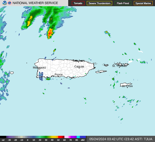
Fiona is starting to look good on radar but on IR still looks a bit sheared and disorganised. Should be better once the sun rises.
3 likes
-
Hurricane Mike
- Category 2
- Posts: 675
- Joined: Tue Apr 10, 2018 7:44 am

-
Chris_in_Tampa
- Category 5
- Posts: 5101
- Age: 42
- Joined: Thu Jun 21, 2007 11:06 pm
- Location: Tampa, Florida, USA
- Contact:
Re: ATL: FIONA - Tropical Storm - Discussion
5am NHC public advisory headline:
Rainfall is now forecast to be up to 25 inches in Puerto Rico. Previous forecast was for up to 20 inches. That brings an important wording update. Rather than previously saying "These rains are likely to produce life-threatening flash flooding and urban flooding" it now says "These rains will produce life-threatening flash flooding and urban flooding".
Most important section from public advisory:
MRMS radar:
https://mrms.nssl.noaa.gov/qvs/product_ ... oduct=CREF
72-hour rainfall accumulation in MRMS display:
https://mrms.nssl.noaa.gov/qvs/product_ ... pacity=0.5
River observations in Puerto Rico:
https://water.weather.gov/ahps/region.php?state=pr
...FIONA FORECAST TO BECOME A HURRICANE LATER TODAY... ...LIFE-THREATENING FLOODING AND MUDSLIDES EXPECTED ACROSS PUERTO RICO AND THE DOMINICAN REPUBLIC...
Rainfall is now forecast to be up to 25 inches in Puerto Rico. Previous forecast was for up to 20 inches. That brings an important wording update. Rather than previously saying "These rains are likely to produce life-threatening flash flooding and urban flooding" it now says "These rains will produce life-threatening flash flooding and urban flooding".
Most important section from public advisory:
RAINFALL: Fiona is forecast to produce the following rainfall:
Leeward Islands: Additional 2 inches or less.
British and U.S. Virgin Islands: 4 to 6 inches, maximum of 10 inches
on St. Croix.
Puerto Rico: 12 to 16 inches with local maximum of 25 inches,
particularly across eastern and southern Puerto Rico.
Northern and Eastern Dominican Republic: 4 to 8 inches with local
maximum 12 inches, particularly near the far east coast.
Rest of Dominican Republic and Haiti: 1 to 3 inches.
Turks and Caicos: 3 to 6 inches.
These rains will produce life-threatening flash flooding and urban
flooding across Puerto Rico and the eastern Dominican Republic,
along with mudslides and landslides in areas of higher terrain.
MRMS radar:
https://mrms.nssl.noaa.gov/qvs/product_ ... oduct=CREF
72-hour rainfall accumulation in MRMS display:
https://mrms.nssl.noaa.gov/qvs/product_ ... pacity=0.5
River observations in Puerto Rico:
https://water.weather.gov/ahps/region.php?state=pr
2 likes
-
Iceresistance

- Category 5
- Posts: 9592
- Age: 22
- Joined: Sat Oct 10, 2020 9:45 am
- Location: Tecumseh, OK/Norman, OK
Re: ATL: FIONA - Tropical Storm - Discussion
NOAA2 Eye Dropsonde has 992 MB with 7 knots of wind.
0 likes
Bill 2015 & Beta 2020
Winter 2020-2021
All observations are in Tecumseh, OK unless otherwise noted.
Winter posts are focused mainly for Oklahoma & Texas.
Take any of my forecasts with a grain of salt, refer to the NWS, SPC, and NHC for official information
Never say Never with weather! Because ANYTHING is possible!
Winter 2020-2021
All observations are in Tecumseh, OK unless otherwise noted.
Winter posts are focused mainly for Oklahoma & Texas.
Take any of my forecasts with a grain of salt, refer to the NWS, SPC, and NHC for official information
Never say Never with weather! Because ANYTHING is possible!
-
Iceresistance
- Category 5
- Posts: 9592
- Age: 22
- Joined: Sat Oct 10, 2020 9:45 am
- Location: Tecumseh, OK/Norman, OK
Re: ATL: FIONA - Tropical Storm - Discussion
We now have 2 recons active in Fiona, AF303's first pass has the lowest extrapolated pressure at 989.5 MB.
3 likes
Bill 2015 & Beta 2020
Winter 2020-2021
All observations are in Tecumseh, OK unless otherwise noted.
Winter posts are focused mainly for Oklahoma & Texas.
Take any of my forecasts with a grain of salt, refer to the NWS, SPC, and NHC for official information
Never say Never with weather! Because ANYTHING is possible!
Winter 2020-2021
All observations are in Tecumseh, OK unless otherwise noted.
Winter posts are focused mainly for Oklahoma & Texas.
Take any of my forecasts with a grain of salt, refer to the NWS, SPC, and NHC for official information
Never say Never with weather! Because ANYTHING is possible!

Re: ATL: FIONA - Tropical Storm - Discussion
Pressure falling, second plane just measured an extrapolated 988.9 mbar. But SFMR so far is only up to 50 kt. Even with max. 10% undersampling that barely supports the current 55 kt intensity. Might be that Fiona is still busy organizing itself. Or the wind field is quite tricky so it's difficult to find the peak winds.
0 likes
-
skyline385
- Category 5
- Posts: 2728
- Age: 35
- Joined: Wed Aug 26, 2020 11:15 pm
- Location: Houston TX
ATL: FIONA - Tropical Storm - Discussion
Hammy wrote:skyline385 wrote:Hammy wrote:
65/994 on the 2am advisory, almost 24 hours ahead of the latest Euro run
Yep, but personally I wouldn't use the Euro for intensity estimates. Asides from being a global model, it was the worst performing model intensity wise in last year's (or 2020) post-season verification. I always prefer to use the global models for track and hurricane models for intensity estimates.
I ignore the hurricane models entirely, they always vastly over-intensify everything
In the 2021 NHC verification, both hurricane models actually come out as the best models intensity wise with the GFS and Euro as the worst, HWRF even beat the FSU super ensemble. Yea they have a tendency to sometimes blow up but with proper recon data fed into them they have been very good. The HAFS model being touted as the next generation model by NOAA will be basically an extension of the hurricane models as well.
Anyways, think we have gone a bit off topic so going to stop here. If you prefer we can continue the discussion in the model thread
Last edited by skyline385 on Sun Sep 18, 2022 6:30 am, edited 1 time in total.
3 likes
-
skyline385
- Category 5
- Posts: 2728
- Age: 35
- Joined: Wed Aug 26, 2020 11:15 pm
- Location: Houston TX
Re: ATL: FIONA - Tropical Storm - Discussion
kevin wrote:Pressure falling, second plane just measured an extrapolated 988.9 mbar. But SFMR so far is only up to 50 kt. Even with max. 10% undersampling that barely supports the current 55 kt intensity. Might be that Fiona is still busy organizing itself. Or the wind field is quite tricky so it's difficult to find the peak winds.
Just got two unflagged 60 kts SFMR with 65 kts FL. NHC will probably upgrade because of proximity to land.
Last edited by skyline385 on Sun Sep 18, 2022 6:31 am, edited 1 time in total.
2 likes
Re: ATL: FIONA - Tropical Storm - Discussion
Both planes just measured higher winds, 64 kt FL winds with 59 kt SFMR. Could be enough to support 60 kt.
0 likes
Who is online
Users browsing this forum: No registered users and 10 guests