https://ftp.nhc.noaa.gov/atcf/btk
ATL: IAN - Post-Tropical - Discussion
Moderator: S2k Moderators
ATL: IAN - Post-Tropical - Discussion
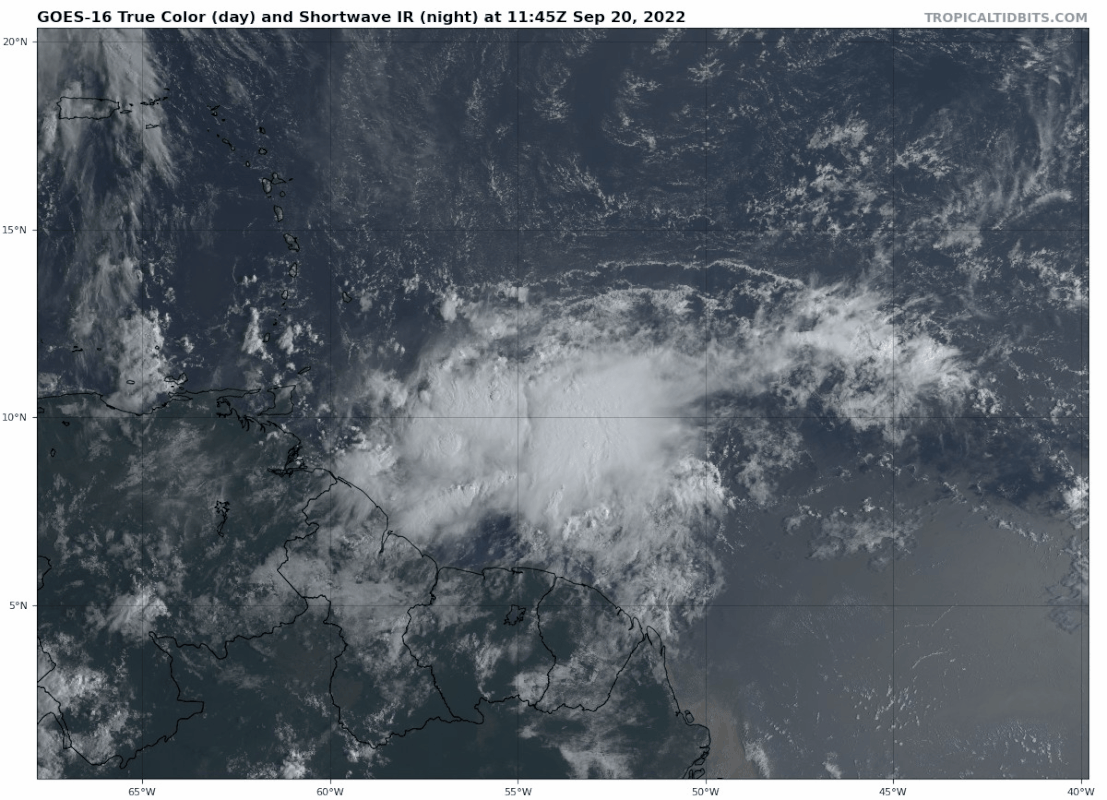
AL, 98, 2022092012, , BEST, 0, 103N, 530W, 25, 1011, DB, 34, NEQ, 0, 0, 0, 0, 1012, 150, 70, 0, 0, L, 0, , 0, 0, INVEST, S, 0, , 0, 0, 0, 0, genesis-num, 028, SPAWNINVEST, al712022 to al982022,
https://ftp.nhc.noaa.gov/atcf/btk
1 likes
Re: ATL: INVEST 98L - Discussion
I think this might become the longest thread of the season. We'll see. Here's IR (data is slightly delayed):
4 likes
- toad strangler
- S2K Supporter
- Posts: 4543
- Joined: Sun Jul 28, 2013 3:09 pm
- Location: Earth
- Contact:
Re: ATL: INVEST 98L - Discussion
That was quick. Very active pattern right now. Impressive. This one has potential somewhere in the western basin for sure.
3 likes
My Weather Station
https://www.wunderground.com/dashboard/pws/KFLPORTS603
- Hurricane2022
- Category 5
- Posts: 1496
- Joined: Tue Aug 23, 2022 11:38 pm
- Location: Araçatuba, Brazil
Re: ATL: INVEST 98L - Discussion
I'm expecting 98L (soon Hermine\Ian) to be the strongest storm of the season. It will have winds of 155 kt and pressure sub-915 mbar. it will also hit a region close to where Michael '18 made landfall.


Last edited by Hurricane2022 on Sat Sep 24, 2022 2:10 am, edited 1 time in total.
2 likes
Sorry for the bad English sometimes...!
For reliable and detailed information for any meteorological phenomenon, please consult the National Hurricane Center, Joint Typhoon Warning Center , or your local Meteo Center.
--------
Una cvm Christo, pro Christo, et in Christo. Sit nomen Domini benedictvm.
For reliable and detailed information for any meteorological phenomenon, please consult the National Hurricane Center, Joint Typhoon Warning Center , or your local Meteo Center.
--------
Una cvm Christo, pro Christo, et in Christo. Sit nomen Domini benedictvm.
- MississippiWx
- S2K Supporter
- Posts: 1696
- Joined: Sat Aug 14, 2010 1:44 pm
- Location: Hattiesburg, Mississippi
Re: ATL: INVEST 98L - Discussion
Wow. This one is already very convectively active. Probably some of the best convection I've seen in the MDR this season. I doubted the GFS runs of developing this quickly, but if this kind of convection continues, it might be right.
3 likes
This post is not an official forecast and should not be used as such. It is just the opinion of MississippiWx and may or may not be backed by sound meteorological data. It is not endorsed by any professional institution including storm2k.org. For Official Information please refer to the NHC and NWS products.
- tropicwatch
- Category 5
- Posts: 3364
- Age: 61
- Joined: Sat Jun 02, 2007 10:01 am
- Location: Panama City Florida
- Contact:
Re: ATL: INVEST 98L - Discussion
The 700-925mb vorticity is stacked nicely.
700mb Vorticity

850mb Vorticity

925mb Vorticity

700mb Vorticity

850mb Vorticity

925mb Vorticity

2 likes
Tropicwatch
Agnes 72', Eloise 75, Elena 85', Kate 85', Charley 86', Florence 88', Beryl 94', Dean 95', Erin 95', Opal 95', Earl 98', Georges 98', Ivan 2004', Arlene 2005', Dennis 2005', Ida 2009' Debby 2012' Irma 2017' Michael 2018'
-
- Tropical Storm
- Posts: 137
- Age: 22
- Joined: Fri Aug 27, 2021 1:00 pm
- Location: The Netherlands
Re: ATL: INVEST 98L - Discussion
I'm not a pro (we don't have any hurricanes in The Netherlands
), but I feel like this one has a good chance of getting pretty far west. It could very well be that right before 98L makes a turn to the north and later northwest, there will be a ridge going from the Central-US to the east/southeast. The trough in the beginning of next week over the (north)eastern-US is probably too far NE to "pull" 98L. The following rigde would steer 98L pretty far west, possibly into the GOM. Consequently also not too much windshear, which would make it a (very) favourable environment. I surely wouldn't rule out a Major Hurriance.

0 likes
21-year old meteorologist and student MSc Climate Studies from The Netherlands. Interested in all fields of meteorology and climatology, including tropical systems like hurricanes.
- Iceresistance
- Category 5
- Posts: 9278
- Age: 21
- Joined: Sat Oct 10, 2020 9:45 am
- Location: Tecumseh, OK/Norman, OK
Re: ATL: INVEST 98L - Discussion
This was a few hours before from BenNollWeather
https://twitter.com/BenNollWeather/status/1572181526267076608
2 likes
Bill 2015 & Beta 2020
Winter 2020-2021
All observations are in Tecumseh, OK unless otherwise noted.
Winter posts are focused mainly for Oklahoma & Texas.
Take any of my forecasts with a grain of salt, refer to the NWS, SPC, and NHC for official information
Never say Never with weather! Because ANYTHING is possible!
Winter 2020-2021

All observations are in Tecumseh, OK unless otherwise noted.
Winter posts are focused mainly for Oklahoma & Texas.
Take any of my forecasts with a grain of salt, refer to the NWS, SPC, and NHC for official information
Never say Never with weather! Because ANYTHING is possible!
Re: ATL: INVEST 98L - Discussion
If this convective activity continues, the GFS might be right about TS Gaston or Hermine in the easternmost Caribbean. It’ll probably stay a TS for a few days due to a poor UL environment thanks to Fiona, but once this gets into the WCar…oh boy.
Today’s HWRF and HMON runs are going to be quite interesting.
2 likes
Irene '11 Sandy '12 Hermine '16 5/15/2018 Derecho Fay '20 Isaias '20 Elsa '21 Henri '21 Ida '21
I am only a meteorology enthusiast who knows a decent amount about tropical cyclones. Look to the professional mets, the NHC, or your local weather office for the best information.
- MississippiWx
- S2K Supporter
- Posts: 1696
- Joined: Sat Aug 14, 2010 1:44 pm
- Location: Hattiesburg, Mississippi
Re: ATL: INVEST 98L - Discussion
aspen wrote:If this convective activity continues, the GFS might be right about TS Gaston or Hermine in the easternmost Caribbean. It’ll probably stay a TS for a few days due to a poor UL environment thanks to Fiona, but once this gets into the WCar…oh boy.
Today’s HWRF and HMON runs are going to be quite interesting.
I smell a modeled HWRF Cat 5 in the Western Caribbean on the 12z run.

5 likes
This post is not an official forecast and should not be used as such. It is just the opinion of MississippiWx and may or may not be backed by sound meteorological data. It is not endorsed by any professional institution including storm2k.org. For Official Information please refer to the NHC and NWS products.
Re: ATL: INVEST 98L - Discussion
Here comes a long thread I fear. 98L is already looking impressive ahead of schedule- vorticity is stacking well and convection is looking quite robust. We’ll have to wait a few days before the models really get a good track on it- after all, the safest place usually seems to be where the models have a storm in a weeks’s time. Not overtly concerned yet for WFL, but certainly keeping an eye out.
Last edited by Beef Stew on Tue Sep 20, 2022 8:47 am, edited 1 time in total.
2 likes
- Blown Away
- S2K Supporter
- Posts: 10140
- Joined: Wed May 26, 2004 6:17 am
Re: ATL: INVEST 98L - Discussion
MississippiWx wrote:aspen wrote:If this convective activity continues, the GFS might be right about TS Gaston or Hermine in the easternmost Caribbean. It’ll probably stay a TS for a few days due to a poor UL environment thanks to Fiona, but once this gets into the WCar…oh boy.
Today’s HWRF and HMON runs are going to be quite interesting.
I smell a modeled HWRF Cat 5 in the Western Caribbean on the 12z run.
No doubt, the HWRF with these predicted favorable conditions will go nuclear.

0 likes
Hurricane Eye Experience: David 79, Irene 99, Frances 04, Jeanne 04, Wilma 05... EYE COMING MY WAY IN 2024…
Hurricane Brush Experience: Andrew 92, Erin 95, Floyd 99, Matthew 16, Irma 17, Ian 22, Nicole 22…
-
- S2K Supporter
- Posts: 7177
- Joined: Wed May 19, 2004 5:46 am
- Location: NE Fort Lauderdale
- Contact:
Re: ATL: INVEST 98L - Discussion
Blown Away wrote:MississippiWx wrote:aspen wrote:If this convective activity continues, the GFS might be right about TS Gaston or Hermine in the easternmost Caribbean. It’ll probably stay a TS for a few days due to a poor UL environment thanks to Fiona, but once this gets into the WCar…oh boy.
Today’s HWRF and HMON runs are going to be quite interesting.
I smell a modeled HWRF Cat 5 in the Western Caribbean on the 12z run.
No doubt, the HWRF with these predicted favorable conditions will go nuclear.
The HWRF is very good in these setups as far as intensity forecasting goes.
0 likes
- Hurricaneman
- Category 5
- Posts: 7349
- Age: 44
- Joined: Tue Aug 31, 2004 3:24 pm
- Location: central florida
Re: ATL: INVEST 98L - Discussion
The convection is organizing and could form a broad low later today or tomorrow if current trends continue
0 likes
- Iceresistance
- Category 5
- Posts: 9278
- Age: 21
- Joined: Sat Oct 10, 2020 9:45 am
- Location: Tecumseh, OK/Norman, OK
Re: ATL: INVEST 98L - Discussion
This already has an Upper-level Anticyclone.

https://s4.gifyu.com/images/Invest-98L.gif
(Trying to get the upper-level winds here, but the map bugged out somewhat)

https://s4.gifyu.com/images/Invest-98L.gif
(Trying to get the upper-level winds here, but the map bugged out somewhat)
3 likes
Bill 2015 & Beta 2020
Winter 2020-2021
All observations are in Tecumseh, OK unless otherwise noted.
Winter posts are focused mainly for Oklahoma & Texas.
Take any of my forecasts with a grain of salt, refer to the NWS, SPC, and NHC for official information
Never say Never with weather! Because ANYTHING is possible!
Winter 2020-2021

All observations are in Tecumseh, OK unless otherwise noted.
Winter posts are focused mainly for Oklahoma & Texas.
Take any of my forecasts with a grain of salt, refer to the NWS, SPC, and NHC for official information
Never say Never with weather! Because ANYTHING is possible!
- Iceresistance
- Category 5
- Posts: 9278
- Age: 21
- Joined: Sat Oct 10, 2020 9:45 am
- Location: Tecumseh, OK/Norman, OK
Re: ATL: INVEST 98L - Discussion
Iceresistance wrote:This already has an Upper-level Anticyclone.
https://s4.gifyu.com/images/Invest-98L.gif
(Trying to get the upper-level winds here, but the map bugged out somewhat)
Finally got it. It already has southern outflow.

https://s5.gifyu.com/images/Upper-level-winds-over-98L.gif
1 likes
Bill 2015 & Beta 2020
Winter 2020-2021
All observations are in Tecumseh, OK unless otherwise noted.
Winter posts are focused mainly for Oklahoma & Texas.
Take any of my forecasts with a grain of salt, refer to the NWS, SPC, and NHC for official information
Never say Never with weather! Because ANYTHING is possible!
Winter 2020-2021

All observations are in Tecumseh, OK unless otherwise noted.
Winter posts are focused mainly for Oklahoma & Texas.
Take any of my forecasts with a grain of salt, refer to the NWS, SPC, and NHC for official information
Never say Never with weather! Because ANYTHING is possible!
Who is online
Users browsing this forum: No registered users and 30 guests