Sciencerocks wrote:https://imagizer.imageshack.com/img924/5366/SmwXya.gif
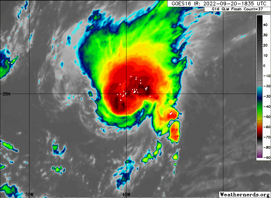
This is probably already close to its initial expected peak (50 kt). H in cone at 5 maybe?
Moderator: S2k Moderators

Sciencerocks wrote:https://imagizer.imageshack.com/img924/5366/SmwXya.gif

MarioProtVI wrote:Sciencerocks wrote:https://imagizer.imageshack.com/img924/5366/SmwXya.gif
This is probably already close to its initial expected peak (50 kt). H in cone at 5 maybe?


Iceresistance wrote:We now officially have Gaston!...DEPRESSION STRENGTHENS INTO TROPICAL STORM GASTON...9:00 PM GMT Tue Sep 20
Location: 34.7°N 44.4°W
Moving: NNE at 17 mph
Min pressure: 1009 mb
Max sustained: 40 mph


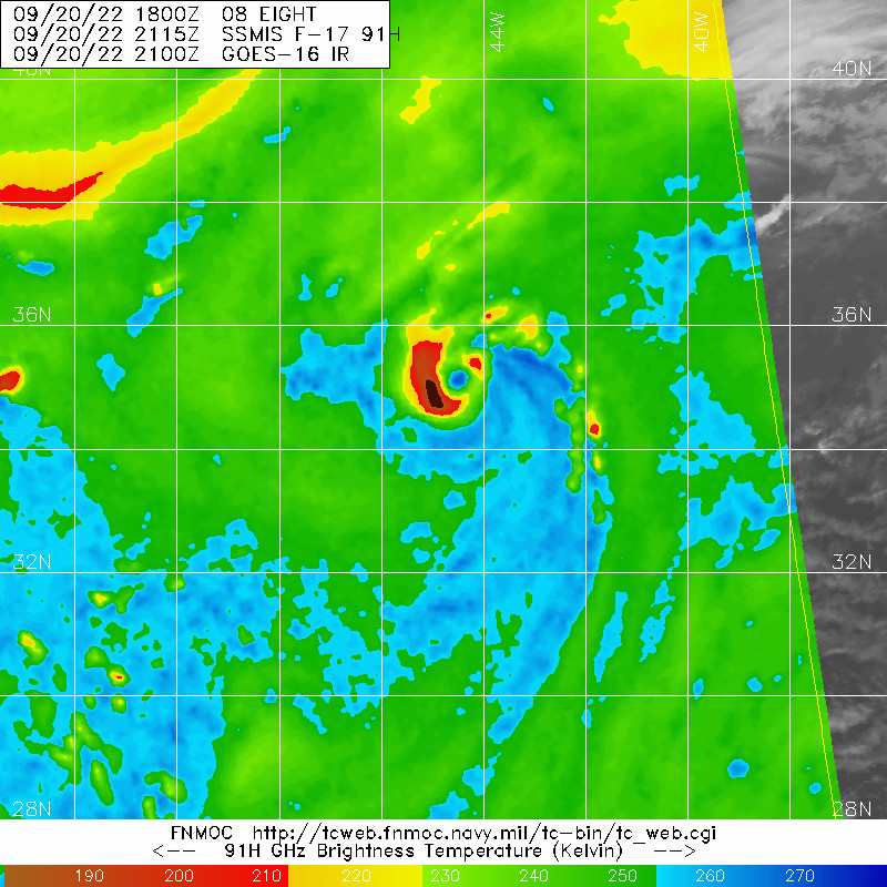
aspen wrote:Playing Eye Spy already. 35kt is too low, not just because of the system's appearance, but how ASCAT usually has a ~5kt low bias. Also that pass was from when this was still classified as TD. I don't get why they weren't like "and based on continuing satellite improvement, the initial intensity is set slightly higher" like has been done for other systems.
https://i.imgur.com/umH5Y8C.jpg


NXStumpy_Robothing wrote:Well, if we can have the video below made for the last Gaston, might as well bring it back
https://www.youtube.com/watch?v=KHDtEd87gwM
On a more serious note - definitely making a run at hurricane status, even if now it is struggling somewhat convectively. With that microwave structure it should bounce back pretty well overnight, though there will obviously be a couple of hiccups or two. Will end up being a brief hurricane starting tomorrow afternoon before conditions worsen as long as it can take advantage like it did today. Always nice to have some eye candy well away from land.
Edit: As a sidenote, did not realize the Youtube embed was messed up, probably some change Google did
Users browsing this forum: No registered users and 71 guests


