ATL: GASTON - Post-Tropical - Discussion
Moderator: S2k Moderators
-
tolakram
- Admin

- Posts: 20186
- Age: 62
- Joined: Sun Aug 27, 2006 8:23 pm
- Location: Florence, KY (name is Mark)
Re: ATL: GASTON - Tropical Storm - Discussion
If you hover over the youtube button you will see instructions for how to embed.
2 likes
M a r k
- - - - -
Join us in chat: Storm2K Chatroom Invite. Android and IOS apps also available.
The posts in this forum are NOT official forecasts and should not be used as such. Posts are NOT endorsed by any professional institution or STORM2K.org. For official information and forecasts, please refer to NHC and NWS products.


Re: ATL: GASTON - Tropical Storm - Discussion
While IR has degraded a bit, I’m still surprised we didn’t get any intensity upgrade at the last update. I’m sure it’ll be rectified in best-track, but still, I thought there would be at least a slight bump.
0 likes

Re: ATL: GASTON - Tropical Storm - Discussion
Not just the winds - the 00z best track pressure is 1004 mb. I’m gonna have to disagree with that one.
2 likes
-
Sciencerocks
- Category 5

- Posts: 10193
- Age: 40
- Joined: Thu Jul 06, 2017 1:51 am
-
somethingfunny

- ChatStaff

- Posts: 3926
- Age: 37
- Joined: Thu May 31, 2007 10:30 pm
- Location: McKinney, Texas
Re: ATL: GASTON - Tropical Storm - Discussion
Sciencerocks wrote:https://imagizer.imageshack.com/img923/2109/k7tjqv.gif
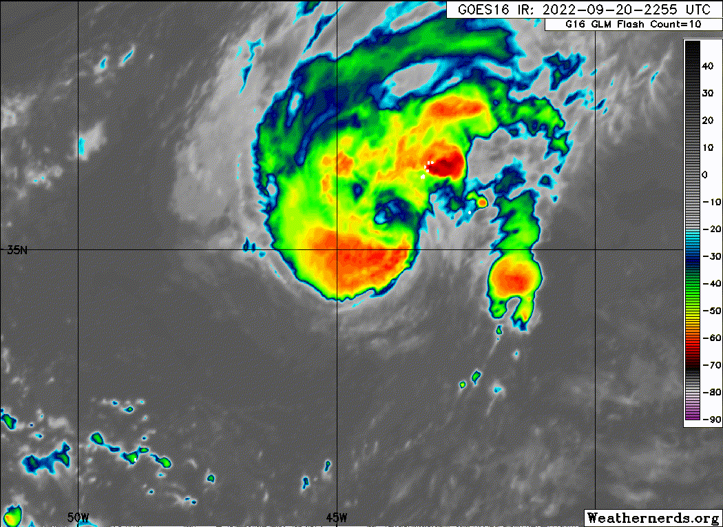
Ah, well... If it weren't for the microwave images posted earlier, I'd probably be on board with keeping that around 50-60kt.
Those microwave images sure look like a minimal hurricane is developing however. The western Azores are under threat from this within 3 days, so hopefully everything looks a lot more sensible tomorrow. It's a shame there's no possibility of recon for Gaston being in such a remote location and overshadowed by Fiona and 98L.
3 likes
I am not a meteorologist, and any posts made by me are not official forecasts or to be interpreted as being intelligent. These posts are just my opinions and are probably silly opinions.

Re: ATL: GASTON - Tropical Storm - Discussion
Up to 55kt/1000mb. 60kt peak expected. 
Tropical Storm Gaston Discussion Number 4
NWS National Hurricane Center Miami FL AL082022
900 AM GMT Wed Sep 21 2022
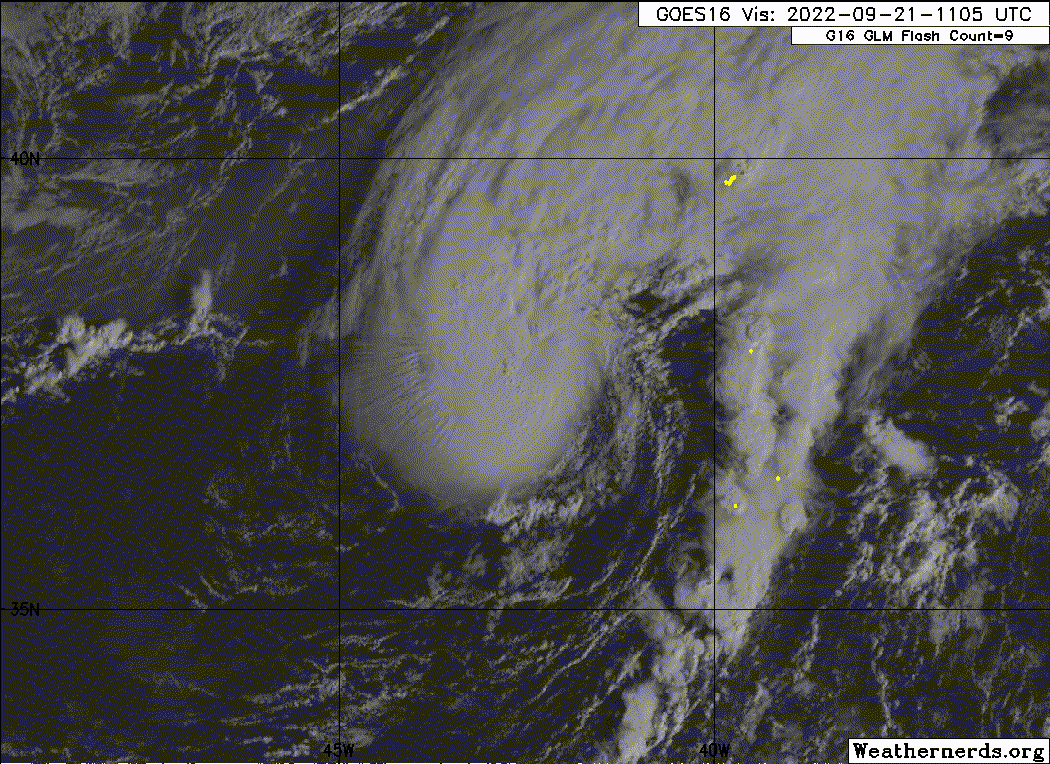
Gaston has continued to improve on satellite imagery overnight.
Curved bands can be seen rotating fully around the southwestern
side
of the tropical cyclone with a warm spot occasionally apparent near
where the center is. I was somewhat skeptical that this structure
was indicative of a formative inner core, but a helpful GMI
microwave pass at 0407 UTC revealed this was no illusion, with a
nearly closed ring of convection on both 89 and 37 GHz channels.
Subjective Dvorak classifications from SAB were T3.0/45-kt and
TAFB T3.5/55-kt. Given the improvement in structure tonight, the
winds have been increased to 55-kt this advisory.
Gaston continues to move to the north-northeast at 025/16 kt. A
turn
north northeastward is expected later today followed by a more
eastward motion by Thursday. By the latter part of this week,
Gaston
is forecast to come to near screeching halt to the west of the
Azores in weak steering currents as a mid-level ridge builds
northward, related to Fiona's downstream diabatic induced ridging.
A
turn to the northwest or north is expected over the weekend as
Gaston moves in the steering flow between Hurricane Fiona to the
west and the building mid-level ridge to the east. The latest NHC
track forecast has changed little and lies very close to the
previous advisory track.
Based on the current structure, Gaston might be able to intensify a
bit more today. However as Gaston slows down the westerly
upper-level flow the storm is embedded will likely cause the
structure to deteriorate, with both the GFS and ECMWF simulated
satellite imagery suggesting the convection could de-couple from
the storm in about 48-60 hours. Thus, the latest forecast shows
weakening during this time period, and Gaston could become a
post-tropical extratropical cyclone as soon as 72 hours. The latest
NHC intensity forecast is a bit higher, owing to the initial
intensity, but remains fairly close to the previous forecast after
60 hours.
Interests in the Azores should continue to monitor the forecast for
Gaston.
FORECAST POSITIONS AND MAX WINDS
INIT 21/0900Z 37.5N 42.6W 55 KT 65 MPH
12H 21/1800Z 38.8N 40.6W 60 KT 70 MPH
24H 22/0600Z 40.1N 37.7W 60 KT 70 MPH
36H 22/1800Z 40.8N 34.7W 55 KT 65 MPH
48H 23/0600Z 40.9N 32.6W 50 KT 60 MPH
60H 23/1800Z 40.8N 31.4W 45 KT 50 MPH
72H 24/0600Z 41.3N 31.5W 45 KT 50 MPH...POST-TROP/EXTRATROP
96H 25/0600Z 42.6N 33.7W 45 KT 50 MPH...POST-TROP/EXTRATROP
120H 26/0600Z 44.3N 35.2W 40 KT 45 MPH...POST-TROP/EXTRATROP
$$
Forecaster Papin
NWS National Hurricane Center Miami FL AL082022
900 AM GMT Wed Sep 21 2022
Gaston has continued to improve on satellite imagery overnight.
Curved bands can be seen rotating fully around the southwestern
side
of the tropical cyclone with a warm spot occasionally apparent near
where the center is. I was somewhat skeptical that this structure
was indicative of a formative inner core, but a helpful GMI
microwave pass at 0407 UTC revealed this was no illusion, with a
nearly closed ring of convection on both 89 and 37 GHz channels.
Subjective Dvorak classifications from SAB were T3.0/45-kt and
TAFB T3.5/55-kt. Given the improvement in structure tonight, the
winds have been increased to 55-kt this advisory.
Gaston continues to move to the north-northeast at 025/16 kt. A
turn
north northeastward is expected later today followed by a more
eastward motion by Thursday. By the latter part of this week,
Gaston
is forecast to come to near screeching halt to the west of the
Azores in weak steering currents as a mid-level ridge builds
northward, related to Fiona's downstream diabatic induced ridging.
A
turn to the northwest or north is expected over the weekend as
Gaston moves in the steering flow between Hurricane Fiona to the
west and the building mid-level ridge to the east. The latest NHC
track forecast has changed little and lies very close to the
previous advisory track.
Based on the current structure, Gaston might be able to intensify a
bit more today. However as Gaston slows down the westerly
upper-level flow the storm is embedded will likely cause the
structure to deteriorate, with both the GFS and ECMWF simulated
satellite imagery suggesting the convection could de-couple from
the storm in about 48-60 hours. Thus, the latest forecast shows
weakening during this time period, and Gaston could become a
post-tropical extratropical cyclone as soon as 72 hours. The latest
NHC intensity forecast is a bit higher, owing to the initial
intensity, but remains fairly close to the previous forecast after
60 hours.
Interests in the Azores should continue to monitor the forecast for
Gaston.
FORECAST POSITIONS AND MAX WINDS
INIT 21/0900Z 37.5N 42.6W 55 KT 65 MPH
12H 21/1800Z 38.8N 40.6W 60 KT 70 MPH
24H 22/0600Z 40.1N 37.7W 60 KT 70 MPH
36H 22/1800Z 40.8N 34.7W 55 KT 65 MPH
48H 23/0600Z 40.9N 32.6W 50 KT 60 MPH
60H 23/1800Z 40.8N 31.4W 45 KT 50 MPH
72H 24/0600Z 41.3N 31.5W 45 KT 50 MPH...POST-TROP/EXTRATROP
96H 25/0600Z 42.6N 33.7W 45 KT 50 MPH...POST-TROP/EXTRATROP
120H 26/0600Z 44.3N 35.2W 40 KT 45 MPH...POST-TROP/EXTRATROP
$$
Forecaster Papin
0 likes
-
Jelmergraaff
- Tropical Storm

- Posts: 138
- Age: 23
- Joined: Fri Aug 27, 2021 1:00 pm
- Location: The Netherlands
Re: ATL: GASTON - Tropical Storm - Discussion
Landy wrote:Up to 55kt/1000mb. 60kt peak expected.Tropical Storm Gaston Discussion Number 4
NWS National Hurricane Center Miami FL AL082022
900 AM GMT Wed Sep 21 2022
Gaston has continued to improve on satellite imagery overnight.
Curved bands can be seen rotating fully around the southwestern
side
of the tropical cyclone with a warm spot occasionally apparent near
where the center is. I was somewhat skeptical that this structure
was indicative of a formative inner core, but a helpful GMI
microwave pass at 0407 UTC revealed this was no illusion, with a
nearly closed ring of convection on both 89 and 37 GHz channels.
Subjective Dvorak classifications from SAB were T3.0/45-kt and
TAFB T3.5/55-kt. Given the improvement in structure tonight, the
winds have been increased to 55-kt this advisory.
Gaston continues to move to the north-northeast at 025/16 kt. A
turn
north northeastward is expected later today followed by a more
eastward motion by Thursday. By the latter part of this week,
Gaston
is forecast to come to near screeching halt to the west of the
Azores in weak steering currents as a mid-level ridge builds
northward, related to Fiona's downstream diabatic induced ridging.
A
turn to the northwest or north is expected over the weekend as
Gaston moves in the steering flow between Hurricane Fiona to the
west and the building mid-level ridge to the east. The latest NHC
track forecast has changed little and lies very close to the
previous advisory track.
Based on the current structure, Gaston might be able to intensify a
bit more today. However as Gaston slows down the westerly
upper-level flow the storm is embedded will likely cause the
structure to deteriorate, with both the GFS and ECMWF simulated
satellite imagery suggesting the convection could de-couple from
the storm in about 48-60 hours. Thus, the latest forecast shows
weakening during this time period, and Gaston could become a
post-tropical extratropical cyclone as soon as 72 hours. The latest
NHC intensity forecast is a bit higher, owing to the initial
intensity, but remains fairly close to the previous forecast after
60 hours.
Interests in the Azores should continue to monitor the forecast for
Gaston.
FORECAST POSITIONS AND MAX WINDS
INIT 21/0900Z 37.5N 42.6W 55 KT 65 MPH
12H 21/1800Z 38.8N 40.6W 60 KT 70 MPH
24H 22/0600Z 40.1N 37.7W 60 KT 70 MPH
36H 22/1800Z 40.8N 34.7W 55 KT 65 MPH
48H 23/0600Z 40.9N 32.6W 50 KT 60 MPH
60H 23/1800Z 40.8N 31.4W 45 KT 50 MPH
72H 24/0600Z 41.3N 31.5W 45 KT 50 MPH...POST-TROP/EXTRATROP
96H 25/0600Z 42.6N 33.7W 45 KT 50 MPH...POST-TROP/EXTRATROP
120H 26/0600Z 44.3N 35.2W 40 KT 45 MPH...POST-TROP/EXTRATROP
$$
Forecaster Papin
I still see the 3AM GMT discussion update, where did you find this?
0 likes
21-year old meteorologist and student MSc Climate Studies from The Netherlands. Interested in all fields of meteorology and climatology, including tropical systems like hurricanes.
-
Iceresistance

- Category 5
- Posts: 9608
- Age: 22
- Joined: Sat Oct 10, 2020 9:45 am
- Location: Tecumseh, OK/Norman, OK
Re: ATL: GASTON - Tropical Storm - Discussion
Jelmergraaff wrote:Landy wrote:Up to 55kt/1000mb. 60kt peak expected.Tropical Storm Gaston Discussion Number 4
NWS National Hurricane Center Miami FL AL082022
900 AM GMT Wed Sep 21 2022
Gaston has continued to improve on satellite imagery overnight.
Curved bands can be seen rotating fully around the southwestern
side
of the tropical cyclone with a warm spot occasionally apparent near
where the center is. I was somewhat skeptical that this structure
was indicative of a formative inner core, but a helpful GMI
microwave pass at 0407 UTC revealed this was no illusion, with a
nearly closed ring of convection on both 89 and 37 GHz channels.
Subjective Dvorak classifications from SAB were T3.0/45-kt and
TAFB T3.5/55-kt. Given the improvement in structure tonight, the
winds have been increased to 55-kt this advisory.
Gaston continues to move to the north-northeast at 025/16 kt. A
turn
north northeastward is expected later today followed by a more
eastward motion by Thursday. By the latter part of this week,
Gaston
is forecast to come to near screeching halt to the west of the
Azores in weak steering currents as a mid-level ridge builds
northward, related to Fiona's downstream diabatic induced ridging.
A
turn to the northwest or north is expected over the weekend as
Gaston moves in the steering flow between Hurricane Fiona to the
west and the building mid-level ridge to the east. The latest NHC
track forecast has changed little and lies very close to the
previous advisory track.
Based on the current structure, Gaston might be able to intensify a
bit more today. However as Gaston slows down the westerly
upper-level flow the storm is embedded will likely cause the
structure to deteriorate, with both the GFS and ECMWF simulated
satellite imagery suggesting the convection could de-couple from
the storm in about 48-60 hours. Thus, the latest forecast shows
weakening during this time period, and Gaston could become a
post-tropical extratropical cyclone as soon as 72 hours. The latest
NHC intensity forecast is a bit higher, owing to the initial
intensity, but remains fairly close to the previous forecast after
60 hours.
Interests in the Azores should continue to monitor the forecast for
Gaston.
FORECAST POSITIONS AND MAX WINDS
INIT 21/0900Z 37.5N 42.6W 55 KT 65 MPH
12H 21/1800Z 38.8N 40.6W 60 KT 70 MPH
24H 22/0600Z 40.1N 37.7W 60 KT 70 MPH
36H 22/1800Z 40.8N 34.7W 55 KT 65 MPH
48H 23/0600Z 40.9N 32.6W 50 KT 60 MPH
60H 23/1800Z 40.8N 31.4W 45 KT 50 MPH
72H 24/0600Z 41.3N 31.5W 45 KT 50 MPH...POST-TROP/EXTRATROP
96H 25/0600Z 42.6N 33.7W 45 KT 50 MPH...POST-TROP/EXTRATROP
120H 26/0600Z 44.3N 35.2W 40 KT 45 MPH...POST-TROP/EXTRATROP
$$
Forecaster Papin
I still see the 3AM GMT discussion update, where did you find this?
The NHC is having connectivity problems, they mentioned it on a tweet and showed the link to Fiona's advisory and discussion.
0 likes
Bill 2015 & Beta 2020
Winter 2020-2021
All observations are in Tecumseh, OK unless otherwise noted.
Winter posts are focused mainly for Oklahoma & Texas.
Take any of my forecasts with a grain of salt, refer to the NWS, SPC, and NHC for official information
Never say Never with weather! Because ANYTHING is possible!
Winter 2020-2021
All observations are in Tecumseh, OK unless otherwise noted.
Winter posts are focused mainly for Oklahoma & Texas.
Take any of my forecasts with a grain of salt, refer to the NWS, SPC, and NHC for official information
Never say Never with weather! Because ANYTHING is possible!
Re: ATL: GASTON - Tropical Storm - Discussion
Jelmergraaff wrote:Landy wrote:Up to 55kt/1000mb. 60kt peak expected.
. . .
[
I still see the 3AM GMT discussion update, where did you find this?
I always grab information from mesonet. Gaston's discussion is here: https://mesonet.agron.iastate.edu/wx/af ... 2209210900
0 likes
-
Sciencerocks
- Category 5
- Posts: 10193
- Age: 40
- Joined: Thu Jul 06, 2017 1:51 am

Re: ATL: GASTON - Tropical Storm - Discussion
The data nerd in me truly wishes this guy would peak at hurricane status, just so we can make up for that "lost ground" to the early season predictions.
9 likes
-
CrazyC83
- Professional-Met

- Posts: 34316
- Joined: Tue Mar 07, 2006 11:57 pm
- Location: Deep South, for the first time!
Re: ATL: GASTON - Tropical Storm - Discussion
With that structure I would place Gaston at 60 kt. Definitely an overperforming storm.
3 likes
-
Sciencerocks
- Category 5
- Posts: 10193
- Age: 40
- Joined: Thu Jul 06, 2017 1:51 am
-
tolakram
- Admin
- Posts: 20186
- Age: 62
- Joined: Sun Aug 27, 2006 8:23 pm
- Location: Florence, KY (name is Mark)
Re: ATL: GASTON - Tropical Storm - Discussion
I wonder if Gaston will get an upgrade post season? Seems awfully close to hurricane strength from time to time.
2 likes
M a r k
- - - - -
Join us in chat: Storm2K Chatroom Invite. Android and IOS apps also available.
The posts in this forum are NOT official forecasts and should not be used as such. Posts are NOT endorsed by any professional institution or STORM2K.org. For official information and forecasts, please refer to NHC and NWS products.
- - - - -
Join us in chat: Storm2K Chatroom Invite. Android and IOS apps also available.
The posts in this forum are NOT official forecasts and should not be used as such. Posts are NOT endorsed by any professional institution or STORM2K.org. For official information and forecasts, please refer to NHC and NWS products.
-
Sciencerocks
- Category 5
- Posts: 10193
- Age: 40
- Joined: Thu Jul 06, 2017 1:51 am
-
cheezyWXguy

- Category 5
- Posts: 6282
- Joined: Mon Feb 13, 2006 12:29 am
- Location: Dallas, TX
Re: ATL: GASTON - Tropical Storm - Discussion
tolakram wrote:I wonder if Gaston will get an upgrade post season? Seems awfully close to hurricane strength from time to time.
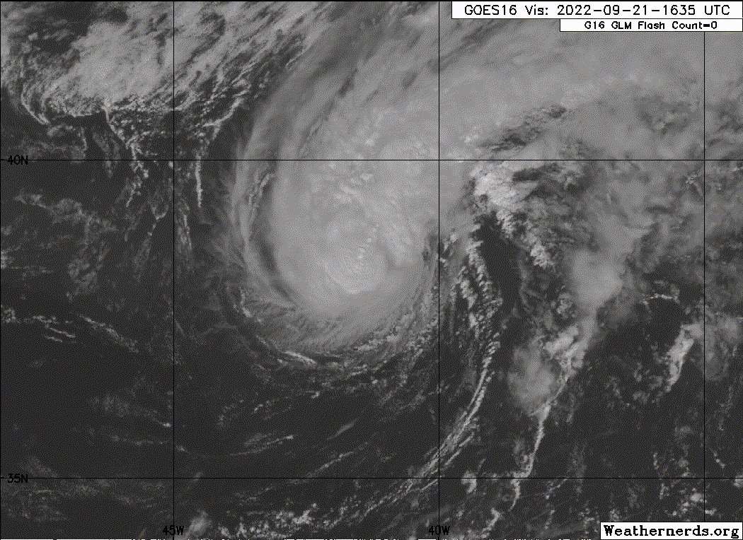
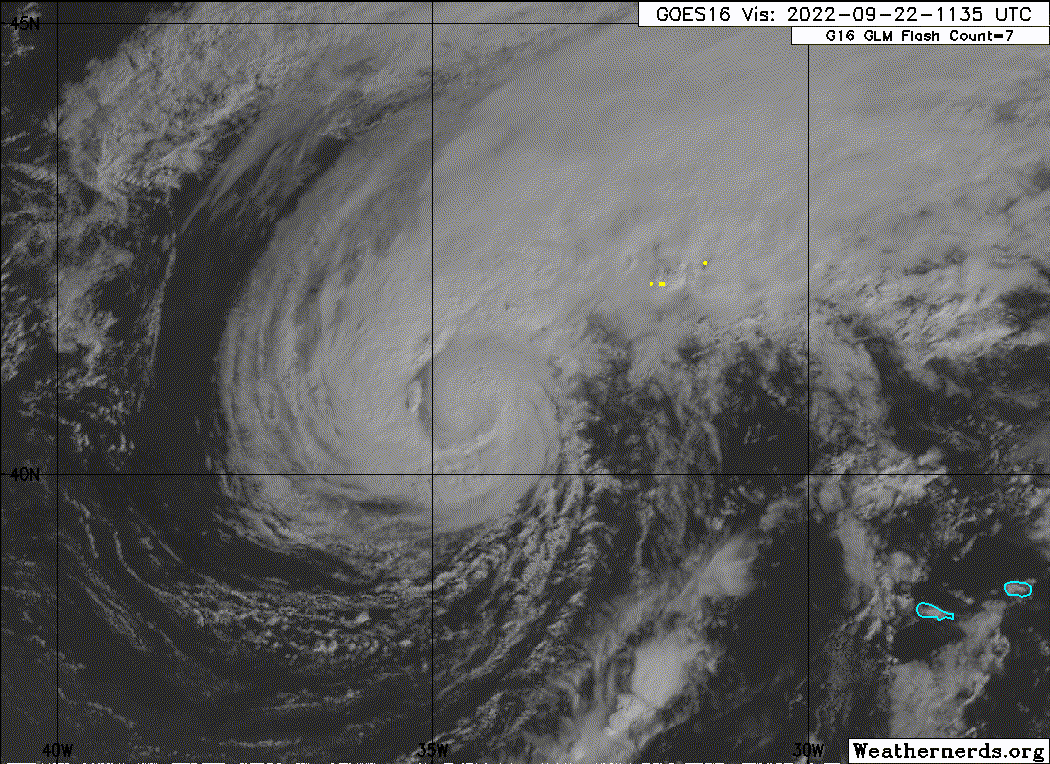
I’m wondering if it gets the upgrade today. The eye is making an appearance again.
1 likes
-
cycloneye

- Admin
- Posts: 149730
- Age: 69
- Joined: Thu Oct 10, 2002 10:54 am
- Location: San Juan, Puerto Rico
Re: ATL: GASTON - Tropical Storm - Discussion

2 likes
Visit the Caribbean-Central America Weather Thread where you can find at first post web cams,radars
and observations from Caribbean basin members Click Here
and observations from Caribbean basin members Click Here
Re: ATL: GASTON - Tropical Storm - Discussion
cheezyWXguy wrote:tolakram wrote:I wonder if Gaston will get an upgrade post season? Seems awfully close to hurricane strength from time to time.
I’m wondering if it gets the upgrade today. The eye is making an appearance again.
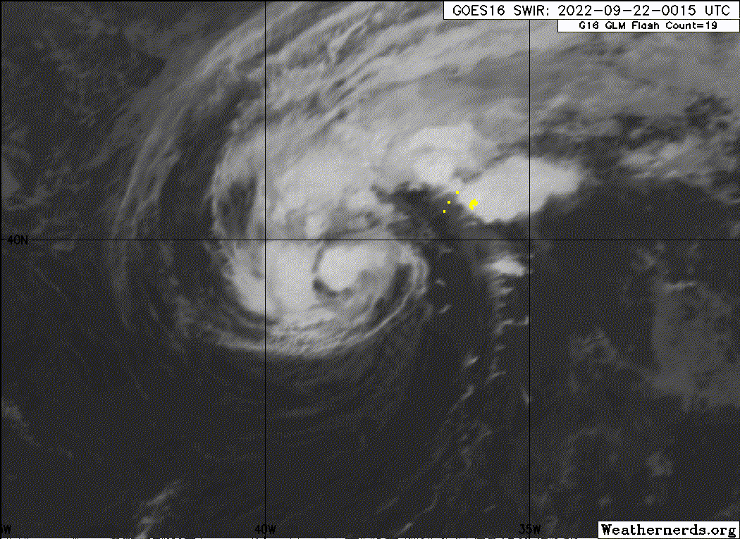
The 11AM EDT/AST NHC update keeps it at 55 knots and doesn't get it to hurricane strength later.
0 likes
Personal Forecast Disclaimer:
The posts in this forum are NOT official forecasts and should not be used as such. They are just the opinion of the poster and may or may not be backed by sound meteorological data. They are NOT endorsed by any professional institution or storm2k.org. For official information, please refer to the NHC and NWS products.
The posts in this forum are NOT official forecasts and should not be used as such. They are just the opinion of the poster and may or may not be backed by sound meteorological data. They are NOT endorsed by any professional institution or storm2k.org. For official information, please refer to the NHC and NWS products.
-
Sciencerocks
- Category 5
- Posts: 10193
- Age: 40
- Joined: Thu Jul 06, 2017 1:51 am
-
AnnularCane

- S2K Supporter

- Posts: 2964
- Joined: Thu Jun 08, 2006 9:18 am
- Location: Wytheville, VA
Re: ATL: GASTON - Tropical Storm - Discussion
This little lad is holding together pretty well, but he should probably be eating 4 dozen eggs every morning. 
2 likes
"But it never rained rain. It never snowed snow. And it never blew just wind. It rained things like soup and juice. It snowed mashed potatoes and green peas. And sometimes the wind blew in storms of hamburgers." -- Judi Barrett, Cloudy with a Chance of Meatballs
Who is online
Users browsing this forum: No registered users and 46 guests