skyline385 wrote:cheezyWXguy wrote:toad strangler wrote:
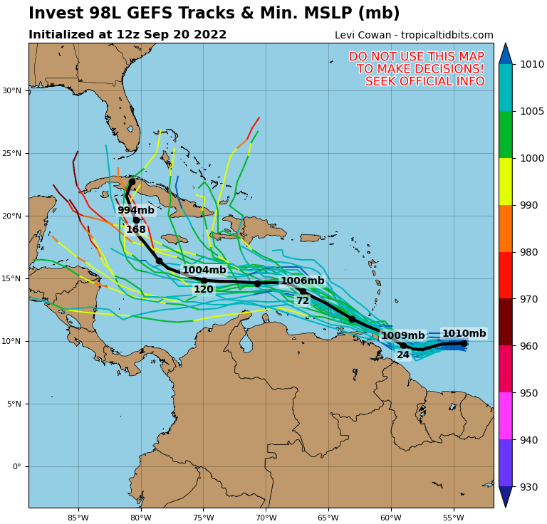
I didn't think that would happen going as far S & W as it did.
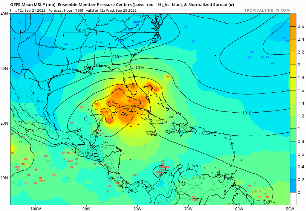
Yeah looks like Pensacola this run. Personally I think this marks the western extreme of plausible paths. One thing I particularly don’t like about this run is that is that there isn’t nearly as much weakening in the gulf as on previous runs
I think it’s because the previous runs has sub-930mb systems. It is relatively easier to weaken a Cat 5/4 than something like a Cat 3 as the requirements to sustain the former are much higher.
Sent from my iPhone using Tapatalk
I'd think 943mb would represent a 4 more so than a 3, but I guess large size would play a role too. Regardless, I'm not sure I believe that's the mechanism in play here. I think the slower movement allows the trough to lift further out than in previous runs. As many have noted here, the trough will play a big role in determining how strong this is and where it goes.
In general, the main scenario I'm hoping we don't see is one that gets the storm far enough west to minimize land interaction with Cuba, but a landfall far enough south on the peninsula to avoid the harsher conditions of the northern gulf. The slower development and faster movement in the Caribbean make me think such a path is not unreasonable.