Using all the data, I would estimate the intensity at 110 kt now. There was only a single pass, so I wouldn't drop it too much.
As Fiona goes north, the mismatch between wind and pressure will become greater most likely - 940 mb would be about 85 kt.
ATL: FIONA - Post-Tropical - Discussion
Moderator: S2k Moderators

Re: ATL: FIONA - Hurricane - Discussion
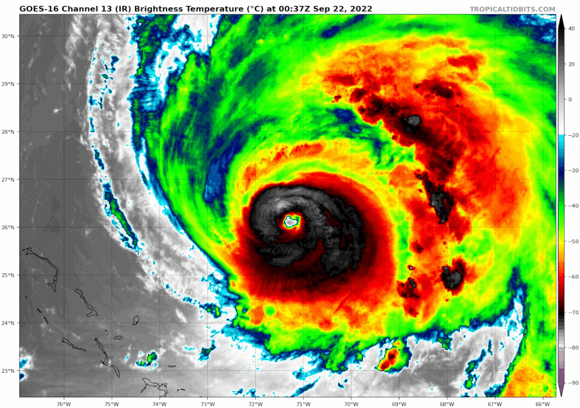
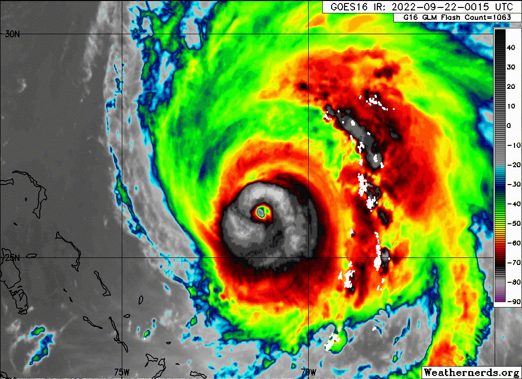
EWRC really becoming evident. Looks like shear has finally let up a bit, so hopefully this one will be cleaner and give Fiona a chance to intensify a bit more afterwards.
NHC kept it at 115 kt for the 11pm advisory, but that's probably too high.
NHC kept it at 115 kt for the 11pm advisory, but that's probably too high.
1 likes
TC naming lists: retirements and intensity
Most aggressive Advisory #1's in North Atlantic (cr. kevin for starting the list)
Most aggressive Advisory #1's in North Atlantic (cr. kevin for starting the list)
-
CrazyC83
- Professional-Met

- Posts: 34315
- Joined: Tue Mar 07, 2006 11:57 pm
- Location: Deep South, for the first time!
Re: ATL: FIONA - Hurricane - Discussion
Next aircraft I don't believe is until tomorrow morning, leaving at 0830Z and arriving for the 12Z fix.
1 likes
-
Hurricane2022

- Category 5

- Posts: 2039
- Joined: Tue Aug 23, 2022 11:38 pm
- Location: Araçatuba, Brazil
Re: ATL: FIONA - Hurricane - Discussion
It looks like Fiona is going through her EWRC quickly. I believe that after completing this phase, it will intensify again.
1 likes
Sorry for the bad English sometimes...!
For reliable and detailed information for any meteorological phenomenon, please consult the National Hurricane Center, Joint Typhoon Warning Center , or your local Meteo Center.
--------
ECCE OMNIA NOVA FACIAM (Ap 21,5).
For reliable and detailed information for any meteorological phenomenon, please consult the National Hurricane Center, Joint Typhoon Warning Center , or your local Meteo Center.
--------
ECCE OMNIA NOVA FACIAM (Ap 21,5).
-
Sciencerocks
- Category 5
- Posts: 10186
- Age: 40
- Joined: Thu Jul 06, 2017 1:51 am

Re: ATL: FIONA - Hurricane - Discussion
Pressure down to 988.1 at the buoy with 46.6kts gusting to 62.2kts. Center is almost 70 miles away to the south east.
0 likes
Personal Forecast Disclaimer:
The posts in this forum are NOT official forecast and should not be used as such. They are just the opinion of the poster and may or may not be backed by sound meteorological data. For official information, please refer to the NHC and NWS products.
The posts in this forum are NOT official forecast and should not be used as such. They are just the opinion of the poster and may or may not be backed by sound meteorological data. For official information, please refer to the NHC and NWS products.

Re: ATL: FIONA - Hurricane - Discussion
Of course the AF plane’s communications cut out as soon as it penetrated the eyewall.
0 likes
Irene '11 Sandy '12 Hermine '16 5/15/2018 Derecho Fay '20 Isaias '20 Elsa '21 Henri '21 Ida '21
I am only a meteorology enthusiast who knows a decent amount about tropical cyclones. Look to the professional mets, the NHC, or your local weather office for the best information.
I am only a meteorology enthusiast who knows a decent amount about tropical cyclones. Look to the professional mets, the NHC, or your local weather office for the best information.
-
TheDreamTraveler

- Category 2

- Posts: 645
- Joined: Sun Aug 22, 2010 3:10 am
- Location: PA
Re: ATL: FIONA - Hurricane - Discussion
From the mets I follow this could be a generational storm and one of the strongest storms to ever strike this part of Canada. Fiona was already going to get retired due to the damage in Puerto Rico but it's not done yet. It's definitely a rarer type of extratropical transition. Has shades of Sandy for sure though Sandy was definitely very unique in of itself.
1 likes
-
tolakram
- Admin

- Posts: 20186
- Age: 62
- Joined: Sun Aug 27, 2006 8:23 pm
- Location: Florence, KY (name is Mark)
Re: ATL: FIONA - Hurricane - Discussion
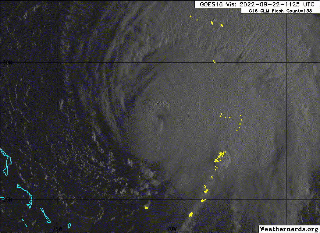
Floater back over Fiona.
https://weather.cod.edu/satrad/?parms=meso-meso2-02-24-0-100-1&checked=map&colorbar=undefined
https://weather.cod.edu/satrad/?parms=meso-meso2-02-24-0-100-1&checked=map&colorbar=undefined
0 likes
M a r k
- - - - -
Join us in chat: Storm2K Chatroom Invite. Android and IOS apps also available.
The posts in this forum are NOT official forecasts and should not be used as such. Posts are NOT endorsed by any professional institution or STORM2K.org. For official information and forecasts, please refer to NHC and NWS products.
-
tolakram
- Admin
- Posts: 20186
- Age: 62
- Joined: Sun Aug 27, 2006 8:23 pm
- Location: Florence, KY (name is Mark)
Re: ATL: FIONA - Hurricane - Discussion
saved loop

0 likes
M a r k
- - - - -
Join us in chat: Storm2K Chatroom Invite. Android and IOS apps also available.
The posts in this forum are NOT official forecasts and should not be used as such. Posts are NOT endorsed by any professional institution or STORM2K.org. For official information and forecasts, please refer to NHC and NWS products.
- - - - -
Join us in chat: Storm2K Chatroom Invite. Android and IOS apps also available.
The posts in this forum are NOT official forecasts and should not be used as such. Posts are NOT endorsed by any professional institution or STORM2K.org. For official information and forecasts, please refer to NHC and NWS products.
-
Category5Kaiju

- Category 5
- Posts: 4335
- Joined: Thu Dec 24, 2020 12:45 pm
- Location: Seattle during the summer, Phoenix during the winter
Re: ATL: FIONA - Hurricane - Discussion
For a 130 mph system, a 934 mbar core pressure seems rather impressive. If you look at many EPAC systems that peaked at 130 mph, their pressures are usually in the 950s or high 940s, and the most recent Atlantic storm I can think of that had such a low pressure for a 130 mph system was Harvey (937).
0 likes
Unless explicitly stated, all information in my posts is based on my own opinions and observations. Tropical storms and hurricanes can be extremely dangerous. Refer to an accredited weather research agency or meteorologist if you need to make serious decisions regarding an approaching storm.
-
Iceresistance

- Category 5
- Posts: 9592
- Age: 22
- Joined: Sat Oct 10, 2020 9:45 am
- Location: Tecumseh, OK/Norman, OK
Re: ATL: FIONA - Hurricane - Discussion
https://twitter.com/RyanMaue/status/1572760054708994048
This is likely going to be an absolute monster.
This is likely going to be an absolute monster.
0 likes
Bill 2015 & Beta 2020
Winter 2020-2021
All observations are in Tecumseh, OK unless otherwise noted.
Winter posts are focused mainly for Oklahoma & Texas.
Take any of my forecasts with a grain of salt, refer to the NWS, SPC, and NHC for official information
Never say Never with weather! Because ANYTHING is possible!
Winter 2020-2021
All observations are in Tecumseh, OK unless otherwise noted.
Winter posts are focused mainly for Oklahoma & Texas.
Take any of my forecasts with a grain of salt, refer to the NWS, SPC, and NHC for official information
Never say Never with weather! Because ANYTHING is possible!
-
SconnieCane
- Category 5
- Posts: 1013
- Joined: Thu Aug 02, 2018 5:29 pm
- Location: Madison, WI
Re: ATL: FIONA - Hurricane - Discussion
Seems like Fiona has always battled shear from one direction or another for most of its life post-DR. If I recall correctly, this was not entirely expected, and that most models showed it having a more favorable atmospheric environment for a while which should have allowed a more sustained period of symmetrical CDO and round, clear eye with stadium effect (and 120-135kt peak intensity). In 2022 fashion, underachieving for the wx nerds a bit although by no means does this diminish the impact it's already had in the northern Caribbean and will continue to have in Bermuda and Atlantic Canada.
0 likes

Re: ATL: FIONA - Hurricane - Discussion
SconnieCane wrote:Seems like Fiona has always battled shear from one direction or another for most of its life post-DR. If I recall correctly, this was not entirely expected, and that most models showed it having a more favorable atmospheric environment for a while which should have allowed a more sustained period of symmetrical CDO and round, clear eye with stadium effect (and 120-135kt peak intensity). In 2022 fashion, underachieving for the wx nerds a bit although by no means does this diminish the impact it's already had in the northern Caribbean and will continue to have in Bermuda and Atlantic Canada.
Global models consistently forecasted about 15-20kt of shear in the SW Atlantic, which is exactly what we saw. NHC mentioned this moderate shear in almost every advisory. Here's on example from #18:
The hurricane will be moving through a fairly moist air mass and
over SSTs warmer than 29 deg C for the next few days. It should be
noted that the SHIPS output shows 15-20 kt of vertical wind shear
over Fiona for the next several days. However that same guidance
model shows steady strengthening with the system becoming a major
hurricane in about 48 hours. Based on the bulk of the numerical
guidance, the official intensity forecast is increased slightly from
the previous NHC prediction, and is near or a little below the
model consensus.
GFS sounding several days out forecasting the shear well:

Peak intensity has also been in line or even higher than the global models overall. Hurricane models did well with intensity but were around 5kt high with peak winds.
5 likes
Kendall -> SLO -> PBC
Memorable Storms: Katrina (for its Florida landfall...) Wilma Matthew Irma
Memorable Storms: Katrina (for its Florida landfall...) Wilma Matthew Irma
Re: ATL: FIONA - Hurricane - Discussion
I think this still might be a Cat 4. Recon found FL winds of up to ~125 kt in the SE eyewall, which translates to 110-115 kt at the surface using the standard 0.9 conversion. If Fiona isn’t a Cat 4 right now, then based on its improving satellite presentation and slight pressure decrease between center fixes, it might try to become one again today.
1 likes
Irene '11 Sandy '12 Hermine '16 5/15/2018 Derecho Fay '20 Isaias '20 Elsa '21 Henri '21 Ida '21
I am only a meteorology enthusiast who knows a decent amount about tropical cyclones. Look to the professional mets, the NHC, or your local weather office for the best information.
I am only a meteorology enthusiast who knows a decent amount about tropical cyclones. Look to the professional mets, the NHC, or your local weather office for the best information.
-
Sciencerocks
- Category 5
- Posts: 10186
- Age: 40
- Joined: Thu Jul 06, 2017 1:51 am
-
ScottNAtlanta

- Category 5
- Posts: 2535
- Joined: Sat May 25, 2013 3:11 pm
- Location: Atlanta, GA
Re: ATL: FIONA - Hurricane - Discussion
Lets also not forget when this hits Atlantic Canada this will be moving at about 25kts. Add that into the wind speed and you have a storm like no other they have ever seen
0 likes
The posts in this forum are NOT official forecast and should not be used as such. They are just the opinion of the poster and may or may not be backed by sound meteorological data. They are NOT endorsed by any professional institution or storm2k.org. For official information, please refer to the NHC and NWS products.
-
Iceresistance
- Category 5
- Posts: 9592
- Age: 22
- Joined: Sat Oct 10, 2020 9:45 am
- Location: Tecumseh, OK/Norman, OK
Re: ATL: FIONA - Hurricane - Discussion
Wow! Saildrone #2 into Fiona! I wonder when we're going to get good videos from these.
0 likes
Bill 2015 & Beta 2020
Winter 2020-2021
All observations are in Tecumseh, OK unless otherwise noted.
Winter posts are focused mainly for Oklahoma & Texas.
Take any of my forecasts with a grain of salt, refer to the NWS, SPC, and NHC for official information
Never say Never with weather! Because ANYTHING is possible!
Winter 2020-2021
All observations are in Tecumseh, OK unless otherwise noted.
Winter posts are focused mainly for Oklahoma & Texas.
Take any of my forecasts with a grain of salt, refer to the NWS, SPC, and NHC for official information
Never say Never with weather! Because ANYTHING is possible!
-
galaxy401

- Category 5
- Posts: 2446
- Age: 30
- Joined: Sat Aug 25, 2012 9:04 pm
- Location: Casa Grande, Arizona
Re: ATL: FIONA - Hurricane - Discussion
SconnieCane wrote:Seems like Fiona has always battled shear from one direction or another for most of its life post-DR. If I recall correctly, this was not entirely expected, and that most models showed it having a more favorable atmospheric environment for a while which should have allowed a more sustained period of symmetrical CDO and round, clear eye with stadium effect (and 120-135kt peak intensity). In 2022 fashion, underachieving for the wx nerds a bit although by no means does this diminish the impact it's already had in the northern Caribbean and will continue to have in Bermuda and Atlantic Canada.
Yeah it "underachieved" when it was originally forecasted to just stay as a weak tropical storm its whole life...
8 likes
Got my eyes on moving right into Hurricane Alley: Florida.
Who is online
Users browsing this forum: No registered users and 19 guests