Iceresistance wrote:The GEFS did not shift east very much if at all.
OP looks to be essentially down the middle of this group as well unlike yesterday.
Moderator: S2k Moderators


Iceresistance wrote:The GEFS did not shift east very much if at all.

psyclone wrote:The EURO is one or 2 runs from missing all of FL to the east!. Still time for that solution to evolve. or for that to evolve and then flip back! Clarity from club NHC will be most helpful.
SouthFLTropics wrote:120 to 144 Hours Euro... Putting all of South Florida from Jupiter to the Keys on the dirty side of the storm.


LarryWx wrote:If anyone has the 168 hour 12Z UKMET map and is able to post it, please do so. Thanks in advance.

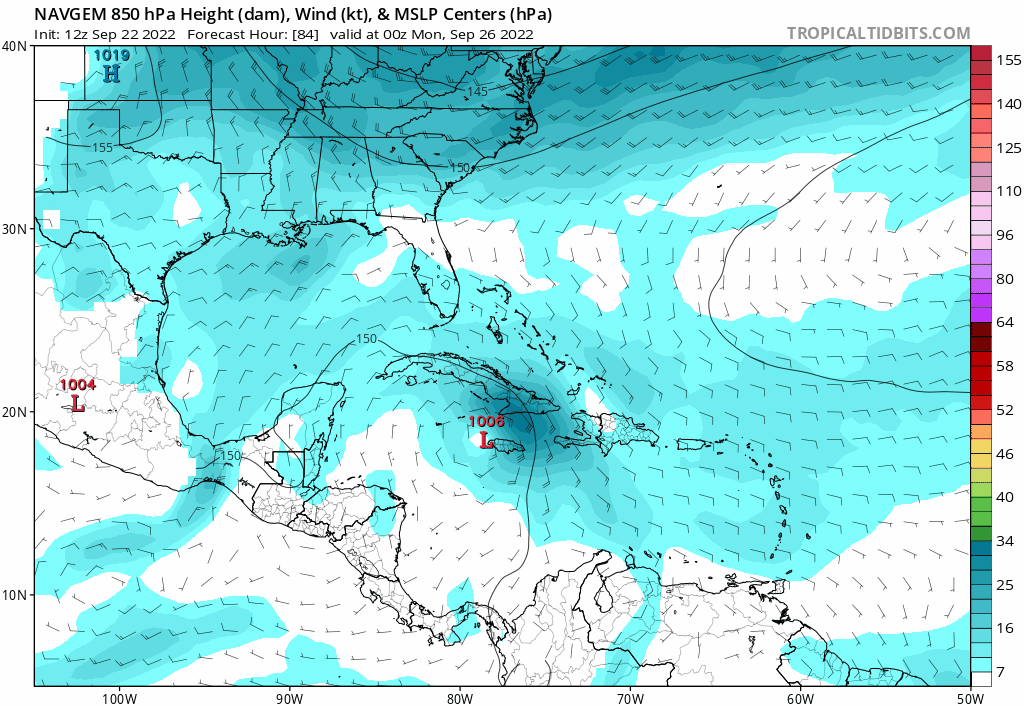
gatorcane wrote:NAVGEM just east of Florida:
https://i.postimg.cc/vZhj7JFP/navgem-mslp-uv850-watl-fh84-138.gif


toad strangler wrote:gatorcane wrote:NAVGEM just east of Florida:
https://i.postimg.cc/vZhj7JFP/navgem-mslp-uv850-watl-fh84-138.gif
THAT is very plausible in this setup. Unlike the intoxicated GFS far western "solutions"

Irma wasnt long ago, full preps in sofla for that oneSFLcane wrote:toad strangler wrote:gatorcane wrote:NAVGEM just east of Florida:
https://i.postimg.cc/vZhj7JFP/navgem-mslp-uv850-watl-fh84-138.gif
THAT is very plausible in this setup. Unlike the intoxicated GFS far western "solutions"
One can not invision the madness across South Florida if this comes to pass. We are talking 5 days away.

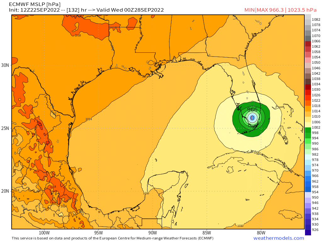
LarryWx wrote:The 12Z EPS 156 mean is quite a bit east of the 0Z EPS 168 mean. There are many tracks that go over far SE FL and even a decent number east of S FL/over NW Bahamas.

jlauderdal wrote:Irma wasnt long ago, full preps in sofla for that oneSFLcane wrote:toad strangler wrote:
THAT is very plausible in this setup. Unlike the intoxicated GFS far western "solutions"
One can not invision the madness across South Florida if this comes to pass. We are talking 5 days away.
chris_fit wrote:LarryWx wrote:The 12Z EPS 156 mean is quite a bit east of the 0Z EPS 168 mean. There are many tracks that go over far SE FL and even a decent number east of S FL/over NW Bahamas.
What site you using? Mine is only out to 84hrs
https://i.imgur.com/lslB4EM.png

Users browsing this forum: No registered users and 23 guests