

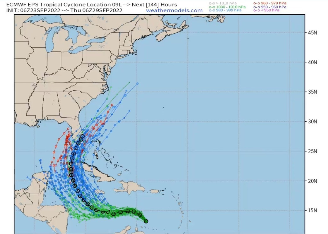
skyline385 wrote:06Z EPS zoomed in, there seems to be a group which goes through SFL and a group (from center relocation maybe) which is westwards.
https://uploads.tapatalk-cdn.com/20220923/91f69f92d33818a0a1458b665c8e8b66.jpg
Sent from my iPhone using Tapatalk
There is has not been any center relocation that i am aware off its some eddys rotating around the broader llc. But either way the mean in black is still across South Florida. We wait and watch


