ATL: IAN - Models
Moderator: S2k Moderators
-
GeneratorPower

- S2K Supporter

- Posts: 1648
- Age: 46
- Joined: Sun Dec 18, 2005 11:48 pm
- Location: Huntsville, AL
-
tolakram
- Admin

- Posts: 20186
- Age: 62
- Joined: Sun Aug 27, 2006 8:23 pm
- Location: Florence, KY (name is Mark)
Re: ATL: IAN - Models

1 likes
M a r k
- - - - -
Join us in chat: Storm2K Chatroom Invite. Android and IOS apps also available.
The posts in this forum are NOT official forecasts and should not be used as such. Posts are NOT endorsed by any professional institution or STORM2K.org. For official information and forecasts, please refer to NHC and NWS products.

-
Bocadude85

- Category 5

- Posts: 2991
- Age: 39
- Joined: Mon Apr 18, 2005 2:20 pm
- Location: Honolulu,Hi
-
tolakram
- Admin
- Posts: 20186
- Age: 62
- Joined: Sun Aug 27, 2006 8:23 pm
- Location: Florence, KY (name is Mark)
Re: ATL: IAN - Models

1 likes
M a r k
- - - - -
Join us in chat: Storm2K Chatroom Invite. Android and IOS apps also available.
The posts in this forum are NOT official forecasts and should not be used as such. Posts are NOT endorsed by any professional institution or STORM2K.org. For official information and forecasts, please refer to NHC and NWS products.
- - - - -
Join us in chat: Storm2K Chatroom Invite. Android and IOS apps also available.
The posts in this forum are NOT official forecasts and should not be used as such. Posts are NOT endorsed by any professional institution or STORM2K.org. For official information and forecasts, please refer to NHC and NWS products.
-
GeneratorPower
- S2K Supporter
- Posts: 1648
- Age: 46
- Joined: Sun Dec 18, 2005 11:48 pm
- Location: Huntsville, AL

Re: ATL: IAN - Models
CronkPSU wrote:hmmmmm so a little bit east but mostly the same path it has taken the last two days....
Rocking between the 8pm and the 11pm, it appears to be farther WEST. At least at landfall. 8pm was close to Cedar Key and 11pm is almost dead center Big Bend. Am I missing something? Are you referring to the models or the official NHC?
2 likes
Re: ATL: IAN - Models
Bocadude85 wrote:0z Canadian is WAY NE of the 12z run.
Looks like landfall on Nature Coast/Big Bend area
GFS west outlier it seems like so far…
Last edited by caneseddy on Sat Sep 24, 2022 11:15 pm, edited 1 time in total.
1 likes
-
Blown Away

- S2K Supporter
- Posts: 10253
- Joined: Wed May 26, 2004 6:17 am
Re: ATL: IAN - Models
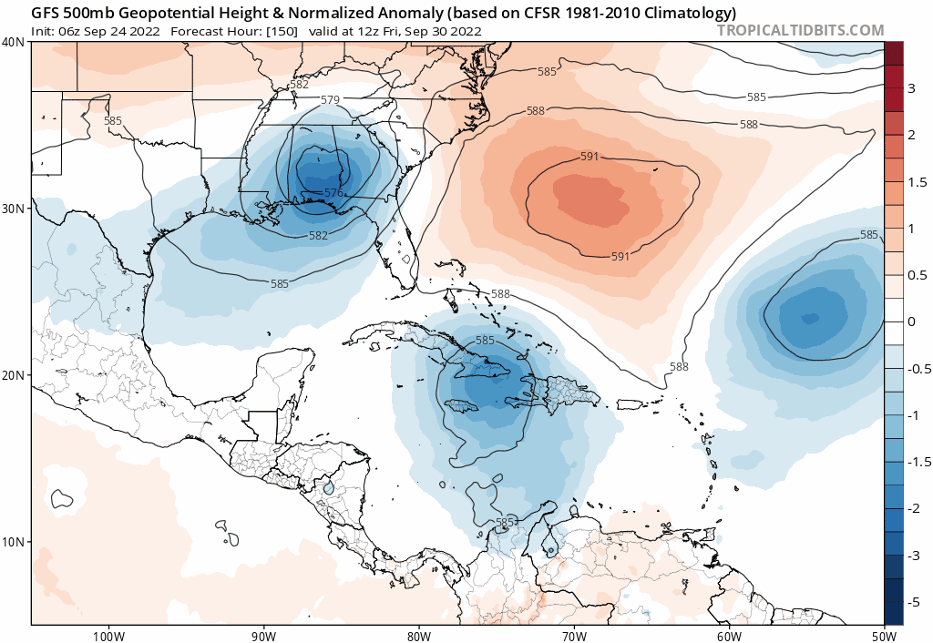
00z GFS trend… HP to the E weaker each run…
2 likes
Hurricane Eye Experience: David 79, Irene 99, Frances 04, Jeanne 04, Wilma 05… Hurricane Brush Experience: Andrew 92, Erin 95, Floyd 99, Matthew 16, Irma 17, Ian 22, Nicole 22…
-
AmandaInDestin
- Tropical Wave

- Posts: 9
- Joined: Fri Sep 23, 2022 8:56 pm
Re: ATL: IAN - Models
GeneratorPower wrote:Gonna be a Walton county landfall?
I would say that L is right on the destin/Miramar line. But it’s silly when destin is only 8 miles long and Miramar isn’t much bigger. But I’m not holding any weight to any of this. It will probably end up in the big bend area.
I take that first part back. Watching the final replay of it and it’s in Destin/okaloosa. This run…
Last edited by AmandaInDestin on Sat Sep 24, 2022 11:19 pm, edited 1 time in total.
1 likes
Re: ATL: IAN - Models
Canadian returned to its senses for 00z, like ICON, but west by 20-30 miles. Surge, rain issues.
1 likes

Re: ATL: IAN - Models
GFS on its own now. Major outlier.
4 likes
The following post is NOT an official forecast and should not be used as such. It is just the opinion of the poster and may or may not be backed by sound meteorological data. It is NOT endorsed by any professional institution including storm2k.org For Official Information please refer to the NHC and NWS products.
-
SFLcane

- S2K Supporter
- Posts: 10281
- Age: 48
- Joined: Sat Jun 05, 2010 1:44 pm
- Location: Lake Worth Florida
Re: ATL: IAN - Models
chaser1 wrote:That sound you just heard was a collective sigh of relief from the good folks down in far S. Florida (for the moment anyway)
That sound was heard since yesterday lol.
1 likes
-
tarheelprogrammer

- S2K Supporter
- Posts: 1793
- Joined: Mon Mar 28, 2016 9:25 pm
- Location: Raleigh, NC area (Garner, NC)
Re: ATL: IAN - Models
GEFS trending east. Hmmm.
1 likes
My posts are not official forecasts. They are just my opinion and may or may not be backed by sound meteorological data. They are NOT endorsed by any professional institution or storm2k.org. For official information, please refer to the NHC and NWS products.
-
eastcoastFL

- Category 5
- Posts: 3996
- Age: 44
- Joined: Thu Apr 12, 2007 12:29 pm
- Location: Palm City, FL
Re: ATL: IAN - Models
blp wrote:GFS on its own now. Major outlier.
This track is going to be a major headache for the NHC over the coming days and the models are not being friendly to them. I bet you they still nail it within 50 miles by sundays forecast.
1 likes
Personal Forecast Disclaimer:
The posts in this forum are NOT official forecast and should not be used as such. They are just the opinion of the poster and may or may not be backed by sound meteorological data. They are NOT endorsed by any professional institution or storm2k.org. For official information, please refer to the NHC and NWS products.
The posts in this forum are NOT official forecast and should not be used as such. They are just the opinion of the poster and may or may not be backed by sound meteorological data. They are NOT endorsed by any professional institution or storm2k.org. For official information, please refer to the NHC and NWS products.
Re: ATL: IAN - Models
0Z UKMET significantly south of the last two full runs with it landfalling FL now well south of Tampa:
MET OFFICE TROPICAL CYCLONE GUIDANCE FOR NORTH-EAST PACIFIC AND ATLANTIC
GLOBAL MODEL DATA TIME 0000UTC 25.09.2022
TROPICAL STORM IAN ANALYSED POSITION : 14.7N 76.9W
ATCF IDENTIFIER : AL092022
LEAD CENTRAL MAXIMUM WIND
VERIFYING TIME TIME POSITION PRESSURE (MB) SPEED (KNOTS)
-------------- ---- -------- ------------- -------------
0000UTC 25.09.2022 0 14.7N 76.9W 1006 28
1200UTC 25.09.2022 12 14.3N 79.4W 1004 25
0000UTC 26.09.2022 24 15.7N 80.6W 1001 31
1200UTC 26.09.2022 36 17.5N 82.2W 1000 33
0000UTC 27.09.2022 48 19.6N 83.0W 998 37
1200UTC 27.09.2022 60 21.8N 83.7W 995 36
0000UTC 28.09.2022 72 23.9N 83.9W 994 41
1200UTC 28.09.2022 84 25.4N 83.5W 992 49
0000UTC 29.09.2022 96 26.1N 83.2W 991 54
1200UTC 29.09.2022 108 26.6N 82.7W 991 49
0000UTC 30.09.2022 120 27.4N 82.0W 990 49
1200UTC 30.09.2022 132 28.6N 81.6W 990 43
0000UTC 01.10.2022 144 30.2N 81.0W 989 44
2 likes
Personal Forecast Disclaimer:
The posts in this forum are NOT official forecasts and should not be used as such. They are just the opinion of the poster and may or may not be backed by sound meteorological data. They are NOT endorsed by any professional institution or storm2k.org. For official information, please refer to the NHC and NWS products.
The posts in this forum are NOT official forecasts and should not be used as such. They are just the opinion of the poster and may or may not be backed by sound meteorological data. They are NOT endorsed by any professional institution or storm2k.org. For official information, please refer to the NHC and NWS products.


Re: ATL: IAN - Models
shah83 wrote:Canadian returned to its senses for 00z, like ICON, but west by 20-30 miles. Surge, rain issues.
CMC (Canadian) shifted quite a bit East on the 0Z.End up in the big bend.
1 likes
-
SFLcane
- S2K Supporter
- Posts: 10281
- Age: 48
- Joined: Sat Jun 05, 2010 1:44 pm
- Location: Lake Worth Florida
Re: ATL: IAN - Models
LarryWx wrote:0Z UKMET significantly south of the last two full runs with it landfalling FL now well south of Tampa:
MET OFFICE TROPICAL CYCLONE GUIDANCE FOR NORTH-EAST PACIFIC AND ATLANTIC
GLOBAL MODEL DATA TIME 0000UTC 25.09.2022
TROPICAL STORM IAN ANALYSED POSITION : 14.7N 76.9W
ATCF IDENTIFIER : AL092022
LEAD CENTRAL MAXIMUM WIND
VERIFYING TIME TIME POSITION PRESSURE (MB) SPEED (KNOTS)
-------------- ---- -------- ------------- -------------
0000UTC 25.09.2022 0 14.7N 76.9W 1006 28
1200UTC 25.09.2022 12 14.3N 79.4W 1004 25
0000UTC 26.09.2022 24 15.7N 80.6W 1001 31
1200UTC 26.09.2022 36 17.5N 82.2W 1000 33
0000UTC 27.09.2022 48 19.6N 83.0W 998 37
1200UTC 27.09.2022 60 21.8N 83.7W 995 36
0000UTC 28.09.2022 72 23.9N 83.9W 994 41
1200UTC 28.09.2022 84 25.4N 83.5W 992 49
0000UTC 29.09.2022 96 26.1N 83.2W 991 54
1200UTC 29.09.2022 108 26.6N 82.7W 991 49
0000UTC 30.09.2022 120 27.4N 82.0W 990 49
1200UTC 30.09.2022 132 28.6N 81.6W 990 43
0000UTC 01.10.2022 144 30.2N 81.0W 989 44
Hmmm,…

2 likes
-
eastcoastFL
- Category 5
- Posts: 3996
- Age: 44
- Joined: Thu Apr 12, 2007 12:29 pm
- Location: Palm City, FL
Re: ATL: IAN - Models
Lol, what are you even supposed to do with this?

8 likes
Personal Forecast Disclaimer:
The posts in this forum are NOT official forecast and should not be used as such. They are just the opinion of the poster and may or may not be backed by sound meteorological data. They are NOT endorsed by any professional institution or storm2k.org. For official information, please refer to the NHC and NWS products.
The posts in this forum are NOT official forecast and should not be used as such. They are just the opinion of the poster and may or may not be backed by sound meteorological data. They are NOT endorsed by any professional institution or storm2k.org. For official information, please refer to the NHC and NWS products.
-
skillz305
- Category 1

- Posts: 312
- Joined: Sat Sep 08, 2018 11:10 am
- Location: Miami, Florida --> Vero Beach, Florida
Re: ATL: IAN - Models
eastcoastFL wrote:Lol, what are you even supposed to do with this?
https://www.tropicaltidbits.com/storminfo/09L_geps_00z.png
Wait for 5/8/11am is the simple answer
2 likes
 Hurricanes: Andrew 1992 - Irene 1999 - Frances 2004 - Jeanne 2004 - Katrina 2005 - Wilma 2005 - Matthew 2016 - Irma 2017 - Ian 2022 - Nicole 2022 - Milton 2024
Who is online
Users browsing this forum: No registered users and 17 guests