
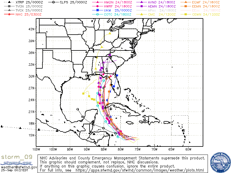
LarryWx wrote:0Z UKMET significantly south of the last two full runs with it landfalling FL now well south of Tampa:
MET OFFICE TROPICAL CYCLONE GUIDANCE FOR NORTH-EAST PACIFIC AND ATLANTIC
GLOBAL MODEL DATA TIME 0000UTC 25.09.2022
TROPICAL STORM IAN ANALYSED POSITION : 14.7N 76.9W
ATCF IDENTIFIER : AL092022
LEAD CENTRAL MAXIMUM WIND
VERIFYING TIME TIME POSITION PRESSURE (MB) SPEED (KNOTS)
-------------- ---- -------- ------------- -------------
0000UTC 25.09.2022 0 14.7N 76.9W 1006 28
1200UTC 25.09.2022 12 14.3N 79.4W 1004 25
0000UTC 26.09.2022 24 15.7N 80.6W 1001 31
1200UTC 26.09.2022 36 17.5N 82.2W 1000 33
0000UTC 27.09.2022 48 19.6N 83.0W 998 37
1200UTC 27.09.2022 60 21.8N 83.7W 995 36
0000UTC 28.09.2022 72 23.9N 83.9W 994 41
1200UTC 28.09.2022 84 25.4N 83.5W 992 49
0000UTC 29.09.2022 96 26.1N 83.2W 991 54
1200UTC 29.09.2022 108 26.6N 82.7W 991 49
0000UTC 30.09.2022 120 27.4N 82.0W 990 49
1200UTC 30.09.2022 132 28.6N 81.6W 990 43
0000UTC 01.10.2022 144 30.2N 81.0W 989 44
How far south is that if I may ask?


 Hurricanes:
