ATL: IAN - Post-Tropical - Discussion

Moderator: S2k Moderators

Message
Author
User avatar
toad strangler
S2K Supporter
S2K Supporter
Posts: 4543
Joined: Sun Jul 28, 2013 3:09 pm
Location: Earth
Contact:

Re: ATL: IAN - Tropical Storm - Discussion

#1321 Postby toad strangler » Sun Sep 25, 2022 8:23 am

johngaltfla wrote:
wxman57 wrote:No change in 12Z consensus = no change in NHC's 15Z track. I still think it'll be east of their track around Tampa and northward. Consensus is biased too far west by GFS/HWFF.


If we are talking about anything in/on the Pinellas County area, the NHC and Florida government will have to act this afternoon or at a minimum early this evening. To evacuate those vulnerable coastal areas will take 2 days at a minimum.

And with a gulf storm approaching from the southwest, there is no guarantee it will weaken at landfall. It is too early in the game to tell.


If I lived in a truly flood prone area out there, I wouldn’t need the government to tell me when to go. I’d be out of there already.
10 likes   

User avatar
johngaltfla
Category 5
Category 5
Posts: 2069
Joined: Sun Jul 10, 2005 9:17 pm
Location: Sarasota County, FL
Contact:

Re: ATL: IAN - Tropical Storm - Discussion

#1322 Postby johngaltfla » Sun Sep 25, 2022 8:30 am

toad strangler wrote:
johngaltfla wrote:
wxman57 wrote:No change in 12Z consensus = no change in NHC's 15Z track. I still think it'll be east of their track around Tampa and northward. Consensus is biased too far west by GFS/HWFF.


If we are talking about anything in/on the Pinellas County area, the NHC and Florida government will have to act this afternoon or at a minimum early this evening. To evacuate those vulnerable coastal areas will take 2 days at a minimum.

And with a gulf storm approaching from the southwest, there is no guarantee it will weaken at landfall. It is too early in the game to tell.


If I lived in a truly flood prone area out there, I wouldn’t need the government to tell me when to go. I’d be out of there already.


You have to understand the mindset over here because the Gulf coast here rarely gets a major hit. A lot of the people think that storm surge only impacts beachfront property. What they do not understand is that a Cat 3-4 slowing into the Bay area is the nightmare scenario for flooding when adding 15" plus of rain on top of it. This area is already saturated so more rain is only going to make things a lot worse in those neighborhoods which tend to flood. Not to mention the big risk of Ian doing a Charley and deciding to make a last minute right turn into the middle of Pinellas County instead of trucking up to Cedar Key.
12 likes   

wx98
Category 5
Category 5
Posts: 1383
Joined: Sat Aug 25, 2018 9:24 pm

Re: ATL: IAN - Tropical Storm - Discussion

#1323 Postby wx98 » Sun Sep 25, 2022 8:34 am

Recon planes still finding a very anemic storm.
3 likes   

User avatar
aspen
Category 5
Category 5
Posts: 8818
Joined: Sat Oct 12, 2019 7:10 pm
Location: Connecticut, USA

Re: ATL: IAN - Tropical Storm - Discussion

#1324 Postby aspen » Sun Sep 25, 2022 8:34 am

The wind/pressure gradient in Ian’s center looks much better during this most recent NOAA2 pass. Still a long way to go. Most of Ian’s convective activity has been away from the center and hasn’t allowed the MLC/LLC to fully stack nor strengthen much.
2 likes   
Irene '11 Sandy '12 Hermine '16 5/15/2018 Derecho Fay '20 Isaias '20 Elsa '21 Henri '21 Ida '21

I am only a meteorology enthusiast who knows a decent amount about tropical cyclones. Look to the professional mets, the NHC, or your local weather office for the best information.

User avatar
toad strangler
S2K Supporter
S2K Supporter
Posts: 4543
Joined: Sun Jul 28, 2013 3:09 pm
Location: Earth
Contact:

Re: ATL: IAN - Tropical Storm - Discussion

#1325 Postby toad strangler » Sun Sep 25, 2022 8:36 am

johngaltfla wrote:
toad strangler wrote:
johngaltfla wrote:
If we are talking about anything in/on the Pinellas County area, the NHC and Florida government will have to act this afternoon or at a minimum early this evening. To evacuate those vulnerable coastal areas will take 2 days at a minimum.

And with a gulf storm approaching from the southwest, there is no guarantee it will weaken at landfall. It is too early in the game to tell.


If I lived in a truly flood prone area out there, I wouldn’t need the government to tell me when to go. I’d be out of there already.


You have to understand the mindset over here because the Gulf coast here rarely gets a major hit. A lot of the people think that storm surge only impacts beachfront property. What they do not understand is that a Cat 3-4 slowing into the Bay area is the nightmare scenario for flooding when adding 15" plus of rain on top of it. This area is already saturated so more rain is only going to make things a lot worse in those neighborhoods which tend to flood. Not to mention the big risk of Ian doing a Charley and deciding to make a last minute right turn into the middle of Pinellas County instead of trucking up to Cedar Key.


The first thing I did before moving to FL years ago was to research flood zones and flooding history of the areas we wanted to be. Common sense isn’t significant trait in human beings though.
6 likes   

User avatar
Weatherboy1
Category 5
Category 5
Posts: 1189
Age: 49
Joined: Mon Jul 05, 2004 1:50 pm
Location: Jupiter/Sarasota, FL

Re: ATL: IAN - Tropical Storm - Discussion

#1326 Postby Weatherboy1 » Sun Sep 25, 2022 8:40 am

aspen wrote:The wind/pressure gradient in Ian’s center looks much better during this most recent NOAA2 pass. Still a long way to go. Most of Ian’s convective activity has been away from the center and hasn’t allowed the MLC/LLC to fully stack nor strengthen much.


The last few satellite frames show some convection firing off in the immediate vicinity of the center. Will need to persist and deepen to really crank the intensity, which is unfortunately what I expect to happen soon
1 likes   

User avatar
Iceresistance
Category 5
Category 5
Posts: 9288
Age: 21
Joined: Sat Oct 10, 2020 9:45 am
Location: Tecumseh, OK/Norman, OK

Re: ATL: IAN - Tropical Storm - Discussion

#1327 Postby Iceresistance » Sun Sep 25, 2022 8:40 am

Kinda did not expect Ian to look like this, but I know that he will explode in intensity as soon as he can stack up and move towards the extremely favorable area, the only question is when he will do it.

Eta and Iota generally looked like this 24-36 hours before they became powerful hurricanes.
Last edited by Iceresistance on Sun Sep 25, 2022 8:42 am, edited 1 time in total.
3 likes   
Bill 2015 & Beta 2020

Winter 2020-2021 :cold:

All observations are in Tecumseh, OK unless otherwise noted.

Winter posts are focused mainly for Oklahoma & Texas.

Take any of my forecasts with a grain of salt, refer to the NWS, SPC, and NHC for official information

Never say Never with weather! Because ANYTHING is possible!

User avatar
Jr0d
S2K Supporter
S2K Supporter
Posts: 1409
Joined: Tue Aug 27, 2019 10:52 am
Location: Cayo Hueso

Re: ATL: IAN - Tropical Storm - Discussion

#1328 Postby Jr0d » Sun Sep 25, 2022 8:41 am

Going to rely on points and how far Ian is away from those points now until until north of Key West to get an idea of how much of an impact we will likely experience.

First point was 15n 80w,(missed just right). Next point for me is 17N 81W, if it hits or misses right we can expect more of an impact, NHC official forecast is left of that point).

Ian appears to be moving NW now and not forecast to move due north until it clears Cuba, obviously if it turns NNW then N before Cuba, this is bad for me and the peninsula. As we know, the further south at land fall the stronger the storm will be.

Not a forecast by any means, but I am NOT expecting a panhandle landfall. My best guess is Fort Myers to Cedar Key. The angle of the storm.vs coastline make it impossible to narrow it down.

While obviously a much different set up, Charley hooking
right earlier than expected and strengthening comes to mind as a bad outlier
3 likes   

Category6
Tropical Depression
Tropical Depression
Posts: 79
Joined: Mon Sep 19, 2005 7:30 pm

Re: ATL: IAN - Tropical Storm - Discussion

#1329 Postby Category6 » Sun Sep 25, 2022 8:43 am

Is SE FL completely in the clear?
0 likes   

User avatar
cycloneye
Admin
Admin
Posts: 145318
Age: 68
Joined: Thu Oct 10, 2002 10:54 am
Location: San Juan, Puerto Rico

Re: ATL: IAN - Tropical Storm - Discussion

#1330 Postby cycloneye » Sun Sep 25, 2022 8:45 am

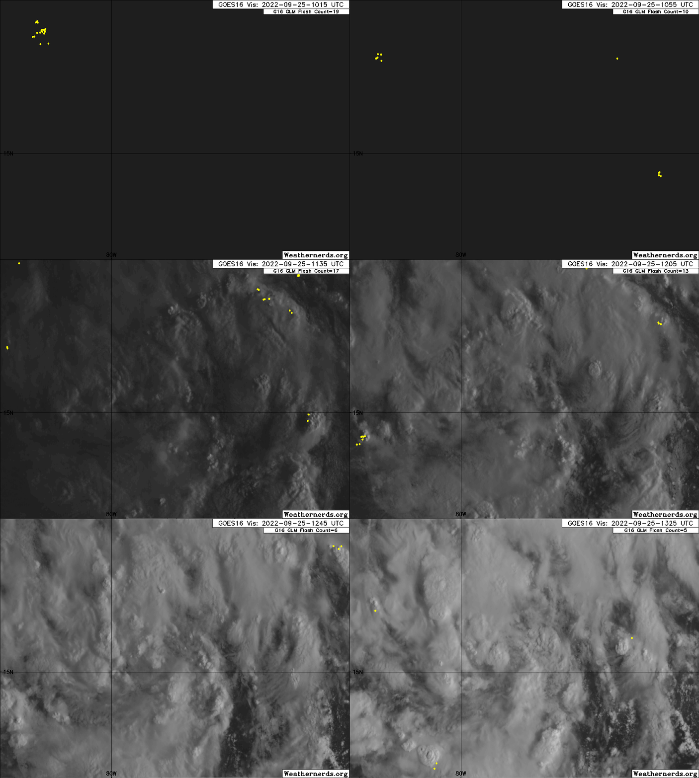
Closeup view of the low center trying to build core.

Image
7 likes   
Visit the Caribbean-Central America Weather Thread where you can find at first post web cams,radars
and observations from Caribbean basin members Click Here

User avatar
Blown Away
S2K Supporter
S2K Supporter
Posts: 10145
Joined: Wed May 26, 2004 6:17 am

Re: ATL: IAN - Tropical Storm - Discussion

#1331 Postby Blown Away » Sun Sep 25, 2022 8:45 am

Image

Seems to be consolidating @15.2N/79.6W.
4 likes   
Hurricane Eye Experience: David 79, Irene 99, Frances 04, Jeanne 04, Wilma 05... EYE COMING MY WAY IN 2024…
Hurricane Brush Experience: Andrew 92, Erin 95, Floyd 99, Matthew 16, Irma 17, Ian 22, Nicole 22…

User avatar
Weatherboy1
Category 5
Category 5
Posts: 1189
Age: 49
Joined: Mon Jul 05, 2004 1:50 pm
Location: Jupiter/Sarasota, FL

Re: ATL: IAN - Tropical Storm - Discussion

#1332 Postby Weatherboy1 » Sun Sep 25, 2022 8:46 am

Jr0d wrote:Going to rely on points and how far Ian is away from those points now until until north of Key West to get an idea of how much of an impact we will likely experience.

First point was 15n 80w,(missed just right). Next point for me is 17N 81W, if it hits or misses right we can expect more of an impact, NHC official forecast is left of that point).

Ian appears to be moving NW now and not forecast to move due north until it clears Cuba, obviously if it turns NNW then N before Cuba, this is bad for me and the peninsula. As we know, the further south at land fall the stronger the storm will be.

Not a forecast by any means, but I am NOT expecting a panhandle landfall. My best guess is Fort Myers to Cedar Key. The angle of the storm.vs coastline make it impossible to narrow it down.

While obviously a much different set up, Charley hooking
right earlier than expected and strengthening comes to mind as a bad outlier


My strong belief based on what I’m seeing out there is that IF Ian tracks in a direction out of line with the official forecast, it’ll be to the south and East not north and west. In other words, I think the chance is higher Ian landfalls south of, say, Tampa than well north
5 likes   

wx98
Category 5
Category 5
Posts: 1383
Joined: Sat Aug 25, 2018 9:24 pm

Re: ATL: IAN - Tropical Storm - Discussion

#1333 Postby wx98 » Sun Sep 25, 2022 8:50 am

Category6 wrote:Is SE FL completely in the clear?

Not in the clear for at least a couple more days. Right now, it isn’t the likely point of impact, but that could always change…
6 likes   

User avatar
Jr0d
S2K Supporter
S2K Supporter
Posts: 1409
Joined: Tue Aug 27, 2019 10:52 am
Location: Cayo Hueso

Re: ATL: IAN - Tropical Storm - Discussion

#1334 Postby Jr0d » Sun Sep 25, 2022 8:50 am

johngaltfla wrote:You have to understand the mindset over here because the Gulf coast here rarely gets a major hit. A lot of the people think that storm surge only impacts beachfront property. What they do not understand is that a Cat 3-4 slowing into the Bay area is the nightmare scenario for flooding when adding 15" plus of rain on top of it. This area is already saturated so more rain is only going to make things a lot worse in those neighborhoods which tend to flood. Not to mention the big risk of Ian doing a Charley and deciding to make a last minute right turn into the middle of Pinellas County instead of trucking up to Cedar Key.


We also have to consider the millions of new residents of the area who have never experienced a significant storm. Some go into full panic, while others get complacent after experincing over hyped weak storm(thank over sensational media sending storm trackers to minimum storms)

I could be wrong, but if this hooks right early like Charley, it will be more or less going with the upper level wind flow not fighting it and getting sheared as bad...this in my amatuer would limit the weakening currently forecast before land fall.
6 likes   

User avatar
Jr0d
S2K Supporter
S2K Supporter
Posts: 1409
Joined: Tue Aug 27, 2019 10:52 am
Location: Cayo Hueso

Re: ATL: IAN - Tropical Storm - Discussion

#1335 Postby Jr0d » Sun Sep 25, 2022 8:57 am

Weatherboy1 wrote:
My strong belief based on what I’m seeing out there is that IF Ian tracks in a direction out of line with the official forecast, it’ll be to the south and East not north and west. In other words, I think the chance is higher Ian landfalls south of, say, Tampa than well north


For sure!

I am currently limited by my cognitive "location" bias that is preventing me from seeing this clearly. I will subconsciously make assumptions or see things that bring Ian closer To Key West. Having those hit it miss points help me a little.

If I were to place bets for a landfall, it would be Tarpon Springs, with Ian hitting south being much more likely than missing north.
3 likes   

User avatar
johngaltfla
Category 5
Category 5
Posts: 2069
Joined: Sun Jul 10, 2005 9:17 pm
Location: Sarasota County, FL
Contact:

Re: ATL: IAN - Tropical Storm - Discussion

#1336 Postby johngaltfla » Sun Sep 25, 2022 8:57 am

Jr0d wrote:
johngaltfla wrote:You have to understand the mindset over here because the Gulf coast here rarely gets a major hit. A lot of the people think that storm surge only impacts beachfront property. What they do not understand is that a Cat 3-4 slowing into the Bay area is the nightmare scenario for flooding when adding 15" plus of rain on top of it. This area is already saturated so more rain is only going to make things a lot worse in those neighborhoods which tend to flood. Not to mention the big risk of Ian doing a Charley and deciding to make a last minute right turn into the middle of Pinellas County instead of trucking up to Cedar Key.


We also have to consider the millions of new residents of the area who have never experienced a significant storm. Some go into full panic, while others get complacent after experincing over hyped weak storm(thank over sensational media sending storm trackers to minimum storms)

I could be wrong, but if this hooks right early like Charley, it will be more or less going with the upper level wind flow not fighting it and getting sheared as bad...this in my amatuer would limit the weakening currently forecast before land fall.


The biggest problem is that since Charley, the population on the West Coast has doubled. The majority of the newcomers have arrived after Irma. So I would guess 40% have no clue as to how to behave. They see us crazy crackers and think its no big deal. I've not boarded up for a one and gone overboard for a 2 so they don't understand it's where you are located, wind direction, etc. I've tried to help a few with my experience, but based on what I saw yesterday at BJ's Wholesale (I wouldn't go near Sam's or Costco) and at WalMart, it is going to be insane when watches and warnings go up on Monday. I just hope that the NHC and state make evacuation recommendations this afternoon for the vulnerable coastal residents because a 4 to 10 foot storm surge is nothing to mess around with.
2 likes   

User avatar
Iceresistance
Category 5
Category 5
Posts: 9288
Age: 21
Joined: Sat Oct 10, 2020 9:45 am
Location: Tecumseh, OK/Norman, OK

Re: ATL: IAN - Tropical Storm - Discussion

#1337 Postby Iceresistance » Sun Sep 25, 2022 8:58 am

Category6 wrote:Is SE FL completely in the clear?


No, too much model uncertainty.
2 likes   
Bill 2015 & Beta 2020

Winter 2020-2021 :cold:

All observations are in Tecumseh, OK unless otherwise noted.

Winter posts are focused mainly for Oklahoma & Texas.

Take any of my forecasts with a grain of salt, refer to the NWS, SPC, and NHC for official information

Never say Never with weather! Because ANYTHING is possible!

jlauderdal
S2K Supporter
S2K Supporter
Posts: 7183
Joined: Wed May 19, 2004 5:46 am
Location: NE Fort Lauderdale
Contact:

Re: ATL: IAN - Tropical Storm - Discussion

#1338 Postby jlauderdal » Sun Sep 25, 2022 9:00 am

Jr0d wrote:Going to rely on points and how far Ian is away from those points now until until north of Key West to get an idea of how much of an impact we will likely experience.

First point was 15n 80w,(missed just right). Next point for me is 17N 81W, if it hits or misses right we can expect more of an impact, NHC official forecast is left of that point).

Ian appears to be moving NW now and not forecast to move due north until it clears Cuba, obviously if it turns NNW then N before Cuba, this is bad for me and the peninsula. As we know, the further south at land fall the stronger the storm will be.

Not a forecast by any means, but I am NOT expecting a panhandle landfall. My best guess is Fort Myers to Cedar Key. The angle of the storm.vs coastline make it impossible to narrow it down.

While obviously a much different set up, Charley hooking
right earlier than expected and strengthening comes to mind as a bad outlier


At a minimum, you should get a surge to deal with in KW. The problem with a storm like this is a few hours of wobble to the east and you have a power outage. We had a situation in sofla mid 2000's where we were hit with one big gust from a feeder band that knocked out power to 250,000 customers. Otherwise, it was sunny and we had less than an inch of rain from a gulf system.
1 likes   

User avatar
cheezyWXguy
Category 5
Category 5
Posts: 6108
Joined: Mon Feb 13, 2006 12:29 am
Location: Dallas, TX

Re: ATL: IAN - Tropical Storm - Discussion

#1339 Postby cheezyWXguy » Sun Sep 25, 2022 9:00 am

New tower has just popped right near the center, wonder what comes of this
1 likes   

User avatar
ScottNAtlanta
Category 5
Category 5
Posts: 2367
Joined: Sat May 25, 2013 3:11 pm
Location: Atlanta, GA

Re: ATL: IAN - Tropical Storm - Discussion

#1340 Postby ScottNAtlanta » Sun Sep 25, 2022 9:01 am

I'm surprised even with the synoptic data that NOAA got last night the EURO hasn't budged. They had a lot of new data that made it into the latest runs.
1 likes   
The posts in this forum are NOT official forecast and should not be used as such. They are just the opinion of the poster and may or may not be backed by sound meteorological data. They are NOT endorsed by any professional institution or storm2k.org. For official information, please refer to the NHC and NWS products.


Return to “2022”

Who is online

Users browsing this forum: No registered users and 19 guests