
EPAC: JULIA - Remnants - Discussion
Moderator: S2k Moderators
-
MHC Tracking
- Tropical Storm

- Posts: 203
- Joined: Mon Mar 15, 2021 10:05 am
Re: ATL: INVEST 91L - Discussion
Ian has demolished the oceanic heat over the eastern gulf and flooded the entire field in that region with dry air. Should a storm try to track that way going forward it will have vastly less fuel under the hood and likely a much less hospitable environment. If this thing develops and heads toward central America...it probably has a much higher ceiling..
3 likes
-
InfernoFlameCat

- Category 5

- Posts: 2127
- Age: 22
- Joined: Mon Dec 14, 2020 10:52 am
- Location: Buford, GA
Re: ATL: INVEST 91L - Discussion
This is producing a new burst at Dmin. Interesting. I am wondering if TCG has already begun.
6 likes
I am by no means a professional. DO NOT look at my forecasts for official information or make decisions based on what I post.
Goal: to become a registered expert over tropical and subtropical cyclones.
Goal: to become a registered expert over tropical and subtropical cyclones.
-
InfernoFlameCat
- Category 5
- Posts: 2127
- Age: 22
- Joined: Mon Dec 14, 2020 10:52 am
- Location: Buford, GA
Re: ATL: INVEST 91L - Discussion
Invest 91L is undergoing a favorable trough interaction right now. Rapid development is a possibility.
6 likes
I am by no means a professional. DO NOT look at my forecasts for official information or make decisions based on what I post.
Goal: to become a registered expert over tropical and subtropical cyclones.
Goal: to become a registered expert over tropical and subtropical cyclones.


Re: ATL: INVEST 91L - Discussion
This wave is already looking quite healthy, relatively speaking. Looking to see if the NHC bumps up genesis odds soon.
7 likes
-
MHC Tracking
- Tropical Storm
- Posts: 203
- Joined: Mon Mar 15, 2021 10:05 am
Re: ATL: INVEST 91L - Discussion
Beef Stew wrote:This wave is already looking quite healthy, relatively speaking. Looking to see if the NHC bumps up genesis odds soon.
I would expect 30/40, or even 40/50 at the 8 pm TWO
4 likes
-
SFLcane

- S2K Supporter

- Posts: 10281
- Age: 48
- Joined: Sat Jun 05, 2010 1:44 pm
- Location: Lake Worth Florida
Re: ATL: INVEST 91L - Discussion
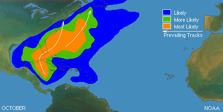
Not looking like a Conus problem at the moment a track towards Central America seems likely for now.
https://twitter.com/burgwx/status/1576658679310393345
https://twitter.com/burgwx/status/1576658679310393345
3 likes
-
Camerooski
- Tropical Low

- Posts: 47
- Joined: Wed Aug 08, 2018 5:40 pm
- Location: Lauderdale-By-the-Sea ---> Coral Gables
Re: ATL: INVEST 91L - Discussion
SFLcane wrote:Not looking like a Conus problem at the moment a track towards Central America seems likely.
https://twitter.com/burgwx/status/1576658679310393345?s=46&t=3CQs_axzxPQqgifvOOLE2A
I've been burned on long-range synoptic forecasts enough to know not to play this game. It's October, a digging trough is the usual climatological pattern here. Watch for the models to trend north in the long-range with time.
9 likes
-
Camerooski
- Tropical Low
- Posts: 47
- Joined: Wed Aug 08, 2018 5:40 pm
- Location: Lauderdale-By-the-Sea ---> Coral Gables
-
toad strangler

- S2K Supporter
- Posts: 4546
- Joined: Sun Jul 28, 2013 3:09 pm
- Location: Earth
- Contact:
Re: ATL: INVEST 91L - Discussion
Camerooski wrote:SFLcane wrote:Not looking like a Conus problem at the moment a track towards Central America seems likely.
https://twitter.com/burgwx/status/1576658679310393345?s=46&t=3CQs_axzxPQqgifvOOLE2A
I've been burned on long-range synoptic forecasts enough to know not to play this game. It's October, a digging trough is the usual climatological pattern here. Watch for the models to trend north in the long-range with time.
It doesn’t make any sense to invest in 10 day steering.
12 likes
My Weather Station
https://www.wunderground.com/dashboard/pws/KFLPORTS603
https://www.wunderground.com/dashboard/pws/KFLPORTS603
Re: ATL: INVEST 91L - Discussion
Camerooski wrote:SFLcane wrote:Not looking like a Conus problem at the moment a track towards Central America seems likely.
https://twitter.com/burgwx/status/1576658679310393345?s=46&t=3CQs_axzxPQqgifvOOLE2A
I've been burned on long-range synoptic forecasts enough to know not to play this game. It's October, a digging trough is the usual climatological pattern here. Watch for the models to trend north in the long-range with time.
Or it could just stay west like Iota, Eta, Mitch, Joan, Keith, etc. A track westward into Central America isn't unusual for this time of year.
4 likes
-
SFLcane
- S2K Supporter
- Posts: 10281
- Age: 48
- Joined: Sat Jun 05, 2010 1:44 pm
- Location: Lake Worth Florida
Re: ATL: INVEST 91L - Discussion
IcyTundra wrote:Camerooski wrote:SFLcane wrote:Not looking like a Conus problem at the moment a track towards Central America seems likely.
https://twitter.com/burgwx/status/1576658679310393345?s=46&t=3CQs_axzxPQqgifvOOLE2A
I've been burned on long-range synoptic forecasts enough to know not to play this game. It's October, a digging trough is the usual climatological pattern here. Watch for the models to trend north in the long-range with time.
Or it could just stay west like Iota, Eta, Mitch, Joan, Keith, etc. A track westward into Central America isn't unusual for this time of year.
A track into CA surely is not unusual the long range steering looks quiet a bit different then with Ian. Hope it sticks
3 likes
Re: ATL: INVEST 91L - Discussion
Looking at the TCHP form before Ian 9/20/2022 vs today 10/02/2022, it looks like Ian had very little effect on the area's potential with the exception of the path from the northern coast of Cuba and where Ian made landfall in Florida. ; heat-wise, to sustain a storm. Source: https://cwcgom.aoml.noaa.gov/cgom/OceanViewer/index_phod.html
I was going to ask if:
That cooler patch bisects the gulf stream so won't it be mixed out fairly quickly?
but I realized the area was already cooler than the surrounding water prior to Ian. Shouldn't that be warm due to the current? or is that typical?
09/20/2022

10/02/2022

However, it looks like if something were to head into the GOM it would be shredded. And that seems quite consistent between all models.
I was going to ask if:
That cooler patch bisects the gulf stream so won't it be mixed out fairly quickly?
but I realized the area was already cooler than the surrounding water prior to Ian. Shouldn't that be warm due to the current? or is that typical?
09/20/2022
10/02/2022
However, it looks like if something were to head into the GOM it would be shredded. And that seems quite consistent between all models.
0 likes
I am just an amateur and a "noob" at that so any speculations that I have made are just that, uneducated speculations. Please refer to the NHC for accurate information.
Thank you all for your thoughts, I've loved reading through this community since '06 and finally decided to post more actively.
-JJ
Thank you all for your thoughts, I've loved reading through this community since '06 and finally decided to post more actively.
-JJ
-
toad strangler
- S2K Supporter
- Posts: 4546
- Joined: Sun Jul 28, 2013 3:09 pm
- Location: Earth
- Contact:
Re: ATL: INVEST 91L - Discussion
SFLcane wrote:IcyTundra wrote:Camerooski wrote:
I've been burned on long-range synoptic forecasts enough to know not to play this game. It's October, a digging trough is the usual climatological pattern here. Watch for the models to trend north in the long-range with time.
Or it could just stay west like Iota, Eta, Mitch, Joan, Keith, etc. A track westward into Central America isn't unusual for this time of year.
A track into CA surely is not unusual the long range steering looks quiet a bit different then with Ian. Hope it sticks
It’s not unusual at all. If that was mentioned I missed it. It’s very plausible. But how many times have we said at some point….. uh … where did that trough come from? Not just in the Caribbean. Anywhere. We see it all the time when storms are modeled to plow west under strong Atlantic ridging only for a big weakness pop out of nowhere and off to the N Atlantic it goes. Too far out!
3 likes
My Weather Station
https://www.wunderground.com/dashboard/pws/KFLPORTS603
https://www.wunderground.com/dashboard/pws/KFLPORTS603
-
cycloneye

- Admin

- Posts: 149550
- Age: 69
- Joined: Thu Oct 10, 2002 10:54 am
- Location: San Juan, Puerto Rico
Re: ATL: INVEST 91L - Discussion
0 likes
Visit the Caribbean-Central America Weather Thread where you can find at first post web cams,radars
and observations from Caribbean basin members Click Here
and observations from Caribbean basin members Click Here
-
Sciencerocks
- Category 5
- Posts: 10186
- Age: 40
- Joined: Thu Jul 06, 2017 1:51 am
-
NotSparta

- Professional-Met

- Posts: 1677
- Age: 24
- Joined: Fri Aug 18, 2017 8:24 am
- Location: Naples, FL
- Contact:
Re: ATL: INVEST 91L - Discussion
Category5Kaiju wrote:kevin wrote:Another Caribbean cruiser, here we go again. As per tradition with these sort of invests on storm2k, here's my post saying 'this is gonna be a long thread'.
It really has been a while since we had that kind of system before (last real one was Felix back in 2007). Who knows what this thing will do...
This one won't be that kind either, would develop/strengthen too late
1 likes
This post was probably an opinion of mine, and in no way is official. Please refer to http://www.hurricanes.gov for official tropical analysis and advisories.
My website, with lots of tropical wx graphics, including satellite and recon: http://cyclonicwx.com
My website, with lots of tropical wx graphics, including satellite and recon: http://cyclonicwx.com
-
cycloneye
- Admin
- Posts: 149550
- Age: 69
- Joined: Thu Oct 10, 2002 10:54 am
- Location: San Juan, Puerto Rico
Re: ATL: INVEST 91L - Discussion
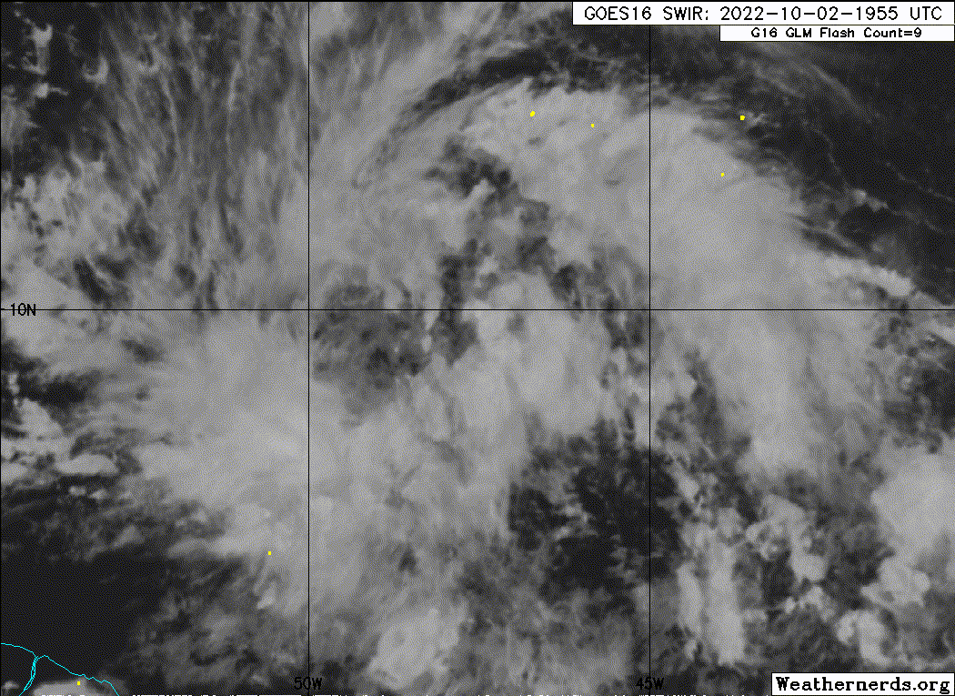
East of the Windward Islands:
Showers and thunderstorms are showing some signs of organization
in association with a tropical wave located several hundred miles
east of the Windward Islands. Further development of the wave
is possible, and a tropical depression could form during the next
few days while it moves generally westward at 15 to 20 mph,
reaching the Windward Islands and the eastern Caribbean Sea by
midweek.
* Formation chance through 48 hours...low...30 percent.
* Formation chance through 5 days...medium...40 percent.
3 likes
Visit the Caribbean-Central America Weather Thread where you can find at first post web cams,radars
and observations from Caribbean basin members Click Here
and observations from Caribbean basin members Click Here


Re: ATL: INVEST 91L - Discussion
NotSparta wrote:Category5Kaiju wrote:kevin wrote:Another Caribbean cruiser, here we go again. As per tradition with these sort of invests on storm2k, here's my post saying 'this is gonna be a long thread'.
It really has been a while since we had that kind of system before (last real one was Felix back in 2007). Who knows what this thing will do...
This one won't be that kind either, would develop/strengthen too late
Do you think this wave has much of a chance at all? Hardly any model support but that upper level environment looks pretty favorable.
0 likes
-
cheezyWXguy

- Category 5
- Posts: 6282
- Joined: Mon Feb 13, 2006 12:29 am
- Location: Dallas, TX
Re: ATL: INVEST 91L - Discussion
WiscoWx02 wrote:NotSparta wrote:Category5Kaiju wrote:
It really has been a while since we had that kind of system before (last real one was Felix back in 2007). Who knows what this thing will do...
This one won't be that kind either, would develop/strengthen too late
Do you think this wave has much of a chance at all? Hardly any model support but that upper level environment looks pretty favorable.
That’s not really correct, there’s decent amount of model support. The 18z gefs is a downtick, yes, but all 12z ensemble suites have at least some signal, and so do a number of ensemble runs before that. Going to need to see 0z runs of both ensemble and deterministic at minimum to determine if this is a fluke or an actual downtrend. I like the NHc’s odds for now though
3 likes
Who is online
Users browsing this forum: No registered users and 6 guests