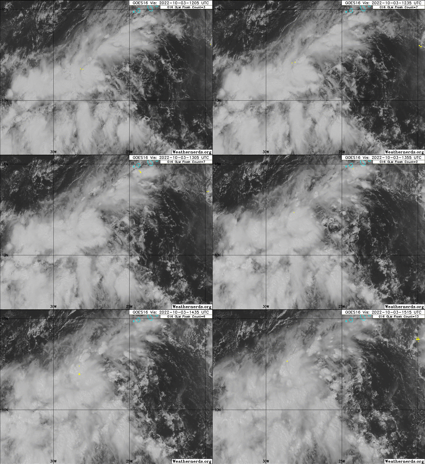
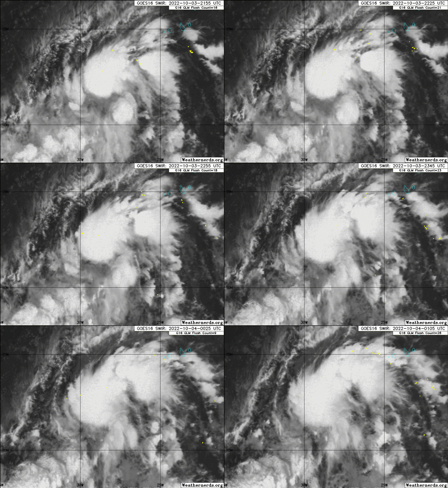
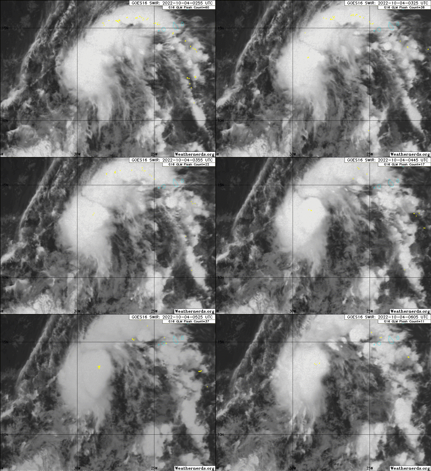
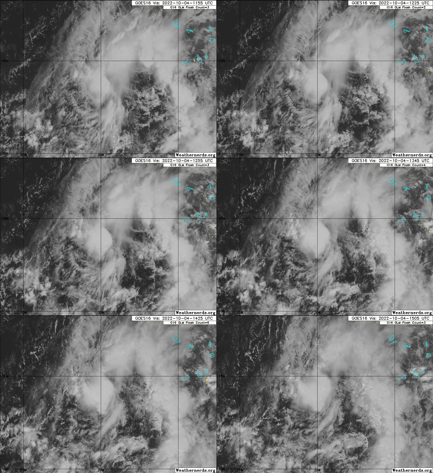
https://ftp.nhc.noaa.gov/atcf/btk/
ATL: TWELVE - Remnants - Discussion
Moderator: S2k Moderators
ATL: TWELVE - Remnants - Discussion
AL, 92, 2022100312, , BEST, 0, 113N, 264W, 20, 1011, DB, 34, NEQ, 0, 0, 0, 0, 1012, 180, 90, 0, 0, L, 0, , 0, 0, INVEST, S, 0, , 0, 0, 0, 0, genesis-num, 032, SPAWNINVEST, al752022 to al922022,
https://ftp.nhc.noaa.gov/atcf/btk/
0 likes
Re: ATL: INVEST 92L - Discussion
This might have some decent ACE potential if something like the 6z GFS verifies, and 92L survives all the way into the central Atlantic subtropics. Like with Hermine and Ian, it’ll probably be a close race to which one gets the next name on the list.
3 likes
Irene '11 Sandy '12 Hermine '16 5/15/2018 Derecho Fay '20 Isaias '20 Elsa '21 Henri '21 Ida '21
I am only a meteorology enthusiast who knows a decent amount about tropical cyclones. Look to the professional mets, the NHC, or your local weather office for the best information.
I am only a meteorology enthusiast who knows a decent amount about tropical cyclones. Look to the professional mets, the NHC, or your local weather office for the best information.
- Iceresistance
- Category 5

- Posts: 9608
- Age: 22
- Joined: Sat Oct 10, 2020 9:45 am
- Location: Tecumseh, OK/Norman, OK
Re: ATL: INVEST 92L - Discussion
ASCAT confirms a LLC on 92L
4 likes
Bill 2015 & Beta 2020
Winter 2020-2021
All observations are in Tecumseh, OK unless otherwise noted.
Winter posts are focused mainly for Oklahoma & Texas.
Take any of my forecasts with a grain of salt, refer to the NWS, SPC, and NHC for official information
Never say Never with weather! Because ANYTHING is possible!
Winter 2020-2021

All observations are in Tecumseh, OK unless otherwise noted.
Winter posts are focused mainly for Oklahoma & Texas.
Take any of my forecasts with a grain of salt, refer to the NWS, SPC, and NHC for official information
Never say Never with weather! Because ANYTHING is possible!
-
Sciencerocks
- Category 5

- Posts: 10193
- Age: 40
- Joined: Thu Jul 06, 2017 1:51 am
- ElectricStorm
- Category 5

- Posts: 5156
- Age: 25
- Joined: Tue Aug 13, 2019 11:23 pm
- Location: Norman, OK
Re: ATL: INVEST 92L - Discussion
This probably has a better chance of developing first and taking Julia. Hopefully we can get a nice OTS hurricane out of this.
2 likes
B.S Meteorology, University of Oklahoma '25
Please refer to the NHC, NWS, or SPC for official information.
Please refer to the NHC, NWS, or SPC for official information.
Re: ATL: INVEST 92L - Discussion
12z GFS and CMC both show 92L surviving the eastern Atlantic and getting into the central subtropics. This is the first model cycle with multiple OP models showing this solution.
3 likes
Irene '11 Sandy '12 Hermine '16 5/15/2018 Derecho Fay '20 Isaias '20 Elsa '21 Henri '21 Ida '21
I am only a meteorology enthusiast who knows a decent amount about tropical cyclones. Look to the professional mets, the NHC, or your local weather office for the best information.
I am only a meteorology enthusiast who knows a decent amount about tropical cyclones. Look to the professional mets, the NHC, or your local weather office for the best information.
- ElectricStorm
- Category 5

- Posts: 5156
- Age: 25
- Joined: Tue Aug 13, 2019 11:23 pm
- Location: Norman, OK
Re: ATL: INVEST 92L - Discussion
1. Eastern Tropical Atlantic:
Showers and thunderstorms have increased today in association with
an area of low pressure located a few hundred miles south-southwest
of the Cabo Verde Islands. Environmental conditions are conducive
for gradual development, and a tropical depression is likely to form
in a day or two. Further development will become less likely late
this week due to increasing upper-level winds. The system is
forecast to move west-northwestward and then turn northwestward by
mid-week over the eastern tropical Atlantic.
* Formation chance through 48 hours...medium...60 percent.
* Formation chance through 5 days...high...70 percent.
0 likes
B.S Meteorology, University of Oklahoma '25
Please refer to the NHC, NWS, or SPC for official information.
Please refer to the NHC, NWS, or SPC for official information.
- cycloneye
- Admin

- Posts: 149730
- Age: 69
- Joined: Thu Oct 10, 2002 10:54 am
- Location: San Juan, Puerto Rico
Re: ATL: INVEST 92L - Discussion
Eastern Tropical Atlantic:
Showers and thunderstorms continue to increase today near a broad
area of low pressure located a few hundred miles southwest of the
Cabo Verde Islands. Environmental conditions are conducive for
further development, and a tropical depression is likely to form
in a day or two. Further development should become less likely
late this week due to increasing upper-level winds. The system is
forecast to move generally northwestward over the eastern tropical
Atlantic.
* Formation chance through 48 hours...high...70 percent.
* Formation chance through 5 days...high...80 percent.
0 likes
Visit the Caribbean-Central America Weather Thread where you can find at first post web cams,radars
and observations from Caribbean basin members Click Here
and observations from Caribbean basin members Click Here
- cycloneye
- Admin

- Posts: 149730
- Age: 69
- Joined: Thu Oct 10, 2002 10:54 am
- Location: San Juan, Puerto Rico
Re: ATL: INVEST 92L - Discussion
Almost a TD.


3 likes
Visit the Caribbean-Central America Weather Thread where you can find at first post web cams,radars
and observations from Caribbean basin members Click Here
and observations from Caribbean basin members Click Here
Re: ATL: INVEST 92L - Discussion
TUTT dropping down on it might shear it so only a weak remnant makes it west to develop there.
0 likes
- Iceresistance
- Category 5

- Posts: 9608
- Age: 22
- Joined: Sat Oct 10, 2020 9:45 am
- Location: Tecumseh, OK/Norman, OK
Re: ATL: INVEST 92L - Discussion
5 likes
Bill 2015 & Beta 2020
Winter 2020-2021
All observations are in Tecumseh, OK unless otherwise noted.
Winter posts are focused mainly for Oklahoma & Texas.
Take any of my forecasts with a grain of salt, refer to the NWS, SPC, and NHC for official information
Never say Never with weather! Because ANYTHING is possible!
Winter 2020-2021

All observations are in Tecumseh, OK unless otherwise noted.
Winter posts are focused mainly for Oklahoma & Texas.
Take any of my forecasts with a grain of salt, refer to the NWS, SPC, and NHC for official information
Never say Never with weather! Because ANYTHING is possible!
-
Sciencerocks
- Category 5

- Posts: 10193
- Age: 40
- Joined: Thu Jul 06, 2017 1:51 am
-
Coolcruiseman
- Tropical Depression

- Posts: 97
- Age: 52
- Joined: Wed Sep 21, 2022 8:10 pm
- Location: Melbourne, FL
Re: ATL: INVEST 92L - Discussion
Where are the models saying what appears could be "Julia" is going to track? The recent NHC outlooks appear to show a potential westward track after going NW.
0 likes
- Category5Kaiju
- Category 5

- Posts: 4347
- Joined: Thu Dec 24, 2020 12:45 pm
- Location: Seattle during the summer, Phoenix during the winter
Re: ATL: INVEST 92L - Discussion
Coolcruiseman wrote:Where are the models saying what appears could be "Julia" is going to track? The recent NHC outlooks appear to show a potential westward track after going NW.
It is expected to make that steep northwestward turn, travel west for a bit, and then recurve well east of Bermuda. I'm fairly confident that this storm will not threaten any land at any point in its life.
0 likes
Unless explicitly stated, all information in my posts is based on my own opinions and observations. Tropical storms and hurricanes can be extremely dangerous. Refer to an accredited weather research agency or meteorologist if you need to make serious decisions regarding an approaching storm.
- ElectricStorm
- Category 5

- Posts: 5156
- Age: 25
- Joined: Tue Aug 13, 2019 11:23 pm
- Location: Norman, OK
Re: ATL: INVEST 92L - Discussion
Convection wise this looks like it's just about there. Maybe they're waiting for another ASCAT pass to confirm an LLC, but to me this looks like it's pretty close to a TD if it isn't one already
0 likes
B.S Meteorology, University of Oklahoma '25
Please refer to the NHC, NWS, or SPC for official information.
Please refer to the NHC, NWS, or SPC for official information.
-
Sciencerocks
- Category 5

- Posts: 10193
- Age: 40
- Joined: Thu Jul 06, 2017 1:51 am
- cycloneye
- Admin

- Posts: 149730
- Age: 69
- Joined: Thu Oct 10, 2002 10:54 am
- Location: San Juan, Puerto Rico
Re: ATL: INVEST 92L - Discussion
Eastern Tropical Atlantic:
A broad low pressure system located a few hundred miles
west-southwest of the Cabo Verde Islands continues to produce a
large area of showers and thunderstorms. Environmental conditions
are currently conducive for development, and a tropical depression
is likely to form during the next day or so while moving
northwestward at about 10 mph over the eastern tropical Atlantic.
Upper-level winds are expected to become less conducive for
development by Wednesday and Thursday.
* Formation chance through 48 hours...high...80 percent.
* Formation chance through 5 days...high...80 percent.
0 likes
Visit the Caribbean-Central America Weather Thread where you can find at first post web cams,radars
and observations from Caribbean basin members Click Here
and observations from Caribbean basin members Click Here
- cycloneye
- Admin

- Posts: 149730
- Age: 69
- Joined: Thu Oct 10, 2002 10:54 am
- Location: San Juan, Puerto Rico
Re: ATL: INVEST 92L - Discussion
AL, 92, 2022100412, , BEST, 0, 140N, 296W, 25, 1008, DB
0 likes
Visit the Caribbean-Central America Weather Thread where you can find at first post web cams,radars
and observations from Caribbean basin members Click Here
and observations from Caribbean basin members Click Here
- Iceresistance
- Category 5

- Posts: 9608
- Age: 22
- Joined: Sat Oct 10, 2020 9:45 am
- Location: Tecumseh, OK/Norman, OK
Re: ATL: INVEST 92L - Discussion
0 likes
Bill 2015 & Beta 2020
Winter 2020-2021
All observations are in Tecumseh, OK unless otherwise noted.
Winter posts are focused mainly for Oklahoma & Texas.
Take any of my forecasts with a grain of salt, refer to the NWS, SPC, and NHC for official information
Never say Never with weather! Because ANYTHING is possible!
Winter 2020-2021

All observations are in Tecumseh, OK unless otherwise noted.
Winter posts are focused mainly for Oklahoma & Texas.
Take any of my forecasts with a grain of salt, refer to the NWS, SPC, and NHC for official information
Never say Never with weather! Because ANYTHING is possible!
-
Sciencerocks
- Category 5

- Posts: 10193
- Age: 40
- Joined: Thu Jul 06, 2017 1:51 am
Who is online
Users browsing this forum: No registered users and 72 guests


