Possible Development Near the GA/Bahamas (Is Invest 98L)
Moderator: S2k Moderators
Forum rules

The posts in this forum are NOT official forecasts and should not be used as such. They are just the opinion of the poster and may or may not be backed by sound meteorological data. They are NOT endorsed by any professional institution or STORM2K. For official information, please refer to products from the National Hurricane Center and National Weather Service.
-
AtlanticWind

- S2K Supporter

- Posts: 1898
- Age: 67
- Joined: Sun Aug 08, 2004 9:57 pm
- Location: Plantation,Fla
Re: Possible Development Near the GA/Bahamas Early Next Week (50/80)
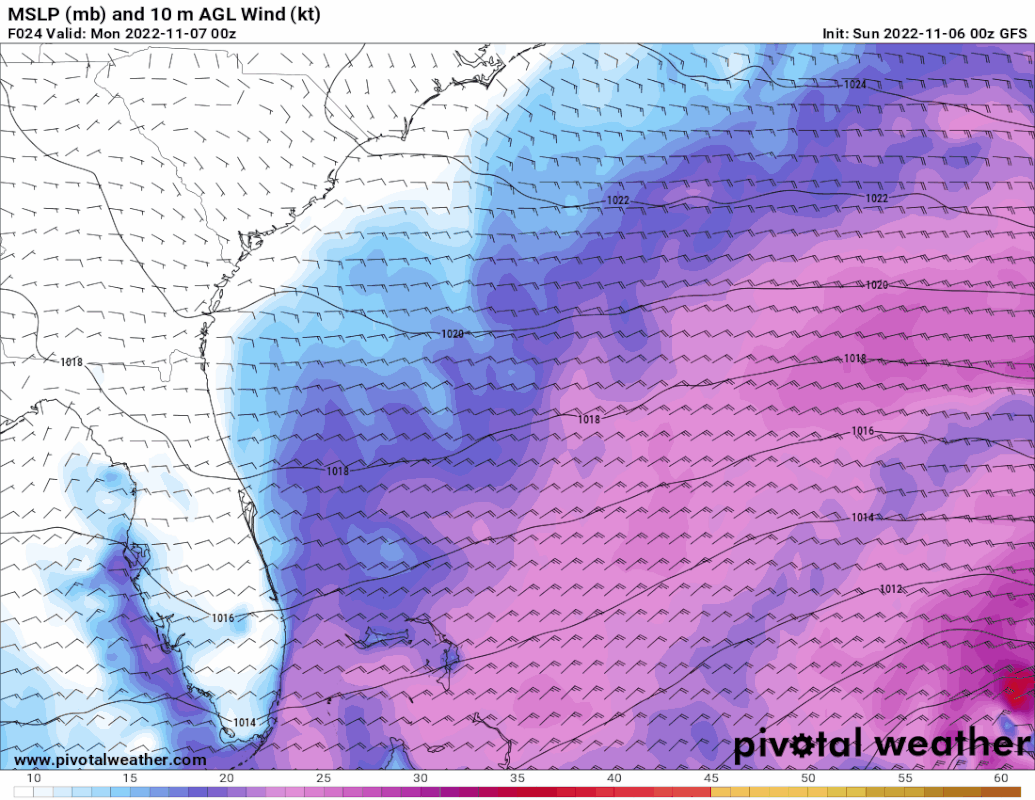
Almost all of the 18z GFS ensembles had the system landfalling in Florida unlike the operational
0 likes
-
eastcoastFL

- Category 5

- Posts: 3996
- Age: 44
- Joined: Thu Apr 12, 2007 12:29 pm
- Location: Palm City, FL
Re: Possible Development Near the GA/Bahamas Early Next Week (50/80)
GFS brings its pretty close to SFL before riding the coast just offshore. Kinda like Isaias.
L
L
0 likes
Personal Forecast Disclaimer:
The posts in this forum are NOT official forecast and should not be used as such. They are just the opinion of the poster and may or may not be backed by sound meteorological data. They are NOT endorsed by any professional institution or storm2k.org. For official information, please refer to the NHC and NWS products.
The posts in this forum are NOT official forecast and should not be used as such. They are just the opinion of the poster and may or may not be backed by sound meteorological data. They are NOT endorsed by any professional institution or storm2k.org. For official information, please refer to the NHC and NWS products.

Re: Possible Development Near the GA/Bahamas Early Next Week (50/80)
0z ICON trending stronger.

0 likes
Re: Possible Development Near the GA/Bahamas (50/80)
Strongest run yet by the GFS before getting close to FL.

0 likes


Re: Possible Development Near the GA/Bahamas (50/80)
Oh boy!

0 likes
The following post is NOT an official forecast and should not be used as such. It is just the opinion of the poster and may or may not be backed by sound meteorological data. It is NOT endorsed by any professional institution including storm2k.org For Official Information please refer to the NHC and NWS products.
-
SouthFLTropics

- Category 5
- Posts: 4258
- Age: 50
- Joined: Thu Aug 14, 2003 8:04 am
- Location: Port St. Lucie, Florida
Re: Possible Development Near the GA/Bahamas (50/80)
I think it is past time to declare this an invest… we need to see what the HWRF and HMON are going to do with this thing. I had to check the calendar to make sure it isn’t September.
Sent from my iPhone using Tapatalk
Sent from my iPhone using Tapatalk
1 likes
Fourth Generation Florida Native
Personal Storm History: David 79, Andrew 92, Erin 95, Floyd 99, Irene 99, Frances 04, Jeanne 04, Wilma 05, Matthew 16, Irma 17, Ian 22, Nicole 22, Milton 24
Personal Storm History: David 79, Andrew 92, Erin 95, Floyd 99, Irene 99, Frances 04, Jeanne 04, Wilma 05, Matthew 16, Irma 17, Ian 22, Nicole 22, Milton 24
-
Blown Away

- S2K Supporter
- Posts: 10253
- Joined: Wed May 26, 2004 6:17 am
Re: Possible Development Near the GA/Bahamas (50/80)
00z GFS… Much stronger, 969 mb at FL landfall…
0 likes
Hurricane Eye Experience: David 79, Irene 99, Frances 04, Jeanne 04, Wilma 05… Hurricane Brush Experience: Andrew 92, Erin 95, Floyd 99, Matthew 16, Irma 17, Ian 22, Nicole 22…
-
Blown Away
- S2K Supporter
- Posts: 10253
- Joined: Wed May 26, 2004 6:17 am
Re: Possible Development Near the GA/Bahamas (50/80)

00z GFS… Landfall in FL, Cat 2/3…
0 likes
Hurricane Eye Experience: David 79, Irene 99, Frances 04, Jeanne 04, Wilma 05… Hurricane Brush Experience: Andrew 92, Erin 95, Floyd 99, Matthew 16, Irma 17, Ian 22, Nicole 22…
Re: Possible Development Near the GA/Bahamas (50/80)
This is not what we wanted tonight, models trending stronger, tomorrow people are going to go nuts when it hits the news.
0 likes
-
CrazyC83
- Professional-Met

- Posts: 34315
- Joined: Tue Mar 07, 2006 11:57 pm
- Location: Deep South, for the first time!
Re: Possible Development Near the GA/Bahamas (50/80)
I'm surprised this isn't 98L yet. It feels like this could be one of those really, really weird systems.
4 likes


-
Blown Away
- S2K Supporter
- Posts: 10253
- Joined: Wed May 26, 2004 6:17 am
Re: Possible Development Near the GA/Bahamas (50/80)
CrazyC83 wrote:I'm surprised this isn't 98L yet. It feels like this could be one of those really, really weird systems.
00z GFS says landfall Thursday.
0 likes
Hurricane Eye Experience: David 79, Irene 99, Frances 04, Jeanne 04, Wilma 05… Hurricane Brush Experience: Andrew 92, Erin 95, Floyd 99, Matthew 16, Irma 17, Ian 22, Nicole 22…
-
AJC3

- Admin

- Posts: 4156
- Age: 62
- Joined: Tue Aug 31, 2004 7:04 pm
- Location: Ballston Spa, New York
- Contact:
Re: Possible Development Near the GA/Bahamas (50/80)
CrazyC83 wrote:I'm surprised this isn't 98L yet. It feels like this could be one of those really, really weird systems.
Yup...in other words, a typical November TC.
0 likes
Re: Possible Development Near the GA/Bahamas (50/80)
CMC big trend west and south with landfall closer to Daytona now.

0 likes
The following post is NOT an official forecast and should not be used as such. It is just the opinion of the poster and may or may not be backed by sound meteorological data. It is NOT endorsed by any professional institution including storm2k.org For Official Information please refer to the NHC and NWS products.
-
Category5Kaiju

- Category 5
- Posts: 4338
- Joined: Thu Dec 24, 2020 12:45 pm
- Location: Seattle during the summer, Phoenix during the winter
Re: Possible Development Near the GA/Bahamas (50/80)
2022 to peninsular Florida after nearly 2 decades of escaping major hurricane landfalls

5 likes
Unless explicitly stated, all information in my posts is based on my own opinions and observations. Tropical storms and hurricanes can be extremely dangerous. Refer to an accredited weather research agency or meteorologist if you need to make serious decisions regarding an approaching storm.
-
Blown Away
- S2K Supporter
- Posts: 10253
- Joined: Wed May 26, 2004 6:17 am
Re: Possible Development Near the GA/Bahamas (50/80)
blp wrote:CMC big trend west and south with landfall closer to Daytona now.
https://i.ibb.co/QFbd7XW/gem-z850-vort-seus-fh120-trend.gif

00z CMC… SW shift
0 likes
Hurricane Eye Experience: David 79, Irene 99, Frances 04, Jeanne 04, Wilma 05… Hurricane Brush Experience: Andrew 92, Erin 95, Floyd 99, Matthew 16, Irma 17, Ian 22, Nicole 22…
-
AdamFirst

- S2K Supporter
- Posts: 2490
- Age: 36
- Joined: Thu Aug 14, 2008 10:54 am
- Location: Port Saint Lucie, FL
Re: Possible Development Near the GA/Bahamas (50/80)
Well that GFS run has my attention... 
2 likes
Dolphins Marlins Canes Golden Panthers HEAT
Andrew 1992 - Irene 1999 - Frances 2004 - Jeanne 2004 - Wilma 2005 - Fay 2008 - Isaac 2012 - Matthew 2016 - Irma 2017 - Dorian 2019 - Ian 2022 - Nicole 2022 - Milton 2024
Andrew 1992 - Irene 1999 - Frances 2004 - Jeanne 2004 - Wilma 2005 - Fay 2008 - Isaac 2012 - Matthew 2016 - Irma 2017 - Dorian 2019 - Ian 2022 - Nicole 2022 - Milton 2024
-
AutoPenalti
- Category 5
- Posts: 4091
- Age: 29
- Joined: Mon Aug 17, 2015 4:16 pm
- Location: Ft. Lauderdale, Florida
Re: Possible Development Near the GA/Bahamas (50/80)
There’s a slight chance this pulls a hard right last second.
0 likes
The posts in this forum are NOT official forecasts and should not be used as such. They are just the opinion of the poster and may or may not be backed by sound meteorological data. They are NOT endorsed by any professional institution or STORM2K. For official information, please refer to products from the NHC and NWS.
Model Runs Cheat Sheet:
GFS (5:30 AM/PM, 11:30 AM/PM)
HWRF, GFDL, UKMET, NAVGEM (6:30-8:00 AM/PM, 12:30-2:00 AM/PM)
ECMWF (1:45 AM/PM)
TCVN is a weighted averaged
-
Blown Away
- S2K Supporter
- Posts: 10253
- Joined: Wed May 26, 2004 6:17 am
Re: Possible Development Near the GA/Bahamas (50/80)
00z ICON… W shift, landfall SC
0 likes
Hurricane Eye Experience: David 79, Irene 99, Frances 04, Jeanne 04, Wilma 05… Hurricane Brush Experience: Andrew 92, Erin 95, Floyd 99, Matthew 16, Irma 17, Ian 22, Nicole 22…
Who is online
Users browsing this forum: WaveBreaking and 169 guests