https://ftp.nhc.noaa.gov/atcf/btk/
ATL: INVEST 99L - Discussion
Moderator: S2k Moderators
ATL: INVEST 99L - Discussion
AL, 99, 2022120512, , BEST, 0, 251N, 553W, 30, 1004, DB, 34, NEQ, 0, 0, 0, 0, 1010, 360, 120, 0, 0, L, 0, , 0, 0, INVEST, M, 0, , 0, 0, 0, 0, genesis-num, 042, SPAWNINVEST, al762022 to al992022,
https://ftp.nhc.noaa.gov/atcf/btk/
0 likes
- Iceresistance
- Category 5

- Posts: 9581
- Age: 22
- Joined: Sat Oct 10, 2020 9:45 am
- Location: Tecumseh, OK/Norman, OK
Re: ATL: INVEST 99L - Discussion
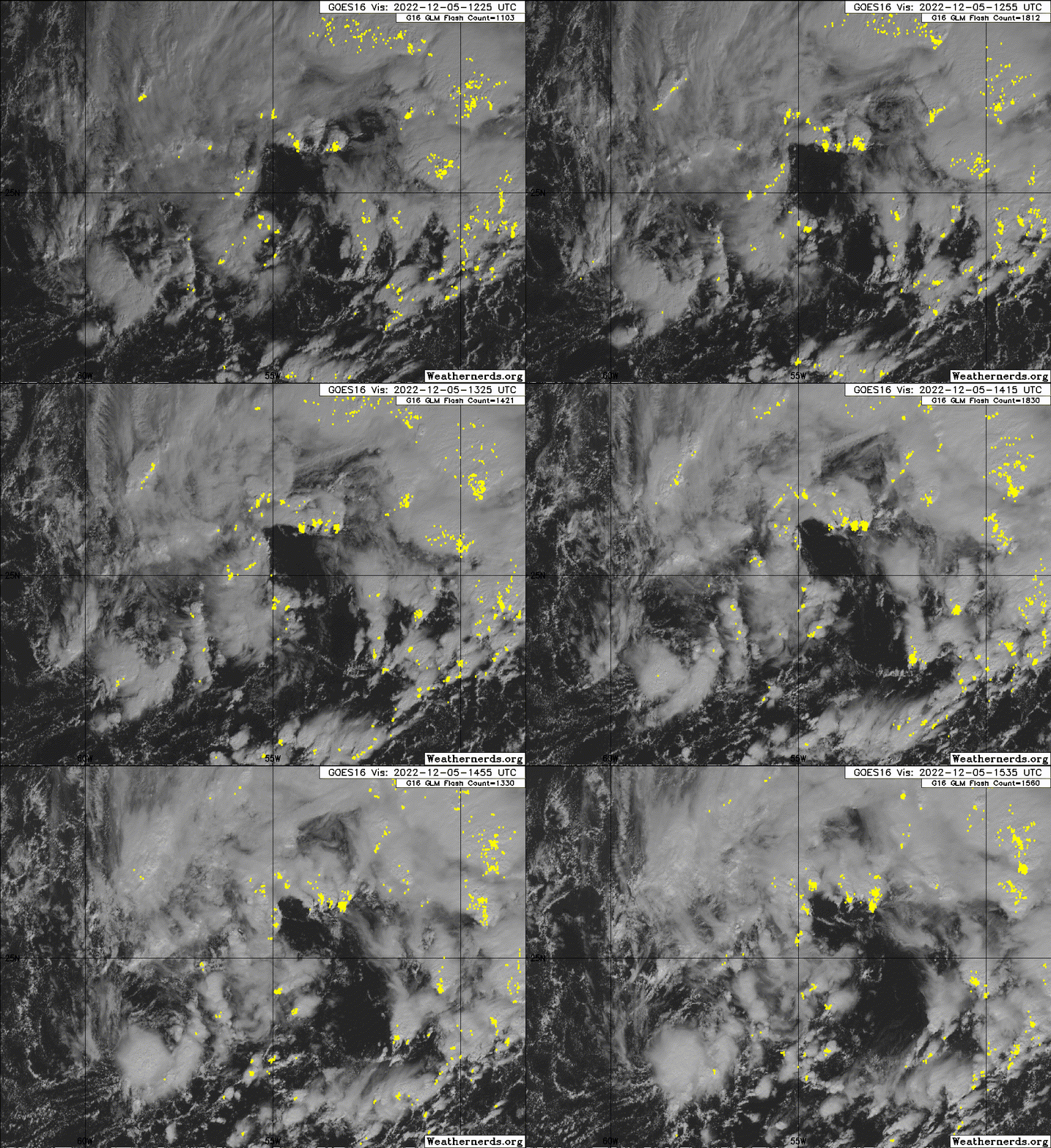
For the North Atlantic...Caribbean Sea and the Gulf of Mexico:
Special Tropical Weather Outlook issued to discuss the potential
for subtropical development this week over the central Atlantic.
1. A large area of low pressure located over the central subtropical
Atlantic about 750 miles northeast of the northern Leeward Islands
is producing disorganized showers and thunderstorms. Environmental
conditions appear conducive for this system to acquire some
subtropical characteristics while it drifts northeastward during the
next few days. By Thursday night or Friday, however, the low is
expected to move over cooler waters, ending its chances of becoming
a subtropical cyclone. Additional information on this system,
including gale warnings, can be found in High Seas Forecasts issued
by the National Weather Service. The next Special Tropical Weather
Outlook on this system will be issued by 9 PM EST today or
earlier.
* Formation chance through 48 hours...low...30 percent.
* Formation chance through 5 days...medium...40 percent.
0 likes
Bill 2015 & Beta 2020
Winter 2020-2021
All observations are in Tecumseh, OK unless otherwise noted.
Winter posts are focused mainly for Oklahoma & Texas.
Take any of my forecasts with a grain of salt, refer to the NWS, SPC, and NHC for official information
Never say Never with weather! Because ANYTHING is possible!
Winter 2020-2021

All observations are in Tecumseh, OK unless otherwise noted.
Winter posts are focused mainly for Oklahoma & Texas.
Take any of my forecasts with a grain of salt, refer to the NWS, SPC, and NHC for official information
Never say Never with weather! Because ANYTHING is possible!
- Hypercane_Kyle
- Category 5

- Posts: 3465
- Joined: Sat Mar 07, 2015 7:58 pm
- Location: Cape Canaveral, FL
Re: ATL: INVEST 99L - Discussion
This one has potential to be one of the strongest December storms we've ever seen should the models verify.
0 likes
My posts are my own personal opinion, defer to the National Hurricane Center (NHC) and other NOAA products for decision making during hurricane season.
-
Sciencerocks
- Category 5

- Posts: 10183
- Age: 40
- Joined: Thu Jul 06, 2017 1:51 am
- Hurricane2022
- Category 5

- Posts: 2018
- Joined: Tue Aug 23, 2022 11:38 pm
- Location: Araçatuba, Brazil
Re: ATL: INVEST 99L - Discussion
last few days i was just watching the world cup games and i didn't even notice that the models showed the possibility of a cyclone in the atlantic ocean this month, DECEMBER
2022 continues to surprise
2022 continues to surprise
Last edited by Hurricane2022 on Mon Dec 05, 2022 3:40 pm, edited 1 time in total.
0 likes
Sorry for the bad English sometimes...!
For reliable and detailed information for any meteorological phenomenon, please consult the National Hurricane Center, Joint Typhoon Warning Center , or your local Meteo Center.
--------
ECCE OMNIA NOVA FACIAM (Ap 21,5).
For reliable and detailed information for any meteorological phenomenon, please consult the National Hurricane Center, Joint Typhoon Warning Center , or your local Meteo Center.
--------
ECCE OMNIA NOVA FACIAM (Ap 21,5).
- AnnularCane
- S2K Supporter

- Posts: 2959
- Joined: Thu Jun 08, 2006 9:18 am
- Location: Wytheville, VA
Re: ATL: INVEST 99L - Discussion
A possible December baby, maybe?
(I didn't realize how many stickied threads the Active Storms forum had.)
(I didn't realize how many stickied threads the Active Storms forum had.)
0 likes
"But it never rained rain. It never snowed snow. And it never blew just wind. It rained things like soup and juice. It snowed mashed potatoes and green peas. And sometimes the wind blew in storms of hamburgers." -- Judi Barrett, Cloudy with a Chance of Meatballs
- cycloneye
- Admin

- Posts: 149369
- Age: 69
- Joined: Thu Oct 10, 2002 10:54 am
- Location: San Juan, Puerto Rico
Re: ATL: INVEST 99L - Discussion
Special Tropical Weather Outlook
NWS National Hurricane Center Miami FL
830 PM EST Mon Dec 5 2022
For the North Atlantic...Caribbean Sea and the Gulf of Mexico:
Special Tropical Weather Outlook issued to discuss the potential for
subtropical development this week over the central Atlantic.
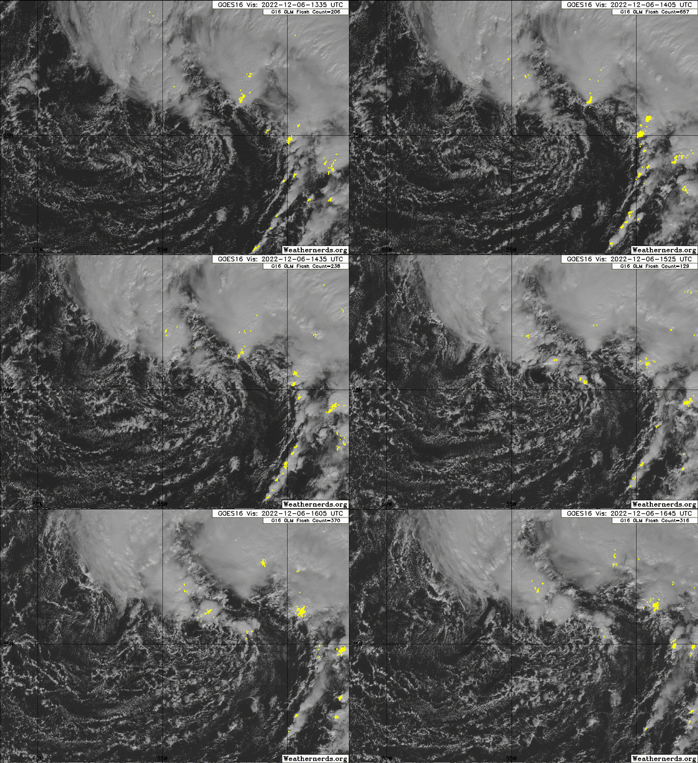
1. Central Subtropical Atlantic:
A large and complex area of low pressure located over the central
subtropical Atlantic about 800 miles northeast of the northern
Leeward Islands continues to produce a broad area of disorganized
showers and thunderstorms. Environmental conditions appear
conducive for this system to acquire some subtropical or tropical
characteristics while it meanders generally northeastward during the
next few days. By Friday, the low is expected to move over cooler
waters and interact with a mid-latitude trough, limiting potential
of tropical transition after that time. Additional information on
this system, including gale warnings, can be found in High Seas
Forecasts issued by the National Weather Service. The next Special
Tropical Weather Outlook on this system will be issued by 9 AM EST
Tuesday, or earlier, if necessary.
* Formation chance through 48 hours...medium...40 percent.
* Formation chance through 5 days...medium...50 percent.
1 likes
Visit the Caribbean-Central America Weather Thread where you can find at first post web cams,radars
and observations from Caribbean basin members Click Here
and observations from Caribbean basin members Click Here
- Hurricane2022
- Category 5

- Posts: 2018
- Joined: Tue Aug 23, 2022 11:38 pm
- Location: Araçatuba, Brazil
Re: ATL: INVEST 99L - Discussion
0 likes
Sorry for the bad English sometimes...!
For reliable and detailed information for any meteorological phenomenon, please consult the National Hurricane Center, Joint Typhoon Warning Center , or your local Meteo Center.
--------
ECCE OMNIA NOVA FACIAM (Ap 21,5).
For reliable and detailed information for any meteorological phenomenon, please consult the National Hurricane Center, Joint Typhoon Warning Center , or your local Meteo Center.
--------
ECCE OMNIA NOVA FACIAM (Ap 21,5).
- cycloneye
- Admin

- Posts: 149369
- Age: 69
- Joined: Thu Oct 10, 2002 10:54 am
- Location: San Juan, Puerto Rico
Re: ATL: INVEST 99L - Discussion
Special Tropical Weather Outlook
NWS National Hurricane Center Miami FL
845 AM EST Tue Dec 6 2022
For the North Atlantic...Caribbean Sea and the Gulf of Mexico:
Special Tropical Weather Outlook issued to discuss the potential for
subtropical development this week over the central Atlantic.
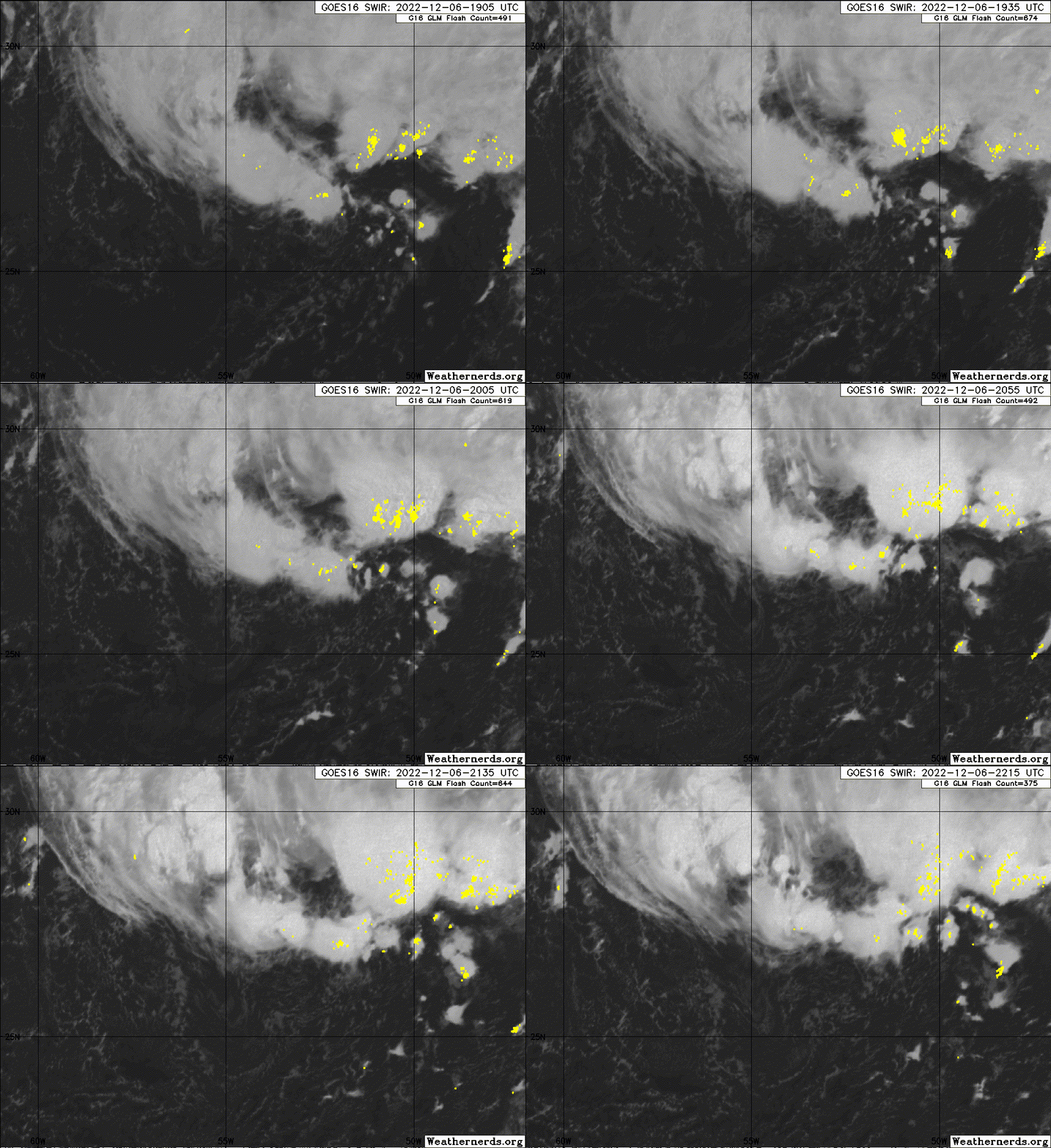
Central Subtropical Atlantic:
A large area of low pressure located over the central subtropical
Atlantic about 800 miles northeast of the northern Leeward Islands
continues to produce a broad area of showers and thunderstorms.
Environmental conditions appear marginally conducive for development
and a subtropical or tropical storm could form in the next couple of
days. By Thursday night or Friday, the low will move northeastward
over cooler waters and interact with a mid-latitude trough, limiting
subtropical or tropical development of the system. Additional
information on this low, including warnings, can be found in High
Seas Forecasts issued by the National Weather Service. The next
Special Tropical Weather Outlook on this system will be issued by 9
PM EST tonight, or earlier, if necessary.
* Formation chance through 48 hours...medium...50 percent.
* Formation chance through 5 days...medium...50 percent.
&&
High Seas Forecasts issued by the National Weather Service
can be found under AWIPS header NFDHSFAT1, WMO header FZNT01
KWBC, and online at ocean.weather.gov/shtml/NFDHSFAT1.php
$$
Forecaster Bucci/Pasch
0 likes
Visit the Caribbean-Central America Weather Thread where you can find at first post web cams,radars
and observations from Caribbean basin members Click Here
and observations from Caribbean basin members Click Here
-
tolakram
- Admin

- Posts: 20184
- Age: 62
- Joined: Sun Aug 27, 2006 8:23 pm
- Location: Florence, KY (name is Mark)
Re: ATL: INVEST 99L - Discussion
0 likes
M a r k
- - - - -
Join us in chat: Storm2K Chatroom Invite. Android and IOS apps also available.
The posts in this forum are NOT official forecasts and should not be used as such. Posts are NOT endorsed by any professional institution or STORM2K.org. For official information and forecasts, please refer to NHC and NWS products.
Re: ATL: INVEST 99L - Discussion
0 likes
-
Sciencerocks
- Category 5

- Posts: 10183
- Age: 40
- Joined: Thu Jul 06, 2017 1:51 am
- Iceresistance
- Category 5

- Posts: 9581
- Age: 22
- Joined: Sat Oct 10, 2020 9:45 am
- Location: Tecumseh, OK/Norman, OK
Re: ATL: INVEST 99L - Discussion
If 99L forms into a STD/S or TD/S, it will be the first ATL December since (ironically) 2013.
0 likes
Bill 2015 & Beta 2020
Winter 2020-2021
All observations are in Tecumseh, OK unless otherwise noted.
Winter posts are focused mainly for Oklahoma & Texas.
Take any of my forecasts with a grain of salt, refer to the NWS, SPC, and NHC for official information
Never say Never with weather! Because ANYTHING is possible!
Winter 2020-2021

All observations are in Tecumseh, OK unless otherwise noted.
Winter posts are focused mainly for Oklahoma & Texas.
Take any of my forecasts with a grain of salt, refer to the NWS, SPC, and NHC for official information
Never say Never with weather! Because ANYTHING is possible!
Re: ATL: INVEST 99L - Discussion
Looks like the center is now under the convection and the convection is increasing.
GOES-16 Proxy Visible + IR
Source - https://col.st/CFITT
GOES-16 Proxy Visible + IR
Source - https://col.st/CFITT
1 likes
Re: ATL: INVEST 99L - Discussion
Iceresistance wrote:If 99L forms into a STD/S or TD/S, it will be the first ATL December since (ironically) 2013.
The "2013 all over again" takes will have gotten at least one point right
6 likes
The above post is not official and should not be used as such. It is the opinion of the poster and may or may not be backed by sound meteorological data. It is not endorsed by any professional institution or storm2k.org. For official information, please refer to the NHC and NWS products.
-
Sciencerocks
- Category 5

- Posts: 10183
- Age: 40
- Joined: Thu Jul 06, 2017 1:51 am
- cycloneye
- Admin

- Posts: 149369
- Age: 69
- Joined: Thu Oct 10, 2002 10:54 am
- Location: San Juan, Puerto Rico
Re: ATL: INVEST 99L - Discussion
Special Tropical Weather Outlook
NWS National Hurricane Center Miami FL
830 AM EST Wed Dec 7 2022
For the North Atlantic...Caribbean Sea and the Gulf of Mexico:
Special Tropical Weather Outlook issued to discuss the potential for
subtropical development over the central Atlantic.
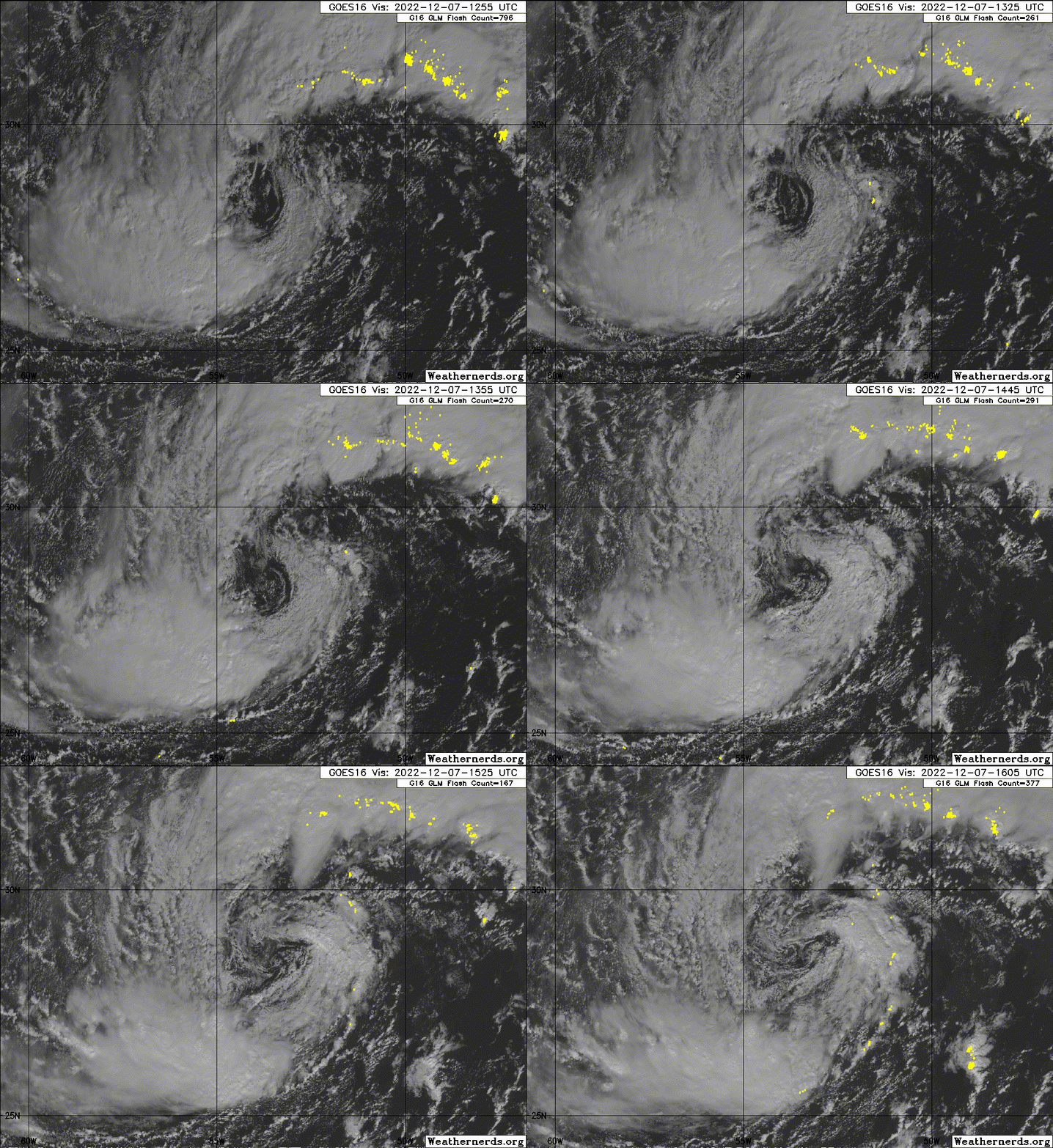
1. Central Subtropical Atlantic:
A large non-tropical area of low pressure located over the central
subtropical Atlantic about 900 miles northeast of the northern
Leeward Islands continues to produce a large area of showers and
thunderstorms. This activity has become somewhat better organized
this morning, though frontal features remain attached to the low.
Environmental conditions appear marginally conducive for development
and a subtropical or tropical storm could form within the next day
or so. By Friday, the low will move northeastward over cooler
waters and interact with a mid-latitude trough, limiting the chance
for additional subtropical or tropical development of the system.
Additional information on this low, including warnings, can be found
in High Seas Forecasts issued by the National Weather Service. The
next Special Tropical Weather Outlook on this system will be issued
by 9 PM EST Wednesday, or earlier, if necessary.
* Formation chance through 48 hours...medium...50 percent.
* Formation chance through 5 days...medium...50 percent.
High Seas Forecasts issued by the National Weather Service
can be found under AWIPS header NFDHSFAT1, WMO header FZNT01
KWBC, and online at ocean.weather.gov/shtml/NFDHSFAT1.php
Forecaster Papin
0 likes
Visit the Caribbean-Central America Weather Thread where you can find at first post web cams,radars
and observations from Caribbean basin members Click Here
and observations from Caribbean basin members Click Here
-
Sciencerocks
- Category 5

- Posts: 10183
- Age: 40
- Joined: Thu Jul 06, 2017 1:51 am
-
PavelGaborik10
- Category 1

- Posts: 472
- Joined: Tue Sep 04, 2018 3:23 pm
Who is online
Users browsing this forum: No registered users and 17 guests


