Based on incoming 12z model guidance, I like what I'm seeing in terms of trends for Thursday and Friday across portions of SC TX and the SA metro specifically. If we can get that frontal boundary to stall/slow just bit more, we could see a nice setup/soaking (1-2 inches) and perhaps even some isolated pockets of higher rainfall amounts.
Trend has been further west/north with time. Interesting to note that SPC has the SA metro in a marginal risk for severe weather (hail) on Thursday as well.
Texas Spring 2023
Moderator: S2k Moderators
Forum rules

The posts in this forum are NOT official forecast and should not be used as such. They are just the opinion of the poster and may or may not be backed by sound meteorological data. They are NOT endorsed by any professional institution or STORM2K.
-
txtwister78

- Category 5

- Posts: 2176
- Joined: Wed Jan 30, 2019 12:56 pm
- Location: San Antonio
Re: Texas Spring 2023
4 likes


Re: Texas Spring 2023
Keep the faith my friends. Those in the coastal plains (SE and S-C Texas will be first) with the initial wetter pattern. The rest of the state will kick in the further into April we go and eastern ridge transpires. WWB in the WPAC with linkage is favorable for us. This is no 2022.

This will also set up a severe-outbreak type-ish pattern further west than of recent and may (pun intended) be of note in a few weeks.
Ntxw wrote:Even with the coolish mid month stretch March will finish above normal for most of us. QPF slight below normal (south) to near normal (north). April will likely feature better rain chances as rising motion appears over the Pacific courtesy of emerging MJO signal that will constructively interfere. Wetter regime probably emanates first along the coastal plain.
Later into April and May may 'feel' more like an El Nino with qpf chances every few days.
This will also set up a severe-outbreak type-ish pattern further west than of recent and may (pun intended) be of note in a few weeks.
4 likes
The above post and any post by Ntxw is NOT an official forecast and should not be used as such. It is just the opinion of the poster and may or may not be backed by sound meteorological data. It is NOT endorsed by any professional institution including Storm2k. For official information, please refer to NWS products.
Help support Storm2K!
-
South Texas Storms

- Professional-Met

- Posts: 4256
- Joined: Thu Jun 24, 2010 12:28 am
- Location: Houston, TX
Re: Texas Spring 2023
txtwister78 wrote:Based on incoming 12z model guidance, I like what I'm seeing in terms of trends for Thursday and Friday across portions of SC TX and the SA metro specifically. If we can get that frontal boundary to stall/slow just bit more, we could see a nice setup/soaking (1-2 inches) and perhaps even some isolated pockets of higher rainfall amounts.
Trend has been further west/north with time. Interesting to note that SPC has the SA metro in a marginal risk for severe weather (hail) on Thursday as well.
Agreed, this is looking like our best rain set up in quite some time...hopefully it verifies! I'm thinking 1-3 inches is a reasonable rainfall forecast for SA and Austin right now. 2-4 inches in Houston and southeast TX.
3 likes
Re: Texas Spring 2023
South Texas Storms wrote:txtwister78 wrote:Based on incoming 12z model guidance, I like what I'm seeing in terms of trends for Thursday and Friday across portions of SC TX and the SA metro specifically. If we can get that frontal boundary to stall/slow just bit more, we could see a nice setup/soaking (1-2 inches) and perhaps even some isolated pockets of higher rainfall amounts.
Trend has been further west/north with time. Interesting to note that SPC has the SA metro in a marginal risk for severe weather (hail) on Thursday as well.
Agreed, this is looking like our best rain set up in quite some time...hopefully it verifies! I'm thinking 1-3 inches is a reasonable rainfall forecast for SA and Austin right now. 2-4 inches in Houston and southeast TX.
If the overall synoptic pattern cooperates accordingly, parts of our region should see even higher totals than this. Like Ntwx said, those Pacific Ocean WWB will help our cause in the long run. I know it’s been very dry, but I still feel good about our rainfall chances going forward through the rest of this Spring and possibly through the Summer months, if the teleconnections play along as well.
Last edited by 869MB on Wed Apr 05, 2023 8:37 pm, edited 1 time in total.
2 likes
-
Iceresistance

- Category 5
- Posts: 9581
- Age: 22
- Joined: Sat Oct 10, 2020 9:45 am
- Location: Tecumseh, OK/Norman, OK
Re: Texas Spring 2023
Why April? Why do you have highs in the 80s and lows in the 60s? Do you want June already?
(Well, I am worried about extreme moisture fuel for Supercells when the lull comes to an end)
(Well, I am worried about extreme moisture fuel for Supercells when the lull comes to an end)
0 likes
Bill 2015 & Beta 2020
Winter 2020-2021
All observations are in Tecumseh, OK unless otherwise noted.
Winter posts are focused mainly for Oklahoma & Texas.
Take any of my forecasts with a grain of salt, refer to the NWS, SPC, and NHC for official information
Never say Never with weather! Because ANYTHING is possible!
Winter 2020-2021
All observations are in Tecumseh, OK unless otherwise noted.
Winter posts are focused mainly for Oklahoma & Texas.
Take any of my forecasts with a grain of salt, refer to the NWS, SPC, and NHC for official information
Never say Never with weather! Because ANYTHING is possible!
-
bubba hotep

- S2K Supporter

- Posts: 6014
- Joined: Wed Dec 28, 2016 1:00 am
- Location: Collin County Texas
Re: Texas Spring 2023
Watching the dryline bulge SW of DFW to see if we can get a storm to fire. All hazards would quickly be in play if something can break the cap.
1 likes
Winter time post are almost exclusively focused on the DFW area.
Re: Texas Spring 2023
Meso analysis has some pretty big parameters in place. Big ? tonight is what can fire. Any that do will be severe. It may be early morning hours. Southern and eastern zones of DFW may have to be on the lookout.
2 likes
The above post and any post by Ntxw is NOT an official forecast and should not be used as such. It is just the opinion of the poster and may or may not be backed by sound meteorological data. It is NOT endorsed by any professional institution including Storm2k. For official information, please refer to NWS products.
Help support Storm2K!
Help support Storm2K!
-
txtwister78
- Category 5
- Posts: 2176
- Joined: Wed Jan 30, 2019 12:56 pm
- Location: San Antonio
Re: Texas Spring 2023
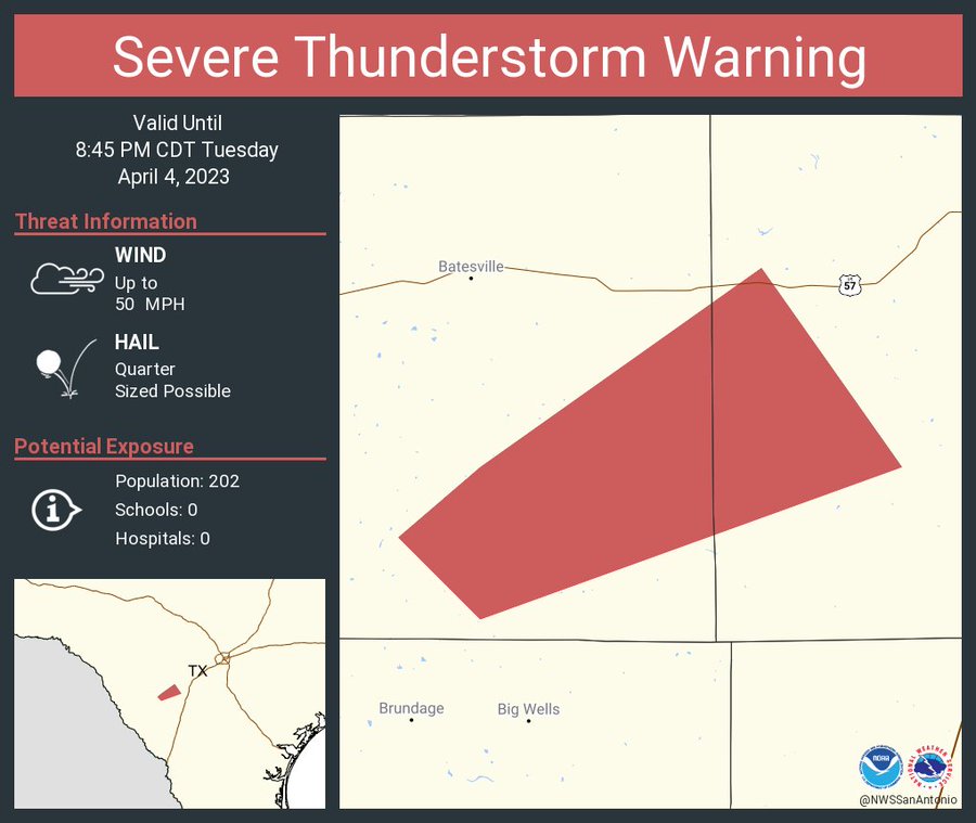
Storms developing SW of SA moving NE. Could see some "bonus" rainfall tonight.
2 likes
-
bubba hotep
- S2K Supporter
- Posts: 6014
- Joined: Wed Dec 28, 2016 1:00 am
- Location: Collin County Texas
Re: Texas Spring 2023
txtwister78 wrote:Storms developing SW of SA moving NE. Could see some "bonus" rainfall tonight.
Now warned.
0 likes
Winter time post are almost exclusively focused on the DFW area.
-
bubba hotep
- S2K Supporter
- Posts: 6014
- Joined: Wed Dec 28, 2016 1:00 am
- Location: Collin County Texas
Re: Texas Spring 2023
00z HRRR puts a pretty nice line of storms together later this evening.

0 likes
Winter time post are almost exclusively focused on the DFW area.
-
Iceresistance
- Category 5
- Posts: 9581
- Age: 22
- Joined: Sat Oct 10, 2020 9:45 am
- Location: Tecumseh, OK/Norman, OK
Re: Texas Spring 2023
Can San Antonio become the Hailstorm Capital for Texas?
1 likes
Bill 2015 & Beta 2020
Winter 2020-2021
All observations are in Tecumseh, OK unless otherwise noted.
Winter posts are focused mainly for Oklahoma & Texas.
Take any of my forecasts with a grain of salt, refer to the NWS, SPC, and NHC for official information
Never say Never with weather! Because ANYTHING is possible!
Winter 2020-2021
All observations are in Tecumseh, OK unless otherwise noted.
Winter posts are focused mainly for Oklahoma & Texas.
Take any of my forecasts with a grain of salt, refer to the NWS, SPC, and NHC for official information
Never say Never with weather! Because ANYTHING is possible!
-
bubba hotep
- S2K Supporter
- Posts: 6014
- Joined: Wed Dec 28, 2016 1:00 am
- Location: Collin County Texas
Re: Texas Spring 2023
Cell SW of SA has gone through a series of mergers and is now a massive supercell! If it holds together, then there could be some significant hail for portions of SA. Latest warning indicates tennis ball size hail.
1 likes
Winter time post are almost exclusively focused on the DFW area.
-
txtwister78
- Category 5
- Posts: 2176
- Joined: Wed Jan 30, 2019 12:56 pm
- Location: San Antonio
Re: Texas Spring 2023
bubba hotep wrote:Cell SW of SA has gone through a series of mergers and is now a massive supercell! If it holds together, then there could be some significant hail for portions of SA. Latest warning indicates tennis ball size hail.
Yup mean 52kft. Last few scans show hail core growing. NWS saying baseball size hail with it. Definitely not a good trend for the metro. Hopefully we see some weakening soon.
https://twitter.com/NWSSanAntonio/status/1643432232076591104
1 likes
-
bubba hotep
- S2K Supporter
- Posts: 6014
- Joined: Wed Dec 28, 2016 1:00 am
- Location: Collin County Texas
Re: Texas Spring 2023
Looks like that hail core is going to go right over Moore, TX.
0 likes
Winter time post are almost exclusively focused on the DFW area.
-
txtwister78
- Category 5
- Posts: 2176
- Joined: Wed Jan 30, 2019 12:56 pm
- Location: San Antonio
Re: Texas Spring 2023
bubba hotep wrote:Looks like that hail core is going to go right over Moore, TX.
Yup. Good news is we've seen some weakening though over the last few minutes. Loss of daytime heating hopefully will help to stabilize environment just enough to lower severe threat for SA.
0 likes
-
South Texas Storms
- Professional-Met
- Posts: 4256
- Joined: Thu Jun 24, 2010 12:28 am
- Location: Houston, TX
Re: Texas Spring 2023
txtwister78 wrote:bubba hotep wrote:Looks like that hail core is going to go right over Moore, TX.
Yup. Good news is we've seen some weakening though over the last few minutes. Loss of daytime heating hopefully will help to stabilize environment just enough to lower severe threat for SA.
Unfortunately it weakened a little too much and now there is not much rain from it in SA...
1 likes
-
Edwards Limestone

- S2K Supporter
- Posts: 510
- Age: 36
- Joined: Tue Dec 28, 2021 11:05 am
- Location: Smithson Valley, TX
Re: Texas Spring 2023
The SA forcefield wins again. 
1 likes
The above post is NOT an official forecast and should not be used as such. It is just the opinion of the poster and may or may not be backed by sound meteorological data. It is NOT endorsed by any professional institution including Storm2k. For official information, please refer to NWS products.
-
Brent
- S2K Supporter
- Posts: 38740
- Age: 37
- Joined: Sun May 16, 2004 10:30 pm
- Location: Tulsa Oklahoma
- Contact:
Re: Texas Spring 2023
Concerning trend up here too... After tonight it's basically just warm and dry for the next 10 days what happened to the wet pattern?
We aren't out of the woods yet... The 2011 analog keeps floating around in the records
what happened to the wet pattern?We aren't out of the woods yet... The 2011 analog keeps floating around in the records
0 likes
#neversummer
-
HockeyTx82
- S2K Supporter
- Posts: 2791
- Joined: Tue Oct 27, 2009 11:17 am
- Location: Ponder, TX
Re: Texas Spring 2023
What's going on with the radar out west of DFW?
0 likes
Don't hold me accountable for anything I post on this forum. Leave the real forecasting up to the professionals.
Location: Ponder, TX (all observation posts are this location unless otherwise noted)
Location: Ponder, TX (all observation posts are this location unless otherwise noted)
-
HockeyTx82
- S2K Supporter
- Posts: 2791
- Joined: Tue Oct 27, 2009 11:17 am
- Location: Ponder, TX
Re: Texas Spring 2023
HockeyTx82 wrote:What's going on with the radar out west of DFW?
Look out by Vernon. I actually just called NWS San Angelo. It appears the wind farms are returning rotation signatures.
I was very confused
0 likes
Don't hold me accountable for anything I post on this forum. Leave the real forecasting up to the professionals.
Location: Ponder, TX (all observation posts are this location unless otherwise noted)
Location: Ponder, TX (all observation posts are this location unless otherwise noted)
Return to “USA & Caribbean Weather”
Who is online
Users browsing this forum: No registered users and 71 guests