
Good chance that the recon will find at least a TD this afternoon if storms maintain during the day.

Moderator: S2k Moderators


NDG wrote:Up to 50% this morning.
BNT20 KNHC 011145
TWOAT
Tropical Weather Outlook
NWS National Hurricane Center Miami FL
800 AM EDT Thu Jun 1 2023
For the North Atlantic...Caribbean Sea and the Gulf of Mexico:
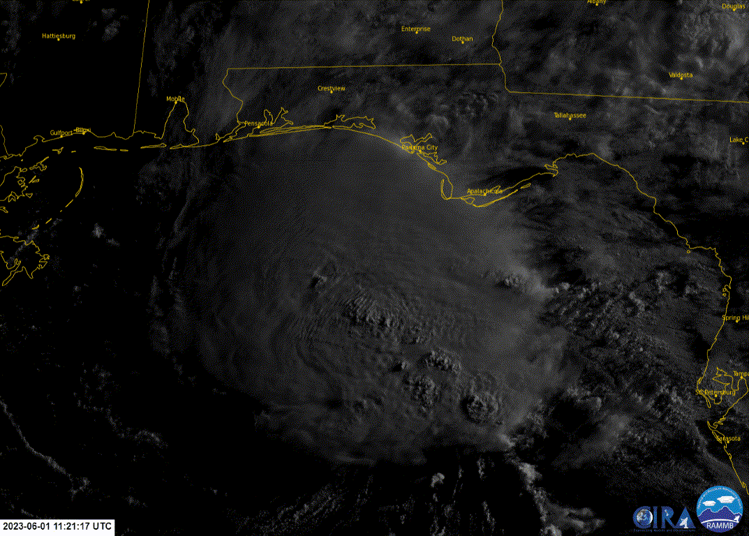
Northeastern Gulf of Mexico (AL91):
Showers and thunderstorms associated with an area of low pressure
over the northeastern Gulf of Mexico have increased and become
better organized during the overnight hours. Environmental
conditions appear marginally favorable for additional development
over the next day or so, and a short-lived tropical depression or
storm could form over that time span as the system meanders over the
northeastern Gulf of Mexico. However, by this weekend environmental
conditions are forecast to become unfavorable for additional
development as the system drifts southward, likely remaining
offshore over the Gulf of Mexico. An Air Force Reserve Hurricane
Hunter aircraft is scheduled to investigate the system later today,
if necessary.
Regardless of development, locally heavy rainfall could occur over
portions of the Florida Peninsula through this weekend. Additional
information on the rainfall and flooding potential can be found in
products issued by your local National Weather Service forecast
office and Excessive Rainfall Outlooks issued by the Weather
Prediction Center.
* Formation chance through 48 hours...medium...50 percent.
* Formation chance through 7 days...medium...50 percent.


tronbunny wrote:I am fascinated by the southward movement that is forecast.
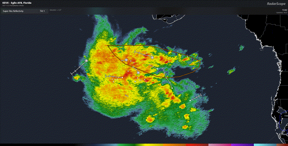
ChrisH-UK wrote:GOES-16 red band loop shows a lot of convection happening and with the rotation now been firmly underneath the convection the rotation is now imparting rotation on to the convective clouds. The models are looking like it will head south over warm waters I think it will improve
Source - https://col.st/YIzrg
[url]https://imagizer.imageshack.com/img924/7124/U9mHkO.gif [/url]

HurricaneBelle wrote:tronbunny wrote:I am fascinated by the southward movement that is forecast.
It's always said that once a storm enters the Gulf it's going to hit someone on the coast but the 06Z GFS shows the one way (outside of dissipation) that would be proved untrue as it sends it south through the Yucatan Channel.
AnnularCane wrote:HurricaneBelle wrote:tronbunny wrote:I am fascinated by the southward movement that is forecast.
It's always said that once a storm enters the Gulf it's going to hit someone on the coast but the 06Z GFS shows the one way (outside of dissipation) that would be proved untrue as it sends it south through the Yucatan Channel.
Another wrong-way storm?

boca wrote:I’d like to know what is pushing eventually south? Is it high pressure pushing down on it or just weak steering currents.
Users browsing this forum: No registered users and 25 guests


